


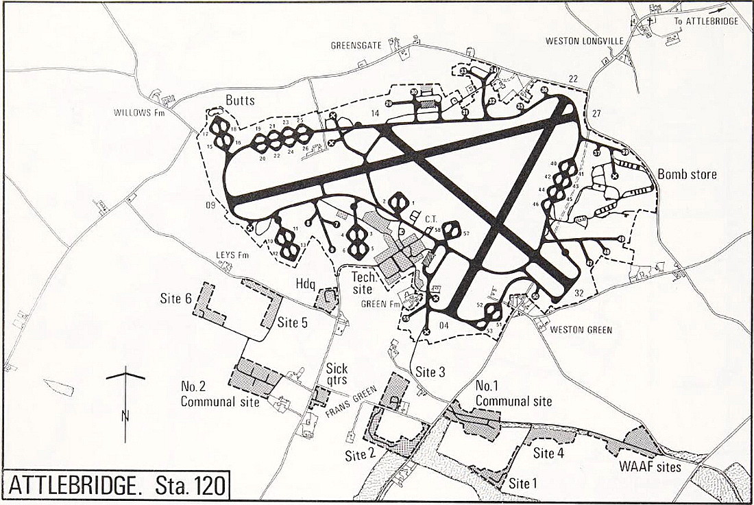
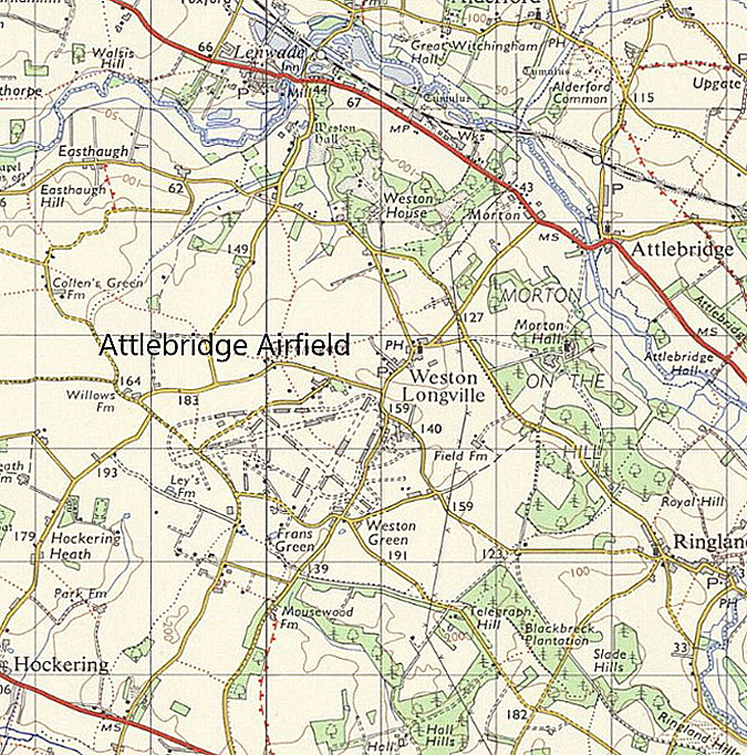
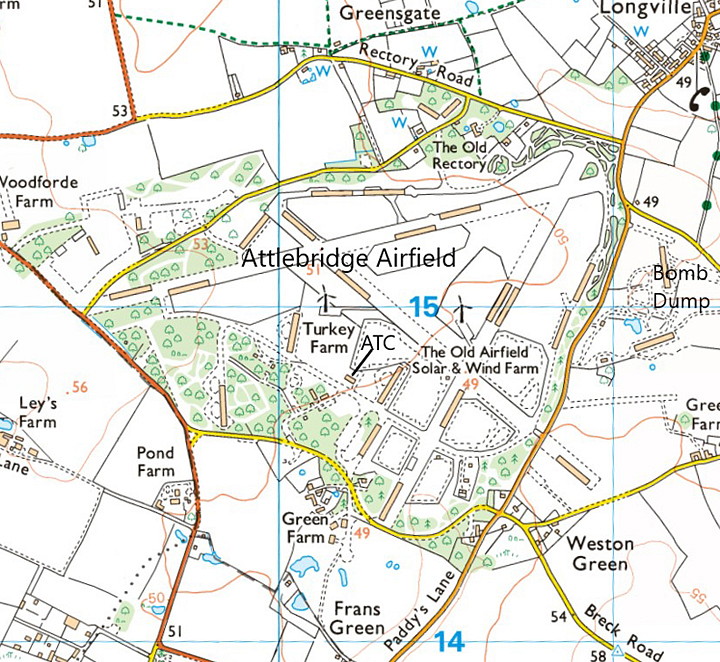
Attlebridge
ATTLEBRIDGE: Military aerodrome
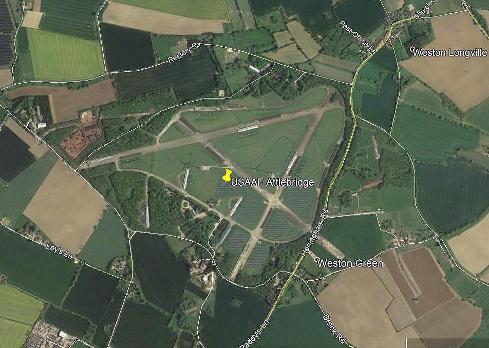
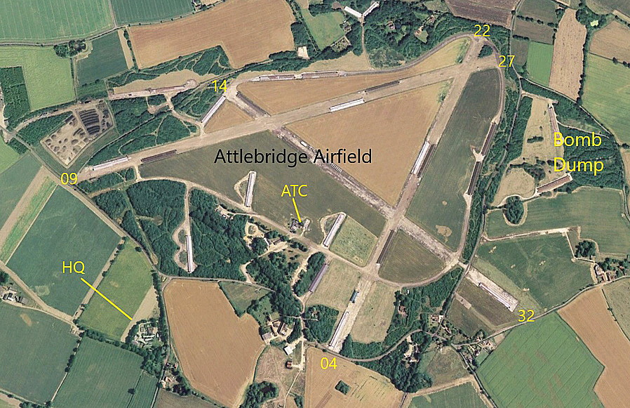
Note: This picture (2017) was obtained from Google Earth ©
Another fine example of a WW2 airfield which, some seventy years later, can still be seen in considerable detail.
Military users: WW2: RAF Bomber Command 2 Group
88 Sqdn (Bristol Blenheim IVs later Douglas A-20 Bostons)
RAF Coastal Command
320 (Netherlands) Sqdn (Avro Ansons & Lockheed Hudsons, then Dougas A-20 Bostons, later North American B-25 Mitchells)
Note: When 320 Sqdn converted to the Bostons, presumably they transferred to 2 Group, Bomber Command?
8th USAAF 2nd Bomb Wing 319th Bombardment Group (Medium)
Martin B-26 Marauders
96th Bombardment Wing 466th Bomb Group
784, 785, 786 & 787 Sqdns (Consolidated B-24 Liberators)
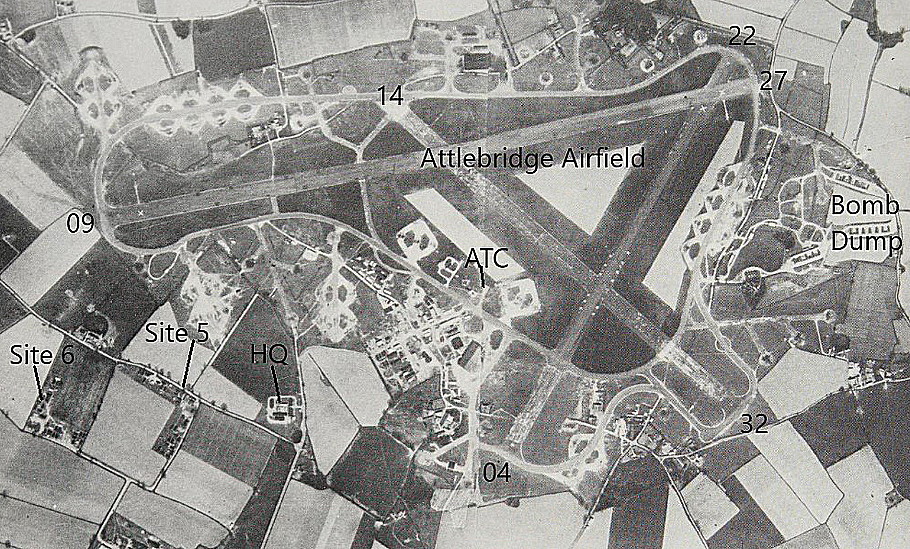
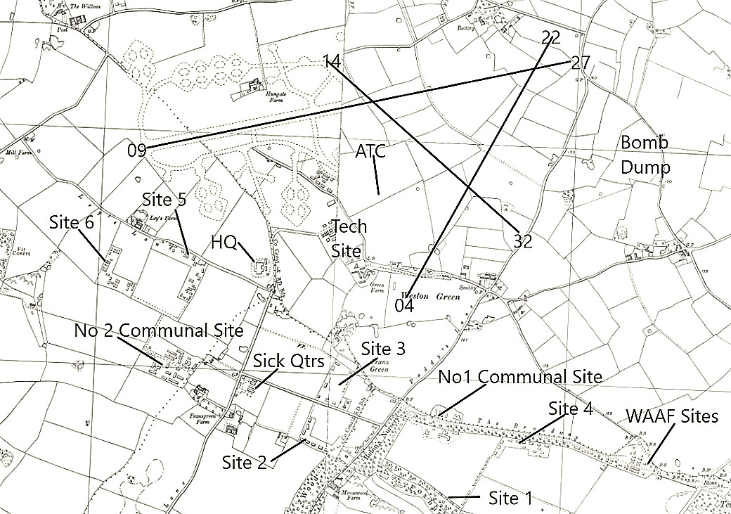
Location: SW of Weston Longville, 7nm NW of Norwich
Period of operation: 1942 to 1950
Runways: WW2: Initial runways:
1115 hard (Presumably 09/27?) 1024 hard 987 hard
09/27 1828x46 hard 04/22 1280x46 hard
14/32 1280x46 hard
A MICHAEL T HOLDER GALLERY
We have Mike Holder, a great friend of this 'Guide', to thank for researching what is available to illustrate this location.
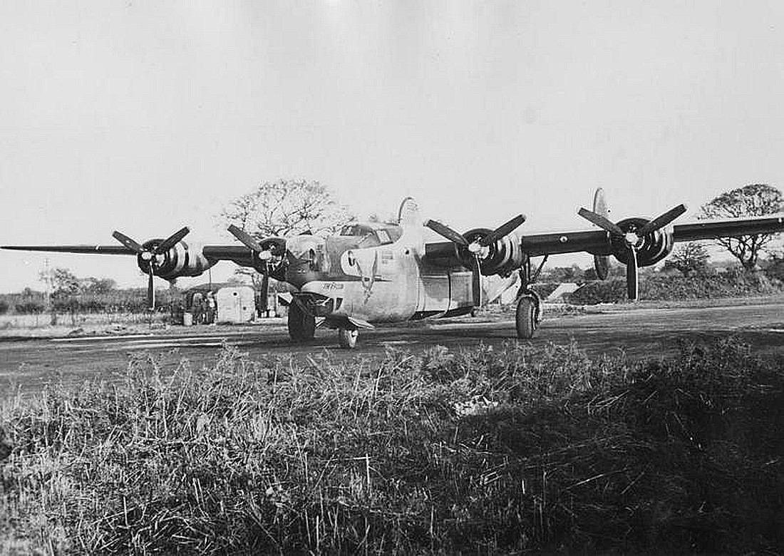
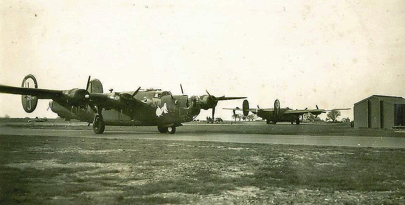
All three of these pictures are from the American Air Museum (AAM). Photo One is of the B-24 Liberator, 42-952248, named "The Falcon". Photo Two is of the B-24 named "Out of Season - Don't Shoot."
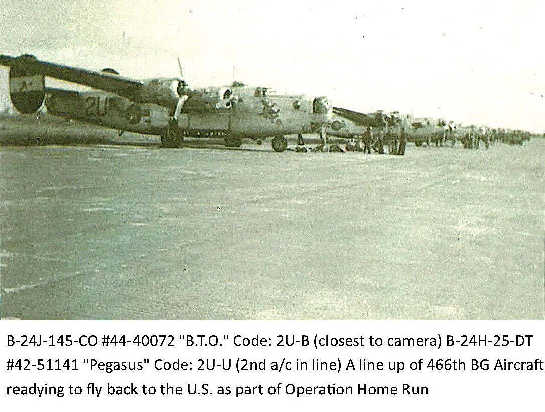
Photo Three shows the 466th Bomb Group B-24s lined up before departing back to the USA.
PRANGS-R-US
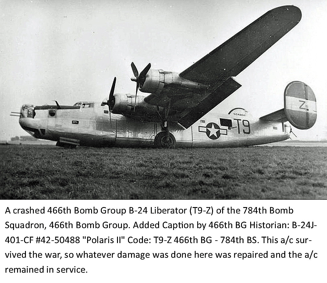
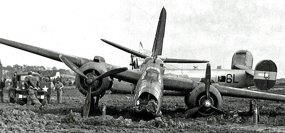
Photo Five shows the B-24J "Easy Queen" sitting behind a crashed Douglas A-20 Boston. This makes me wonder if that Boston was left over from the period when the RAF occupied this aerodrome? In all three cases it appears that one of the main wheels either failed to come down, or collapsed on landing. The main causes were failures in the hydraulic system, many of course due to battle damage.
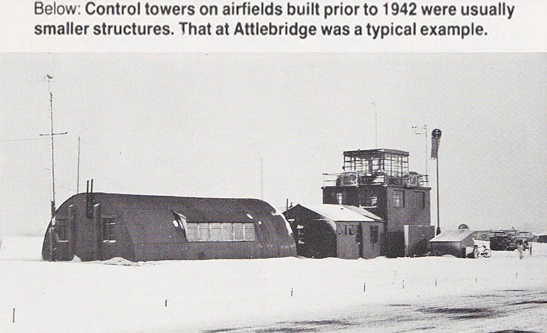
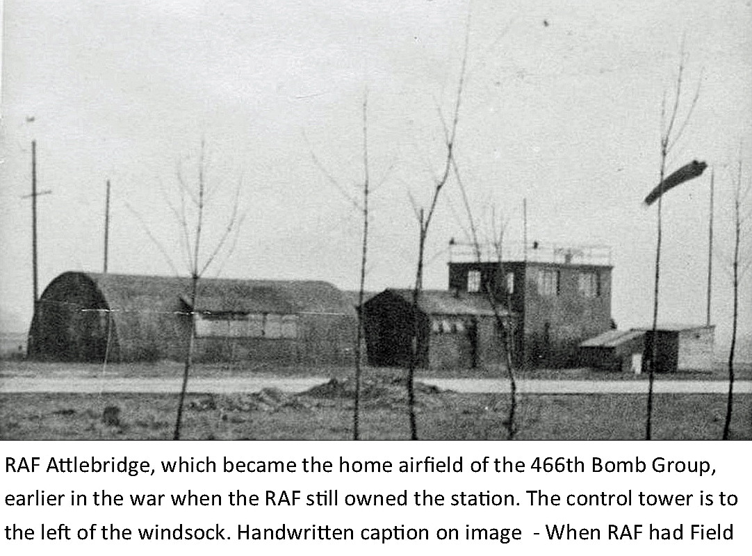
The photo of the control tower is from Mighty Eighth Warfare Manual by Roger A Freeman.
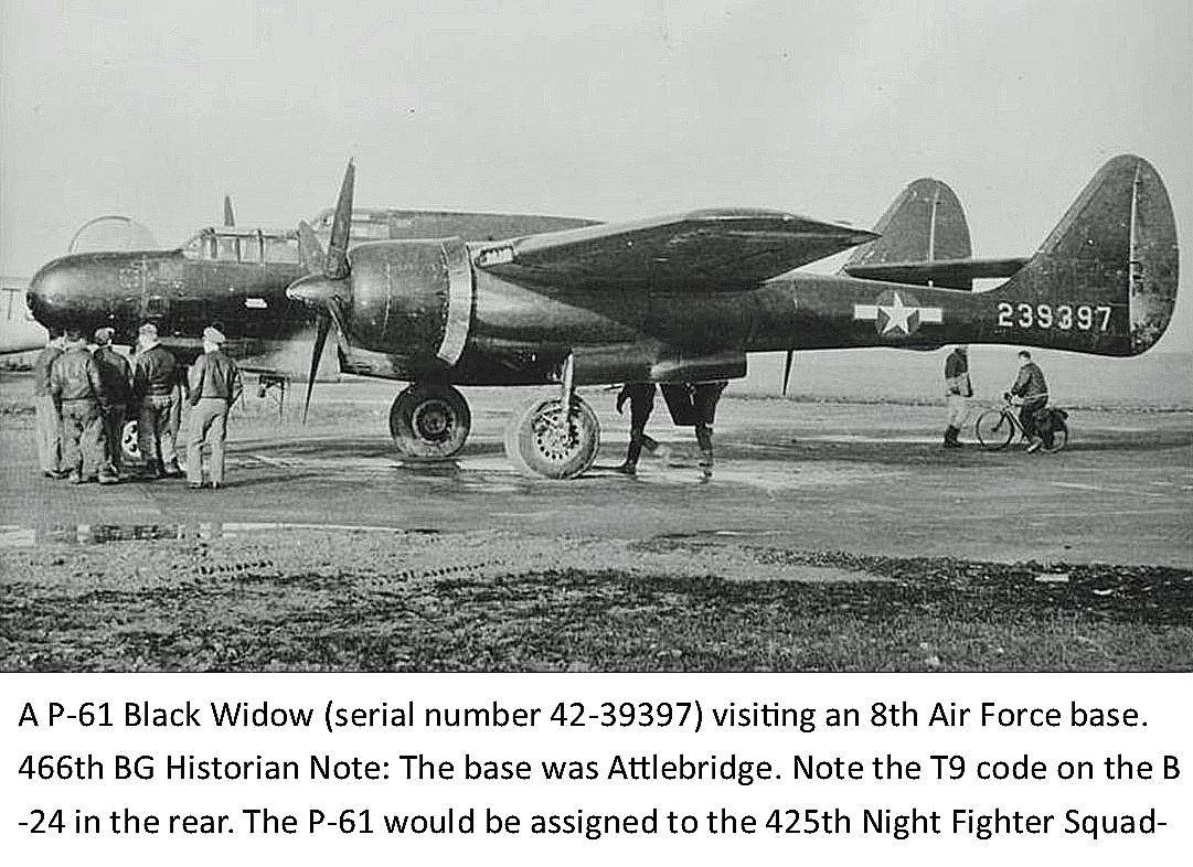
UNUSUAL VISITORS
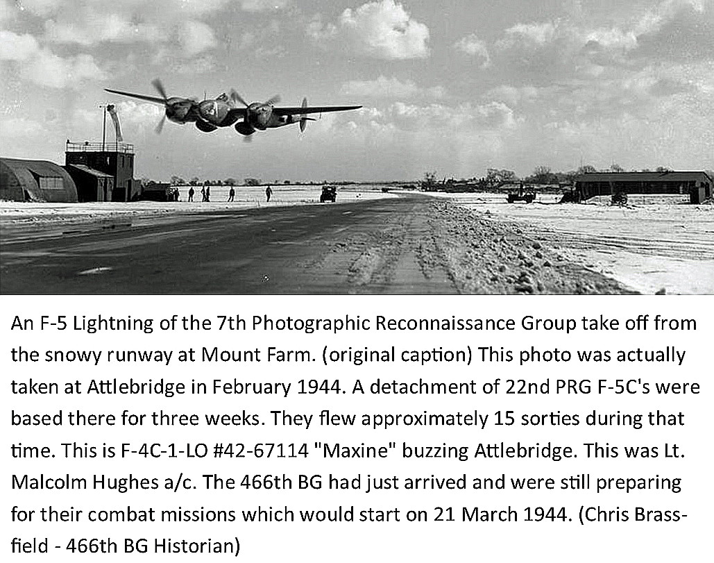
These three items are all from the AAM. What a great picture of the Lightning doing a low level 'beat-up'. This was from the 7th Photographic Reconnaissance Group based at MOUNT FARM in Oxfordshire.
Both of these pictures are also from the AAM. As for the Boeing B-17G Flying Fortress, I don't think I've heard of the USAAF doing Night Leaflet Missions. Always thought that was very much a thankless duty undertaken by the RAF. However, it does appear from what I have read, that these leaflet dropping missions were very much appreciated by people on the continent, due to the scarcity of toilet paper.
SOME ODDS & SODS FROM THE AMERICAN AIR MUSEUM
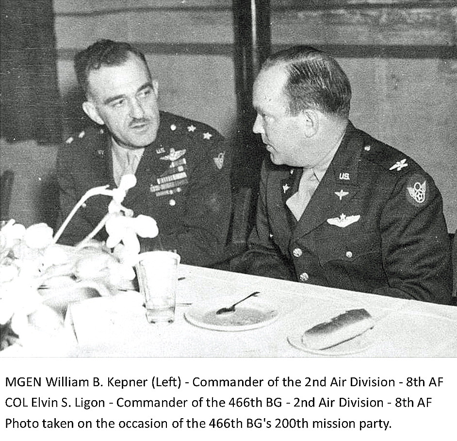
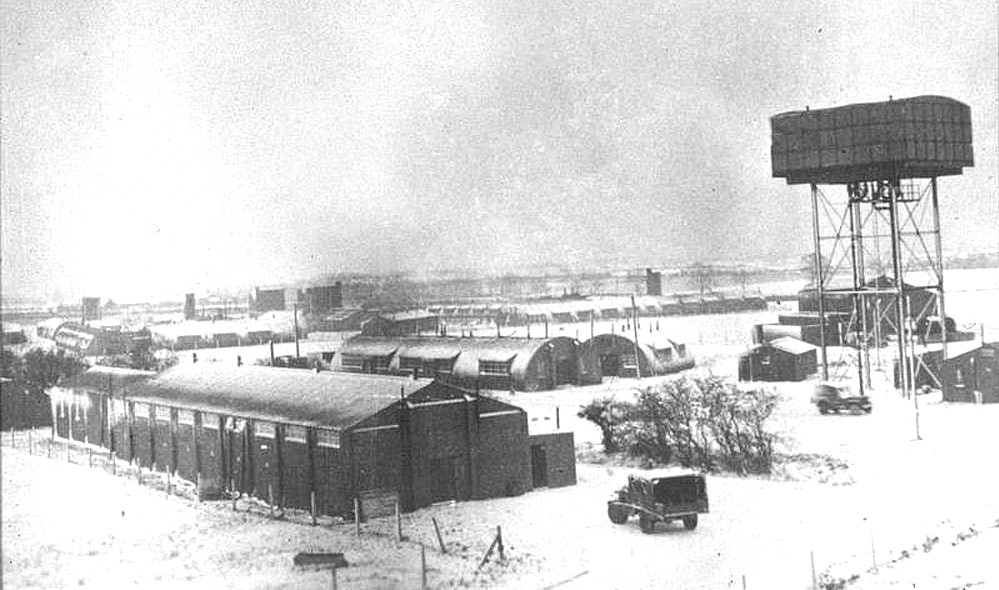
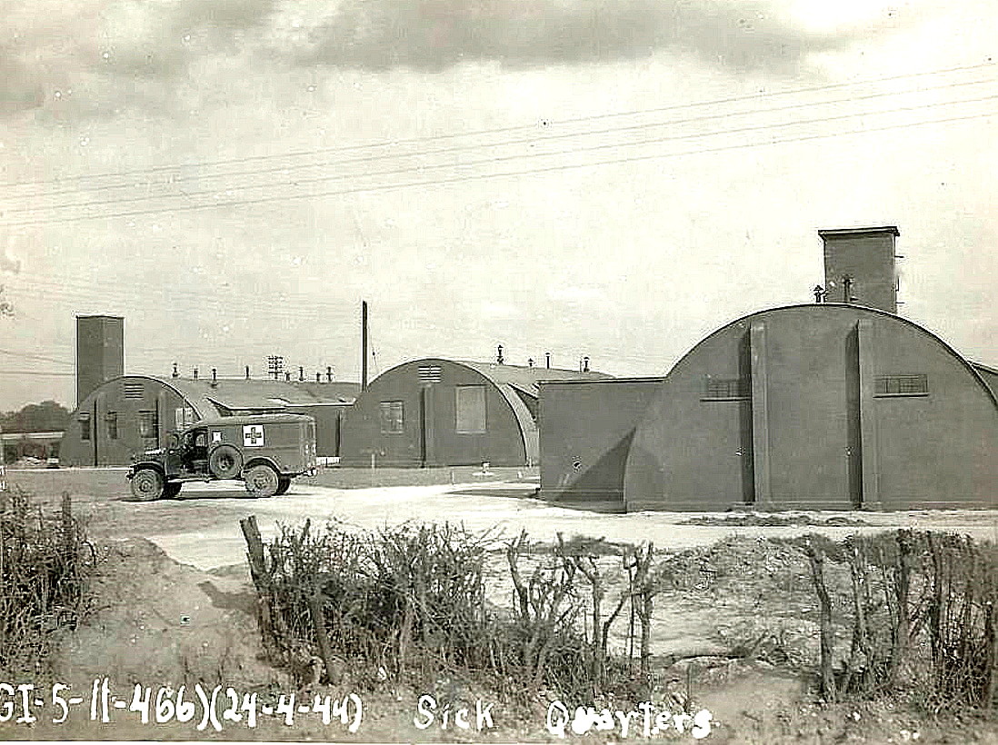
Photo Seven = Nissen huts. Photo Eight = The Sick Quarters.
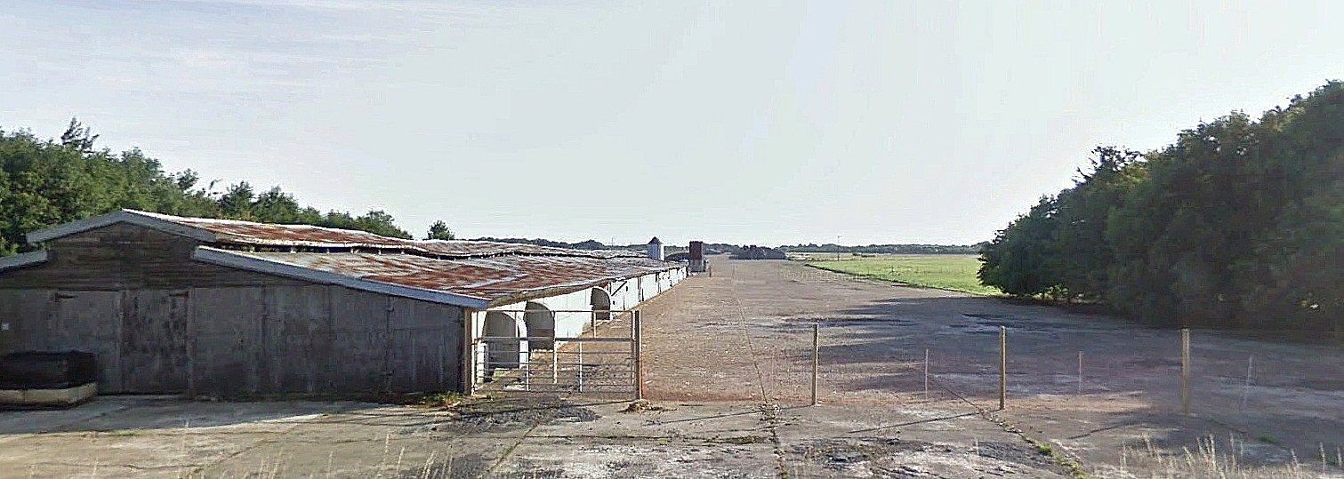
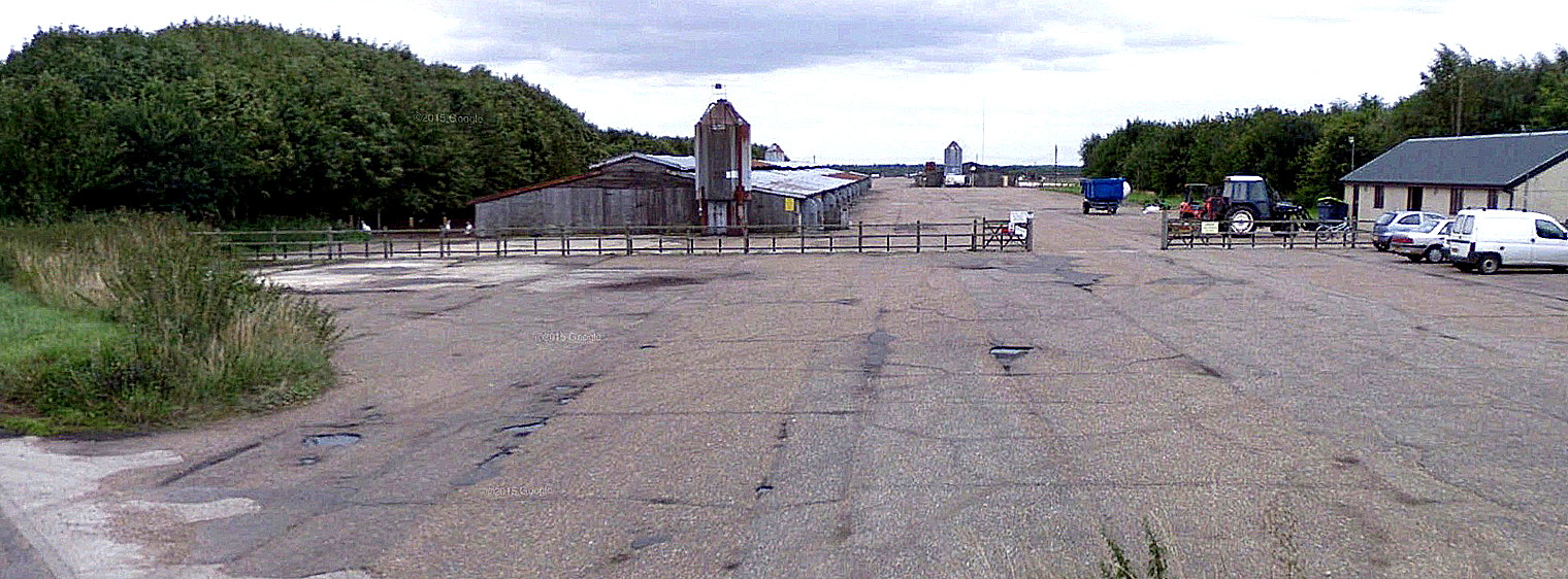
SOME MORE MODERN VIEWS. (Note: Well, they were in 2025).
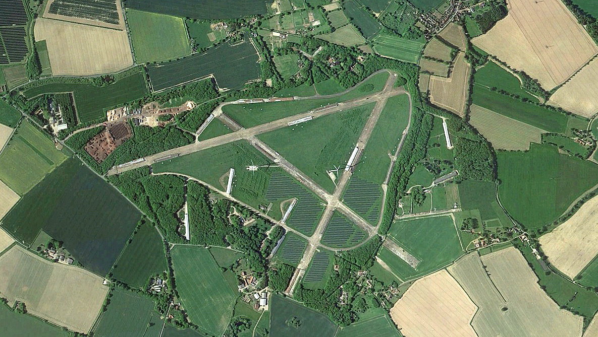
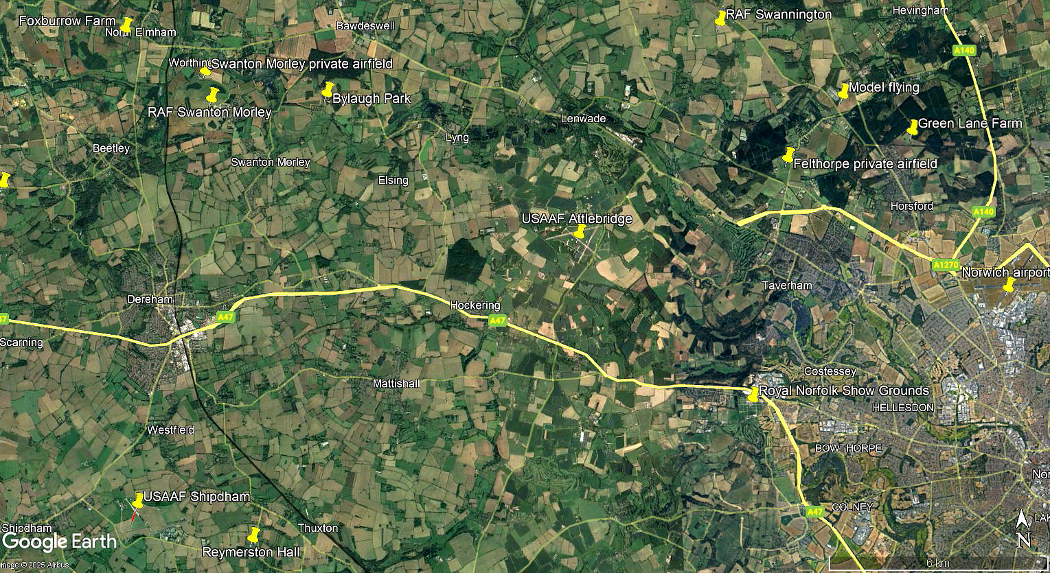
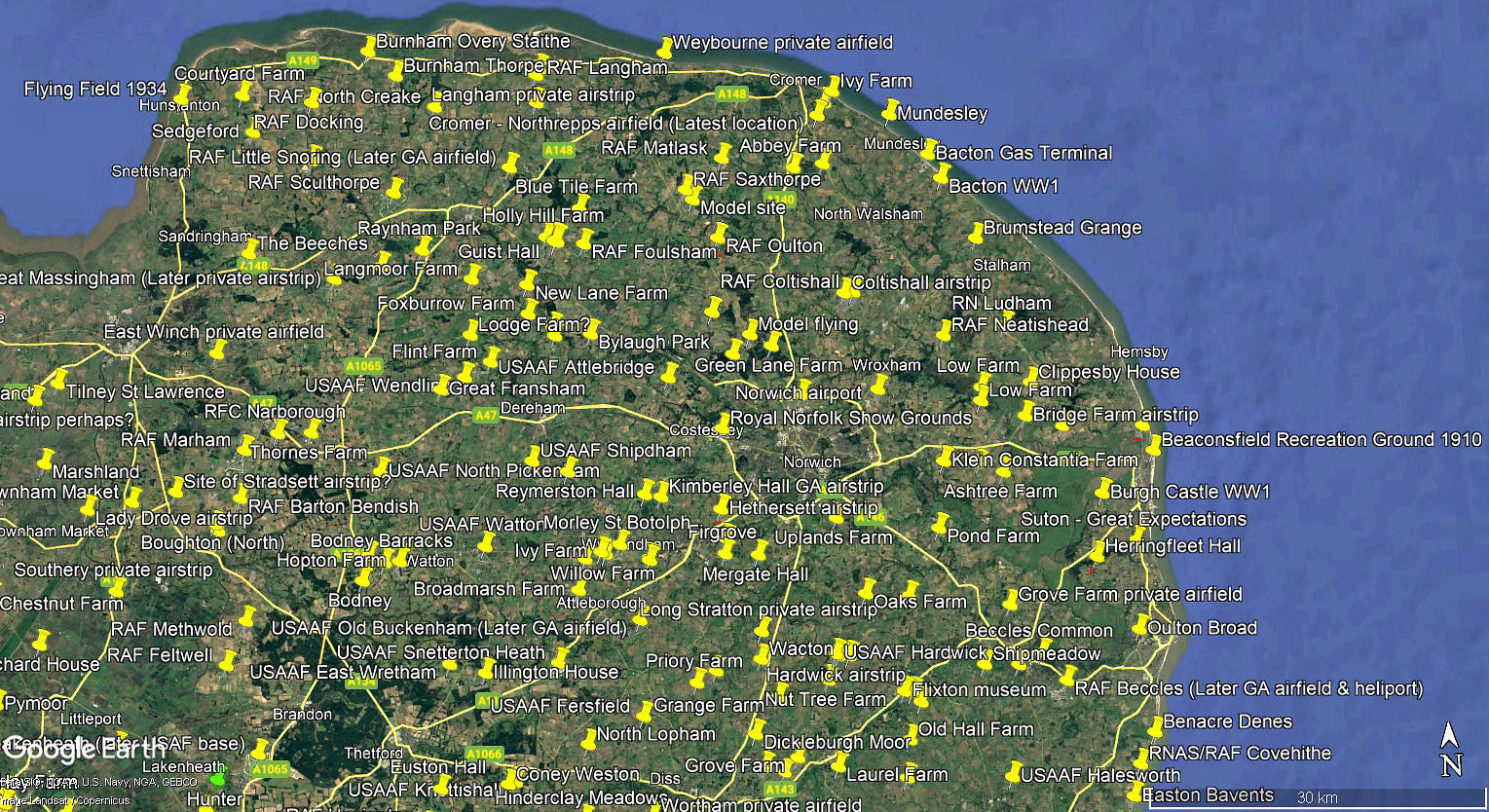
The local area and area views are from my Google Earth © derived database.
NOTES: It was standard practice for the USAAF to base four bomber squadrons at each of their UK aerodromes in WW2. From around 1959/1962 the site was listed as being used as a turkey farm with the control tower being the ‘office’. No doubt a fine example of recycling. It also occurs to me that during WW2, for the incoming USAAF people, aircrews especially, they may well have regarded arriving on our green and septic, (sceptic?), island, anchored in the Atlantic, as being very much like turkeys voting for Xmas? Just a thought.
I have also wondered about what they made of the British weather, let alone similar conditions in northern Europe. Especially as the stateside USAAF training bases were usually situated in the southern States to speed up the training programme. Many British private pilots still go to the USA for getting their PPL. I have always regarded this as being somewhat foolish as it does not equip you to deal with the usually highly unstable and very variable climatic conditions we 'enjoy'. Hence the oft repeated phrase when I was learning to fly, - "Time to spare? Go by air."
simon roberts
This comment was written on: 2018-09-25 13:45:47Hiya...Love your site - really interesting - just thought you might be interested to add on to your list....One and a quarter miles due north of Heathfield Police Staition East Sussex. Ultra Light aircraft reg.,-G-BUWK ...the aircraft plainly visible from above on GoogleEarth
Reply from Dick Flute:
Hi Simon, You will find this airstrip listed as Bradley's Lawn. Best regards, Dick
We'd love to hear from you, so please scroll down to leave a comment!
Leave a comment ...
Copyright (c) UK Airfield Guide
