


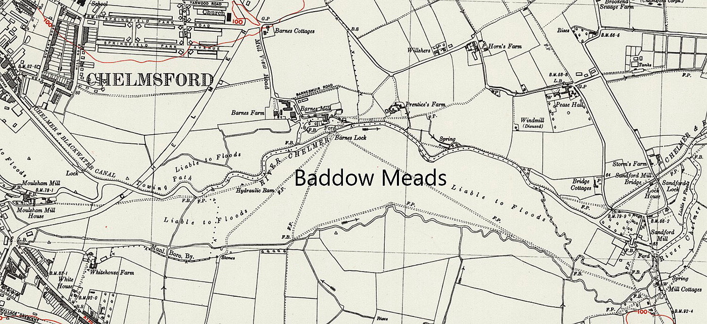
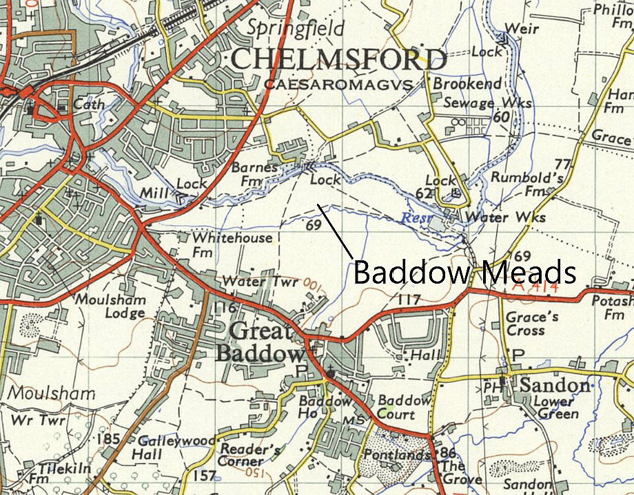
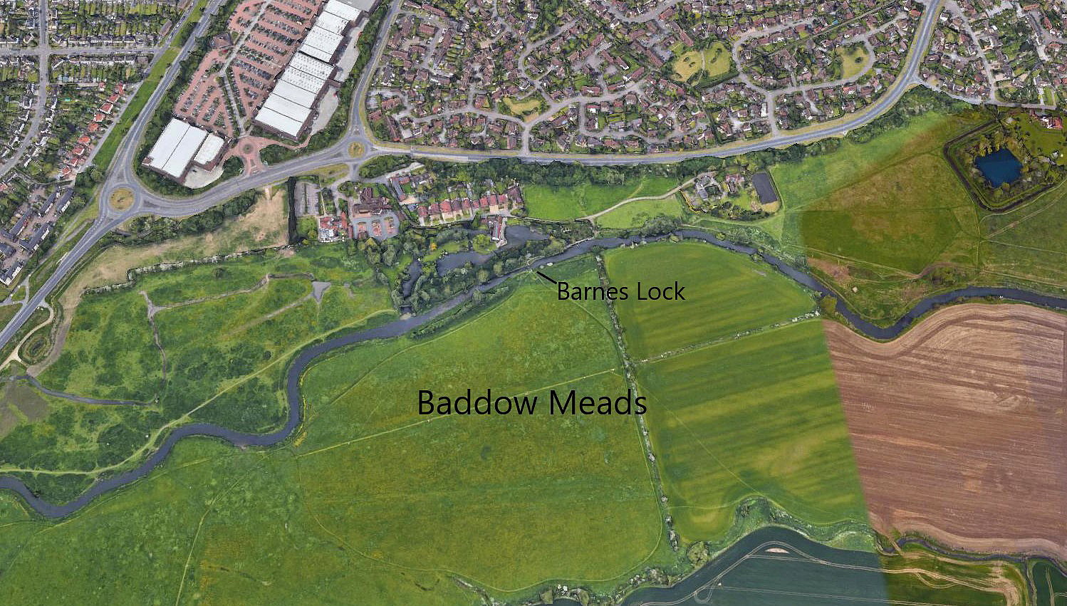
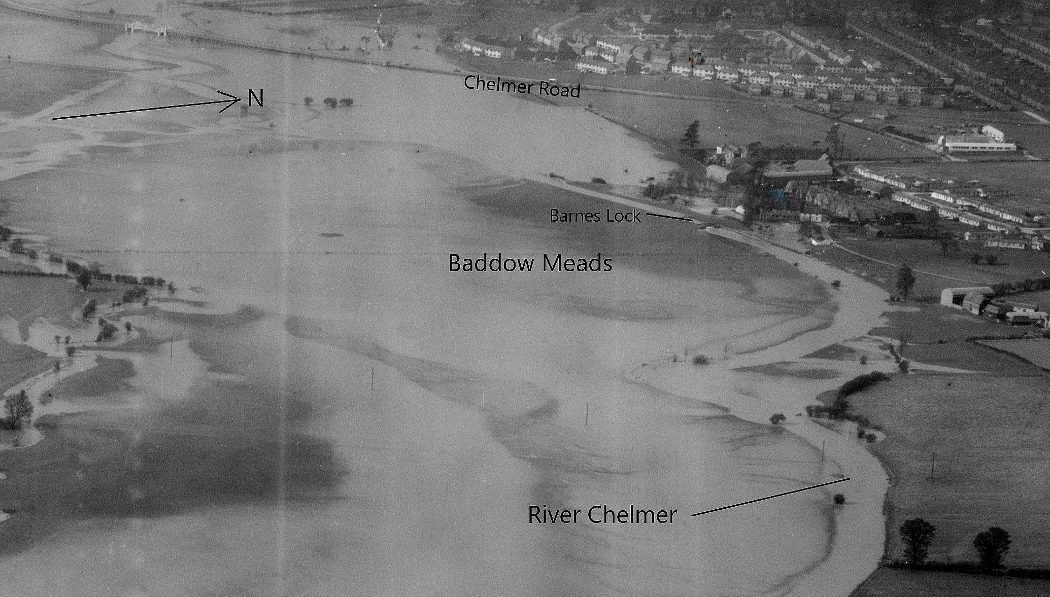
Baddow Meads
Note: Some years I made this comment: "After some research I now believe this map gives a rough location for Baddow Meads. However, if anybody can kindly offer advice about where this venue actually took place, this will be most welcome.
Mick Bond kindly offered advice, and I now hope the map is much more accurate. Then, much later in April 2021, Mike Holder, a great friend of this 'Guide', really came up with the goods. See his Gallery below.
I often need to remember, when I first started the research for this 'Guide' over twenty years ago, (which was originally planned to be a book!), that in those days I barely had an idea about where most flying sites were situated. And how true the saying is that, the more you learn, the more you realise how little you know.
BADDOW MEADS: Temporary civil aerodrome
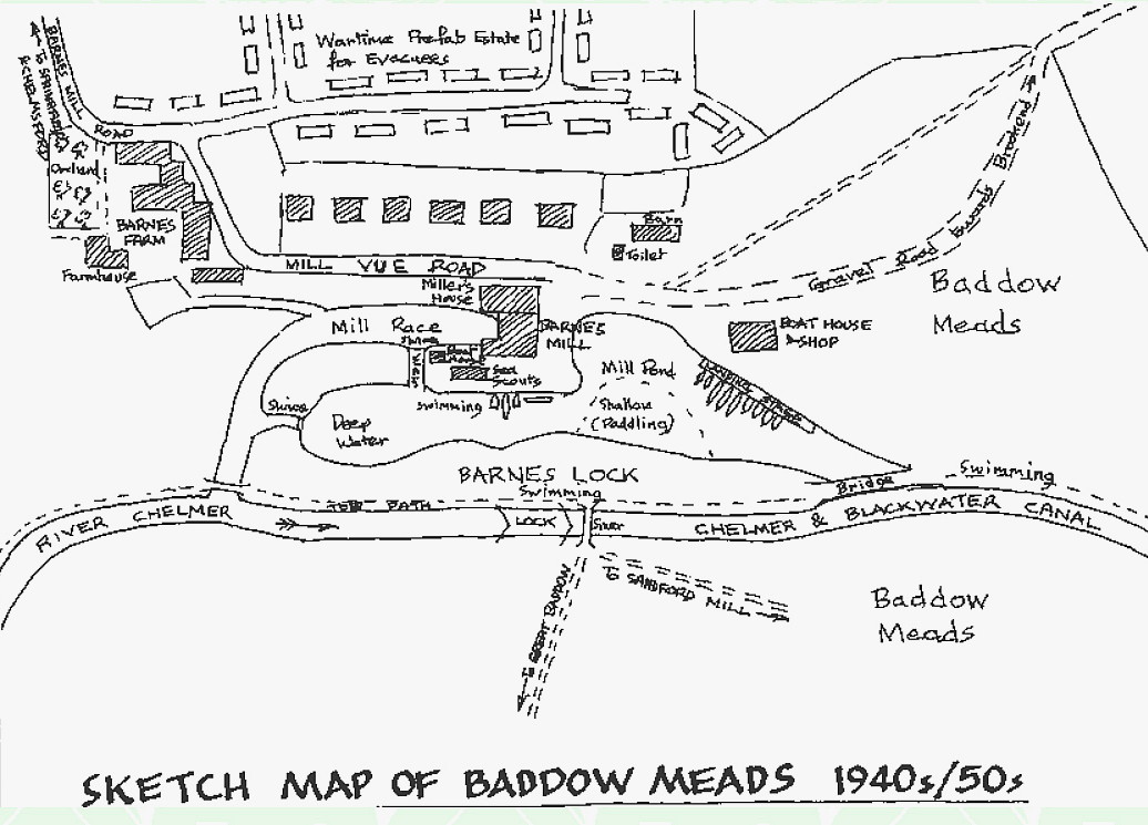
A MICHAEL T HOLDER GALLERY
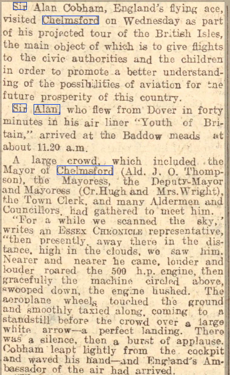
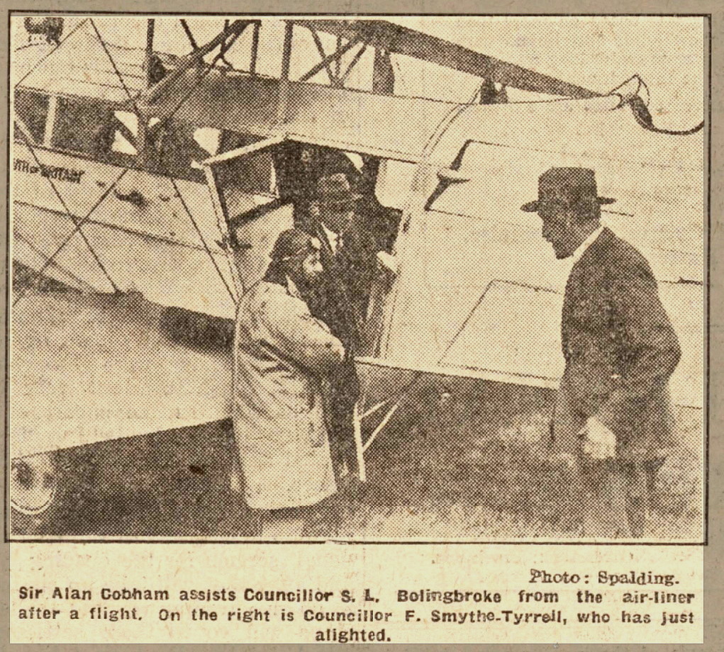
Note: The second and fourth items were published in the Chelmsford Chronicle on the 16th August 1929.
Operated by: Sir Alan Cobham’s UK Municipal Aerodrome Campaign
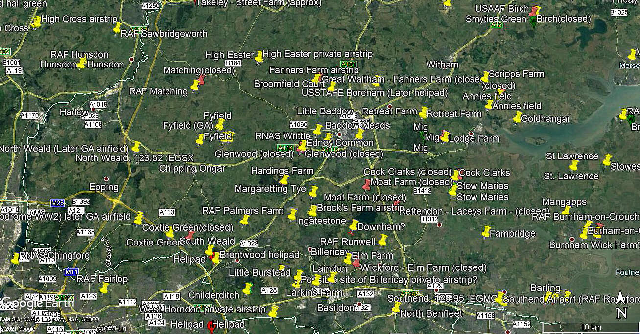
Location: Near and E of Chelmsford
Period of operation: 14th August 1929
NOTES: BADDOW MEADS was the planned 52nd venue for this Tour. Starting in May and ending in October, one hundred and seven venues were intended to be visited. Mostly in England, two venues were in Wales and eight in Scotland. As might be expected, along the way Cobham had a couple of accidents and other problems, but, he still managed to visit about 95 venues. In itself a quite remarkable achievement.
Without much doubt this Tour resulted in several aerodromes/regional airports being commissioned. But not in Chelmsford.
The aircraft Cobham mostly used was the ten-seater DH61 'Giant Moth' G-AAEV named 'Youth of Britain'. The punishing schedule he set himself seems astonishing today. See STOCKTON-on-TEES for more information. Or better still read his memoirs in A Time to Fly.
Mr Mick Bond
This comment was written on: 2019-06-03 20:37:55Hi. No, Baddow Meads is between A138 A1114 and A414. It is grass area divided by the River Chelmer. Also, the estate of Meadgate was built over more of the Meads. There was allegedly an airfield at Springfield, maybe Lyons, but not sure Hope that helps
We'd love to hear from you, so please scroll down to leave a comment!
Leave a comment ...
Copyright (c) UK Airfield Guide
