


Beverley flying sites
Note: This map only gives the location of Beverley within the UK.
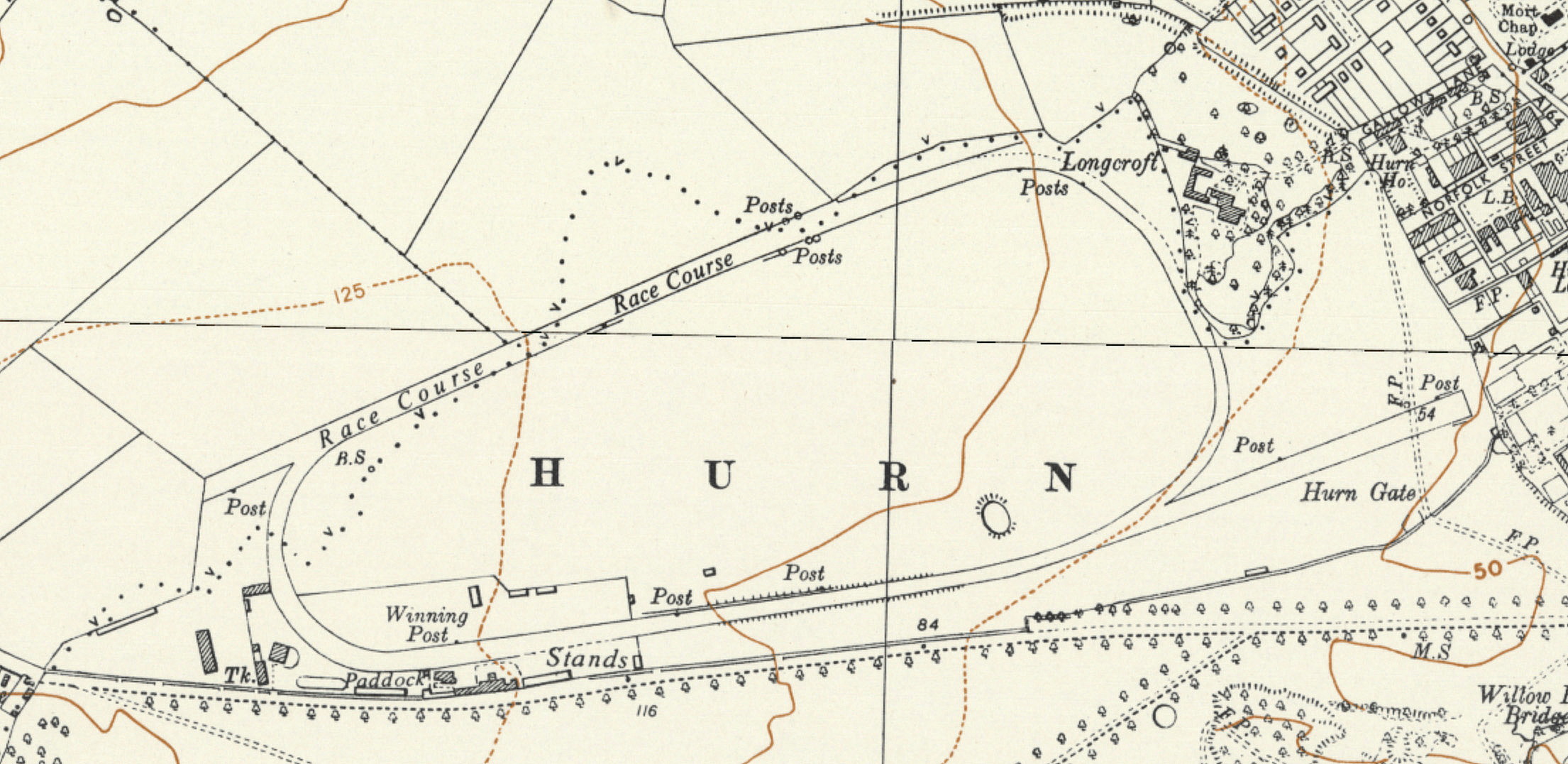
BEVERLEY: Military Flight Station later Landing Ground
Military users: RFC/RAF (Royal Flying Corps / Royal Air Force)
33 [Home Defence] Squadron (Royal Aircraft Factory B.E.2, later F.E.2 types. In 1918 Bristol F2B Fighters, replaced by Avro 504 night fighters)
34 Reserve and Training Squadron
Location: I mile from Beverley railway station
Period of operation: 1915 to 1919
Site area: 179 acres 1052 x 549
BEVERLEY: Temporary aerodrome?
A MICHAEL T HOLDER GALLERY
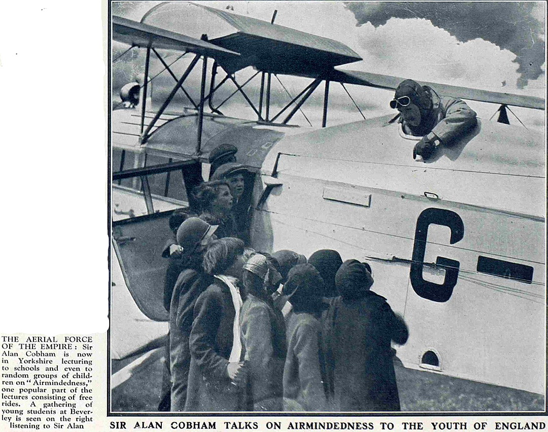
Note: The photo was published in The Sphere on the 29th June 1929. The Sphere was an illustrated newspaper that ran from 1900 to 1964.
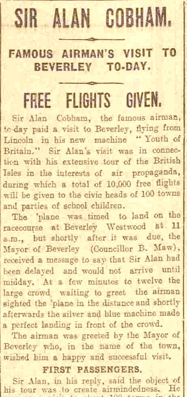
Note: The newspaper article was published in the Hull Daily Mail on the 5th June 1929.
NOTES: Beverley was the 17th venue, on the 5th June, for Sir Alan Cobham's Municipal Aerodrome Campaign 1929 Tour. Starting in May and ending in October one hundred and seven towns and cities were planned to be visited, mostly in England but with two venues in Wales and eight in Scotland. In the end, after a couple of crashes and other setbacks, he managed to visit 97 venues - which was still a magnificent achievement.
The aircraft he mostly used was the DH61 'Giant Moth' G-AAEV, named 'Youth of Britain'. Presumably Beverley was the nearest suitable site the Cobham team could find to entertain the Mayor of Hull and other dignitaries. Typically he would land around ten or eleven o'clock from the previous venue and treat the 'worthy' citizens to a flight around their town. Sometimes this entailed up to three flights. Then there would be a slap-up lunch affair when he delivered his entreaties for an aerodrome to be built, or better still a regional airport.
After this he would return to the aircraft and conduct joy-rides for children sponsored by an anonymous donor, typically forty or fifty ten at a time. We now know the sponsor was Lord Wakefield of Castrol Oil fame.
Then, still without a break, he continued for several hours carrying fare paying passengers. The revenue from these flights paying the costs of the 'Tour'. It was an astonishing display of stamina, and organisation from his team at his office in London.
In April 1931 C D Barnard Air Tours operated from a venue in/near Beverley.
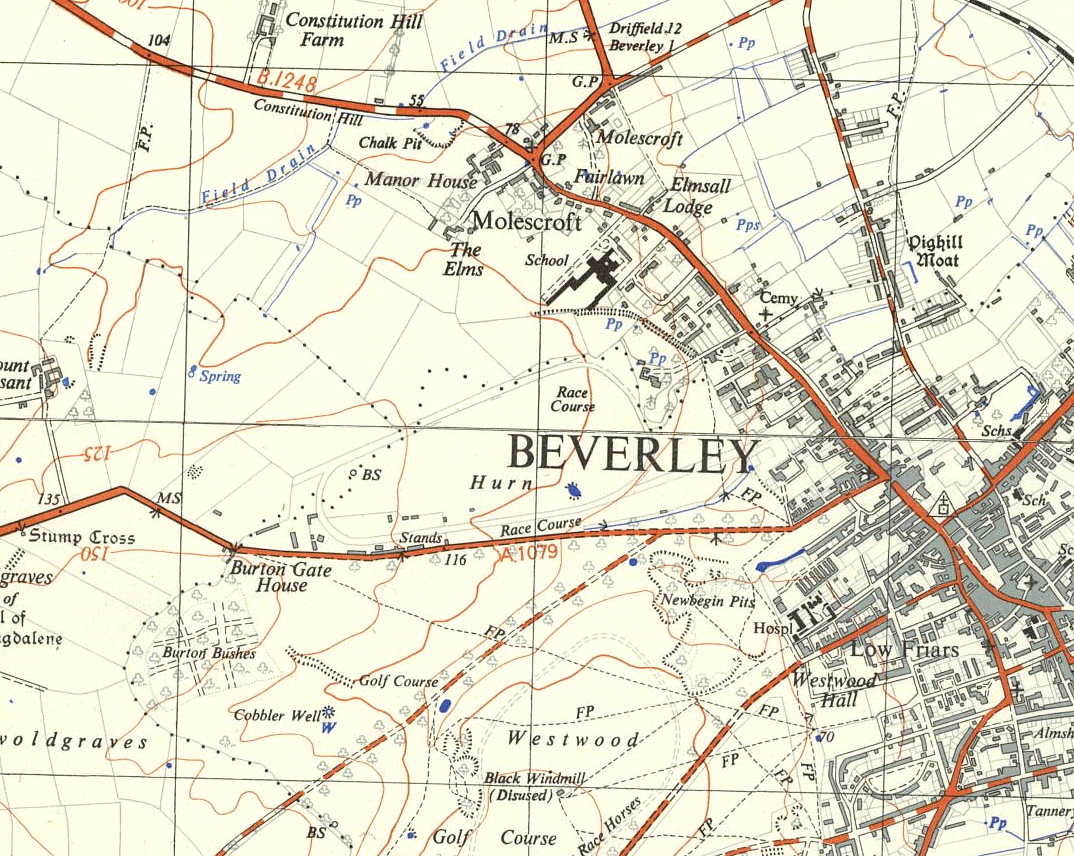
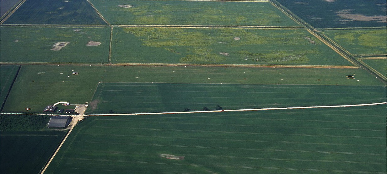
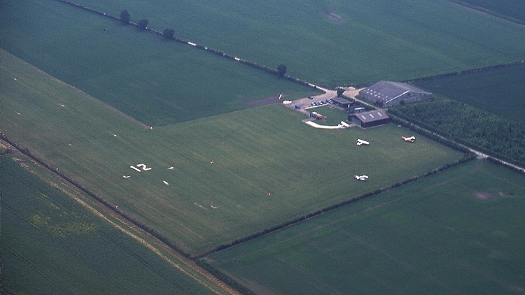
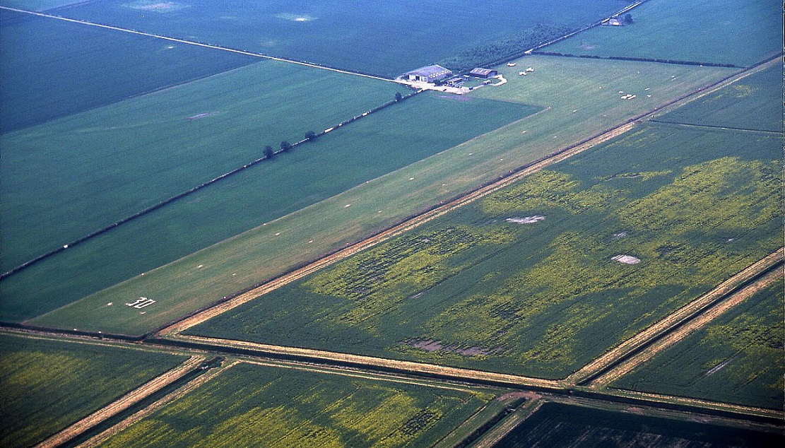
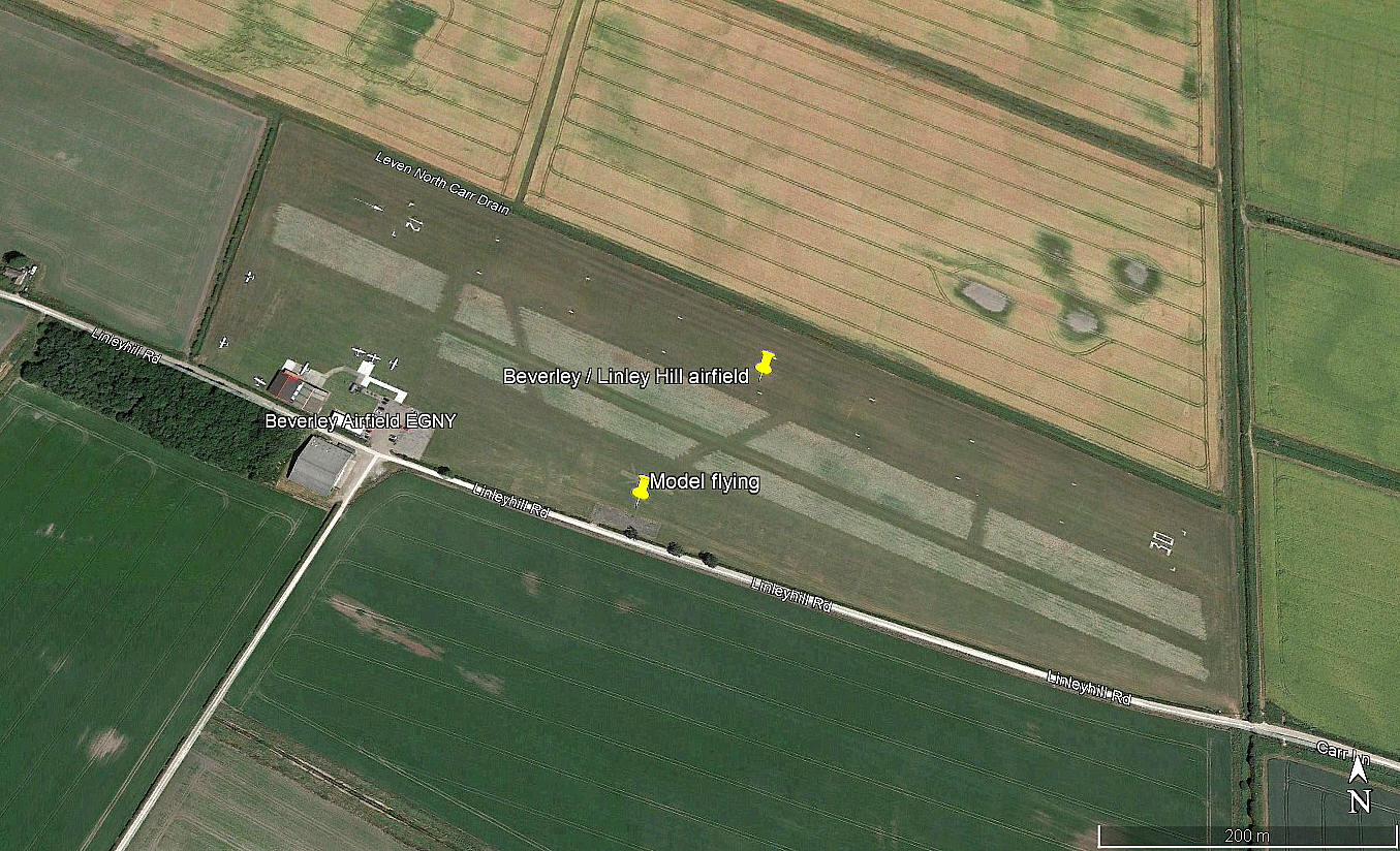
BEVERLEY: Civil aerodrome (Also known as LINLEY HILL)
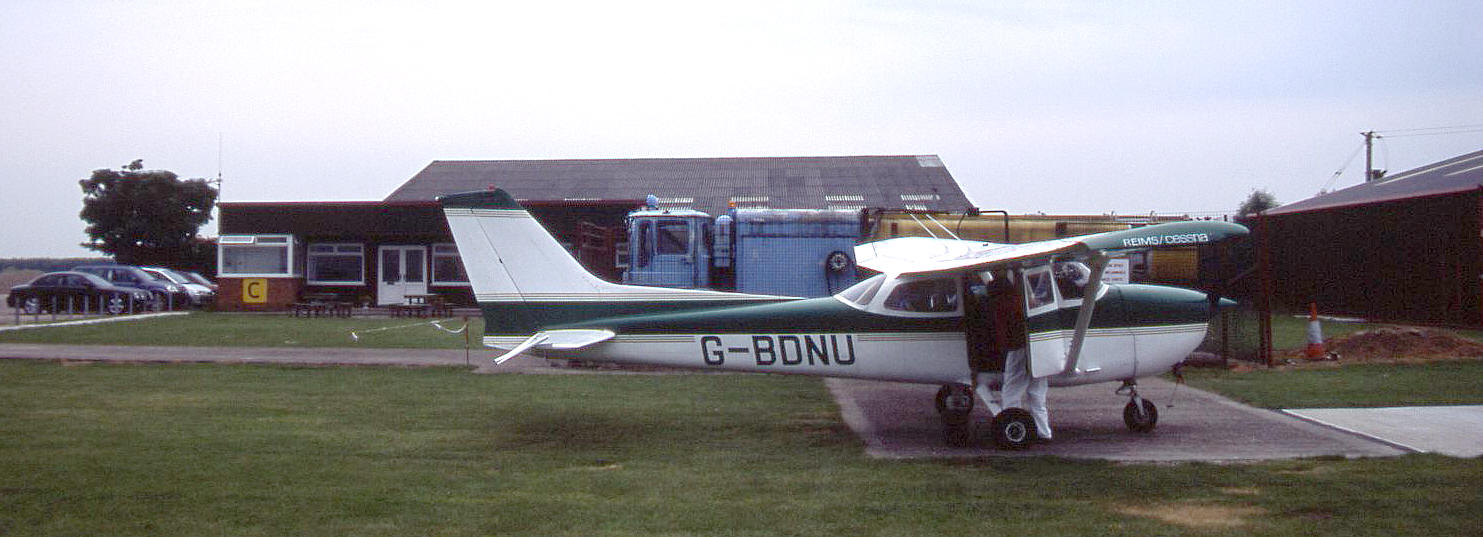
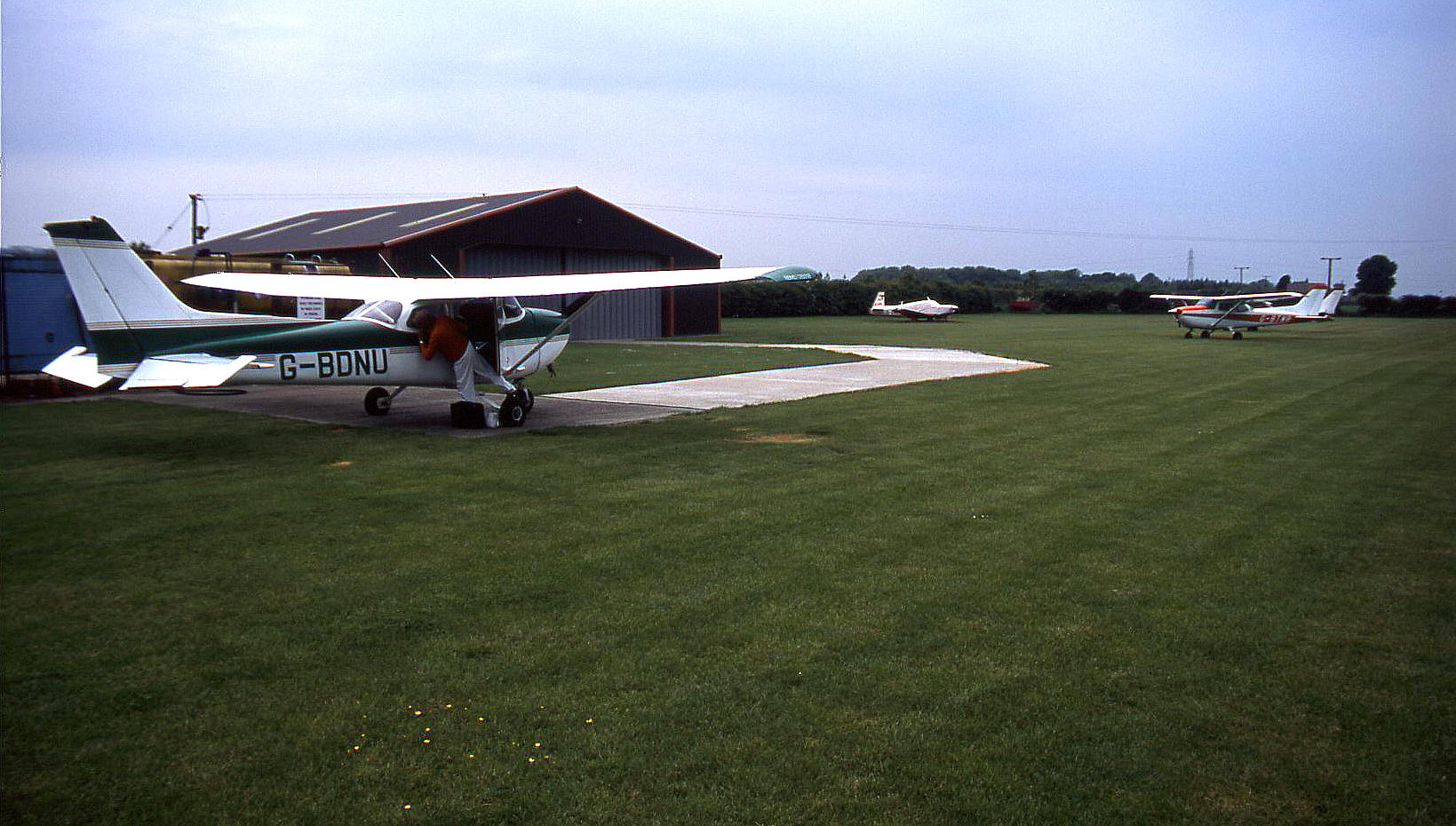
Note: Pictures by the author unless specified.
Operated by: Hull Aero Club
Flying club/school: Hull Aero Club
Helicopter ops: Foremans Aviation
Location: 4 nm NNE of Beverley
Period of operation: 1990 to present day?
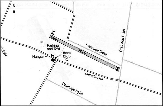
Note: This map is reproduced with the kind pemission of Pooleys Flight Equipment Ltd. Copyright Robert Pooley 2014.
Runway: 12/30 720x30 grass
RADIO CONTROLLED MODEL FLYING
We have Mr Graham Frost, a great friend of this 'Guide', to thank for pointing out this aspect of the aerodrome.
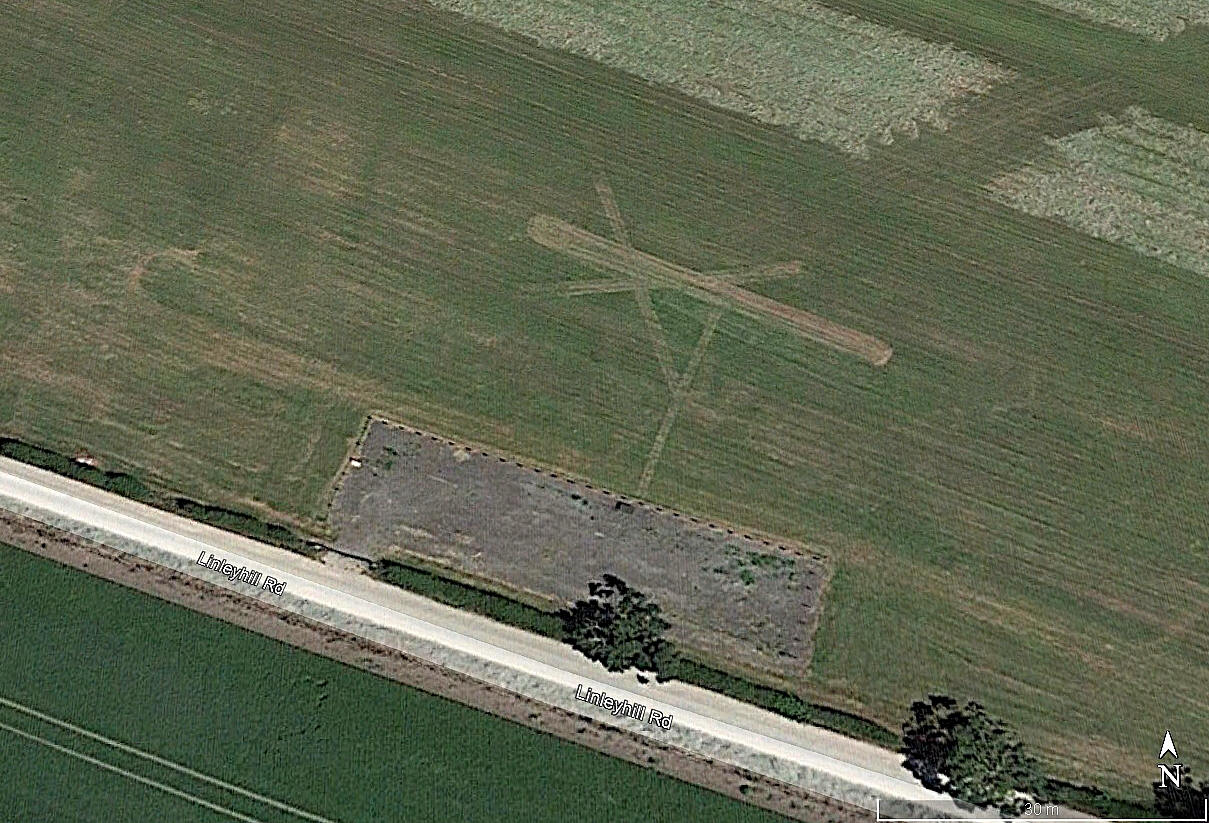
I can see no evidence of this model flying location existing before 2018. I suppose it is still in use, (by 2026?), but the Google Earth© pictures I can access are of very poor quality after 2018.
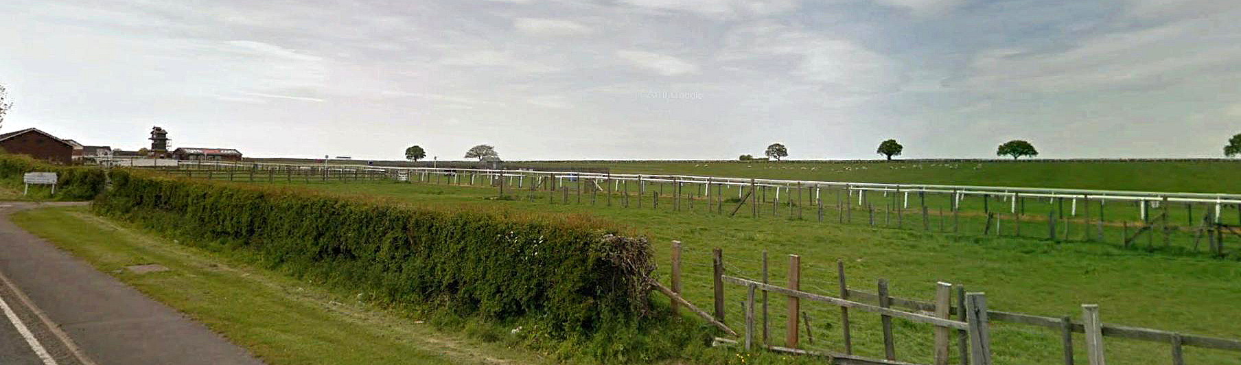
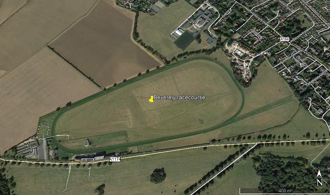
BEVERLEY RACECOURSE: Helicopter landing area
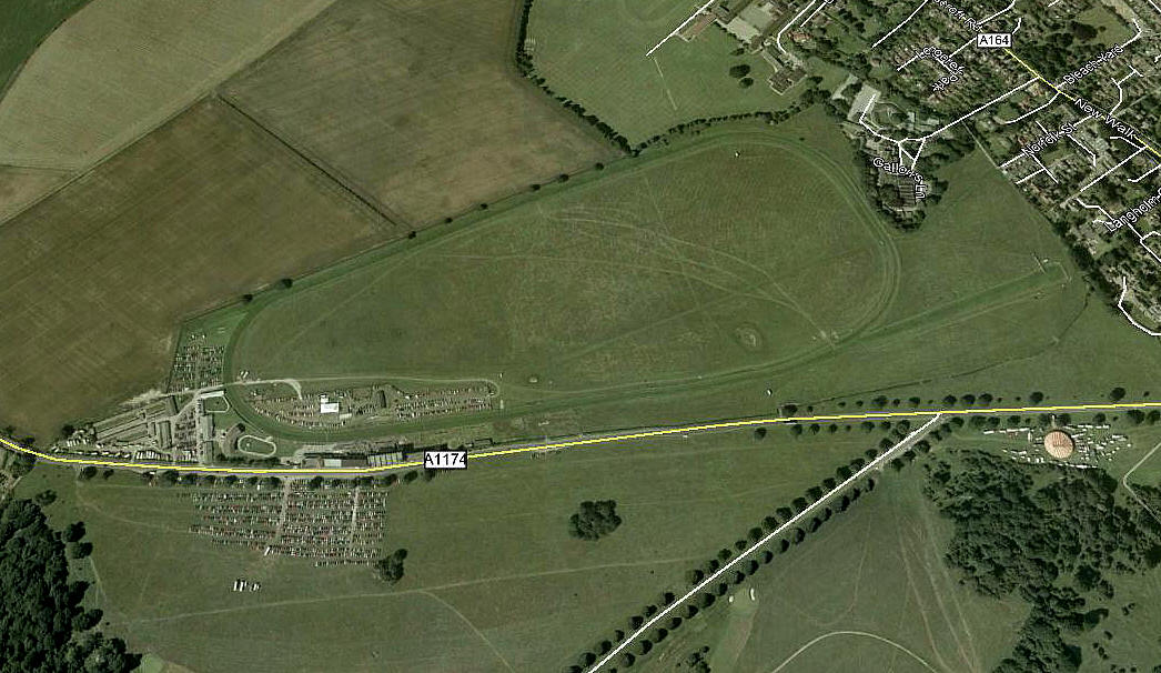
Note: This picture was obtained from Google Earth ©
Location: Between the A1035 and A164, WNW of Beverley town centre
Landing area: In centre of racecourse
NOTES: On the web-site it is said that fixed-wing aircraft can use HUTTON CRANSWICK airport. I can find no evidence of this airfield even though it is shown on road maps.
We'd love to hear from you, so please scroll down to leave a comment!
Leave a comment ...
Copyright (c) UK Airfield Guide
