














Birmingham Air Race 1913
Note: This map shows the location of the TALLY-HO race start and finish point.
BIRMINGHAM AIR RACE 1913: Mostly Temporary Landing Grounds
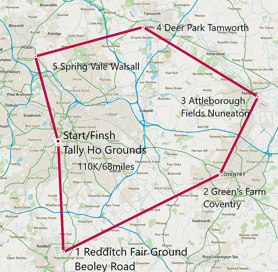
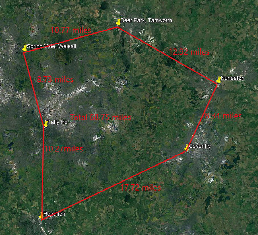
Note: This map and the Google Earth © picture were very kindly provided by Mr Michael T Holder
Saturday, 30th August, 1913: Starting from the TALLY-HO Flying Ground near Edgebaston the landing points were: REDDITCH, COVENTRY, NUNEATON, TAMWORTH (Drayton Manor), WALSALL and back to the TALLY-HO.
This sponsored air race by the Daily Post was, I think (?), apart from the incredibly famous London to Manchester air race sponsored by the Daily Mail in April 1910, the first example in England of two of the most famous aviators of the time, racing against each other? And this time of course, between two British aviators, the 1910 race being won by the Frenchman Louis Paulhan.
THE RACE SCHEDULE
START: TALLY-HO GROUND, BIRMINGHAM: 14.30
REDDITCH: 14.40 to 15.10
COVENTRY: 15.30 to 16.00
NUNEATON: 16.10 to 16.40
TAMWORTH: 16.55 to 17.35
WALSALL: 17.50 to 18.20
FINISH: TALLY-HO GROUND, BIRMINGHAM: 18.30
Note: For younger readers especially I have given these times in modern terms, using the now typical international 24 hour convention. It appears the Canadian armed forces were the first to adopt this in 1917, the U.S.Navy in 1920 and the U.S. Army during WW2 in 1942. When I was a lad, (born in 1947), we still used the twelve hour system. 00.00 to 12.00 being a.m. (Ante-Meridiem, before), and 12.01 to 24.00 being p.m. (Post-Meridiem, after). Even today, very old fashioned watches, such as the one I wear and really like, still show just twelve hours on the dial.
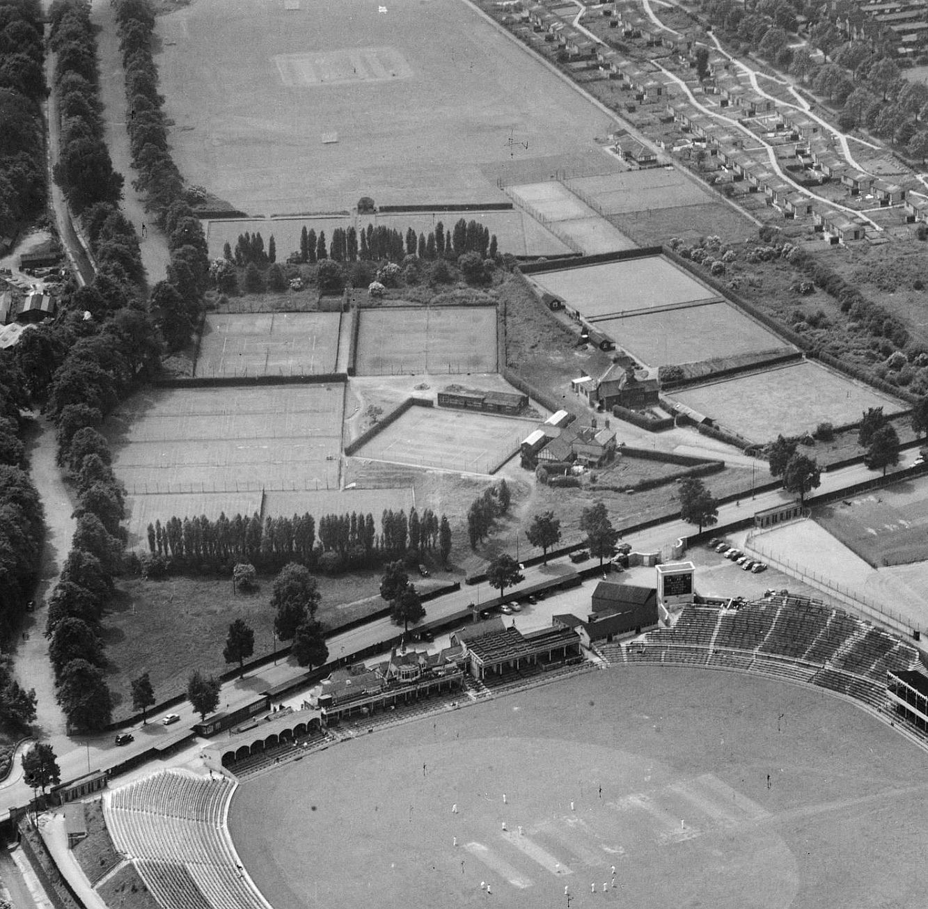
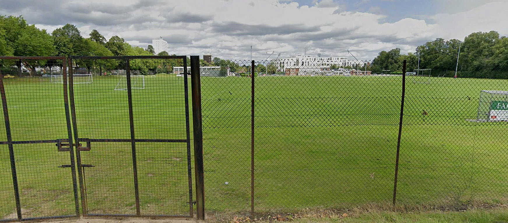
THE TALLY-HO VENUE
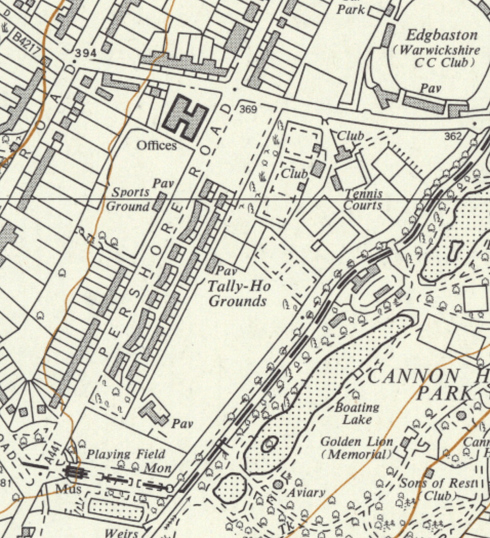
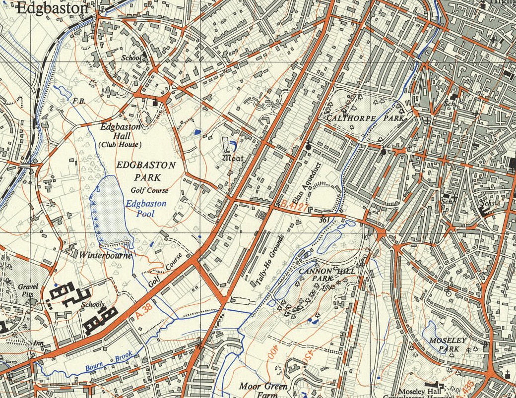

Note: These six maps and pictures were kindly provided by Michael T Holder
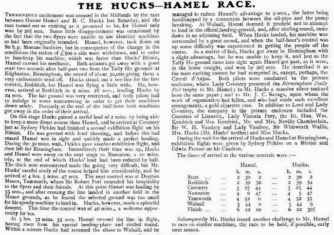
IN REALITY, THE WHOLE PROJECT WAS RENDERED A FIASCO
It appears that the race organisers had the very sensible idea to have two top pilots racing, as near as possible, identical machines. (A concept that F.1 today has tried to adopt). To date we have yet to discover what these types were intended to be. Possibly types with 50hp engines? Reading the newspaper report above, it is obvious that the 'super-star' Hamel basically trashed the whole point of the race by turning up with a 80hp Morane-Saulnier machine.
Only a complete fool would think, as Hamel did, that carrying his mechanic around the course, would equal things out. That account is well worth reading, and the fact that Hamel won by twenty seconds, does not in the slightest prove that the race was fair. Indeed, it seems the organisers scratched the £500 prize for each, which is entirely reasonable. Bentfield 'Benny' Hucks, being altogether a professional, suggested the race should be held again, this time with identical machines.
REDDITCH CONTROL AND WAYPOINT
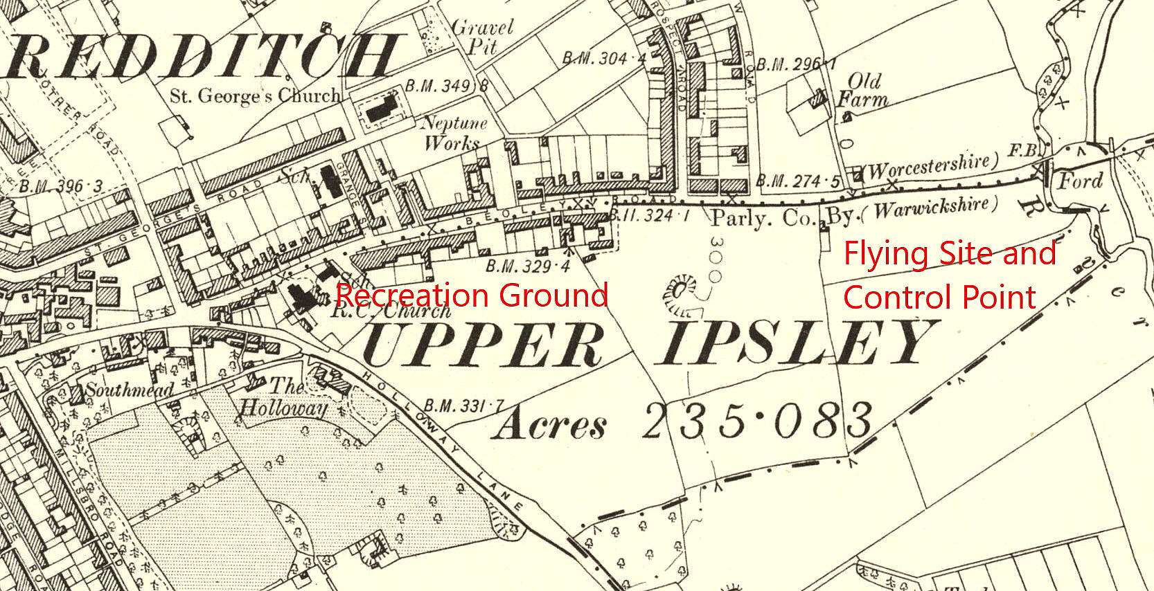
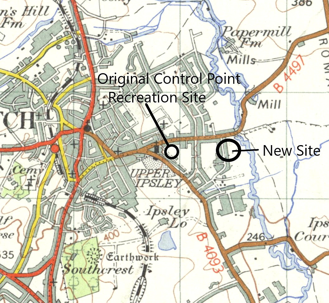
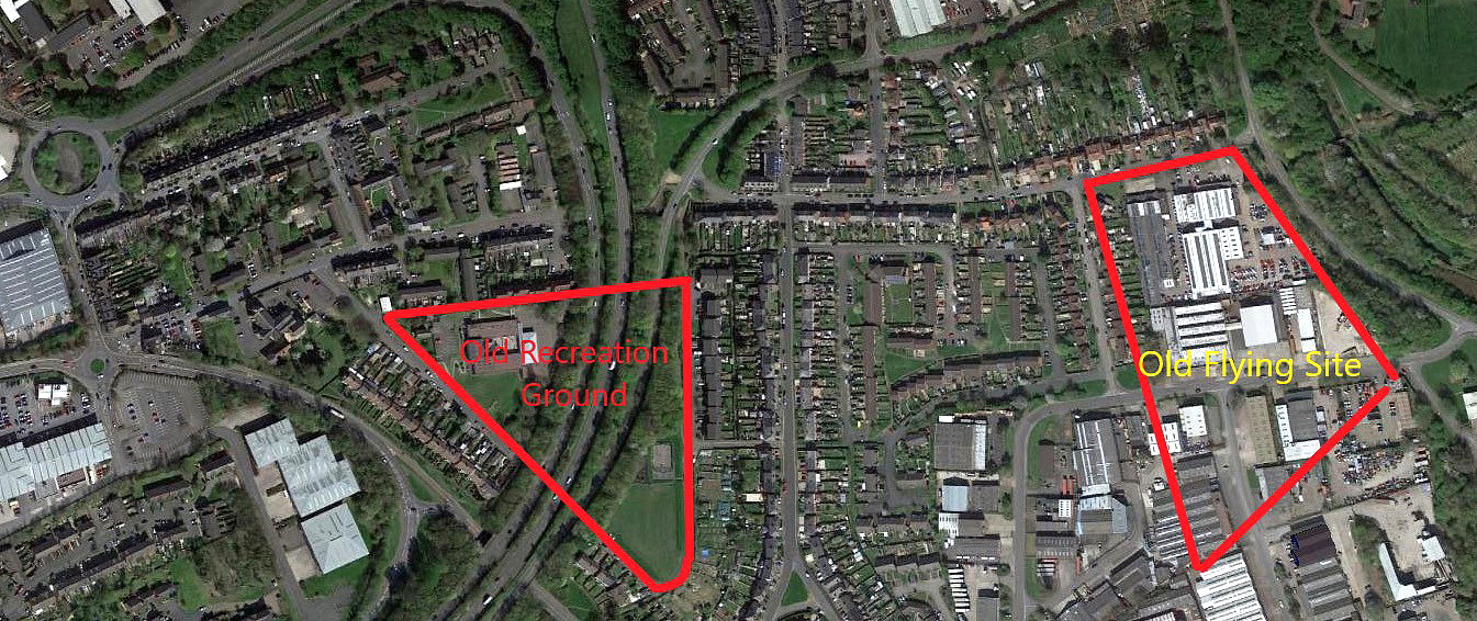
Note: These two maps and the picture were kindly provided by Mike Holder
NOTES:
It appears that a week earlier, before the start of the race, Bentfield Hucks had flown the race course to judge the suitability of the selected waypoints. According to the Redditch Local History Society account: "When Mr. Hucks went round the course last Saturday he found all the suggested controls were suitable with the exception of the one at Redditch. The land which had been fixed upon there was on a slope, which, in certain weather conditions, might be dangerous to descend upon. It has consequently been decided to change the landing place at that town. Instead of using the fair ground, as was the original intention, the aviators will descend on a field belonging to Mr. Albert Edwards, lower down the Beoley Road, by the brook. In all other respects the arrangements will be as originally announced."
One aspect of this account seems most admirable, in that Hucks was so professional in those days, to undertake a survey of the route and 'control' points.
THE COVENTRY CONTROL AND WAYPOINT
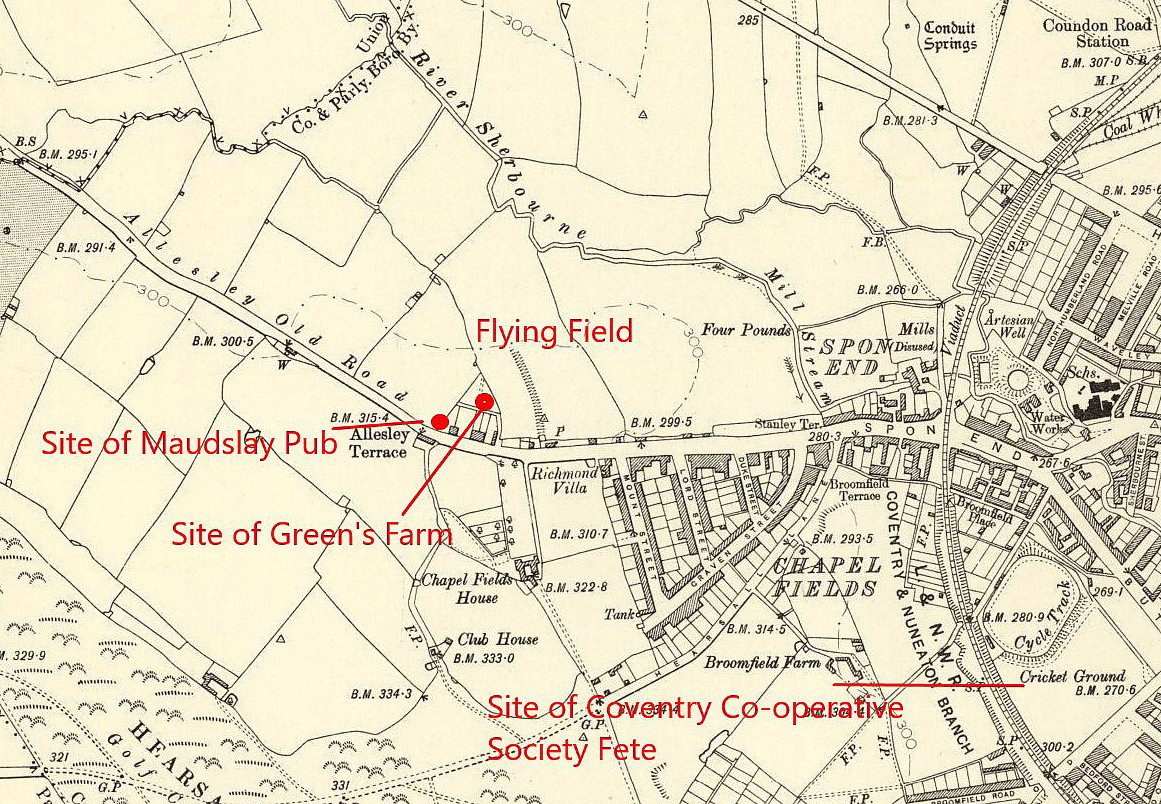
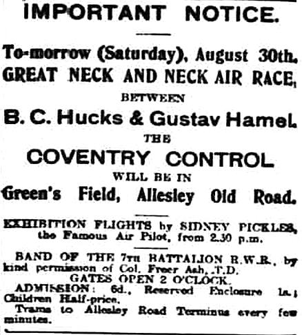
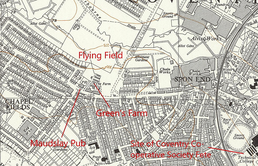
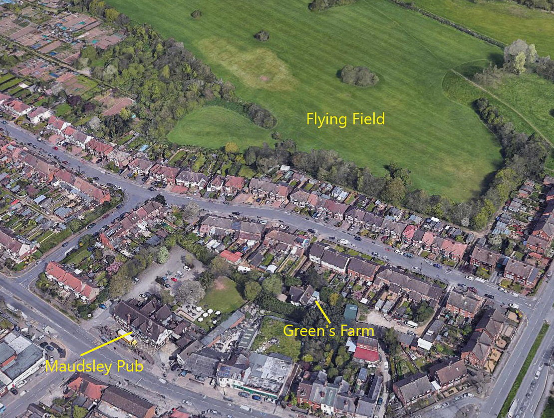
Note: All four of these maps etc were provided by Mike Holder, as was the 'bonus' picture below.
BONUS PICTURE:
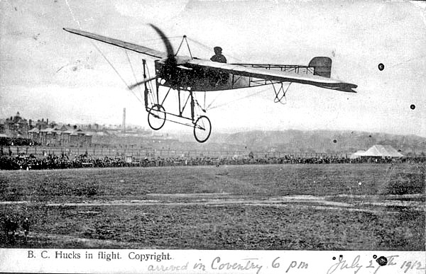
Note: Mike Holder unearthed this picture of Bentfield 'Benny' Hucks flying at a Coventry venue on the 27th July 1912. He also wishes to make it known that he was much aided in identifying this site by a local historical society who were discussing the flying at Green's Field. For example:
"Green's farmhouse was behind where the Maudsley pub is now at the top of what was to become the Prince of Wales Road." And:
"The Coventry control was again on Mr Green's field on Allesley Old Road and 4,336 paid admission, with many thousands more outside the official enclosure or viewing from vantage points such as Hearsall Common."
It really must be mentioned that, along the way in producing this 'Guide', so many members of local historical societies have been a great help.
THE NUNEATON CONTROL AND WAYPOINT
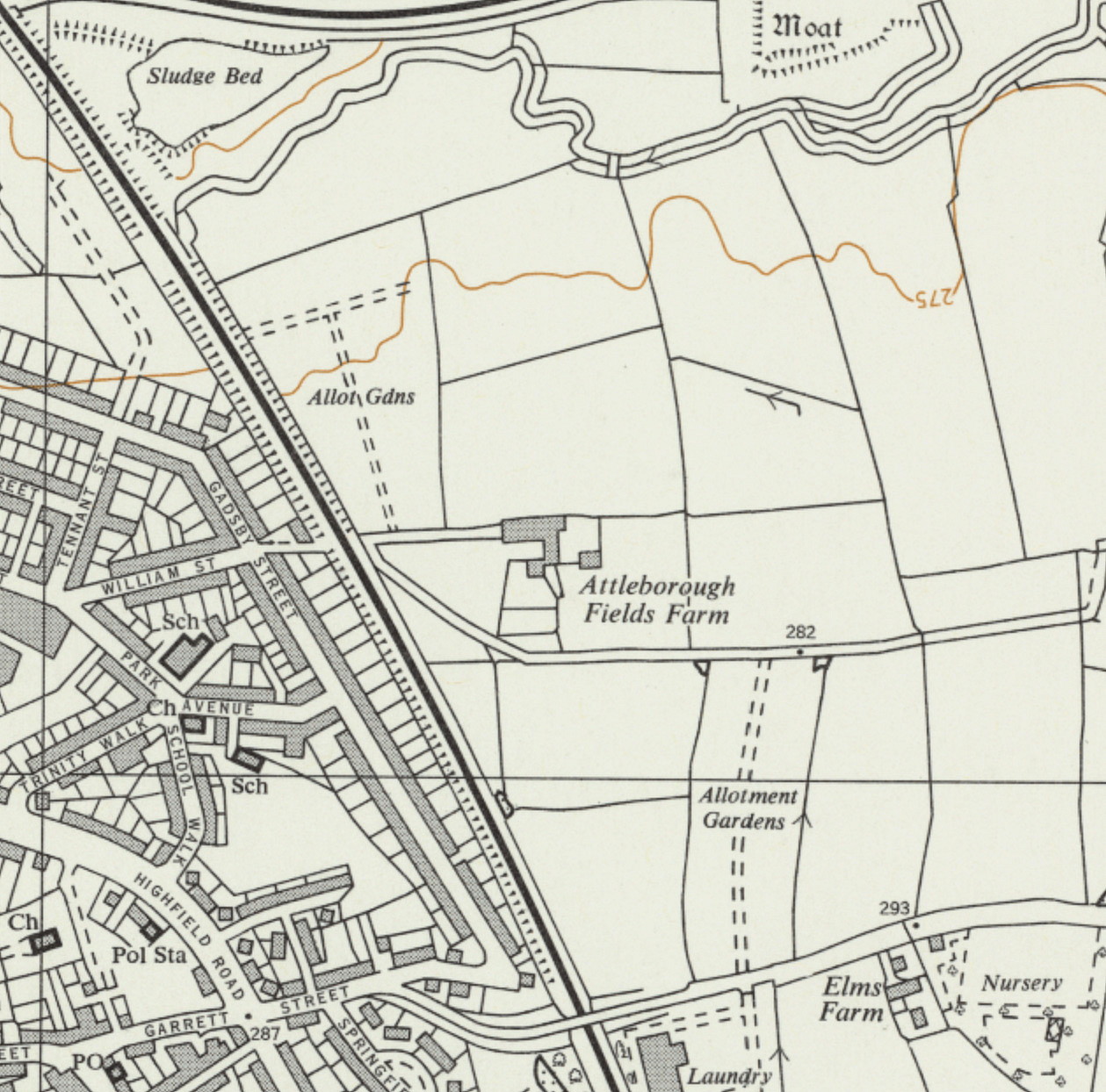
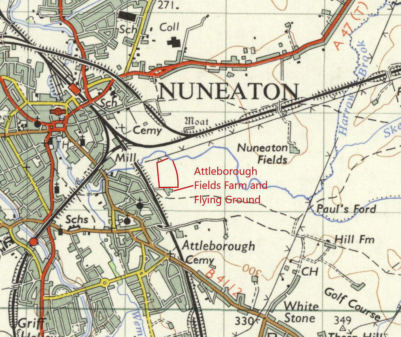
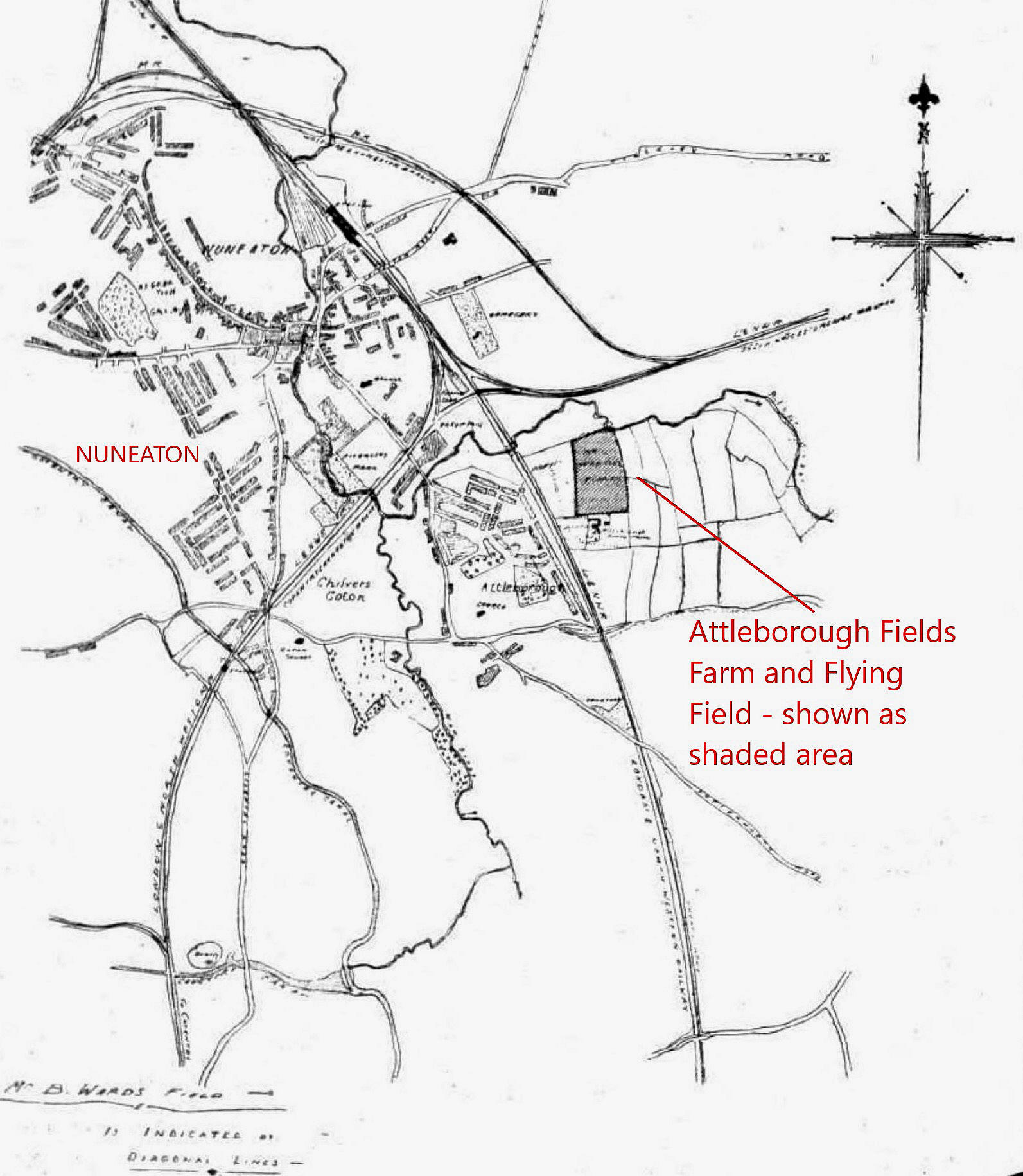
The first five maps and pictures were kindly provided by Michael T Holder. I have added the race course imposed on a modern Google Earth © view of the area which shows some of the sites listed in this 'Guide'.
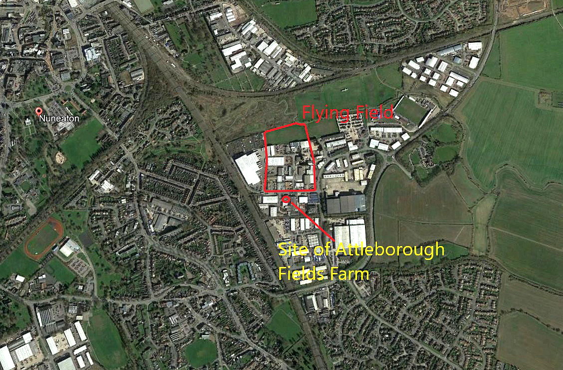
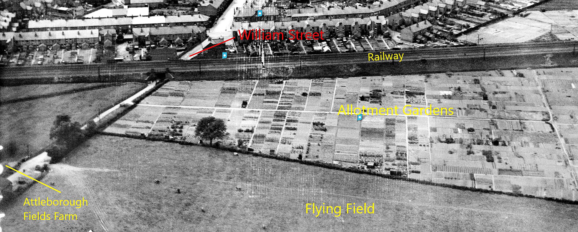
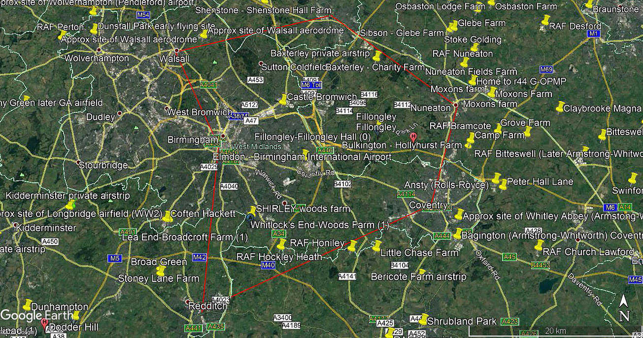
NOTES: Just a rather pedantic point I suppose, but it was stated that a half-hour break at each control point, (Tamworth forty minutes), would allow the aviators to refuel and make adjustments to their engines. Highly laudable of course, but even in those days these aeroplanes easily had the range to complete the whole course. Clearly, having to land and take-off at each waypoint would have increased the fuel consumption considerably, but even then, at worst, only one refuelling would have been needed.
THE TAMWORTH CONTROL AND WAYPOINT
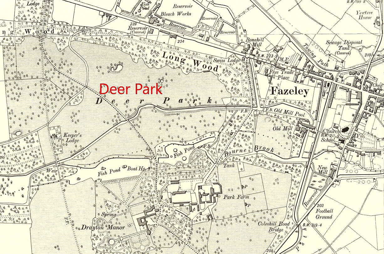
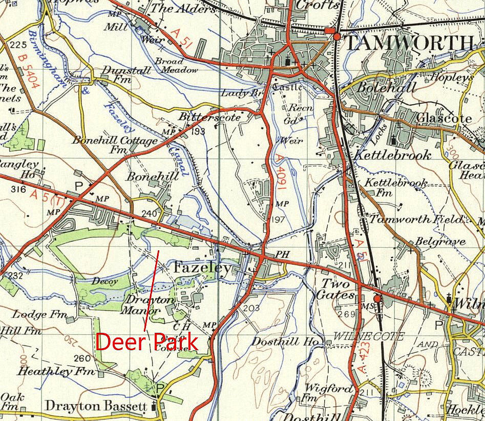
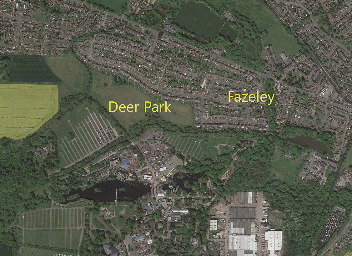
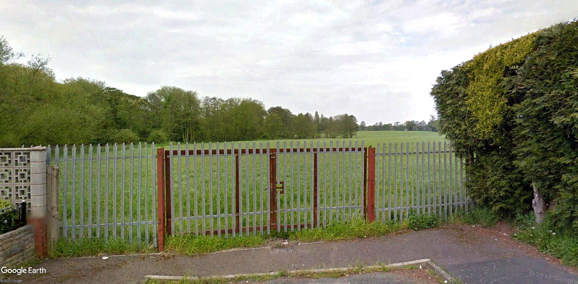
Note: Once again, these maps and pictures kindly provided by Mr Michael T Holder
This article was published in the Tamworth Herald on Saturday the 30th August 1913:
The Birmingham Air Race.
___________
DRAYTON MANOR CONTROL
_______
HUCKS v. HAMEL
"It is evident that the public are enormously interested in the unique air race which is to be decided today (Saturday), when the well known aviators Mr. B.C. Hucks and Mr. Gustave Hamel will start from the Tally-Ho Club grounds, Edgbaston, on a "neck-and-neck" flight round Birmingham for £500 a side and a trophy offered by the "Daily Post". We are now able to give a time-table showing the approximate times of arrival and departure." (My note - this is shown above).
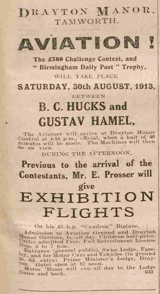
"The public will be admitted to the various 'controls' at each of which a halt of half an hour will be made, (except at Drayton, where the contestants will have forty minutes for refreshments), but there will be no exhibition flights at any of these stopping stations. The aviators will simply stop to take on a fresh supply of petrol or make any necessary adjustments to their engines. The services of Mr. E. Prosser, a Birmingham airman, who flies a 45 h.p. Caudron biplane, have been enlisted. He will give flying exhibitions at the Drayton Manor control from 3 p.m. until 4-15, when he will fly to the Walsall 'control'."
THE WALSALL CONTROL AND WAYPOINT
Note: See seperate listing for SPRING VALE
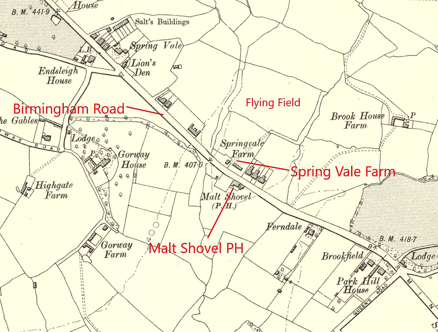
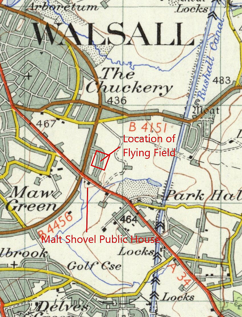
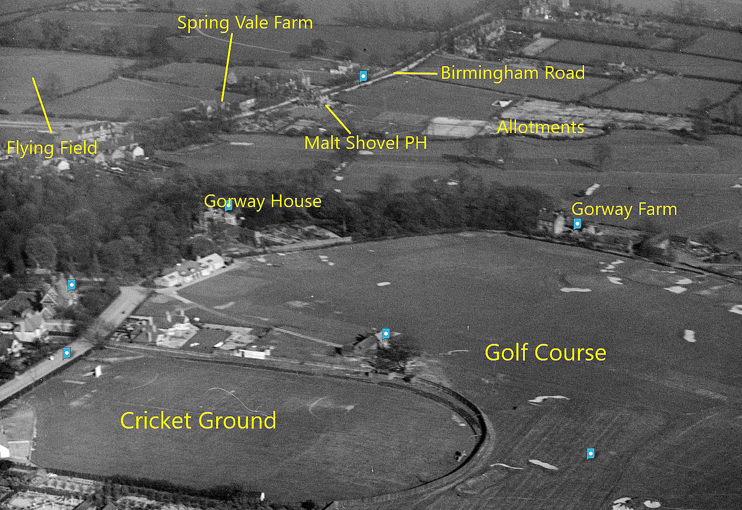
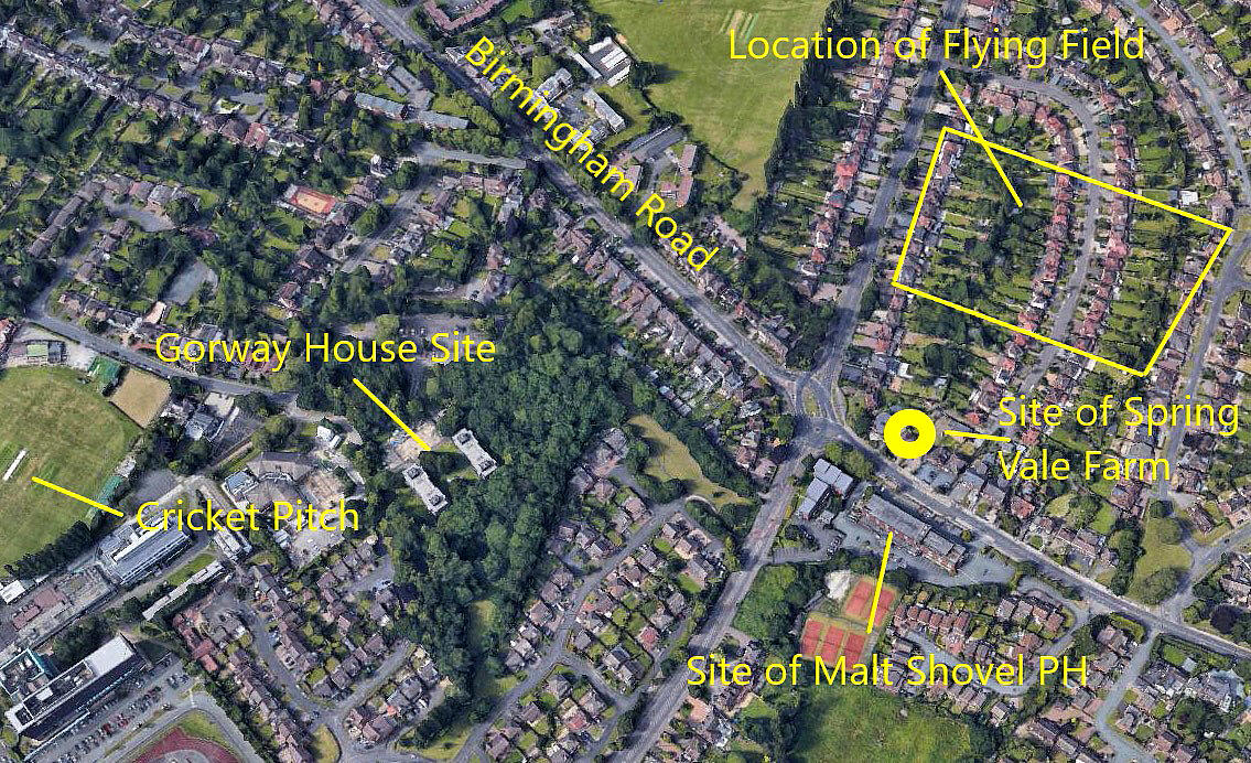
Note: Here again, all maps and pictures, and the advert below, were kindly provided by Michael T Holder.
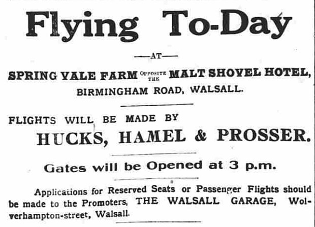
My comment: It is such a shame, especially when seen from over a century since, that the cavalier and contemptuous attitude of Gustav Hamel ruined the whole idea of this race. It would have been of great interest to those then, and us today, to see how these two aviators would have coped given 'identical' machines. My money is on Hucks, being by far the most professional aviator. Perhaps Hamel knew this too, hence his decision to ruin the event?
END NOTE
All this said, the event is, without any doubt, well worth adding to the history this 'Guide' is dedicated to.
We'd love to hear from you, so please scroll down to leave a comment!
Leave a comment ...
Copyright (c) UK Airfield Guide
