














Burnham-on-Crouch flying sites
BURNHAM -on-CROUCH: Seaplane Alighting Area
Location: In the River Crouch estuary roughly S of Burnham-on-Crouch
NOTES: Shown on Admiralty chart 1610 in the 1930s
BURNHAM-on-CROUCH: Military Landing Ground
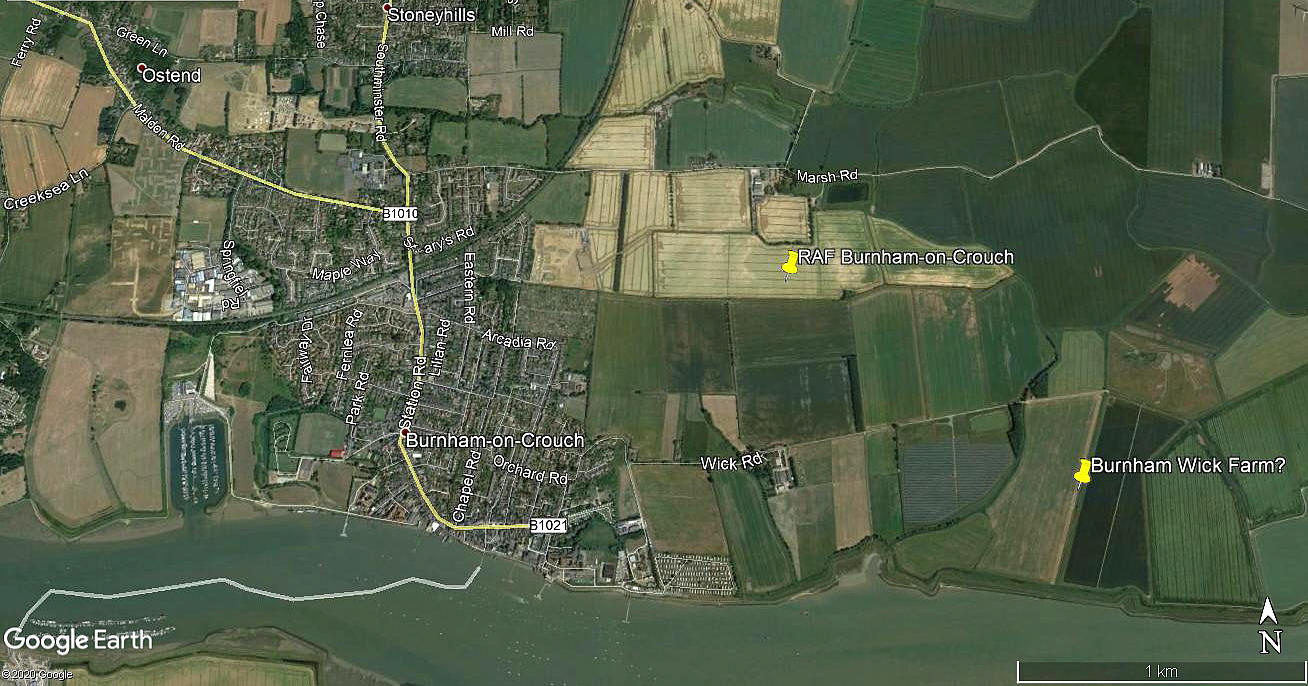
Note: This picture was obtained from Google Earth ©
I have the Airfields of Britain Conservation Trust for helping me to pinpoint this airfield
Military users: 1914: RNAS HD Station (Royal Naval Air Service - Home Defence Station)
1916-1919 RFC/RAF (Royal Flying Corps / Royal Air Force)
37 [Home Defence] Sqdn (Royal Aircraft Factory B.E.12)
Location: Just NE of town, S of road to Burnham Wick
Period of operation: WW1: 1914 to 1919
Site area: WW1: 102 acres 686 x 549
NOTES: I was, many years ago, assuming that as the evidence does seem to fit, that the 1930s civilian site is exactly the same as the WW1 airfield?
I now think a separate listing is needed after information provided by the ARG (Airfield Research Group), and other sources since, that became available many years later after making the initial notes: See below.
BURNHAM-on-CROUCH: Civil Landing Ground
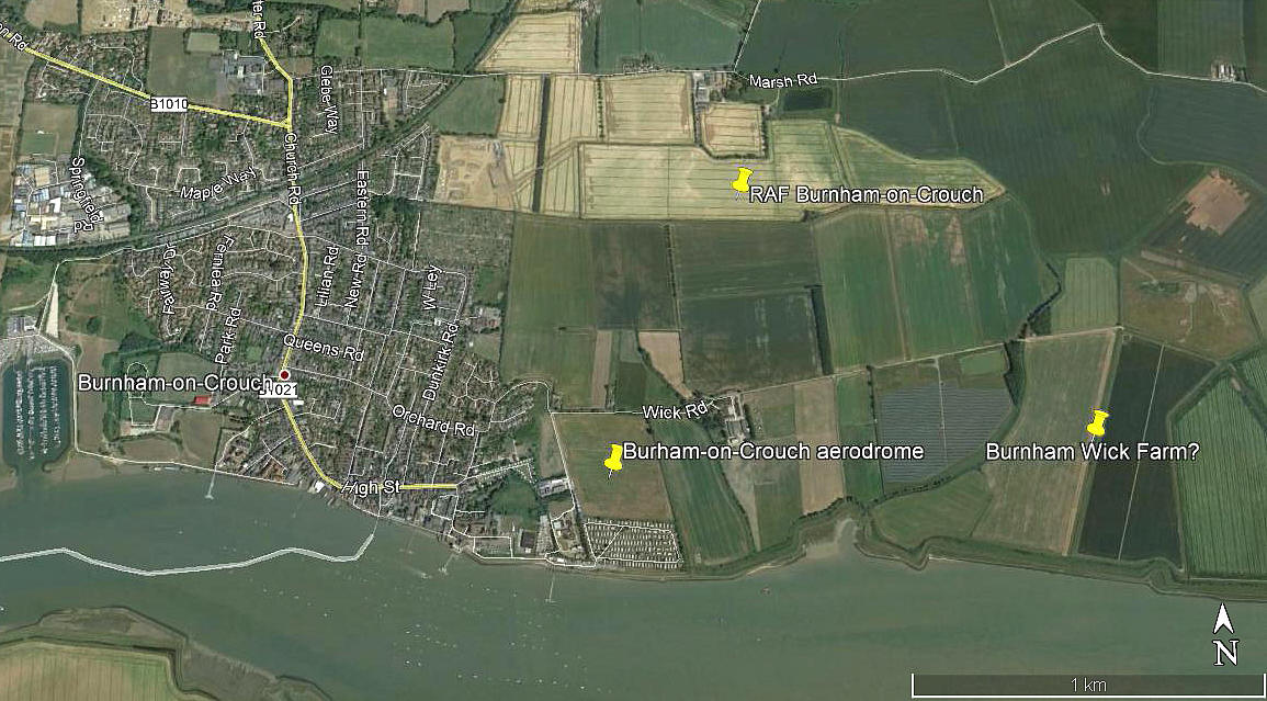
Note: This picture was obtained from Google Earth ©
Once again I have the Airfields of Britain Conservation Trust to thank for helping me pinpoint this location.
Operated by: The Royal Corinthian Yacht Club
Location: “250 yards from the Royal Corinthian Yacht Club” in Burnham-on-Crouch.
Period of operation: 1930s only? 1934 to 1939 according to the Airfields of Britain Conservation Trust.
Runways: 1933: Max run available: 366 grass
NOTES: This was it appears also an AA (Automobile Association) approved Landing Ground. Fuel wasn’t available on site but could be ordered from P. Newall Pettecrow, Belvedere Road, or from Crouch Engineering. Transport was available from Mr Bridge at Lilian Road. The hotel recommended was the White Hart also in Burnham-on-Crouch and a telephone was available in the Yacht Club.
We'd love to hear from you, so please scroll down to leave a comment!
Leave a comment ...
Copyright (c) UK Airfield Guide
