














Caversham flying sites
Note: This map only shows the position of Caversham within the UK.
In March 2020 I was kindly contacted by Mr John Joyes - see 'Comment' below which refers to the BLAGRAVES FARM location. Since then Mr Michael T Holder, a great friend of this 'Guide' has had a look into the history of this area. See below.
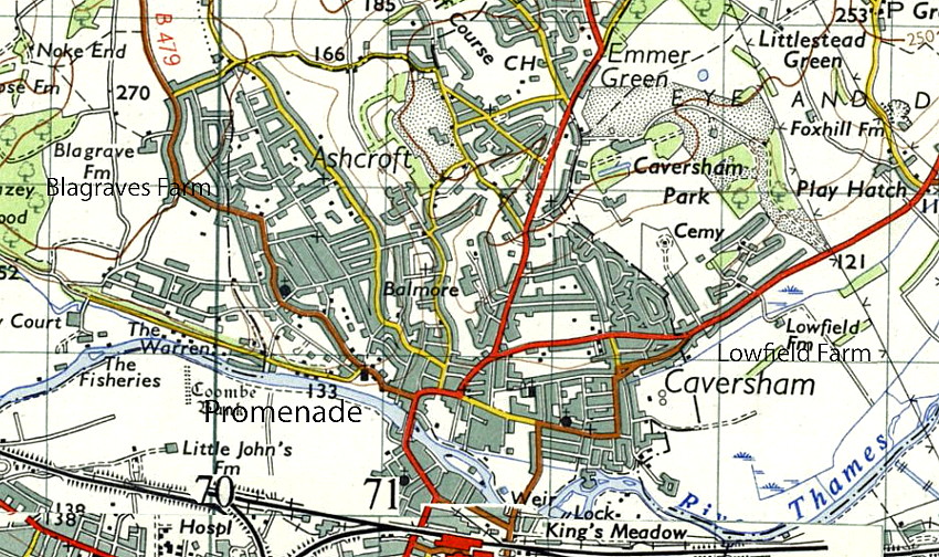
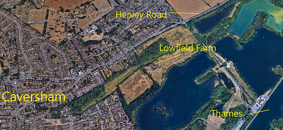
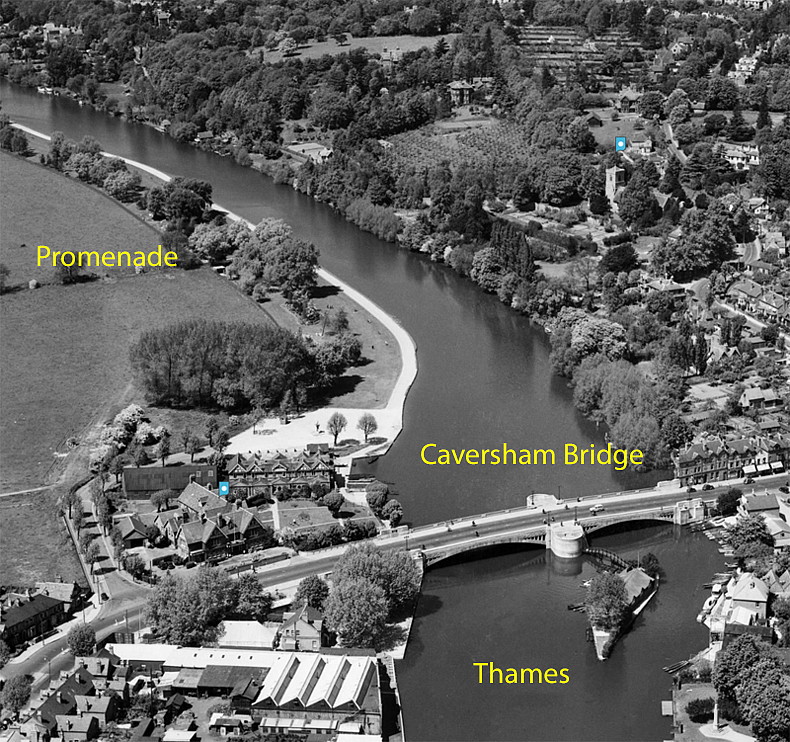
CAVERSHAM: In the 1920s there were three temporary aerodromes being used for flying displays and joy-rides. The first was BLAGRAVES FARM, roughly 1nm WNW of Caversham bridge, being used from 1919 to 1922. Later displays were held at LOWFIELD FARM, situated east of Caversham, perhaps from 1926 to 1928? In 1929 at least one display took place from the field adjacent to the PROMENADE which is on the south bank of the River Thames, just west of Caversham Bridge. So, strictly speaking, not actually in Caversham?
A MICHAEL T HOLDER GALLERY
BLAGRAVES FARM
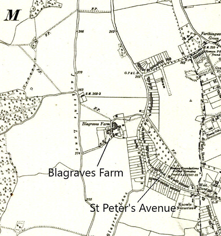
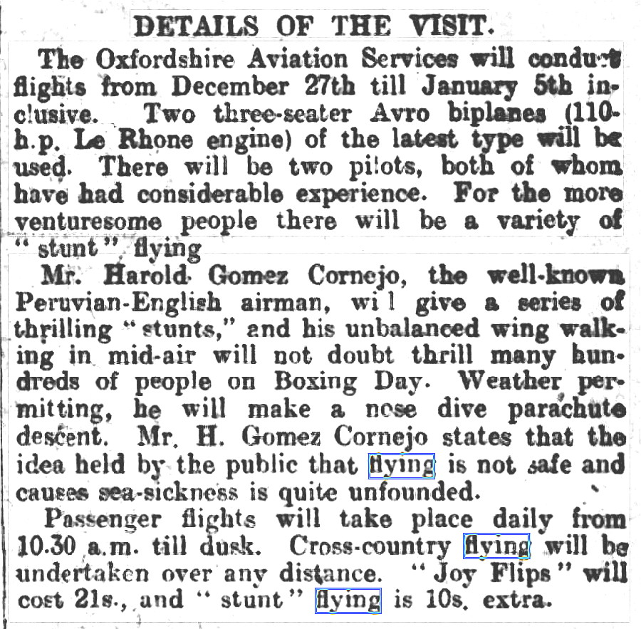
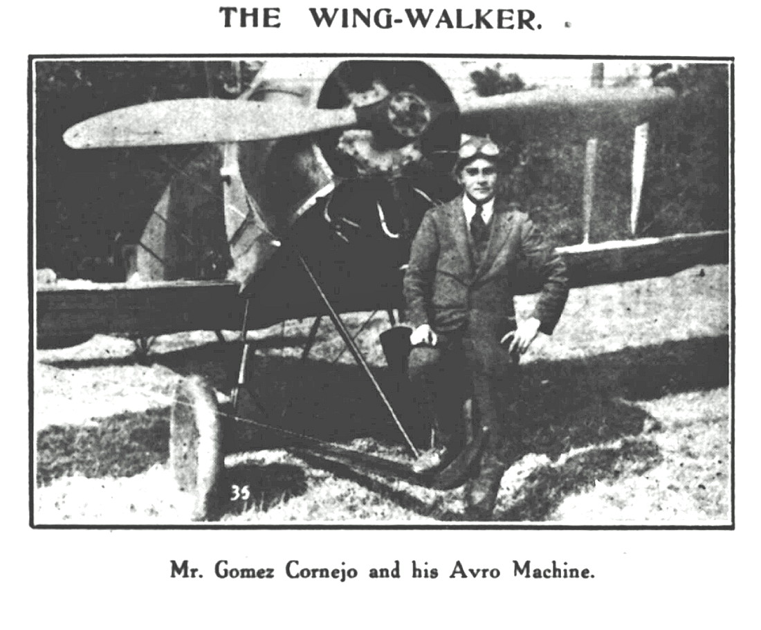
Note: The Article One was published in the Reading Observer on the 18th December 1920. The second item, a picture, was published in the Reading Observer on the 8th January 1921.
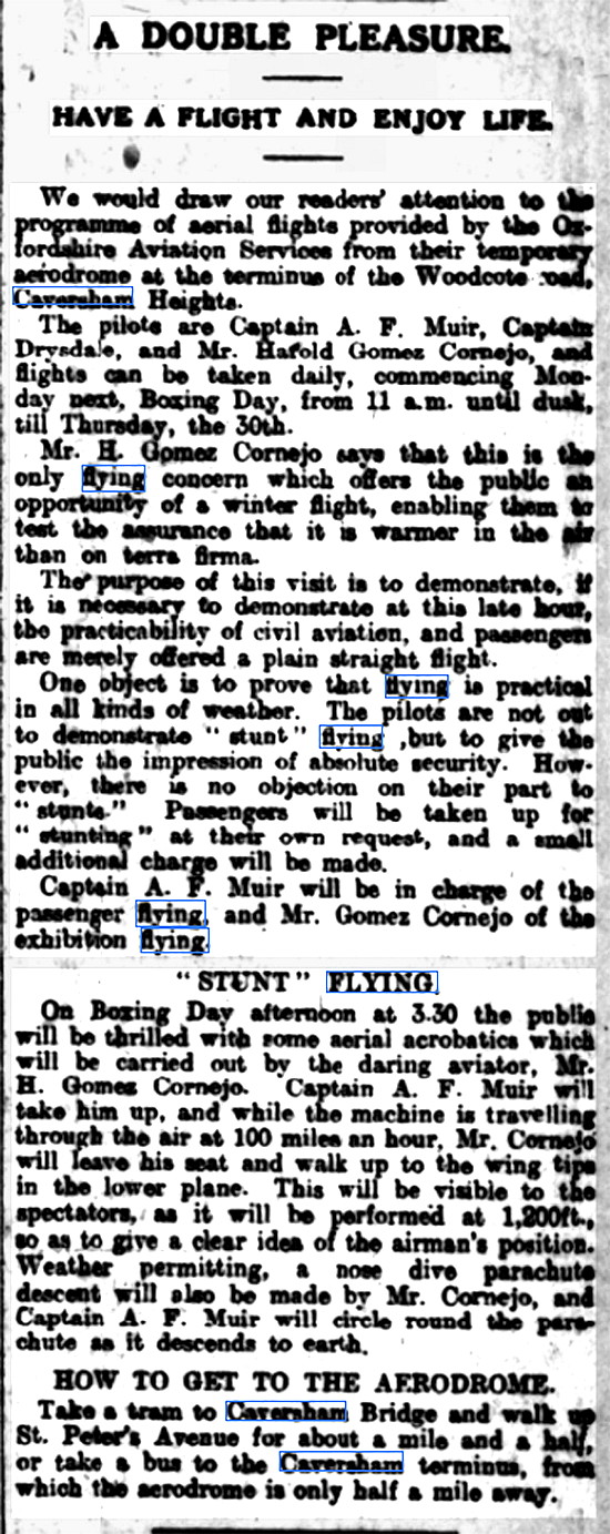
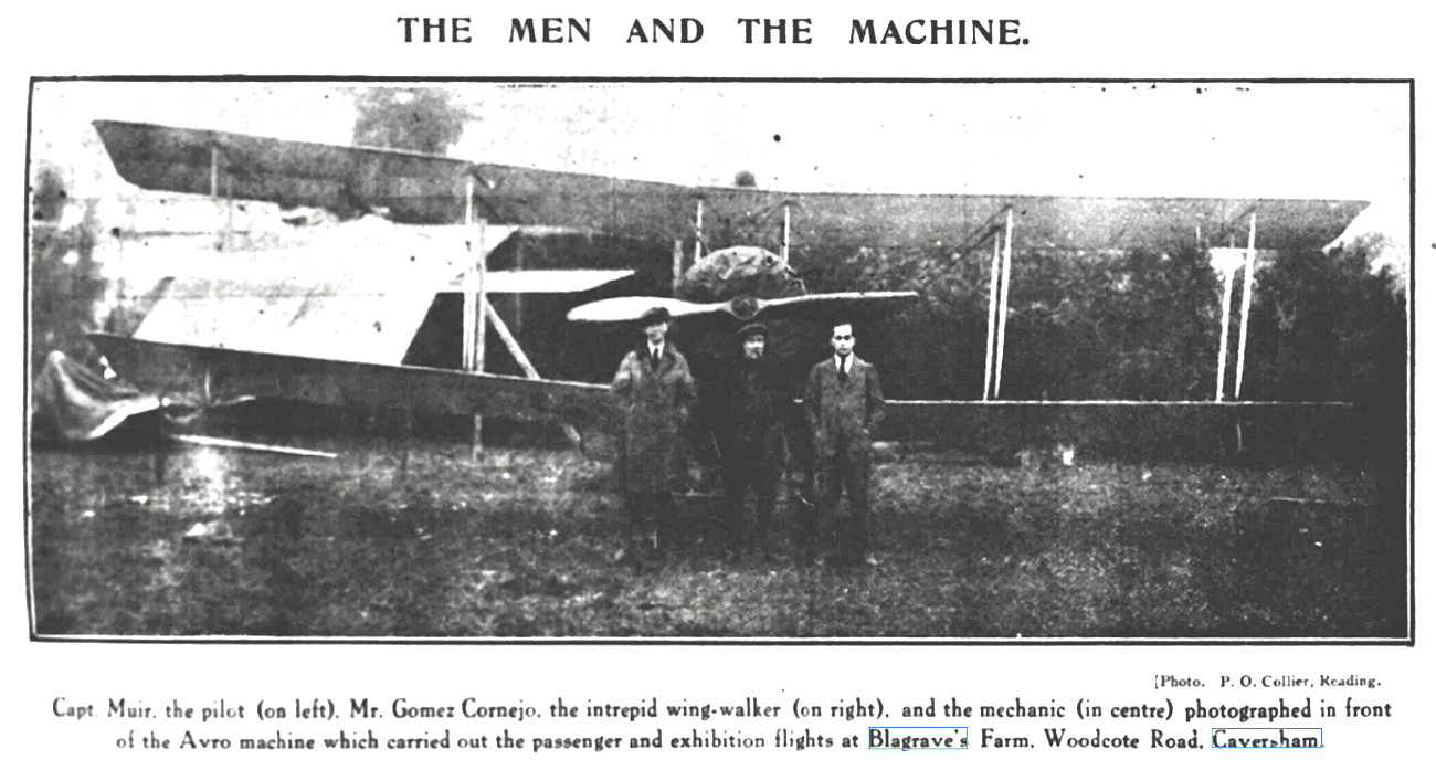
The fourth item, article Two, was published in the Reading Observer on the 25th December 1920. The picture was published in the Reading Observer on the 8th January 1921.
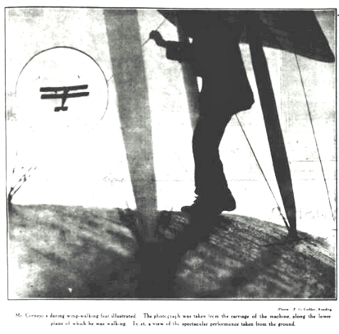
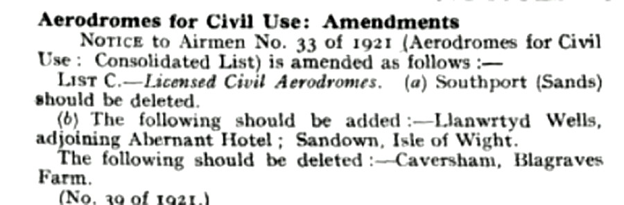
Note: This seventh item, a picture, was published in the Reading Observer on the 8th January 1921. The eighth item, a notice in Flight magazine, was published on the 12th May 1921.
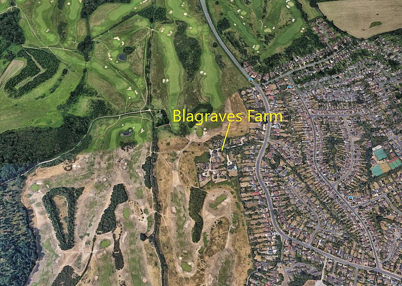
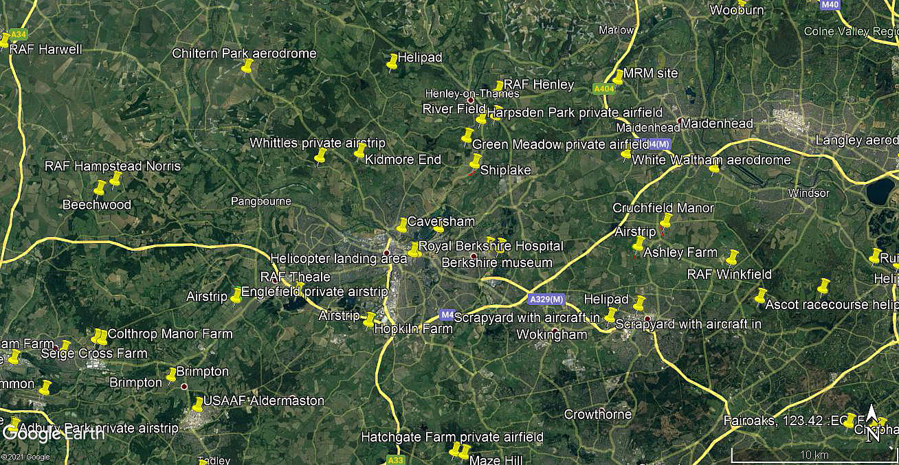
The ninth item, an area view, is from my Google Earth © database.
SOME EXTRA ITEMS
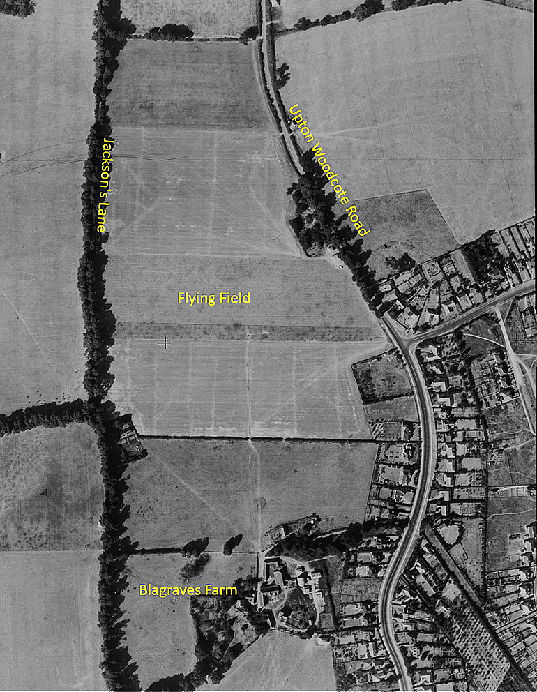
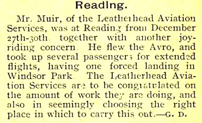
The process of compiling this 'Guide' is often a case of adding additional items found over many years. Some of which can change the existing story quite seriously, or pose more questions. The aerial photo above for example appears to show to modern eyes, the likely evidence of an east-west runway. Without much if any doubt this is misleading, as in most cases in those days for temporary venues such as this, pilots landed and took-off on a field facing into wind. Which was why windsocks were invented very early on.
Just a minor point of course in most respects, but of interest to me at least when trying to compile a 'Guide' which includes to some extent who did what and when, is that the article in the Reading Observer says that Capt. A F Muir was flying for Oxfordshire Aviation Services. Whereas the short article published in The Aeroplane on the 5th January 1921, says he was with Leatherhead Aviation Services, which I think he may well have formed, therefore being a sub-contractor.
I mention this because this is an early example of 'subbies' being used at large events, especially when the "Flying Circus" era emerged during the "Great Depression" from the early 1930s. Indeed, in those days perhaps around half of the display teams were comprised of 'subbies'.
LOWFIELD FARM
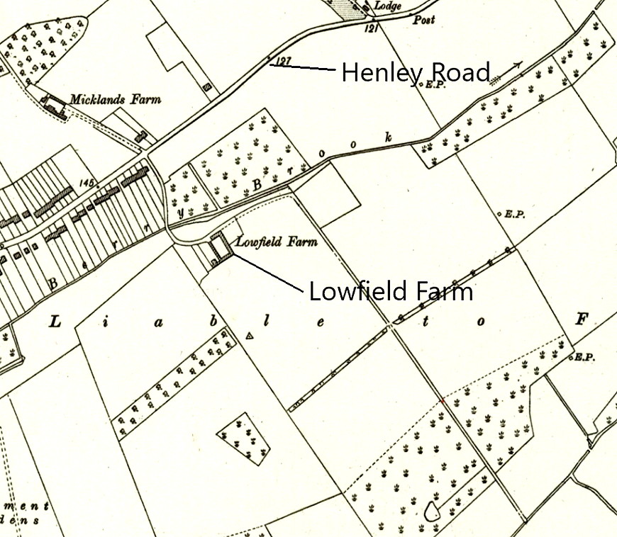
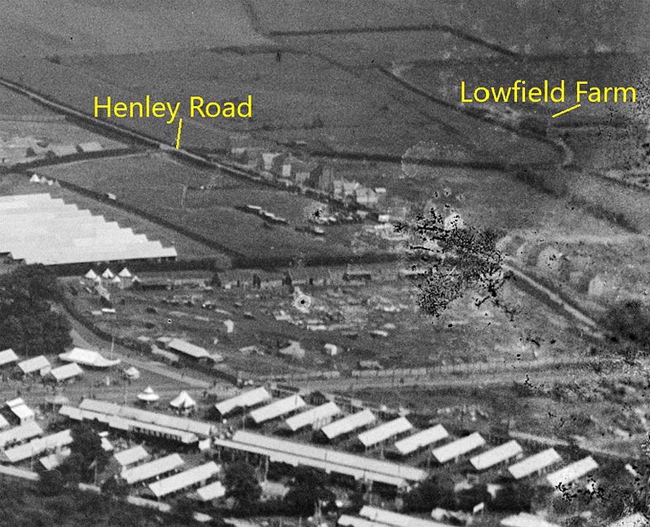
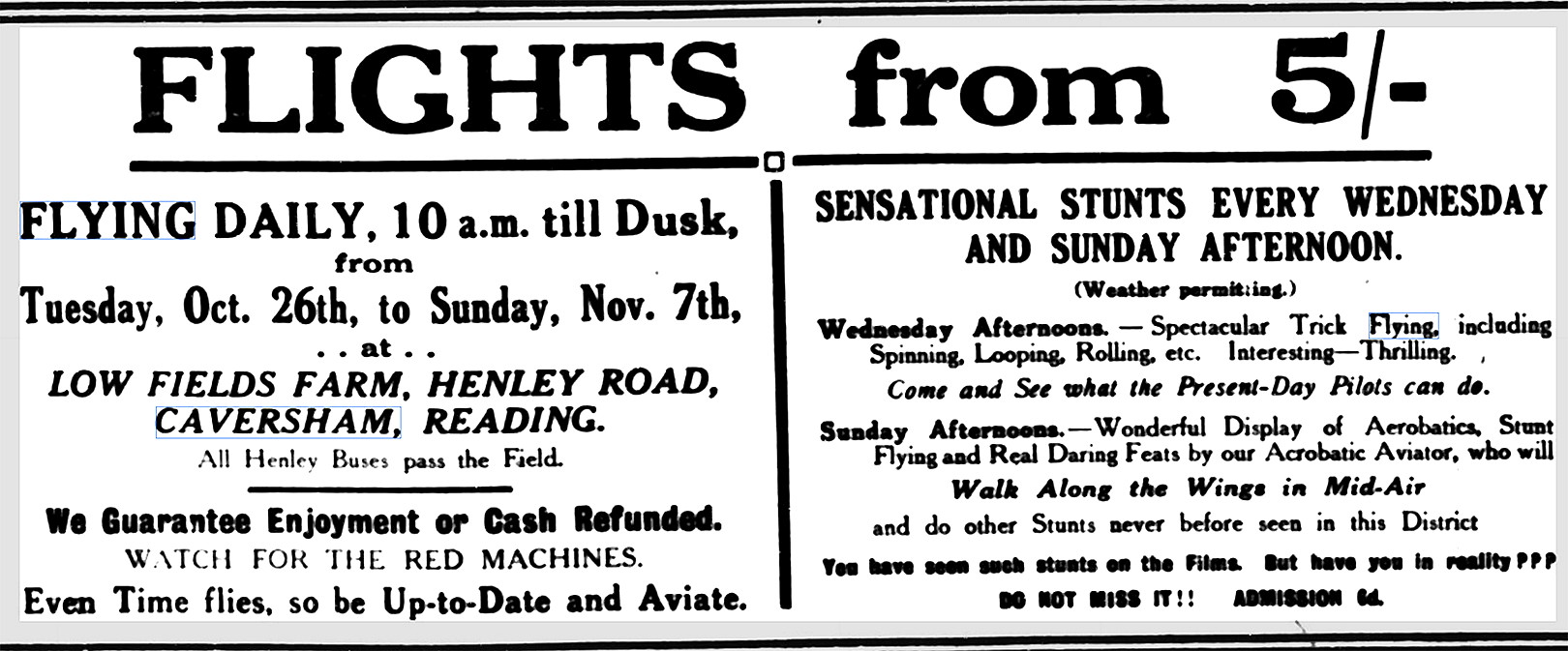
Note: This third item, an advert, was published in the Reading Standard on the 30th October 1926, concerning Air Displays being held from the 26th October until the 7th November.
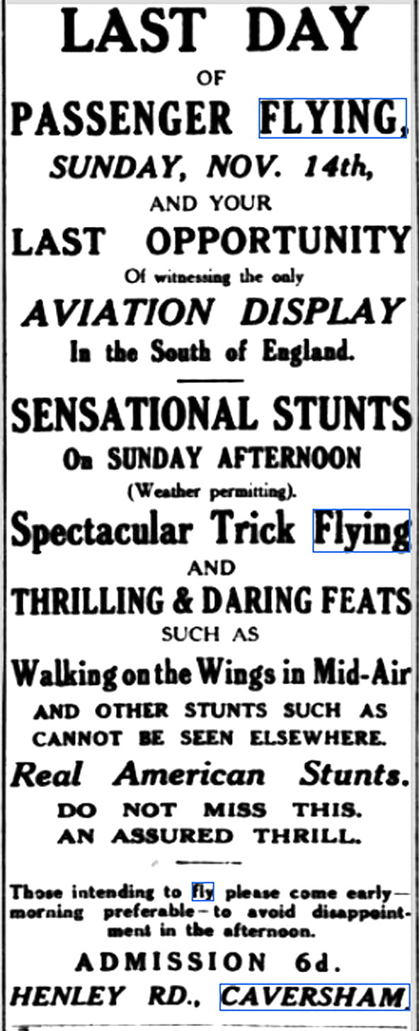
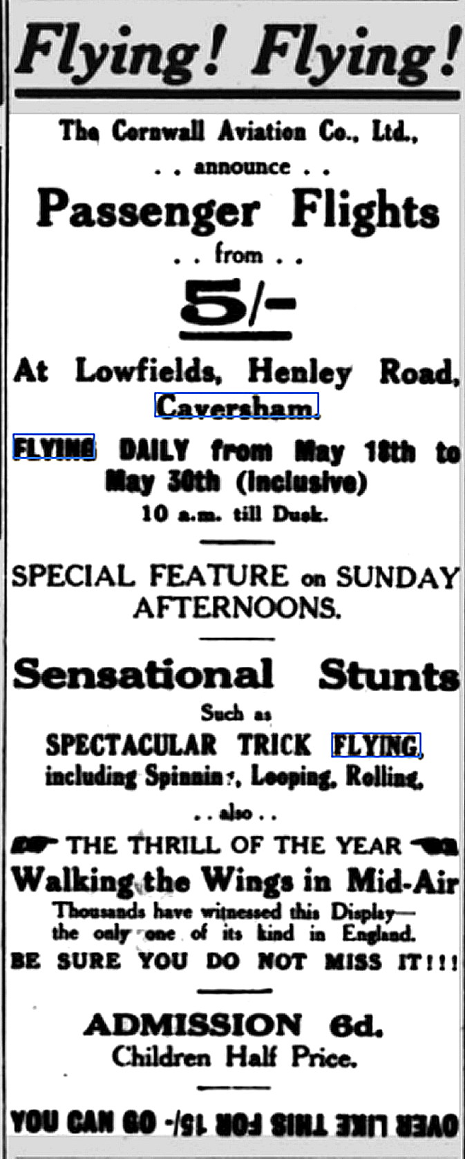
Note: The fourth item, an advert, was published in the Reading Standard on the 13th November 1926 regarding an air display being held on the 14th November 1926.
The sixth item, another advert, was published in the Reading Standard on the 19th May 1928.
There is a lesson to be learnt here from the fourth item. Having enough business generated over several days clearly indicates the huge amount of popular enthusiasm for such events. Just a few years later, even bigger and more spectacular displays, in most cases, would warrant just a single day display.
PROMENADE
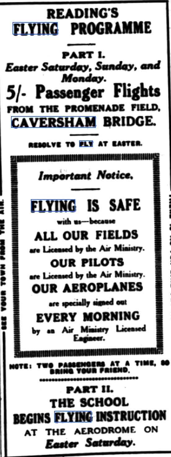
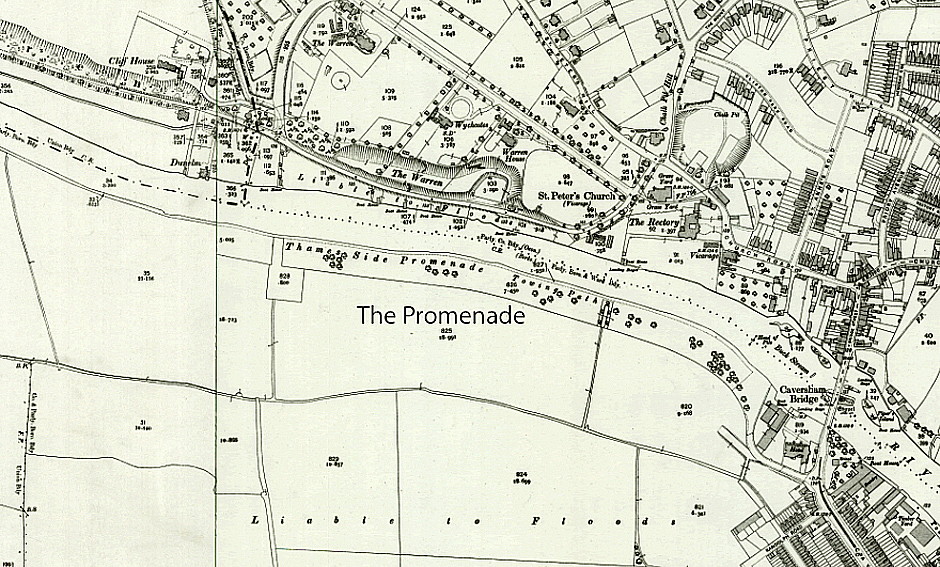
Note: The advert was published in the Reading Standard on the 23rd March 1929.
NOTES: As always in this 'Guide', if anybody can kindly offer advice and information, this will be most welcome.
John Joyes
This comment was written on: 2020-03-25 10:34:05Not really an aerodrome, just a farmers field leased for displays and pleasure flights, a few times a year, from 1919 to 1922, at Blagraves Farm, 51°28'43.9"N 0°59'59.5"W, now a golf course. Information derived from newspaper adverts and reports.
We'd love to hear from you, so please scroll down to leave a comment!
Leave a comment ...
Copyright (c) UK Airfield Guide
