


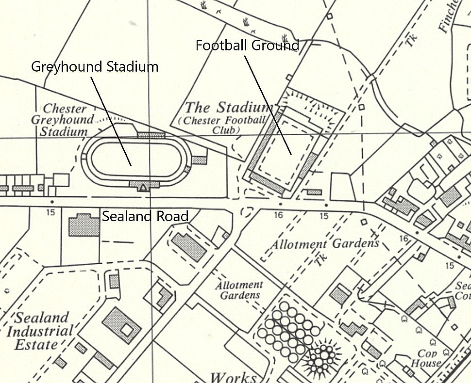
Chester City Football Ground
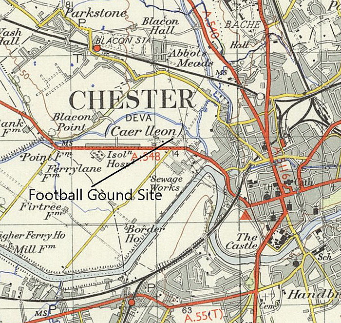
Note: This map shows the present location of the Club.
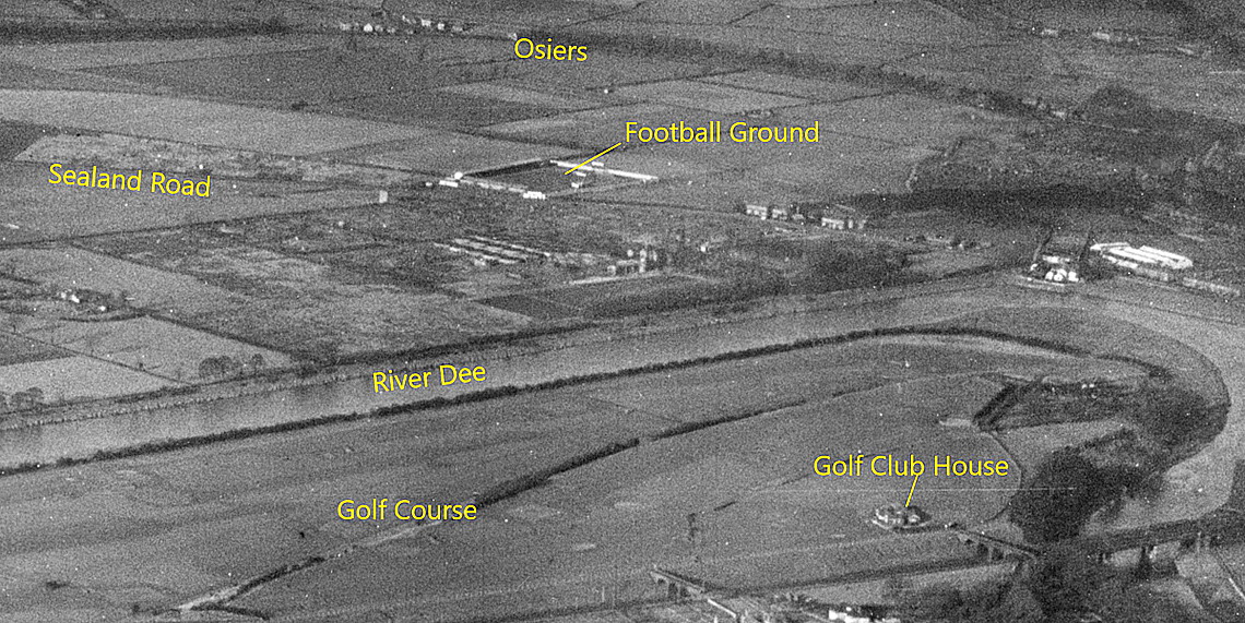
CHESTER CITY FOOTBALL GROUND: Temporary aerodrome
Note: This map was provided by Mr Graham Frost, a great friend of this 'Guide'. This was provided long before Mike Holder decided to investigate the vernue. (See below)
Operated by: Gustav Hamel, (presumably on account of the Graham-White Co?)
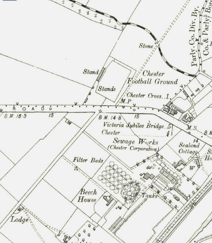
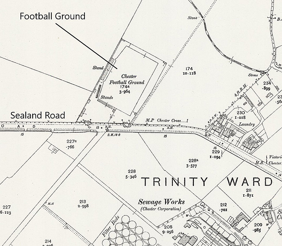
Location: Sealand Road, Chester
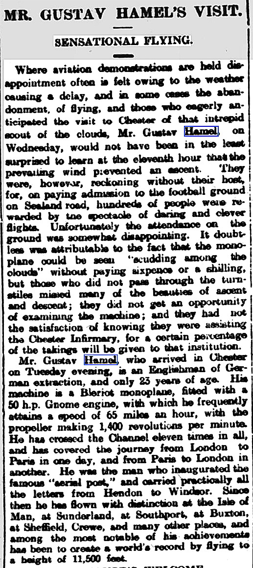
Period of operation: Wednesday, 16th October 1912
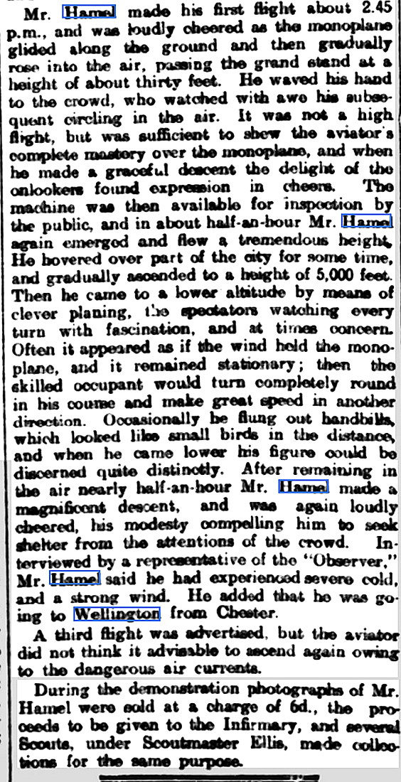
NOTES: Hamel, presumably flying his Blériot, gave three demonstration flights at 14.30, 15,30 and 16.30. (The latter 16.30 exhibition being planned but not flown it seems?) Part of the proceeds went to the Chester Royal Infirmary.
A MICHAEL T HOLDER GALLERY
We have Mike Holder, a great friend of this 'Guide', to thank for investigating this venue and providing the following.
This article, in three parts, was published in the Cheshire Observer on the19th October 1912.
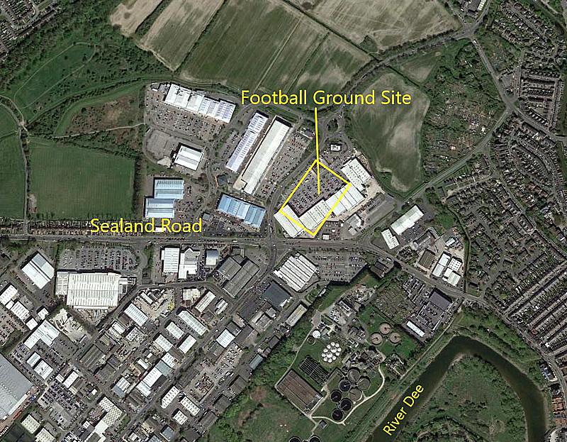
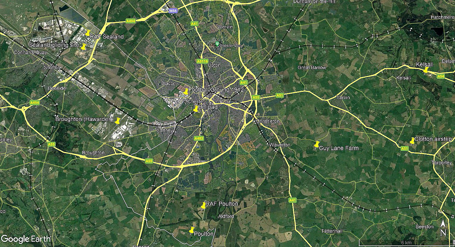
The local area view is from my Google Earth © derived database.
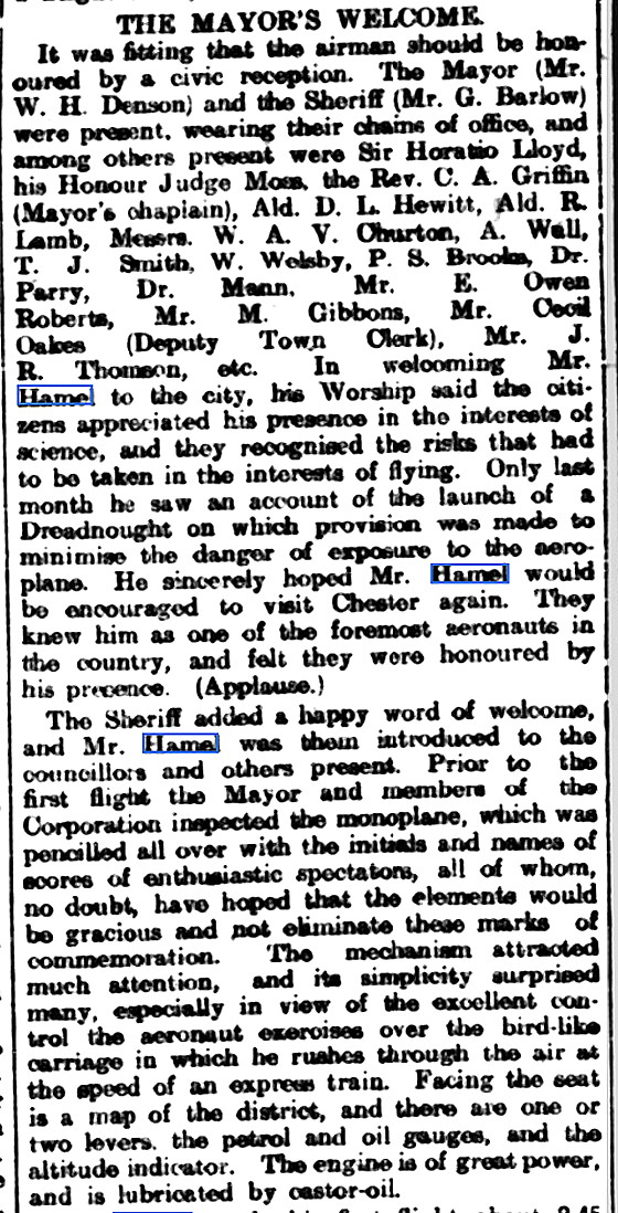
NOTES: As mentioned many times elsewhere in this 'Guide', the appearance of an aviator with his machine, (as aeroplanes were then called), excited much interest for the public if an exhibition of flying was about to take place. And indeed, the local dignitaries were very keen to be involved.
Especially so if a very famous aviator, such as Gustav Hamel, was giving the 'exhibition of flying'.
We'd love to hear from you, so please scroll down to leave a comment!
Leave a comment ...
Copyright (c) UK Airfield Guide
