


Coalisland
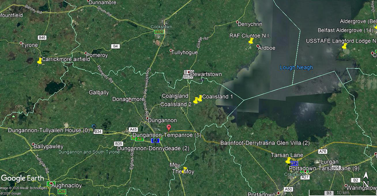
Note: This map shows the position of COALISLAND 2 listed below.
COALISLAND: Private airstrips
Note: It was Karel Adams, a great friend of this 'Guide' who suggested I should look into this area, giving me his suggestion of where the first listing could be. And, he was quite correct. These two airstrips must of course be known locally by other names, but so far we cannot find what these are. It has to be said that investigating the history of British flying sites within the U.K. really is, in so many cases a nightmare. In Northern Ireland, doubly so.
I have to say that having toured the region with my wife it really is a most lovely part of the world, and we could not have wished to be treated by such kind and welcoming people everywhere we went and stayed. But of course, I wasn't looking for the airstrips!
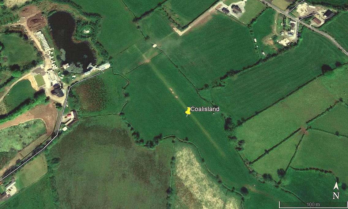
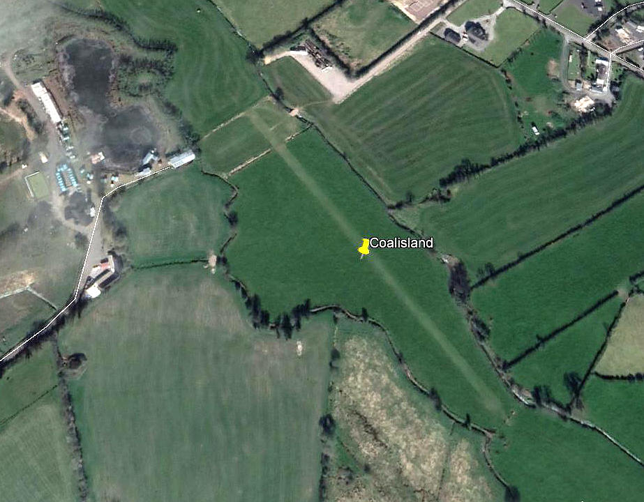
COALISLAND 1
Note: These two pictures were obtained from Google Earth ©
Location: 2nm ESE of Coalisland
Period of operation: Circa 2009 to 2013?
Runway: 18/36 265 grass
Note: This picture was obtained from Google Earth ©
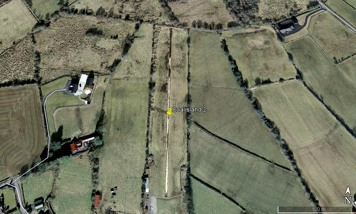
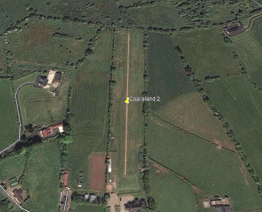
COALISLAND 2
Note: Both of these pictures were obtained from Google Earth ©
Location: About 1.75nm ESE to SE of Coalisland
Period of operation: Circa 2015 perhaps(?) to -
Runway: 14/32 315 grass
NOTES: The proof of an airstrip in this area existing comes only from the AAIB report EW/G2005/12/15.
I had noted a few years ago that; "A good look at the area on Google Earth in 2018 appears to show no evidence of any airstrip. I did find a reference to a 500 metre runway from one source, but, looking at Google Earth there were very few fields in the area anywhere near this size. This said it is not uncommon for an airstrip to run across two, or even three fields."
I have learnt a trick or two over the years, and with some help of course, these two sites now appear in the 'Guide'.
If anybody can kindly offer advice, this will be most welcome.
In May 2019 I was kindly contacted by Andrew Bunting. He confirmed that COALISLAND was still operational and a pilot from NEWTOWNARDS had recently visited it.
We'd love to hear from you, so please scroll down to leave a comment!
Leave a comment ...
Copyright (c) UK Airfield Guide
