


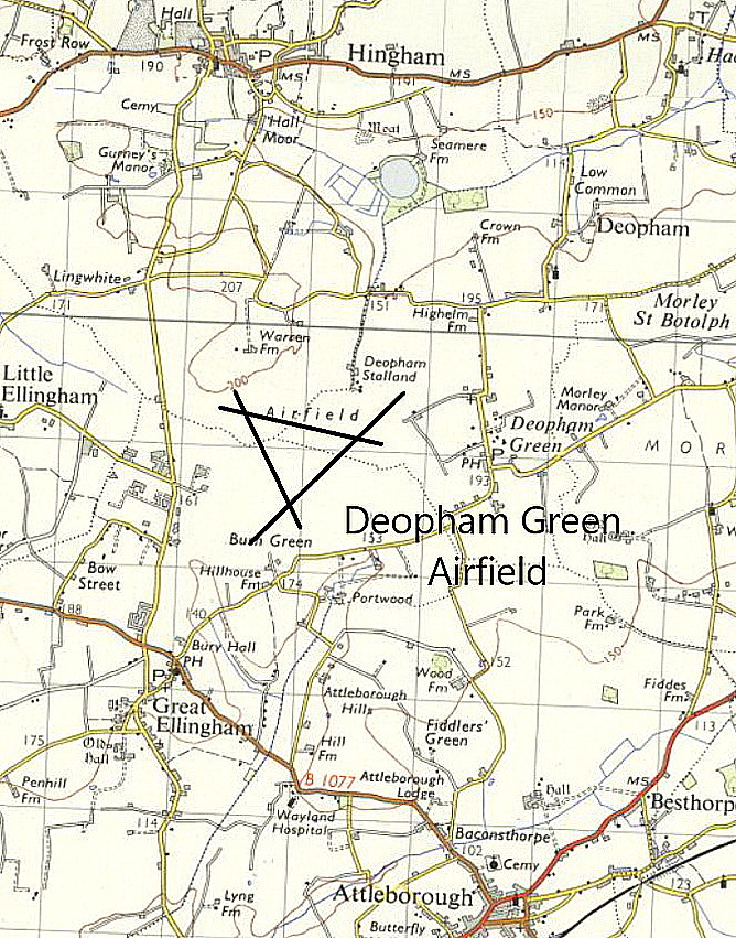
Deopham Green
DEOPHAM GREEN: Military aerodrome
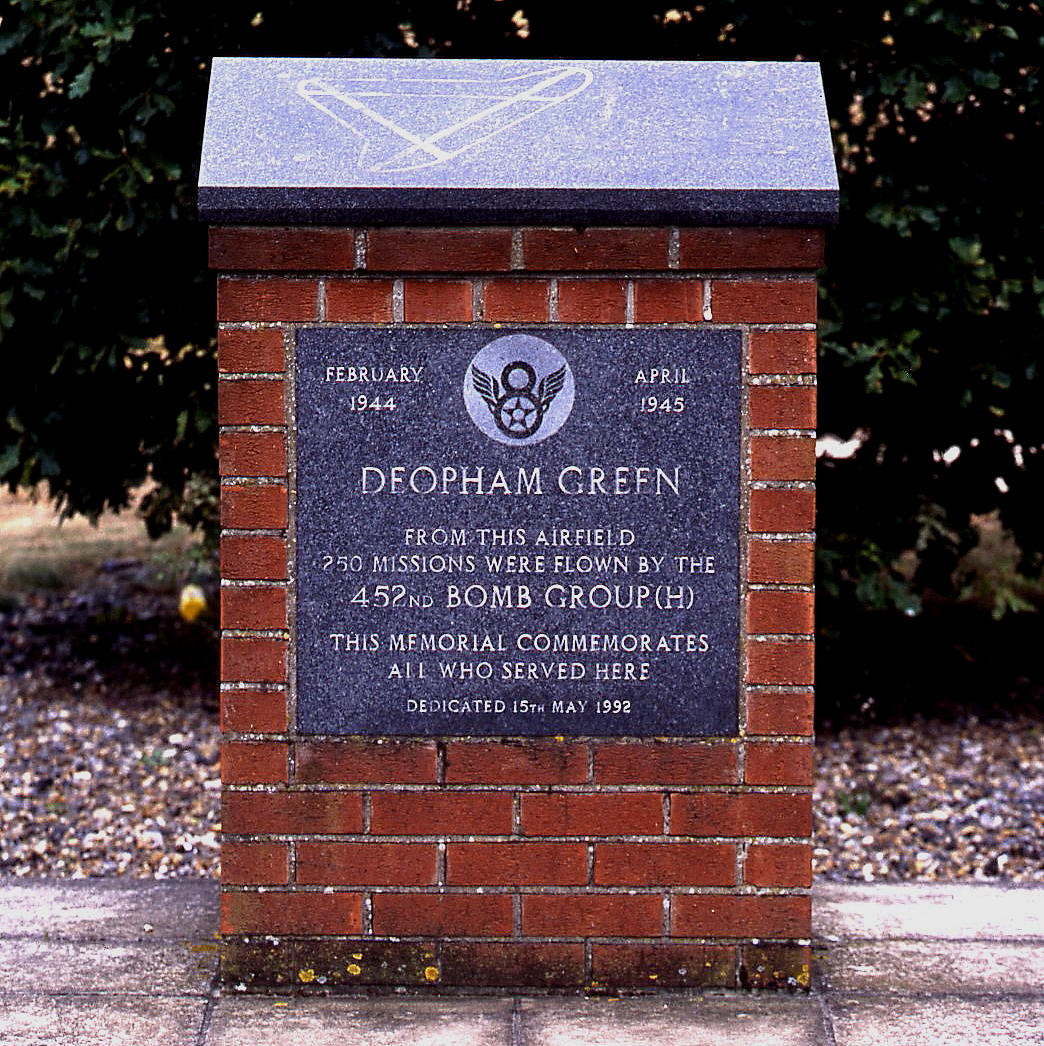
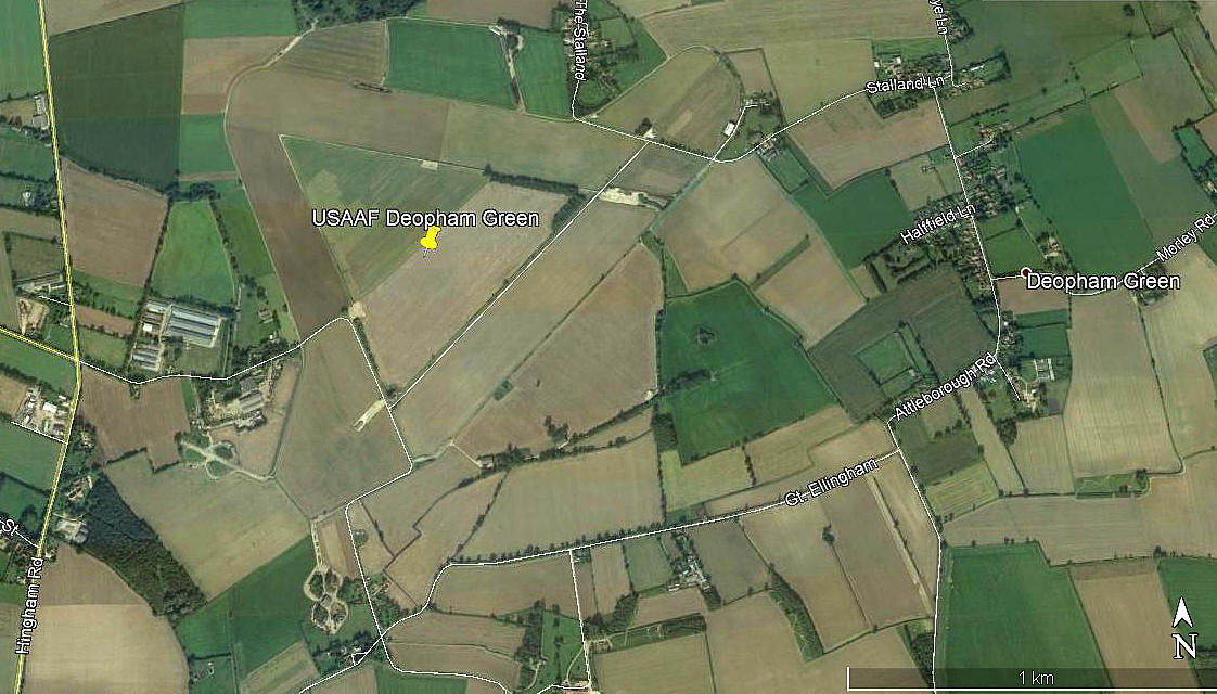
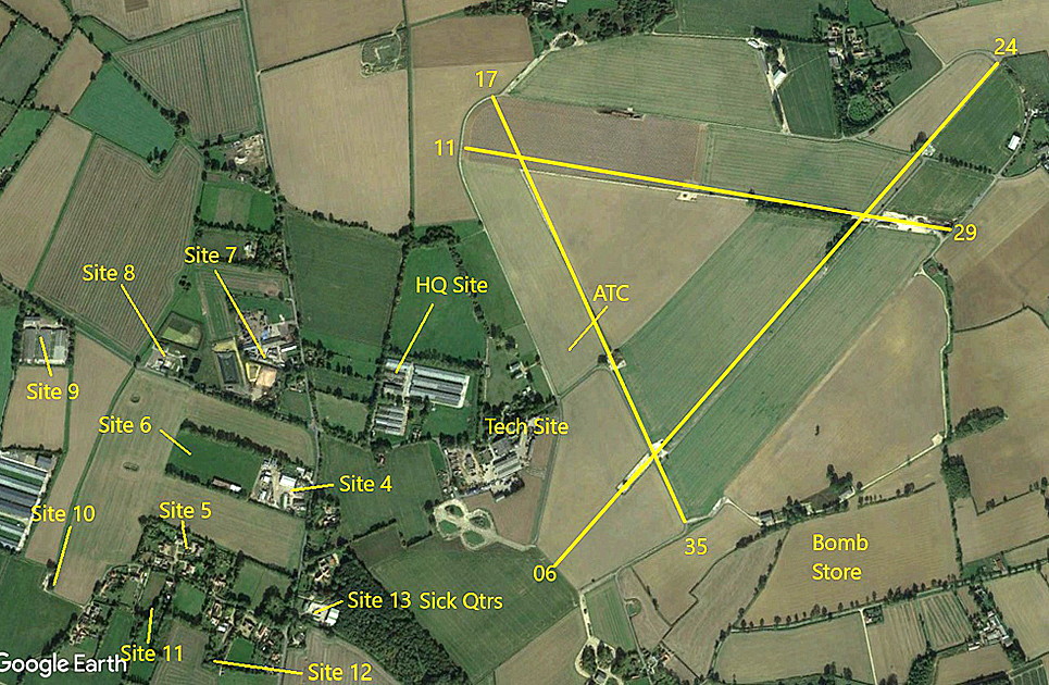
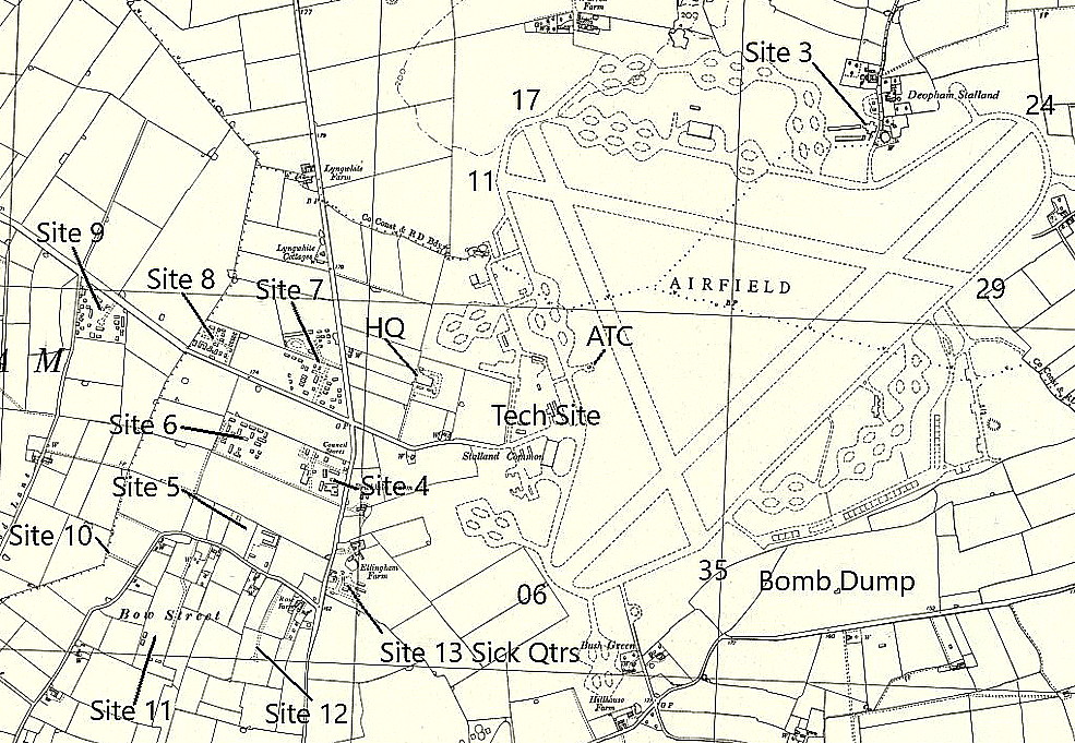
Note: As far as I could see, this small memorial is now the only proof that this WW2 USAAF airfield ever existed. However, the aerial view (2017) obtained from Google Earth © clearly shows the extent of the WW2 airfield, the layout of the fields still marking the WW2 runways - and, a couple of the dispersals still exist.
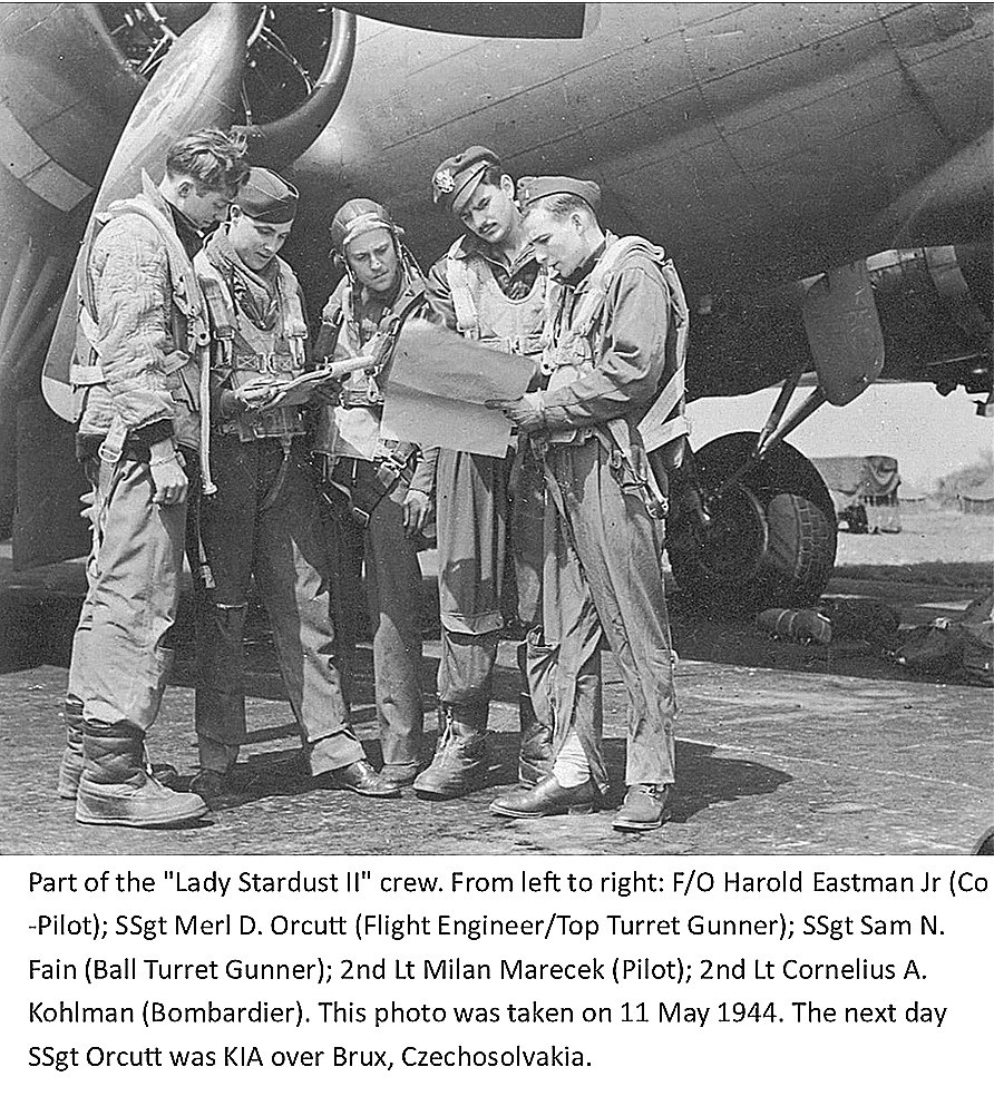
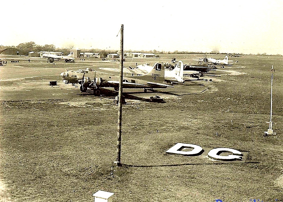
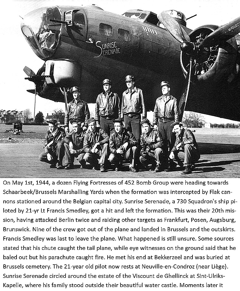
Military users: WW2: 8th USAAF 45th Bombardment Wing
452nd Bombardmant Group (Heavy)
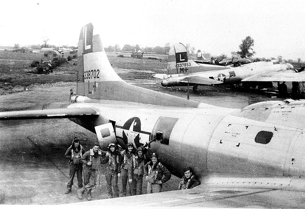
728, 729, 730 & 731 Sqdns (Boeing B-17 Flying Fortress)
Location: W of Deopham Green, 1.5nm N of Attleborough
Period of operation: 1944 to 1959
Note: This airfield was built during 1942 and 1943 for use by the USAAF Eighth Air Force. It was opened on the 3rd January 1944 and the 452nd BG, after settling in, made their first combat mission on the 5th February. This is something I have had a bit of a struggle with - getting the chronology of WW2 sorted out. Here, yet another new USAAF airfield opening in 1944! By this time it was patently clear that the war was over - the Allied forces had won. In fact, equally obvious in 1943. But, such was the grip Hitler and the Nazi Party had, (by then Hitler was clearly insane), they would not surrender. Despite ever increasing numbers of their military forces being needlessly killed, and countless civilians - not just German civilians either.
In effect, the D-DAY invasion on the 6th June that year, was to all intents and purposes a 'mopping-up' excercise, of huge proportions of course. Just think about it, the Allied forces had to battle their way mile by mile towards Berlin. And of course they made it in just less than one year, Germany surrendering, soon after Hitler committed suicide in his Berlin bunker, on the 7th May 1945.
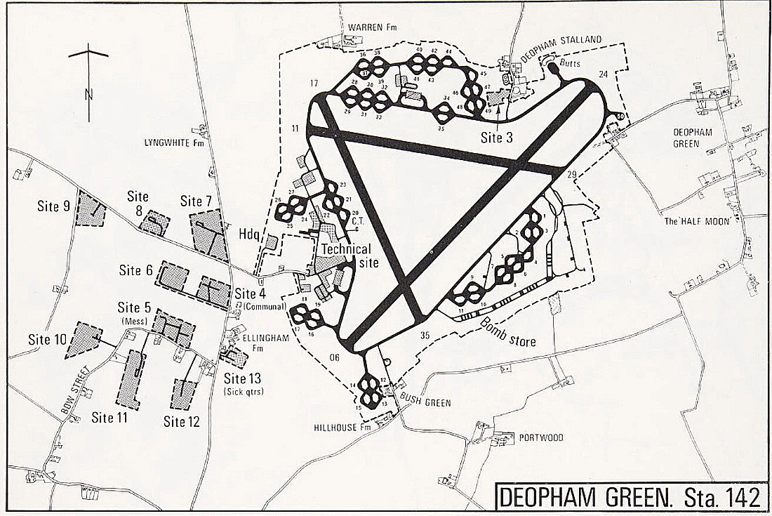
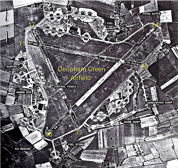
Runways: WW2: 06/24 1829x46 hard 11/29 1280x46 hard
17/35 1280x46 hard
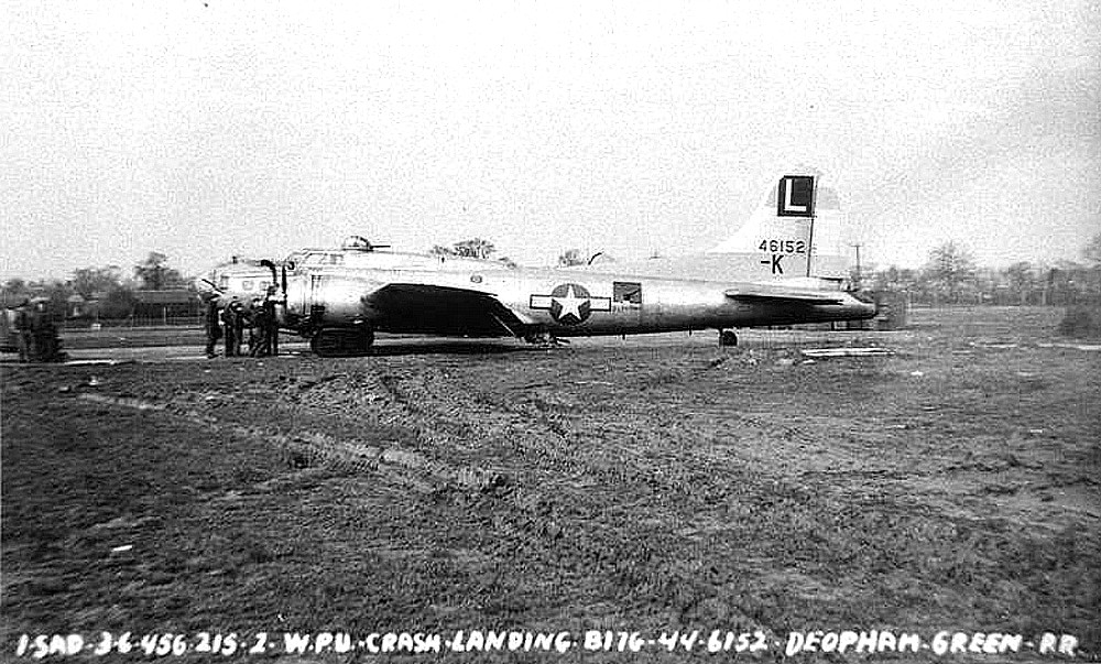
A MICHAEL T HOLDER GALLERY
We have Mike Holder, a great friend of this 'Guide', to thank for providing the following items.
PICTURES FROM THE AMERICAN AIR MUSEUM
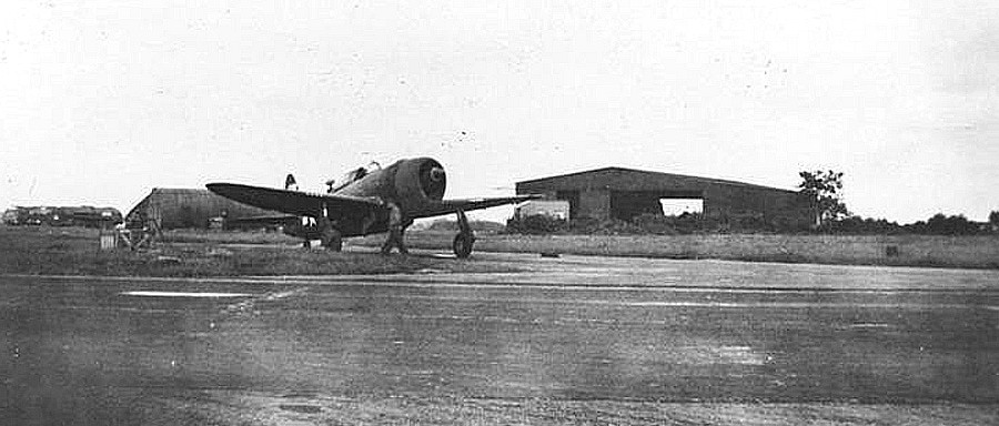
We do not know why the Republic P-47 Thunderbolt was pictured here. Perhaps just a friendly visit, or perhaps, quickly delivering important documents or maps etc.
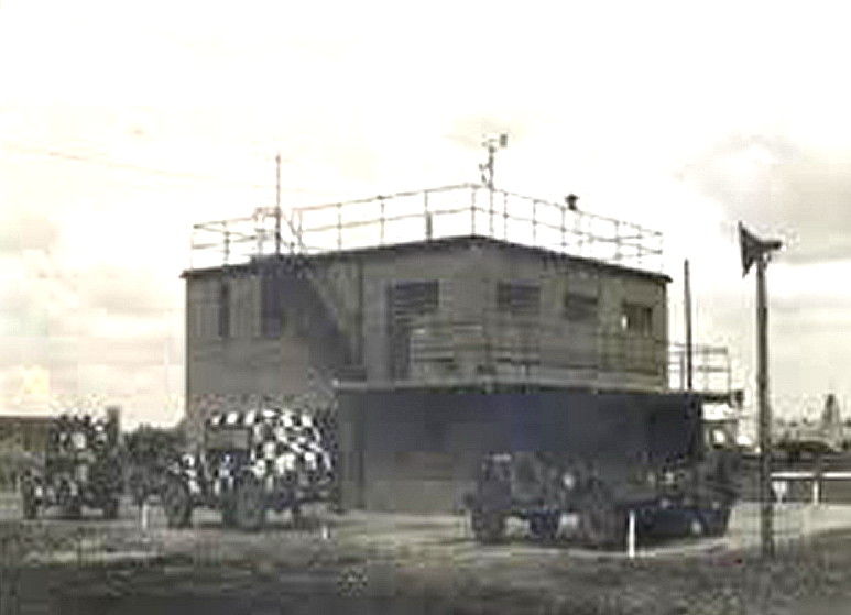
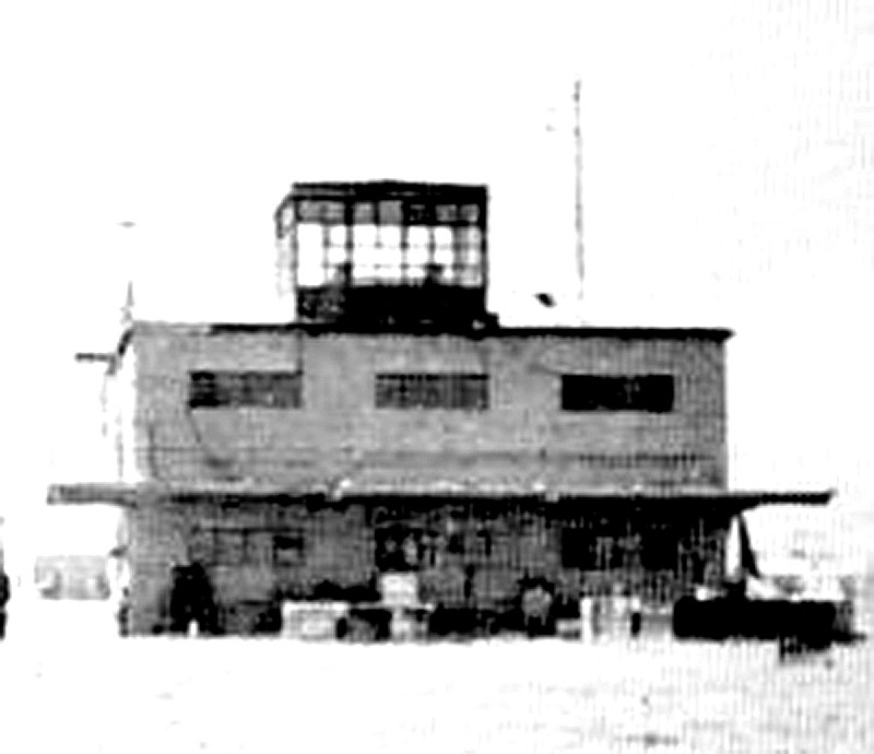
The two pictures of the control tower were obtained from Forgotten Airfields.
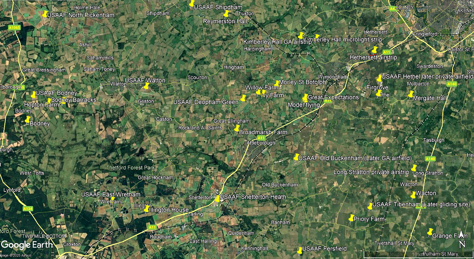
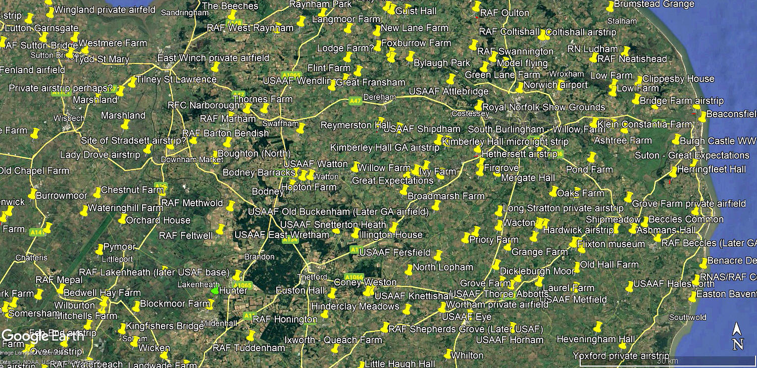
The local area and area views are from my Google Earth © derived database. Please not that, by far, not all the flying sites listed in this 'Guide'. are pinned on my database.
NOTES: I do hope that looking at my local and area views above, in which I think I have now pinned all the USAAF WW2 air bases, goes to show the often held opinion that all of East Anglia for the USAAF, and Lincolnshire and the eastern parts of Yorkshire for the RAF, were, by the end of WW2, covered in concrete! Mostly for USAAF and RAF heavy bomber squadrons. It has to be noted though, that when the Americans arrived, they were given the best locations to fly from, the RAF being moved further north where the general weather and especially fog problems were more common hazards.
But, there is another aspect that I had failed to comprehend when starting out in this project, now just over a quarter of a century ago. And that is, for many USAAF air bases in WW2, which took a year or two to build, in effect being self-contained townships, were only used for a year or so. DEOPHAM GREEN being handed back to the RAF in October 1945 for RAF Maintenance Command.
We'd love to hear from you, so please scroll down to leave a comment!
Leave a comment ...
Copyright (c) UK Airfield Guide
