














East Retford
EAST RETFORD: Military Landing Ground (Aka RAF RETFORD, RANBY AERODROME & BABWORTH AERODROME)


Note: The local view was obtained from Google Earth ©. The local area and area views are from my Google Earth © derived database.
Military users: RFC/RAF (Royal Flying Corps / Royal Air Force)
33 [Home Defence] Sqdn (1916 to 1919)
Note: Initially equipped with the Royal Aircraft Aircraft BE.2, later the FE.2 type. In June 1918 Bristol F2B Fighters arrived, but these were quickly replaced in August by the Avro 504 Night Fighter. Yet another Squadron based in this region for utterly futile reasons, as the 'Zeppelin' threat never really materialised. They made no contacts.
187 (Night Training) Sqdn (Martinsyde Elephant, Royal Aircraft Factory BE.2e)
199 Sqdn (Farman, Airco DH.1, Royal Aircraft Factory FE.2b)
200 Sqdn (Farman F.20, Airco DH.1, Royal Aircraft Factory FE.2b)
RFC/RAF Night Training Squadron Training Station (1917 to 1919)
Location: East of the A.1 today, and W of Retford, just north of the A620
Period of operation: 1916 to 1920
Site area: 172 acres 914 x 823
NOTES: It seems a FTS (Flying Training School) were based here using the Avro 504K type.
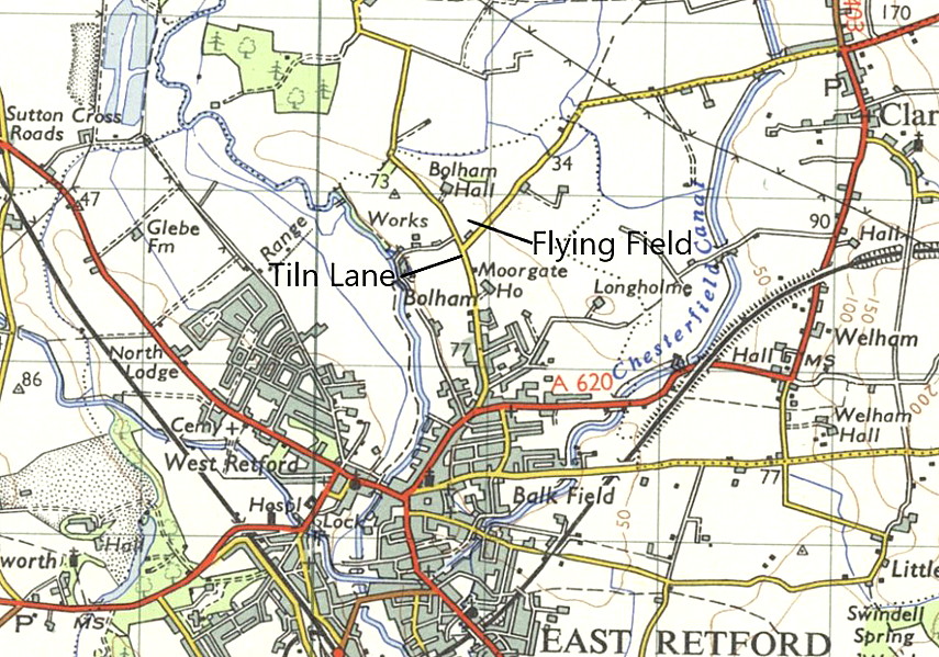
It is one of those aspects, sometimes encountered in producing this 'Guide', when it is hard to make sense of things. For example, why was EAST RETFORD called such when it was clearly well to the west of Retford? This map, kindly provided by Mike Holder for the TILN LANE listing, surely provides the answer. Clearly it shows that Retford town as we now know it, was very much identified, even in 1961, as being East Retford.
We'd love to hear from you, so please scroll down to leave a comment!
Leave a comment ...
Copyright (c) UK Airfield Guide
