














Farsley
Notes: My initial remark was: This map only shows the location of Farsley town within the UK. If anybody can kindly provide a more precise position for the airfield, this advice will be most welcome.
In October 2017 I was kindly contacted by Eden, see 'Comment' below, who has provided an exact location.
FARSLEY: Military Landing Ground
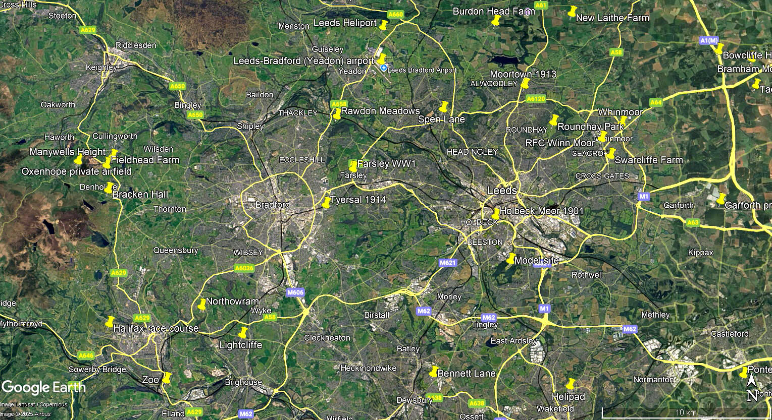
This area view is from my Google Earth© derived database.
Military user: RFC (Royal Flying Corps)
33 Sqdn [Home Defence] (Royal Aircraft Factory BE.2s & FE.2s)
76 Sqdn [Home Defence] (Royal Aircraft Factory BE.2s & BE.12s)
Location: Roughly 2.5nm ENE of Bradford city centre and 3nm WNW of Leeds city centre
Period of operation: 1916 to 1917
NOTES: This airfield was an out-station for these two squadrons, presumably to boost public confidence that they were being defended against the 'Zeppelin' airship scourge. 'Zeppelin' was a generic term, (like 'Hoover' for vacuum cleaners), as not all the airships attacking the UK were built by Zeppelin.
It must have been very frustrating for the pilots at least, because as far as I can make out, they did not have one single combat encounter during their stay here. And indeed, quite probably never saw a German airship? In fact this was the case for many RFC squadrons engaged on Home Defence duties. Against this, there was at the time it appears, something approaching hysteria concerning the public view of an airship attack.
Oddly enough one might think, when just some twenty years later WW2 commenced, with the British civilian population enduring the Luftwaffe Blitz regime with colossal casualties and immense damage to property and civic amenties, power supplies and so on - the civilian population mostly displayed heroic stoiscm. As is often said, the greatest fear is of fear itself. Most people can cope with reality, no matter how catastrophic, as the German civilian population demonstrated to their credit when the Allied bombers started systemically destroying their cities from around 1942.
There is a huge amount of hypocrisy today, let alone downright lies and people seeking to distort history. One simple fact is quite clear - every single bomb dropped on Germany was justified, and perhaps it is a shame that the Allies could not have dropped a great deal more to hasten the end. But has history has shown almost since the beginning of 'so-called' human civilisation, it is invariably the civilians who suffer the worst brutality.
LATER CIVIL TEMPORARY AERODROME?
I have found a record of the Berkshire Aviation Company hosting a 'Flying Circus' event at the 'Preistthorpe Lane Aerodrome, Leeds Road, Farsley from the 17th to the 23rd November 1919. But, was this the same site as used in 1916 to 1917?
A MICHAEL T HOLDER GALLERY
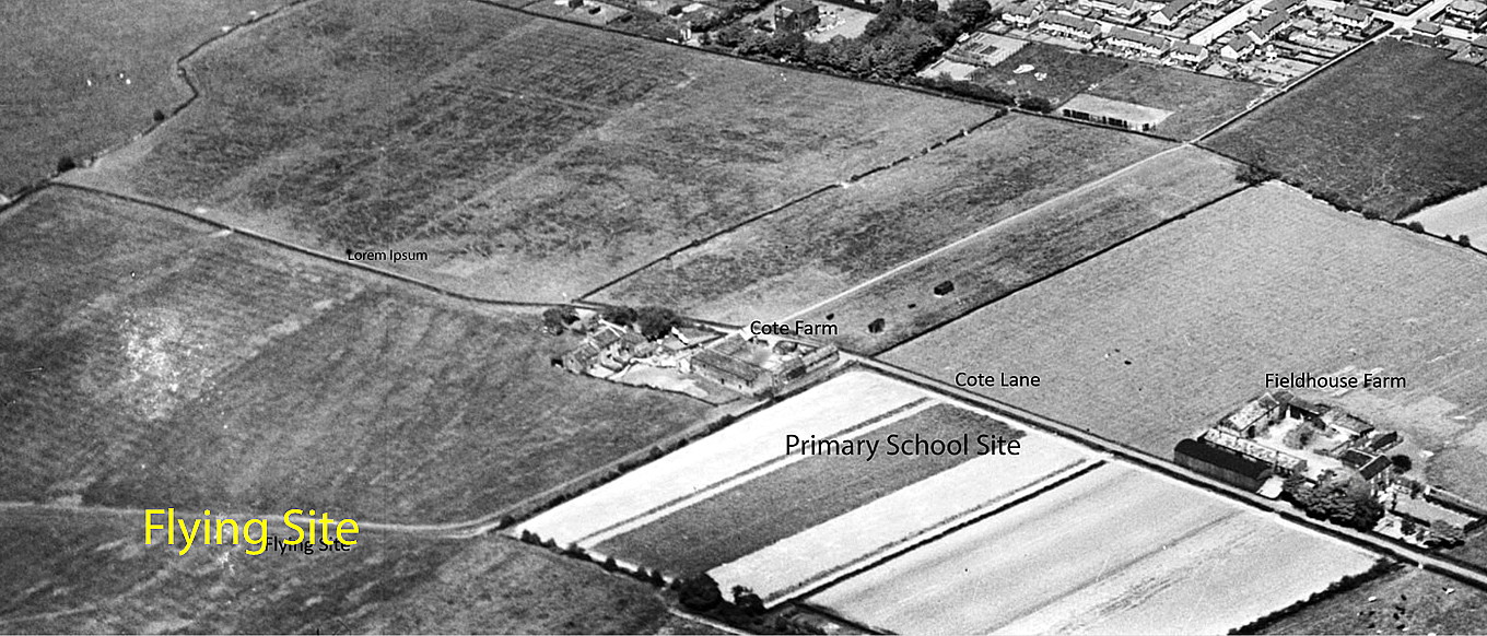
We have to thank Mike Holder, a great friend of this 'Guide', for investigating this location and it does indeed appear that the Berkshire Aviation Company used the old WW1 site.
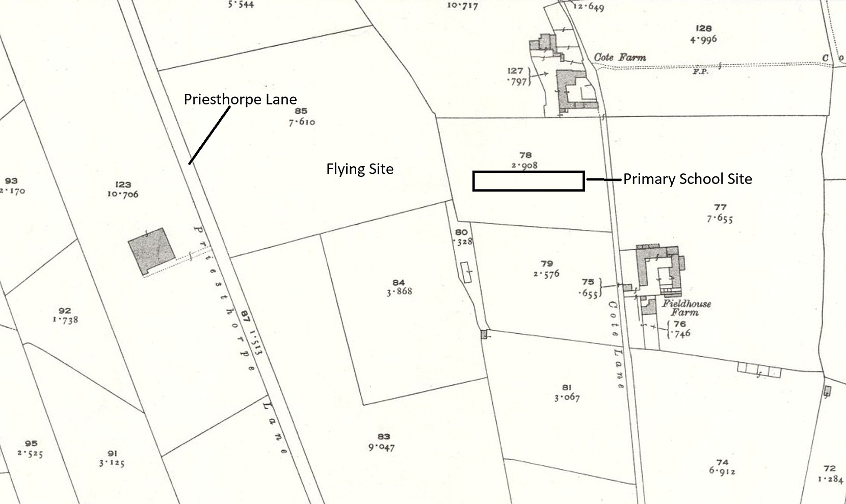
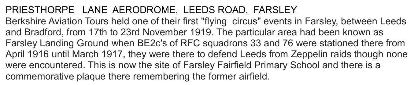

The "text info" is from the Air Yorkshire Aviation Society.
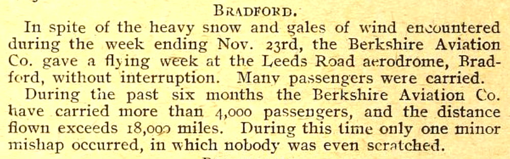
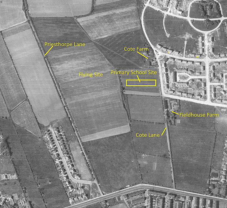
The 'Short article' was published in The Aeroplane magazine on the 26th November 1919.
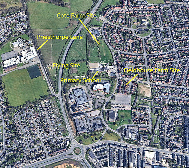
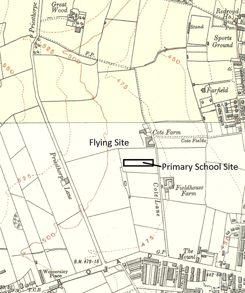
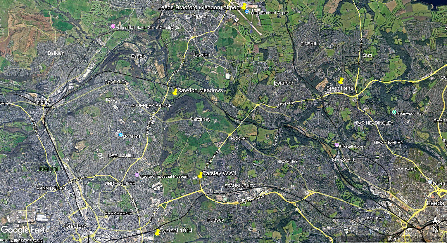
The local area view is also from my Google Earth© derived database.
NOTES: After WW1 many people involved in aviation during that period were very keen to persue a career in civil aviation and offering joy-rides was the obvious solution. But of course almost none of them had any idea about how to run a business, so most of these enterprises failed as the revenues gained during the summer season could not sustain them during the winter months.
The Berkshire Aviation Company, without any doubt then led by Alan Cobham during 1919, knew that in order to survive, they would need to keep flying all year round, and, go to venues where most of the people lived. It would be often be tough going of course, as shown above, during the winter months, but they did succeed.
Eden
This comment was written on: 2017-10-29 10:21:57I am currently researching Farsley Airfield for some homework. It was where Farsley Farfield Primary school is now. I know this because there is a stone kind of notice saying Farsley Airfield.
Reply from Dick Flute:
Hi Eden, Many thanks indeed. Your advice is much appreciated and I am certain I can now find the exact site for the map. My best regards, Dick
We'd love to hear from you, so please scroll down to leave a comment!
Leave a comment ...
Copyright (c) UK Airfield Guide
