


Fryern Court
FRYERN COURT: Temporary landing site
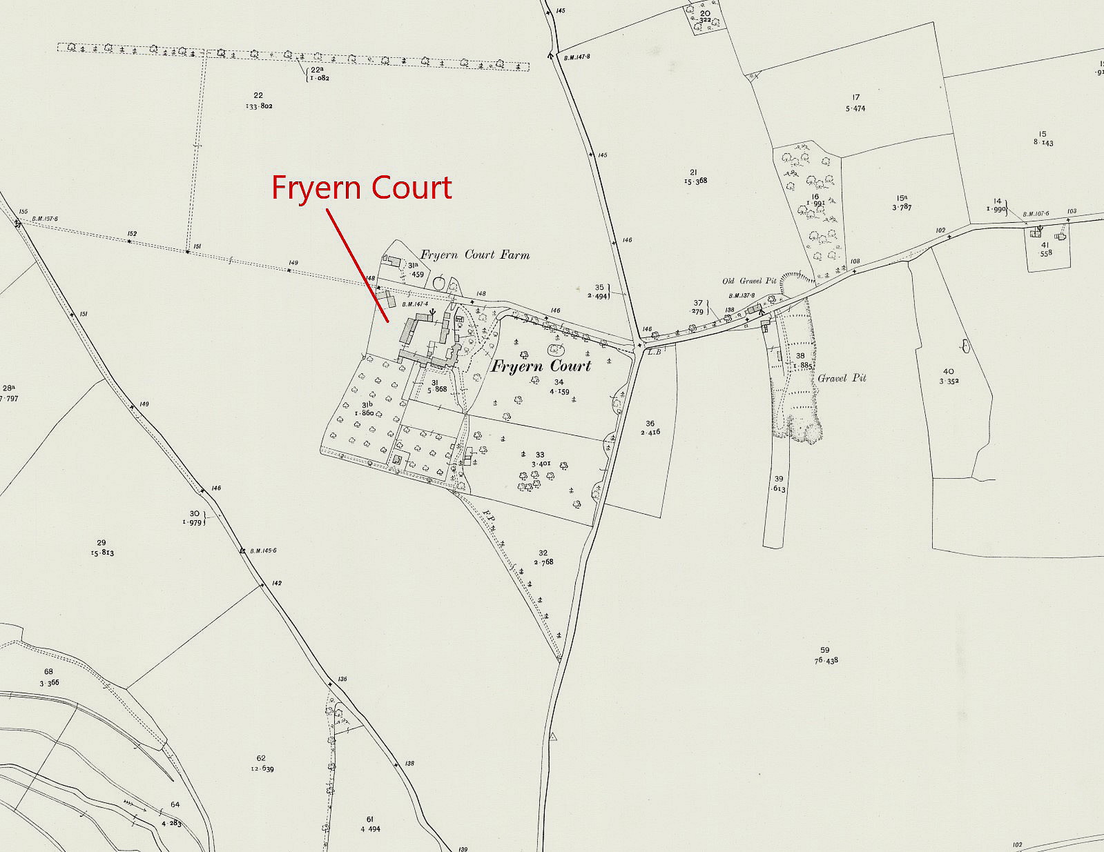
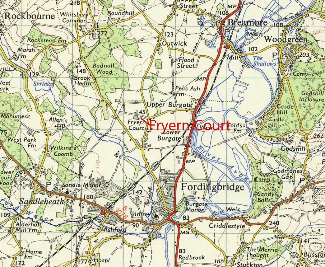
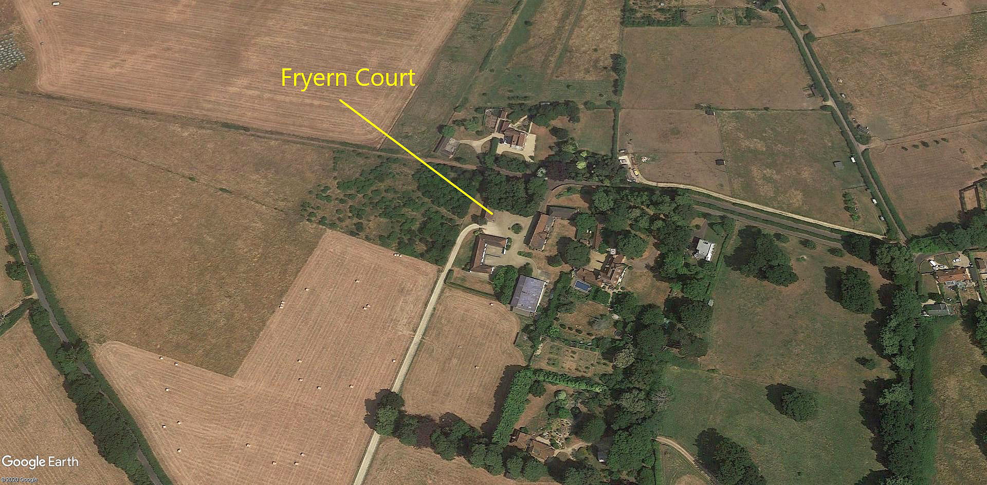
Note: Mr Michael T Holder, a great friend of this 'Guide' kindly provided the first three maps and picture. I added the area view obtained from Google Earth ©
Location: Just W of Mouland David, about 1.5nm NNW of Fordingbridge town centre
NOTES: Mr Graham Gilmour landed here at around 08.00 on the 12th April1911, having departed from LARK HILL at 07.30 in a 'Bristol Military Biplane' which we would know today as a Bristol Boxkite. He had Mr Gordon England on board, who had just gained his pilots certificate to act as his engineer. The intention was to fly to BOWER HINTON in Somerset - a distance in a straight line of about 50 miles. The series of flights he made took two days.
As many private pilots still say today : "Time to spare - go by air."
He soon became lost after leaving LARK HILL, flying south rather than south-west, and landed here, to be entertained to breakfast by Mr and Mrs Norris. In those days the unannounced arrival of an aeroplane was a major novelty and a most welcome diversion to normal life proceedings.
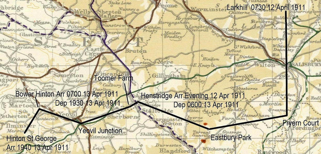
This map was also kindly provided by Mike Holder.
JUST A MENTION
The original information I found of this site or temporary Landing Ground was from an account by C C Turner published in around 1927. I mention this simply because, in those days the 'art' of aerial navigation was virtually non-existent and pilots frequently became hopelessly lost after just a few miles.
We need to remember that the pilots of machines such as the 'Boxkite' sat fully exposed to the elements. No nacelle, let alone a cockpit was provided, and purpose designed flying suits with enclosed knee-pads were way off in the future. So access to a map was impossible. Plus of course it takes some time to learn how to fly using a map - and still does.
We also need to remember that in those days, as a general rule, flying could only take place early in the morning or in the evening when the winds had died down, unless a high pressure weather system prevailed. Which of course as tempertures drop, often results in misty if not foggy conditions, especially in the early morning.
Presumably they were blessed with fairly clear visibility because they took off to visit Mr Gilmours friend, Mr Farquharson, at EASTBURY PARK at Tarrant Gunville in Dorset.
Michael Holder
This comment was written on: 2020-05-06 15:59:51Fryern Court 50 56 43"N 001 47 55"W
We'd love to hear from you, so please scroll down to leave a comment!
Leave a comment ...
Copyright (c) UK Airfield Guide
