


Grantez
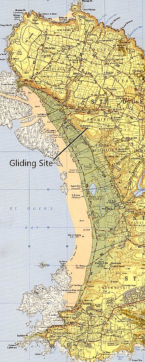
GRANTEZ: Gliding site
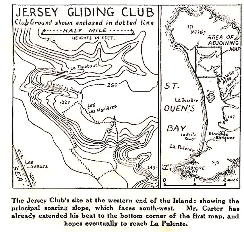
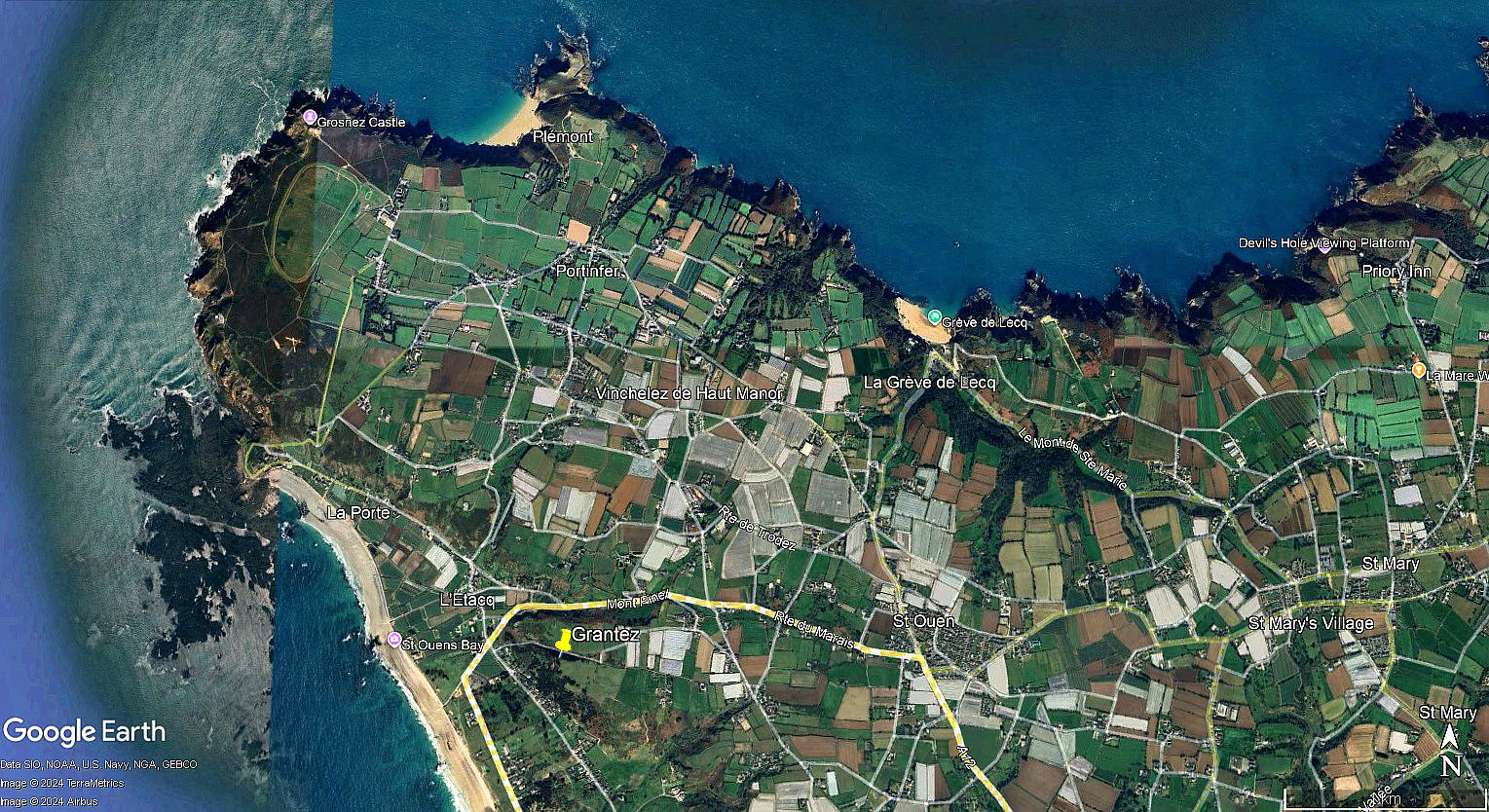
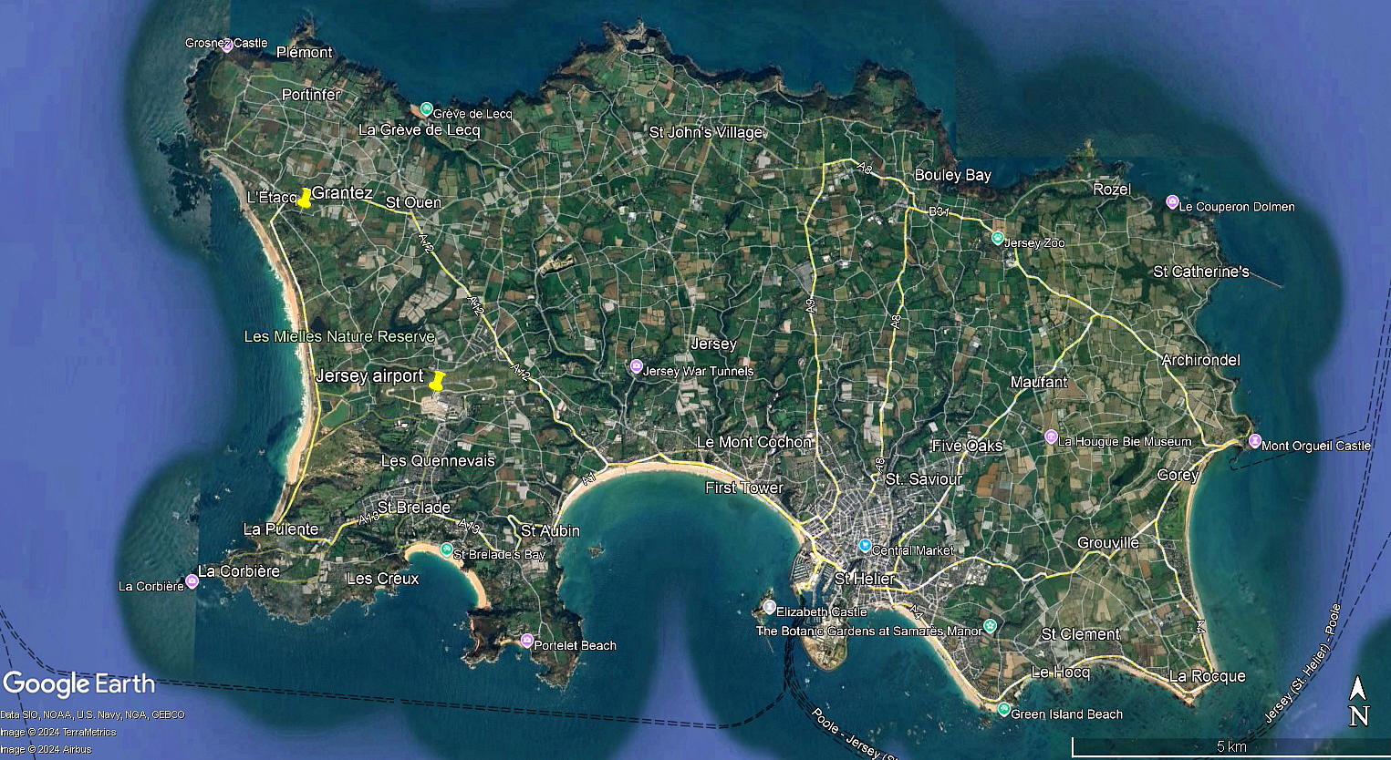
The 1935 maps were part of an article from the Jersey Gliding Club published in Sailplane magazine. The local area and area views are from my Google Earth © derived database.
Operated by: Jersey Gliding Club
Location: Just ESE of L'Etacg, about 6.5nm NW of St Heliers town centre
Period of operation: Probably around 1935/36, possibly later?
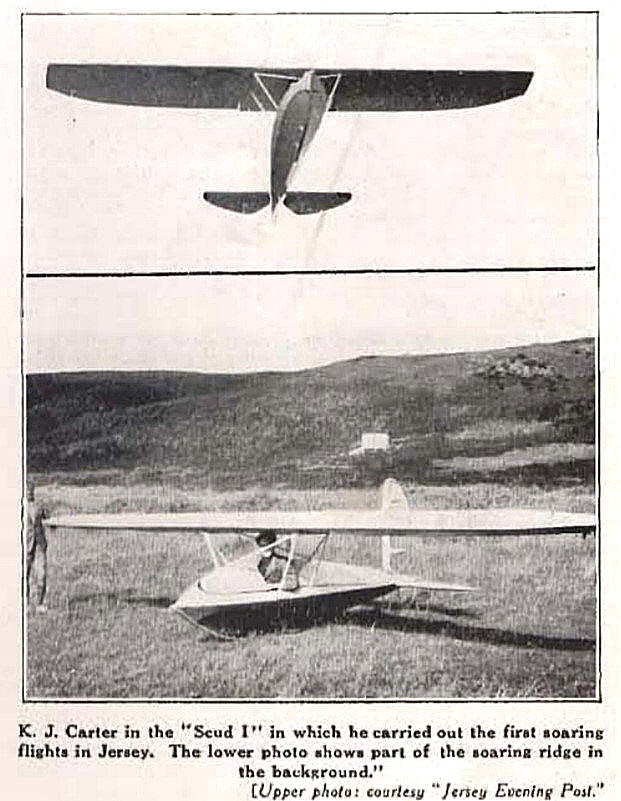
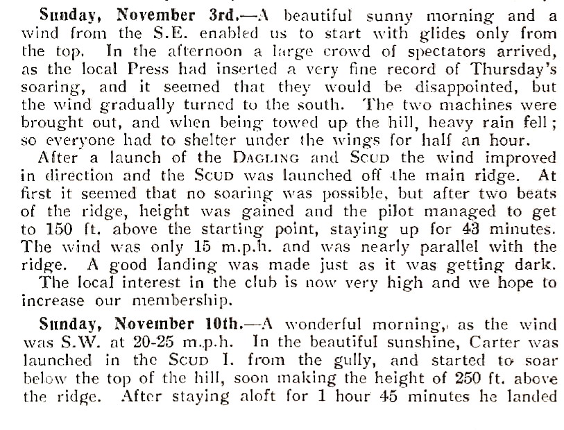
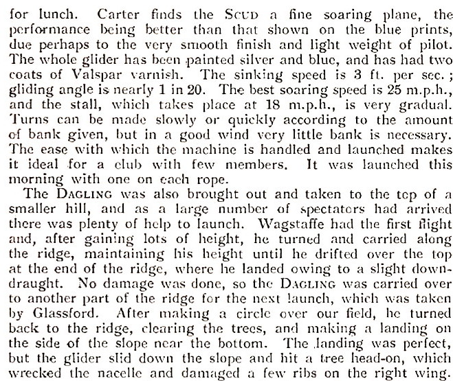
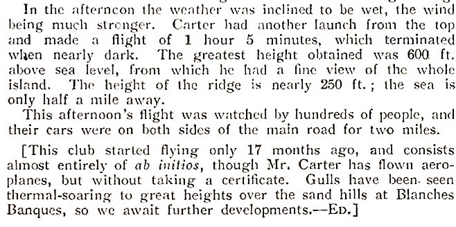
These two photos were also published in The Sailplane magazine. It appears the first flights were made on the 13th October 1935. The first soaring flight being made on the 31st October. The Club operated two machines, a Dagling and a SCUD 1.
NOTES: We have Mr Graham Frost, a great friend of this 'Guide', to thank for discovering this little known location.
A JOINT EFFORT WITH EXTRA ITEMS BY MR MICHAEL T HOLDER
It is always such a pleasure for me to have so much help available in producing this 'Guide'. This listing being made with two of the most stalwart friends of the 'Guide' - Graham Frost and Mike Holder. Graham got the 'ball rolling' and I then sent off a request to Mike to ask if he could help? Typically, by 'return of post' Mike came up with the goods. He had not only traced the article in Sailplane magazine, but had sub-divided it into sections I could then incorporate given the 500KB file size limit which the designer of the web-site had imposed for pictures, maps and text sent by e-mail.
This included the maps in the Sailplane magazine, (see above), the article in three parts, and very generously two extra maps plus the Google Street view, which was taken looking towards the south-west. It was certainly quite a surprise, to the three of us, to find this gliding site on Jersey, operating in the 1930s.
THE ARTICLE TEXT
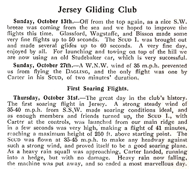
Reading this account is of some interest, to me at least, as it appears the Club were using two launch methods. Typically the bungee cord technique by volunteers running down a slope towing a glider, (very common in those days), but also a car. In this case an old Studebaker. From memory, think I am correct that using a car for launching was a quite recent innovation?
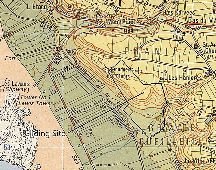
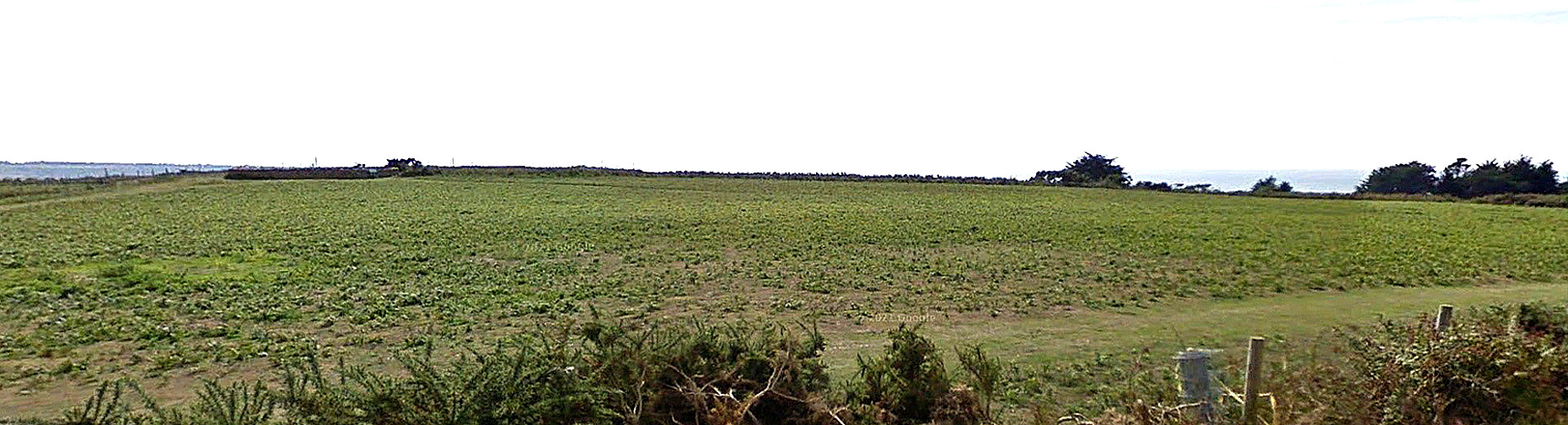
The Google Street View shows the field used for car towed launches.
FINAL NOTES
It seems to me, (and will be glad to be corrected), that most of the U.K. flying location web-sites tend to ignore early gliding sites? If so this 'Guide' intends to rectify that situation - to some extent of course. If anybody can kindly offer advice on other locations not listed, I will much appreciate hearing about them.
We'd love to hear from you, so please scroll down to leave a comment!
Leave a comment ...
Copyright (c) UK Airfield Guide
