


Great Ashfield
Note: This airfield subsumed the WW1 airfield of ELMSWELL, aka ASHFIELD and GREAT ASHFIELD. See seperate entry for ELMSWELL.
GREAT ASHFIELD: Military aerodrome Later private airstrip
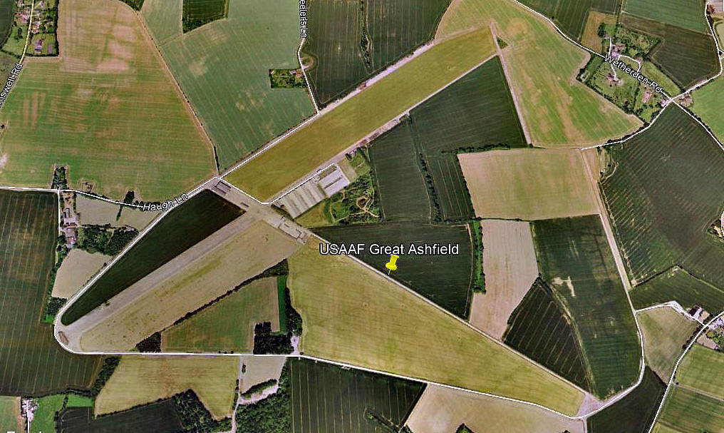
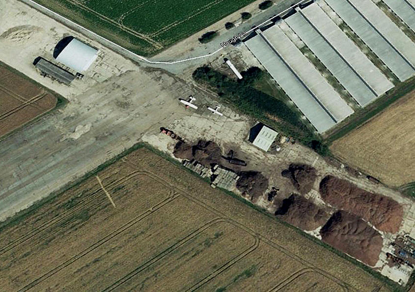
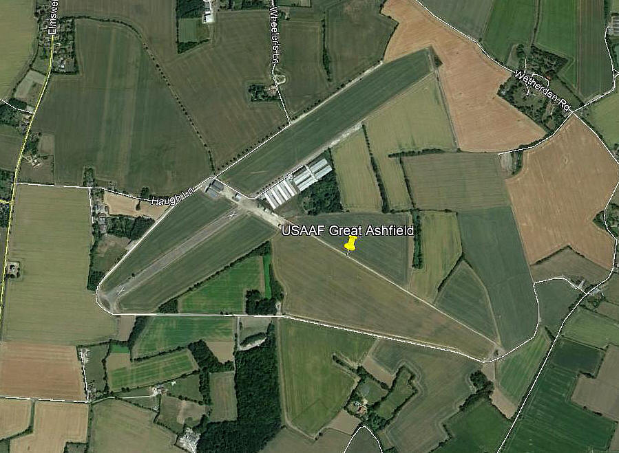
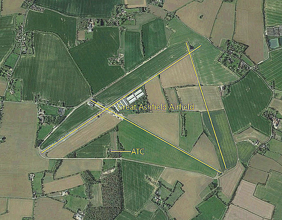
Note: These three pictures were obtained from Google Earth ©
Military users: WW2: 8th USAAF 4th Bombardment Wing
385th Bomb Group
548, 549, 550 & 551 Sqdns (Boeing B.17 Flying Fortresses)
Location: 5nm NW of Stowmarket and 8.5nm E of Bury St Edmunds according to ‘official records’ it seems. Nitpicking, I would say it was more like 8.5nm ENE of Bury St Edmunds
Period of operation: Military: 1943 to 1955 Civil: 1980s only?
Runways: WW2: 06/24 1829x46 hard 18/36 1280x46 hard
13/31 1372x46 hard
2008: 06/24 640 hard
By 2018, probably before, this runway was marked as unserviceable
A MICHAEL T HOLDER GALLERY
Here once again, we have Mike Holder, a great friend of this 'Guide', to thank for providing the following items when investigating what might be available to be included.
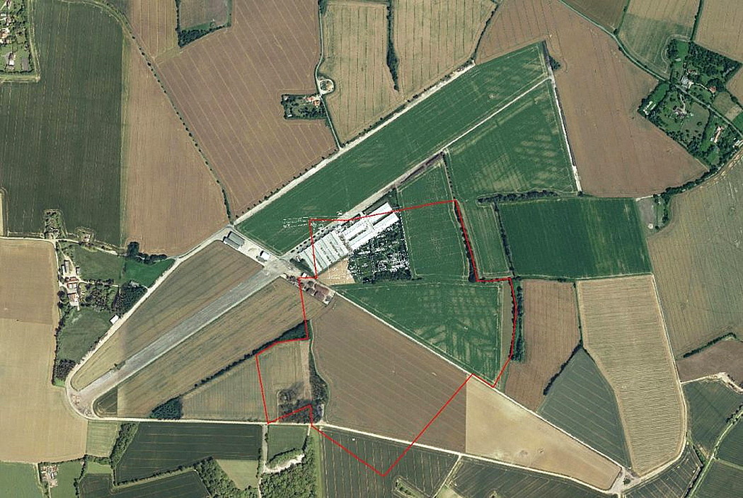
The Google Earth © view shows the WW1 ELMSWELL aerodrome within the WW2 USAAF air base.
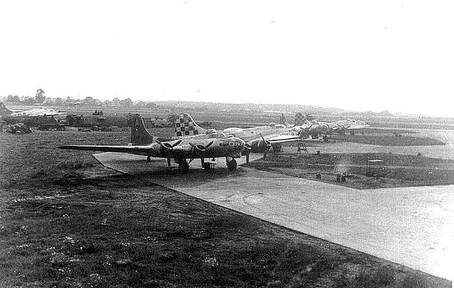
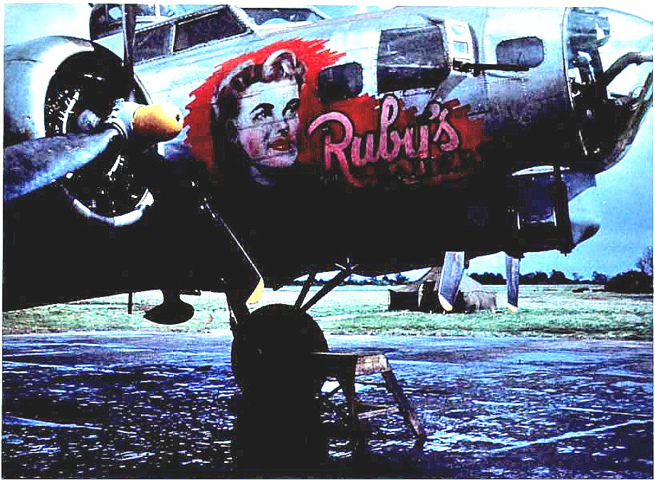
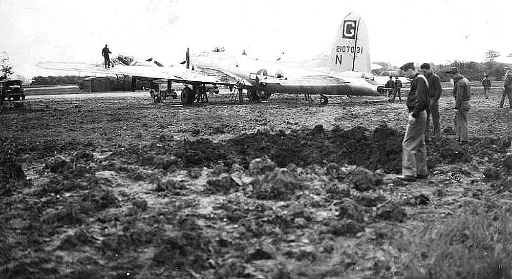
The Photo One of the B-17s is courtesy of the Elmswell History Group. Photo Two, of the 385th B.G. B-17 Flying Fortress "Ruby's Raiders", is from Round the Clock by Philip Kaplan and Jack Currie.
Photo Three shows aircrew inspecting a bomb crater, presumably dropped by the Luftwaffe? This from the American Air Museum.
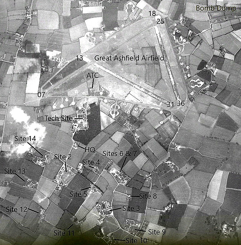
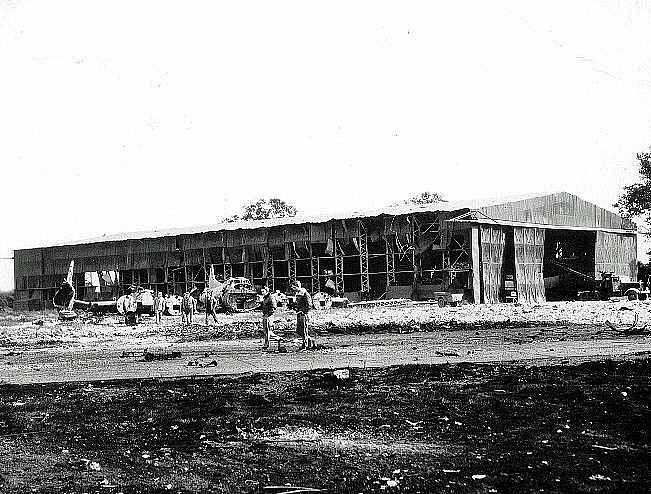
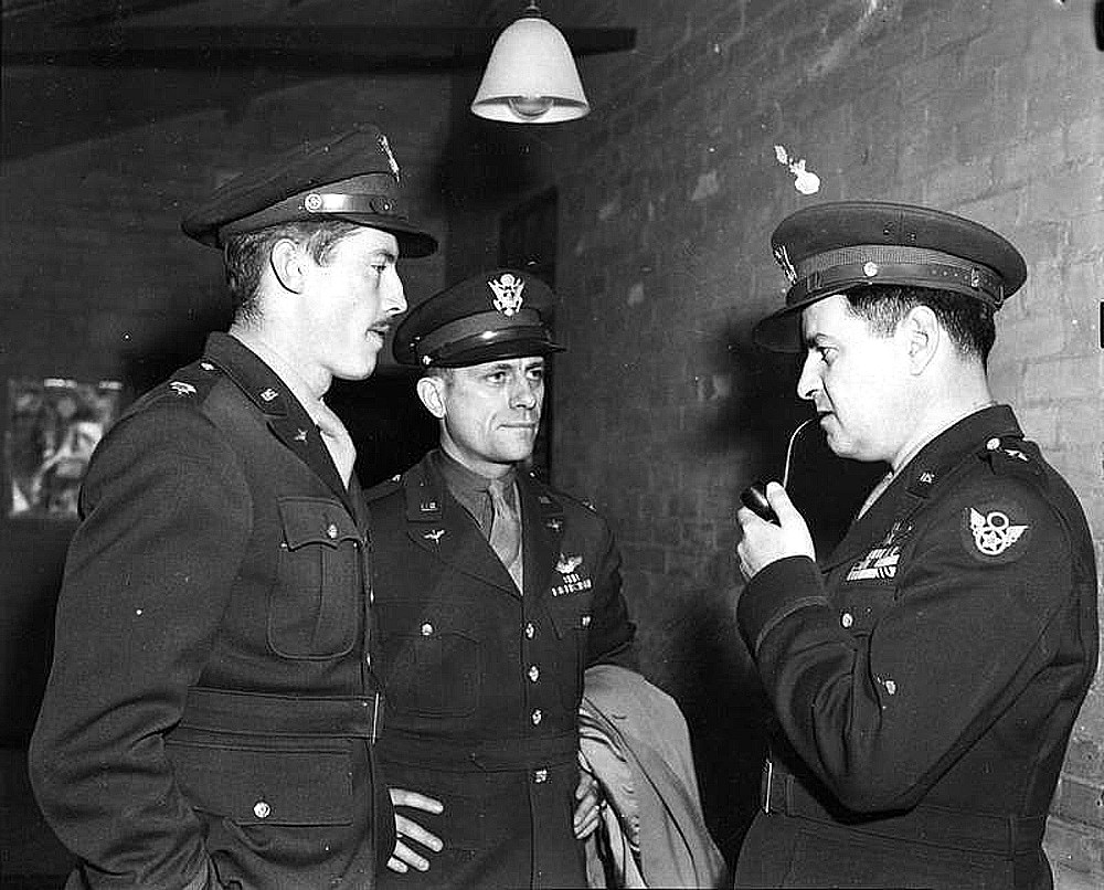
Photo Four shows part of the result after a bombing raid by the Luftwaffe. Picture from the Elmswell History Group. Photo Five includes Brig. Gen. Curtiss E Le May, (with pipe).
THREE MORE PICTURES SHOWING MORE INTIMATE ASPECTS
These are from Round the Clock by Phlip Kaplan and Jack Currie.
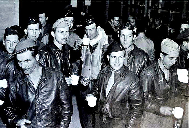
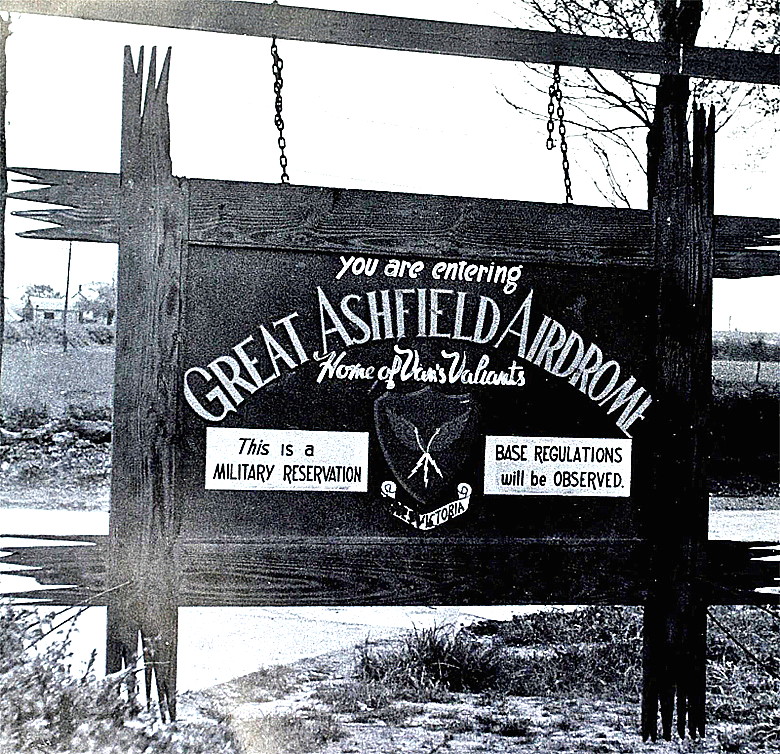
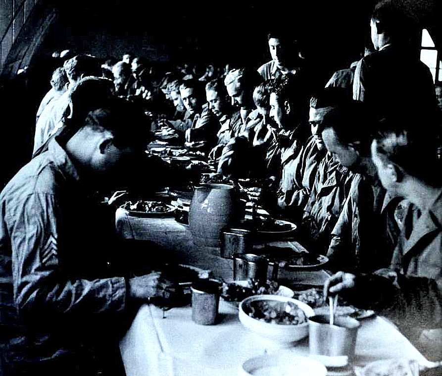
Photo Six is of a crew surviving a raid on the 9th October. Photo Seven shows the rather home-made sign outside the main gate. Note the term "Airdrome" which I have never heard of before.
Photo Eight is of a Thanksgiving dinner c.1943. This being, for Americans, roughly the equivalent of our Xmas dinner celebrations.
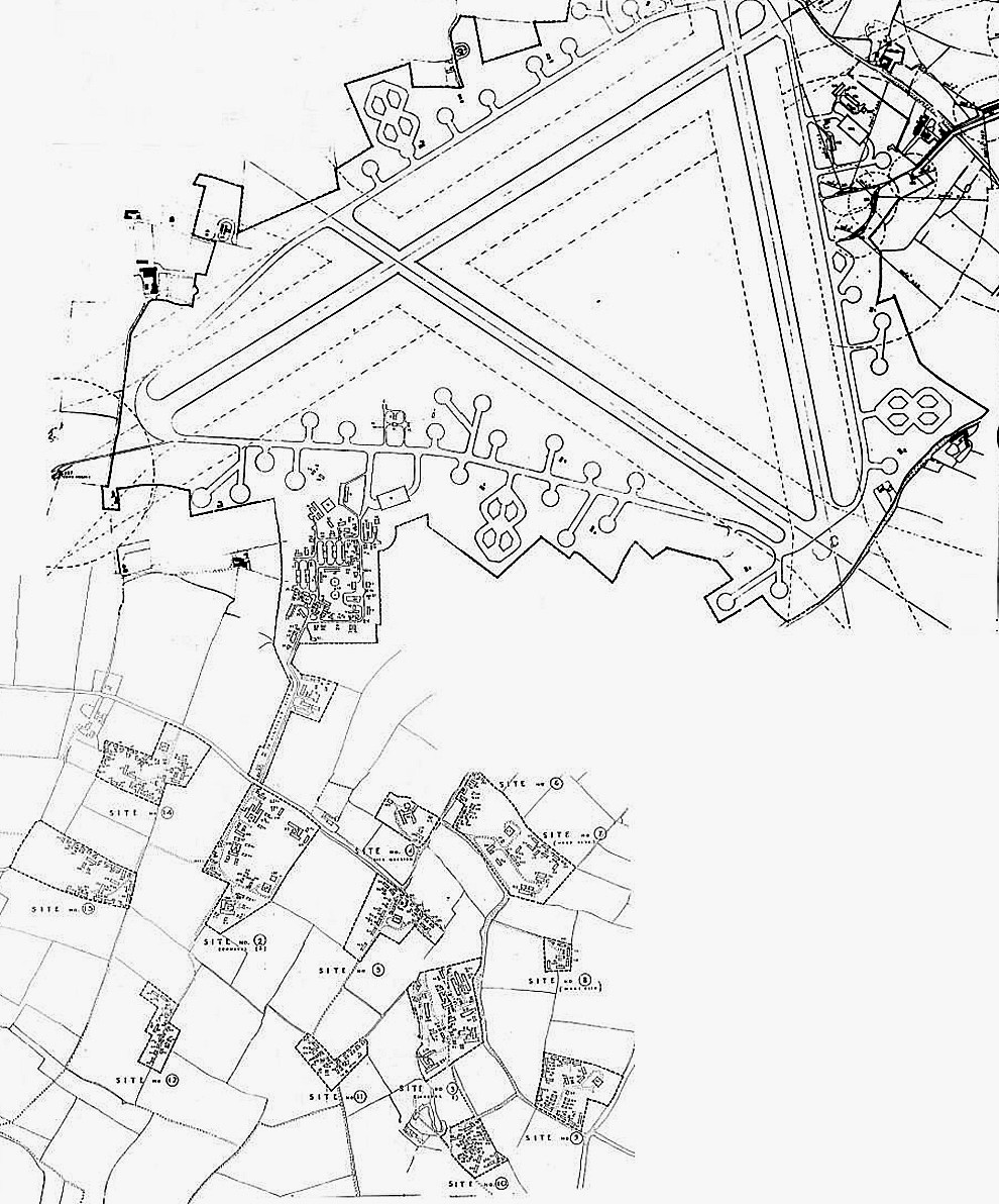
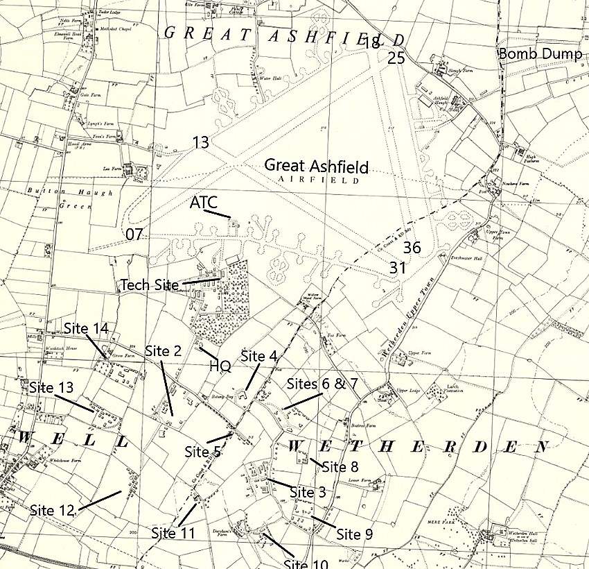
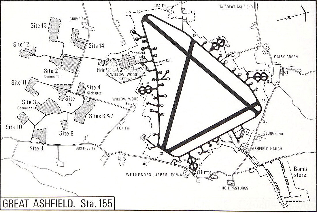
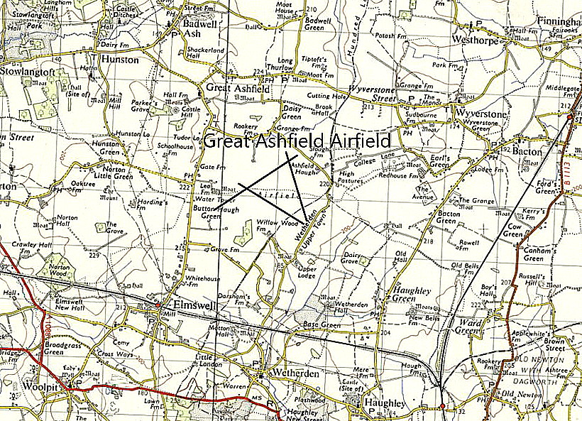
The map of the airfield layout c.1944 is also from the Elmswell History Group.
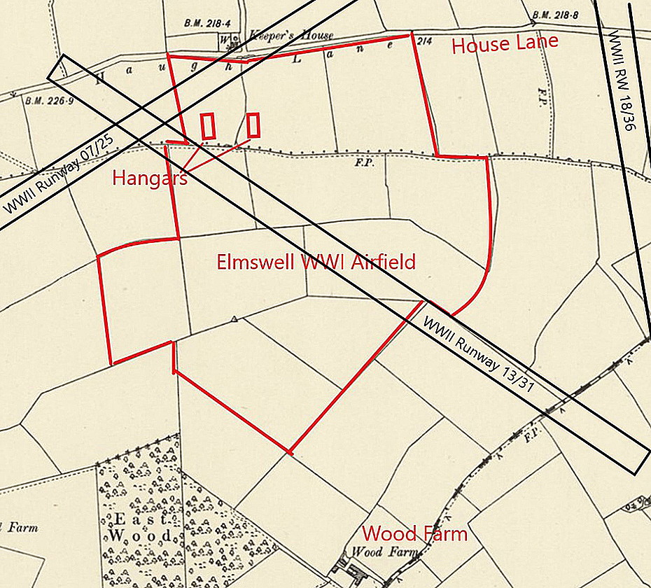
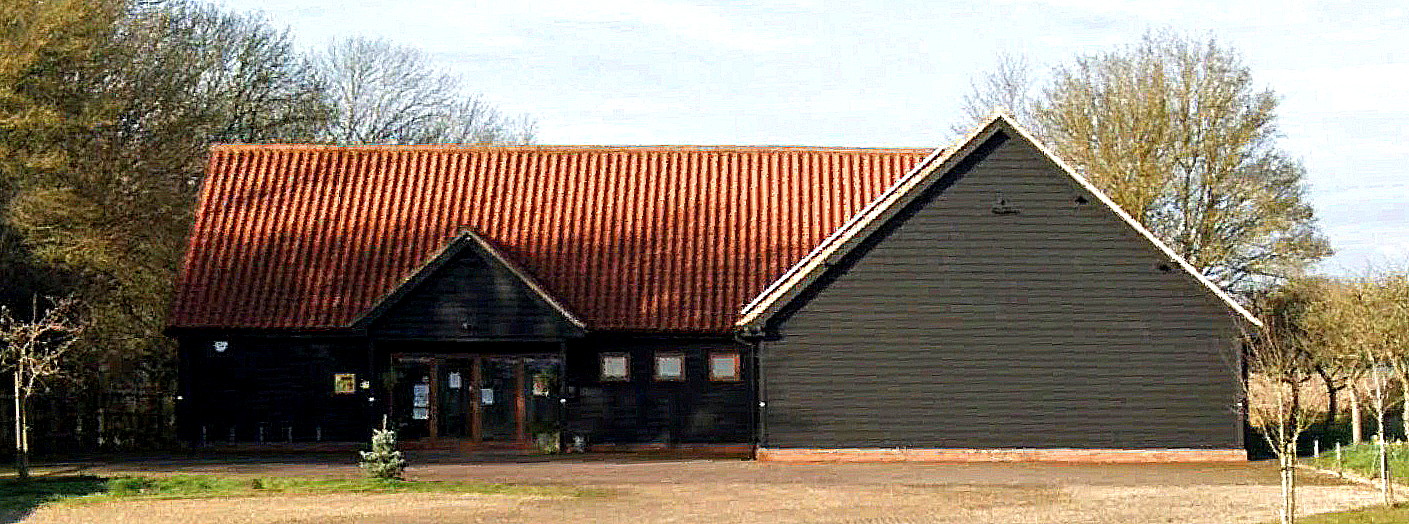
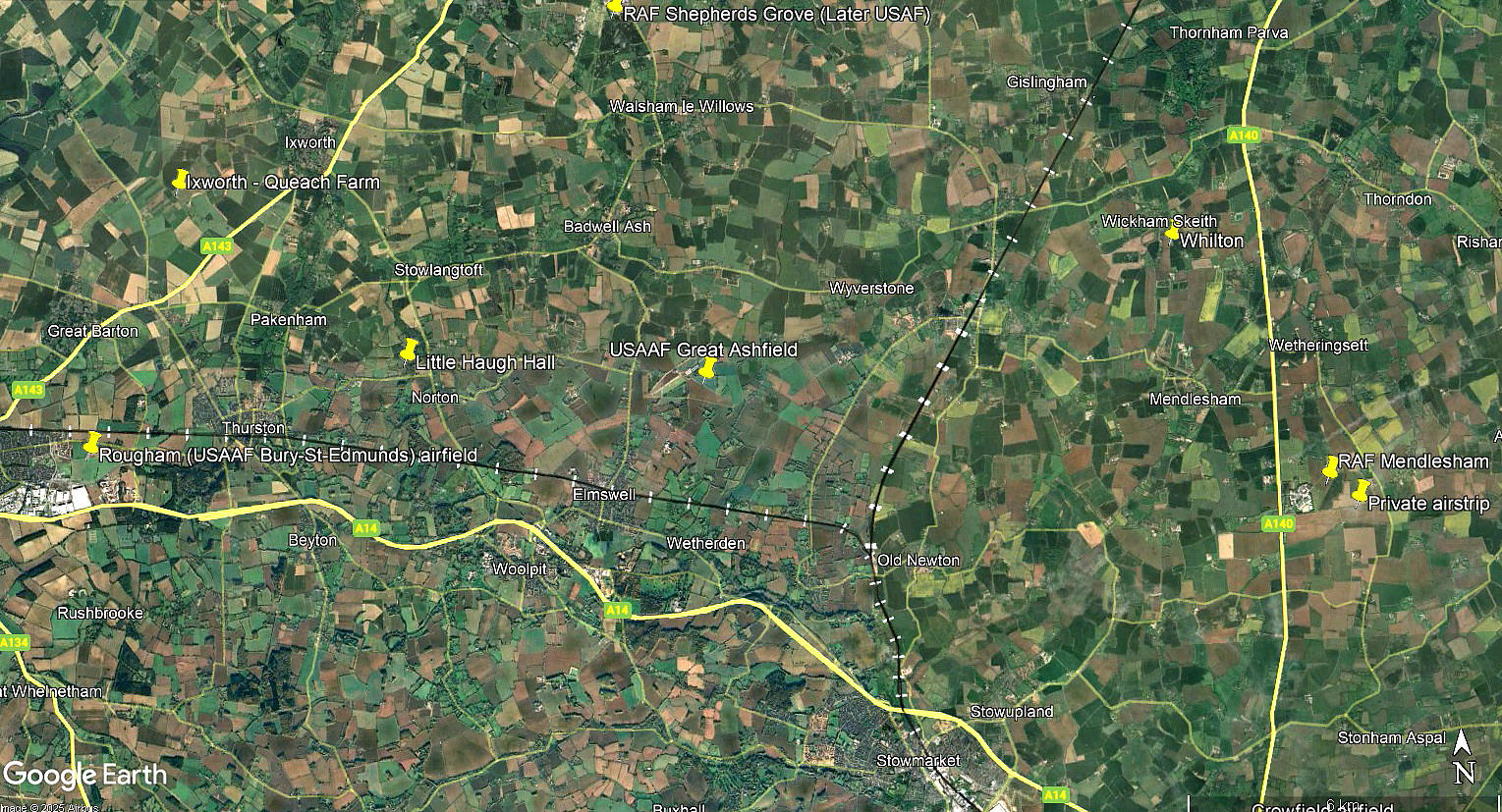
The extra map shows how the WW1 aerodrome was subsumed by the WW2 USAAF air base. The Google Street View shows the village hall at Drinkstone, once the USAAF officers mess.
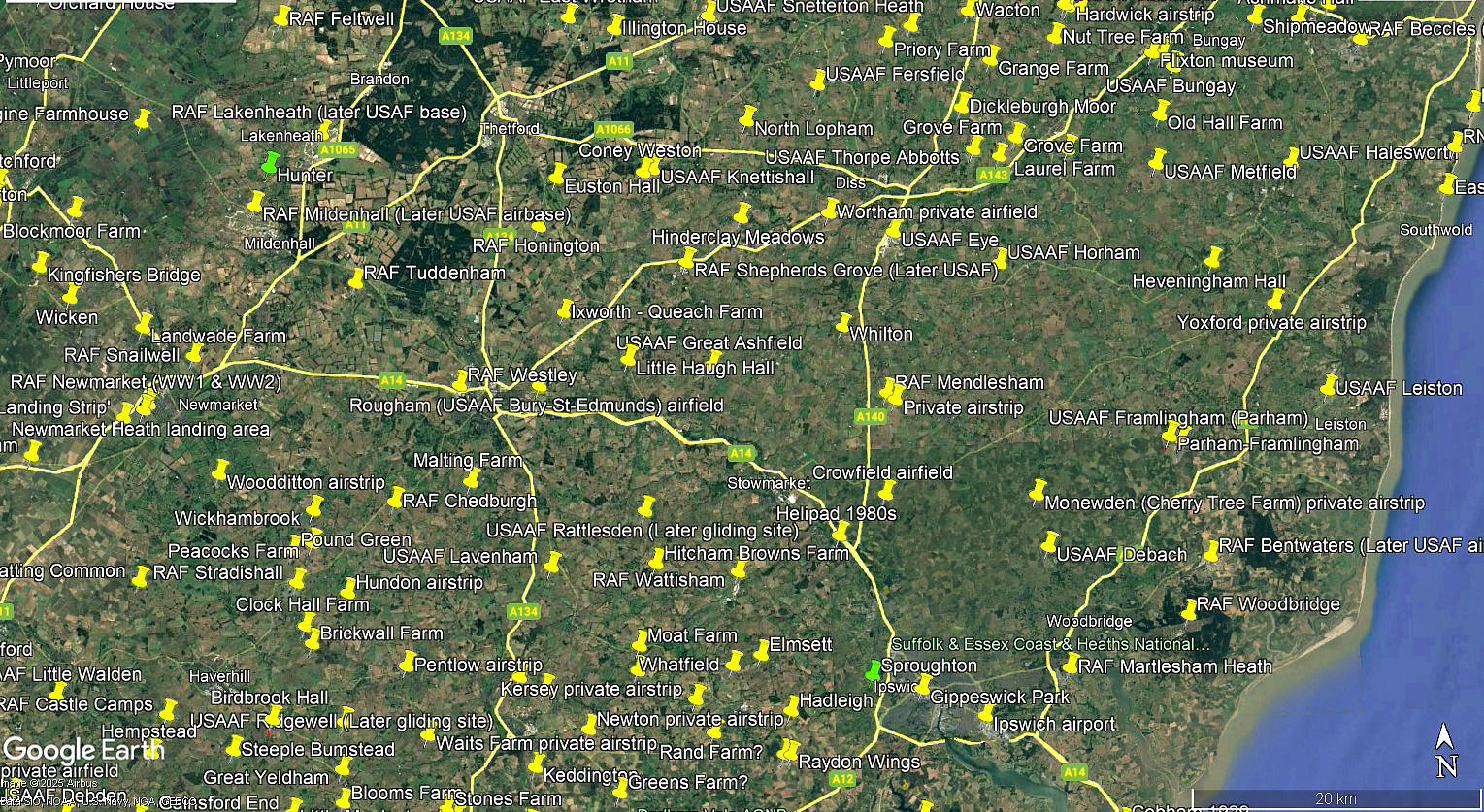
The local area and views are from my Google Earth © derived database. And, not all of the locations listed in this 'Guide' are pegged on the database.This said, I feel fairly confident that nearly all of the WW2 locations are now in place. What an astonishing picture this shows to us today. England. (let alone the rest of the UK), in WW2 has been described as being an "aircraft carrier" anchored off the coast of Europe, and that seems to me to be quite a good description.
NOTES: Another substantial USAAF WW2 base with 2894 personnel on station in late 1944.
In 2006 the Reims Cessna F172N G-BHDZ was probably based here?
David Lawrence Coggiola
This comment was written on: 2019-05-30 14:54:53My wife and I are going to travel to see the airfield in late June. Can anyone suggest other nearby sites to visit while we're there? Isn't there a church with a leaded glass window featuring the 385th nearby as well? Any pubs or restaurants you can suggest??
We'd love to hear from you, so please scroll down to leave a comment!
Leave a comment ...
Copyright (c) UK Airfield Guide
