


Great Fosters Hotel
GREAT FOSTERS HOTEL: Private helicopter landing area
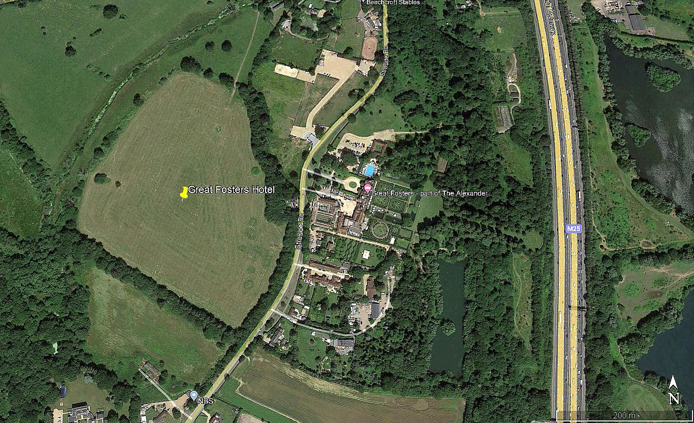
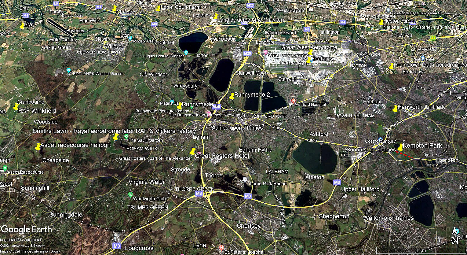
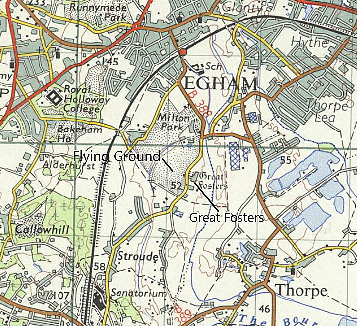
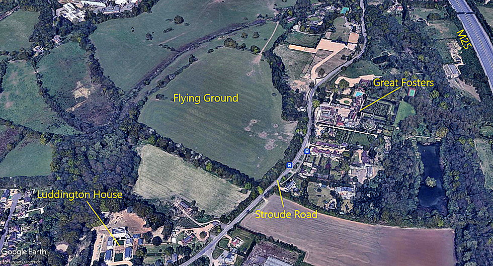
Location: Just E of Stroude Road, just W of the M25, about 0.75nm S of Egham town centre, roughly 5nm SW of HEATHROW centre
Landing area: 1998: Lawns at rear of hotel, between the long walk and moat
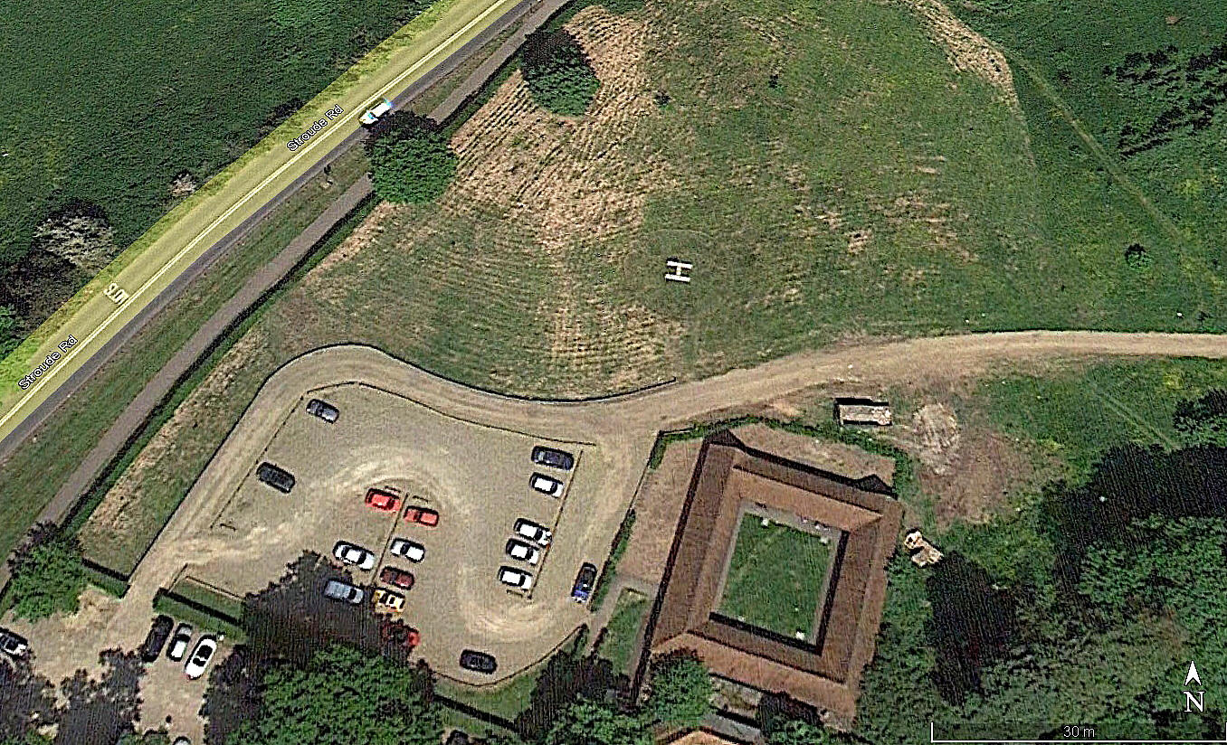
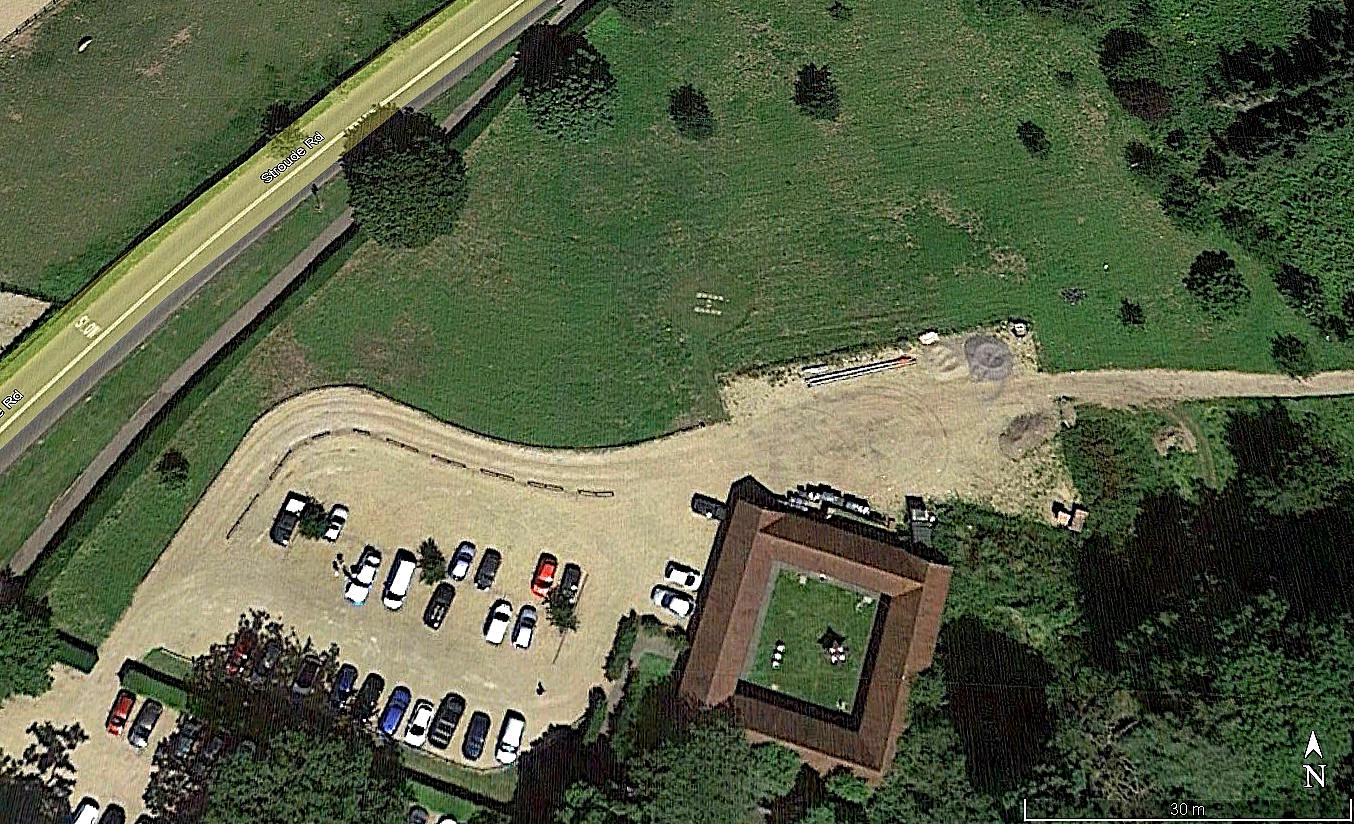
Note: Later, from about 2010, a new helipad at the north end. All three pictures obtained from Google Earth ©.
BUT, WHAT CAN WE MAKE OF THIS?
We have Mike Holder, a great friend of this 'Guide', to thank for discovering this information. The article from Flight magazine, dated 17th August 1933, certainly implies that the Landing Ground was being used.
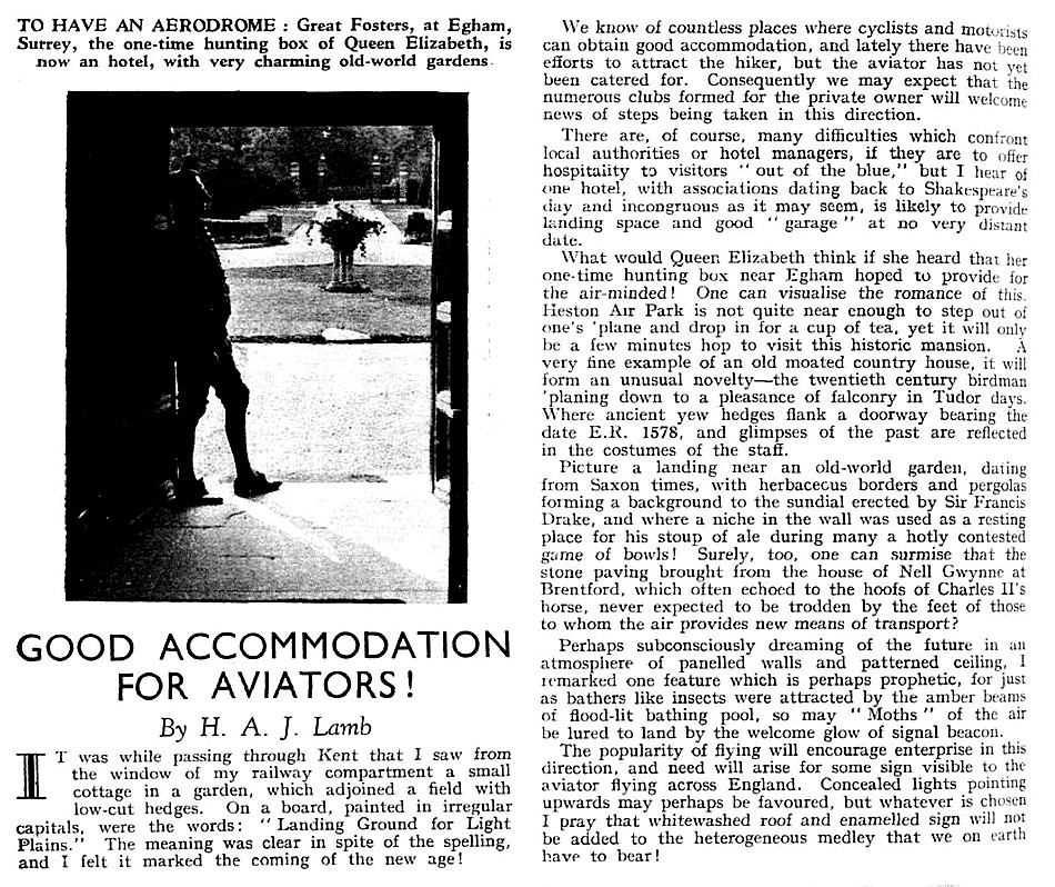
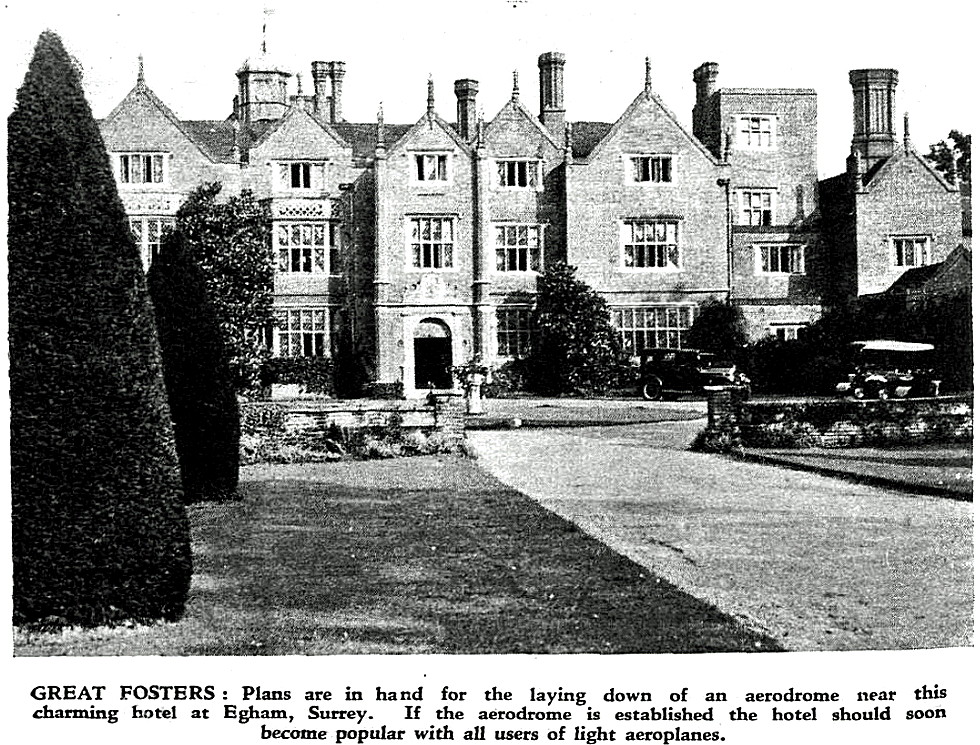
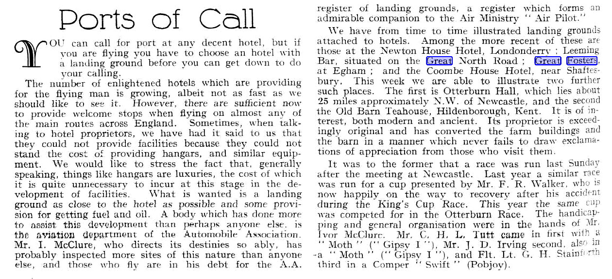
The Article One and Photo One were published in Flight magazine on the 10th August 1933. The area view is from my Google Earth © derived database.
Article Two was published in Flight magazine on the 17th August 1933.
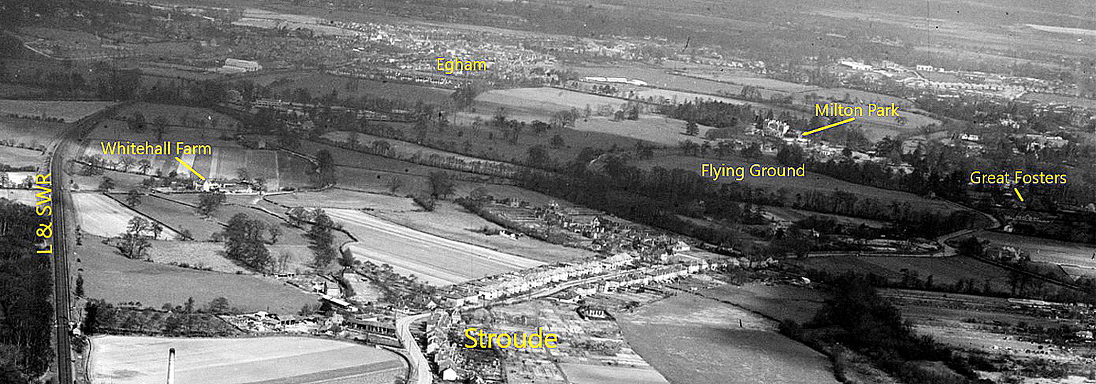

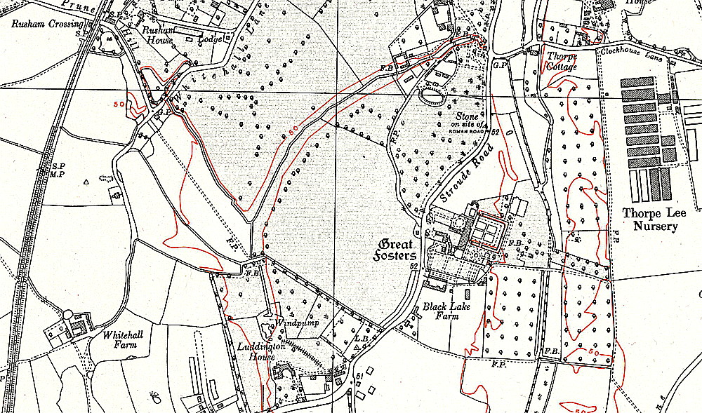
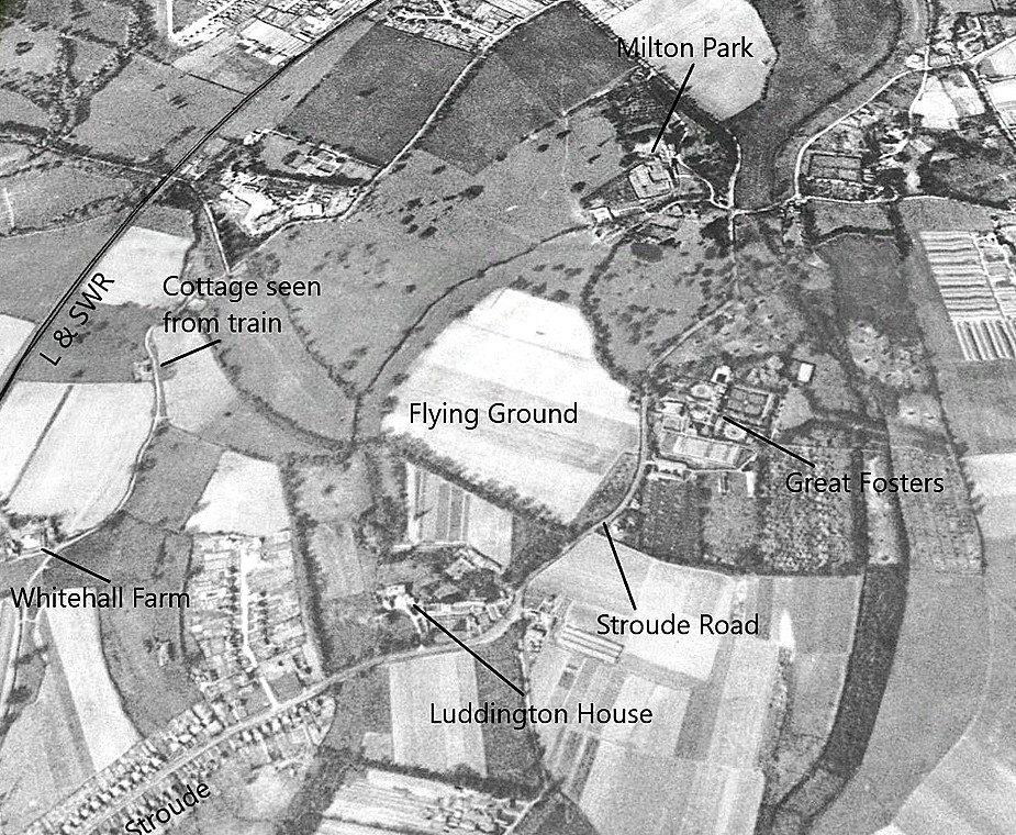
NOTES: The large field which still exists today, just west of the hotel, would have been very suitable. Especially as, presumably, the trees would have been much lower, and perhaps fewer of them? The 1938 map above shows that this field is, more or less, of the same size, with landing runs ranging from: N/S 400 metres and E/W 300 metres.
If these dimensions seem on the tight side - they were. Especially if you consider that many light aircraft were not fitted with brakes, or flaps, relying instead on the tail-skid for braking action. But, they had wing profiles with considerable camber meaning they generated a lot of lift at the expense of increased drag. In other words highly suitable for quite low approach speeds, with a steep approach angle, especially with the engine at idle.
Another aspect is that the notion we have today of adding, say, 25% to take-off and landing runs, for safety due to errors, was unheard of. We must also bear in mind that in those days, these were new and relatively inexpensive machines, mostly being owned and flown by wealthy individuals. Having a crash was quite common, generally without any serious if any injury, and the aircraft could invariably be quickly repaired.
If anybody can kindly offer advice and information, this will be much appreciated.
We'd love to hear from you, so please scroll down to leave a comment!
Leave a comment ...
Copyright (c) UK Airfield Guide
