


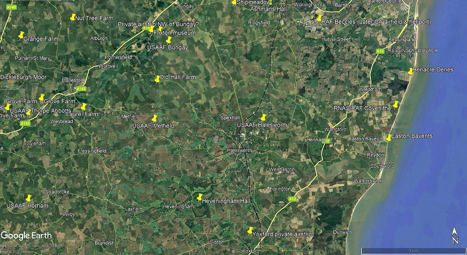
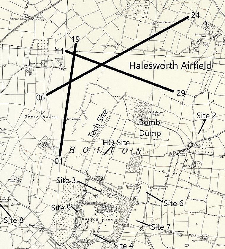
Halesworth flying sites
Note: This map gives the location of the WW2 airfield.
HALESWORTH: Temporary Landing Ground?
NOTES: In 1928 it appears that members of the Suffolk and Eastern Counties Aeroplane Club arranged a visit to Halesworth. Does anybody know if this was a ‘one off’ visit, or perhaps a regularly used site, and of course, the location used?
And indeed, as is often the case, did the site used during the 1930s later become the WW2 airfield listed below?
HALESWORTH: Military aerodrome
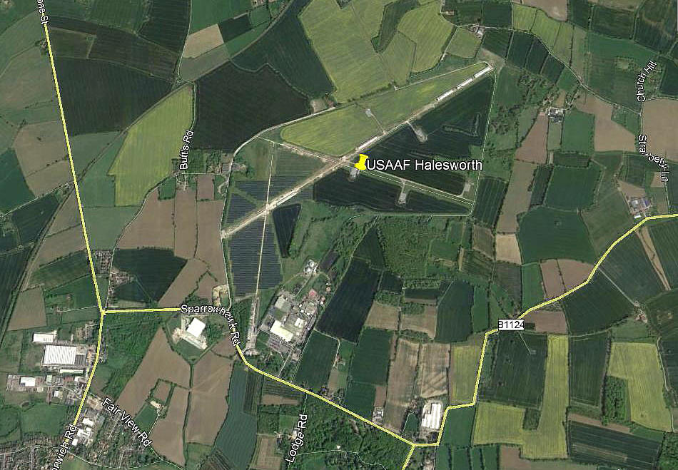
Note: This picture (2017) was obtained from Google Earth ©
Another example of just how clearly the layout of this airfield can still be seen seventy years later.
Military users: 8th USAAF
56th Fighter Group
Fighter Sqdns: 61st, 62nd & 63rd (Republic P-47 Thunderbolts)
489th Bombardment Group
Bombardment Sqdns: 844th, 845th, 846th & 847th (Consolidated B-24 Liberators)
5th Emergency Rescue Sqdn (Consolidated OA-10 Catalinas)
Also Republic P-47 Thunderbolts and Boeing SB-17 Flying Fortresses equipped to drop lifeboats
It also appears that this air base was used for training pilots on the North American P-51 Mustang.
END NOTES
On the 5th June 1945 HALESWORTH was transferred to RAF Bomber Command, who in turn allocated it to the Royal Navy on the 5th August. They decided to make it an advanced flying training base. The Fleet Air Arm posted two squadrons: No.798 with Airspeed Oxfords and No.762 equipped with de Havilland Mosquito T.3s.
Location: W of A144, about 7nm W of Southwold
Period of operation: 1942 to 1946
Runways: 06/24 1829x46 hard 01/19 1280x46 hard
11/29 1280x46 hard
A MICHAEL T HOLDER GALLERY
We have Mike Holder, a great friend of this 'Guide', to thank for investigating what might be available to illustrate HALESWORTH, plus providing the maps.
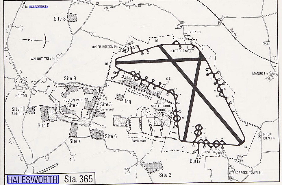
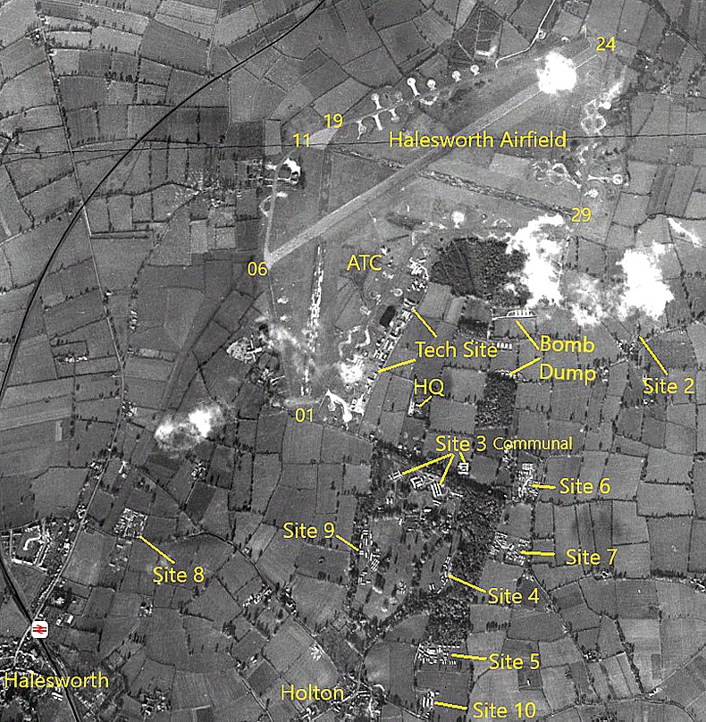
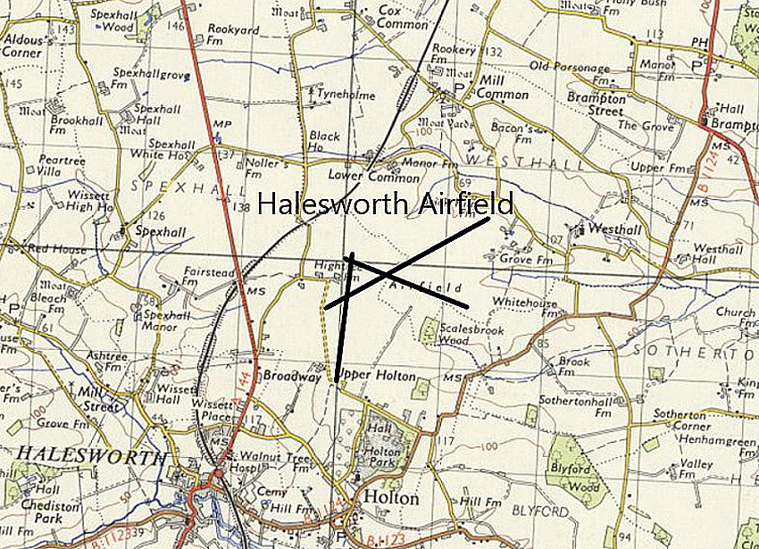
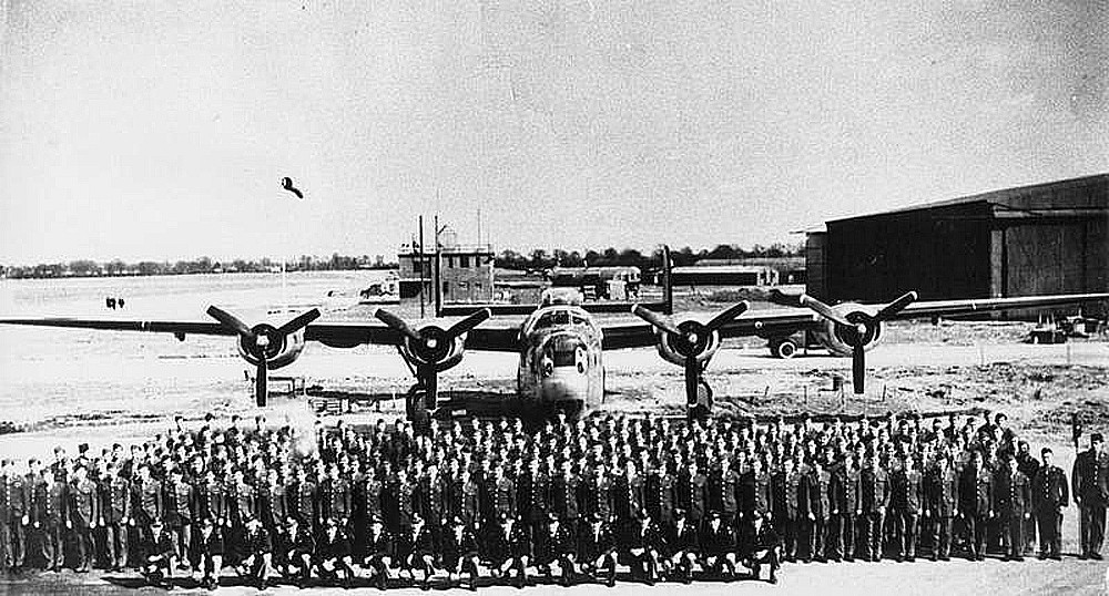
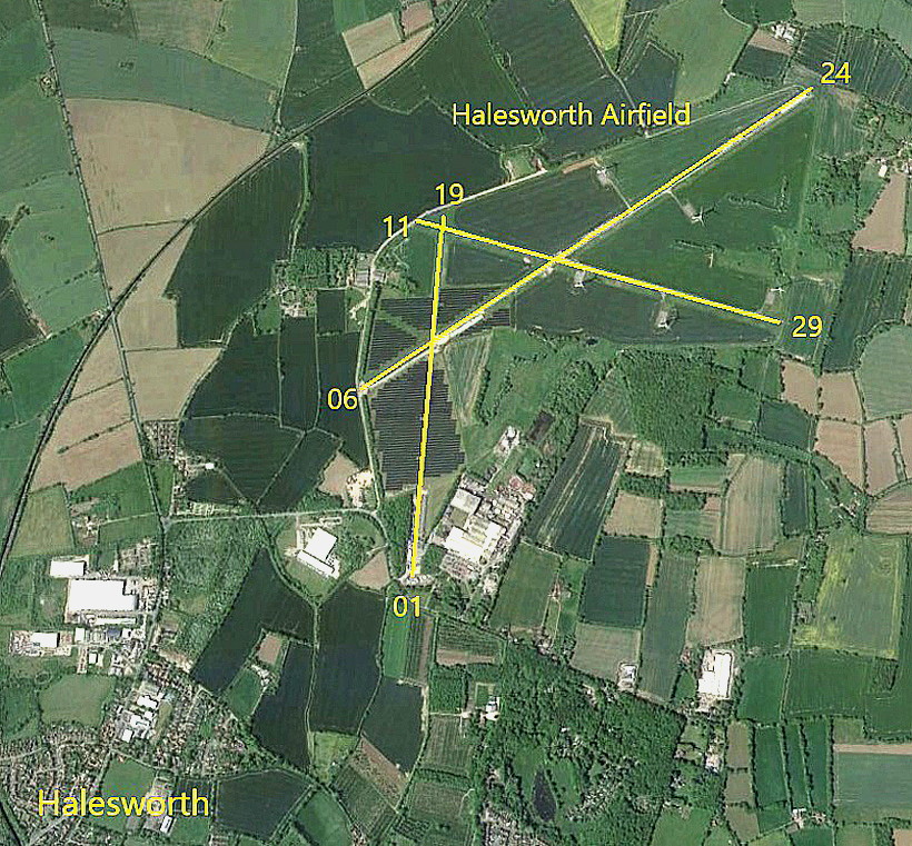
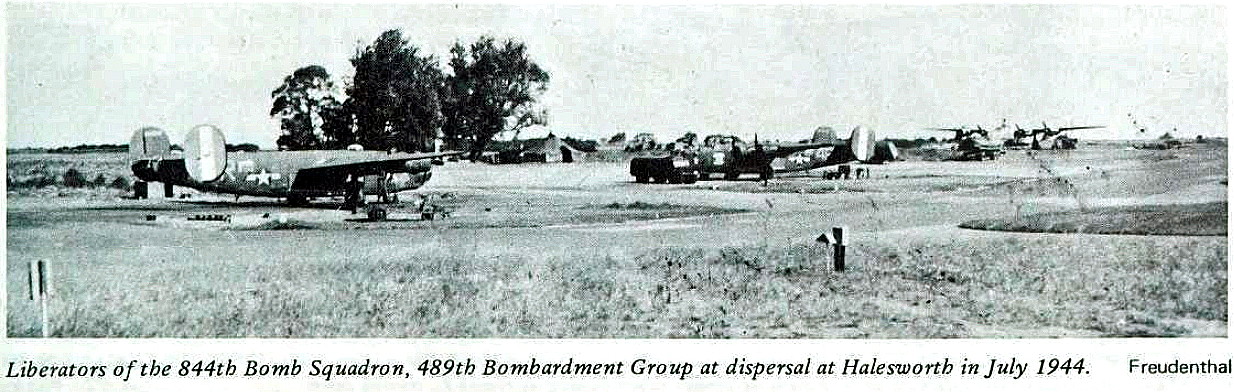
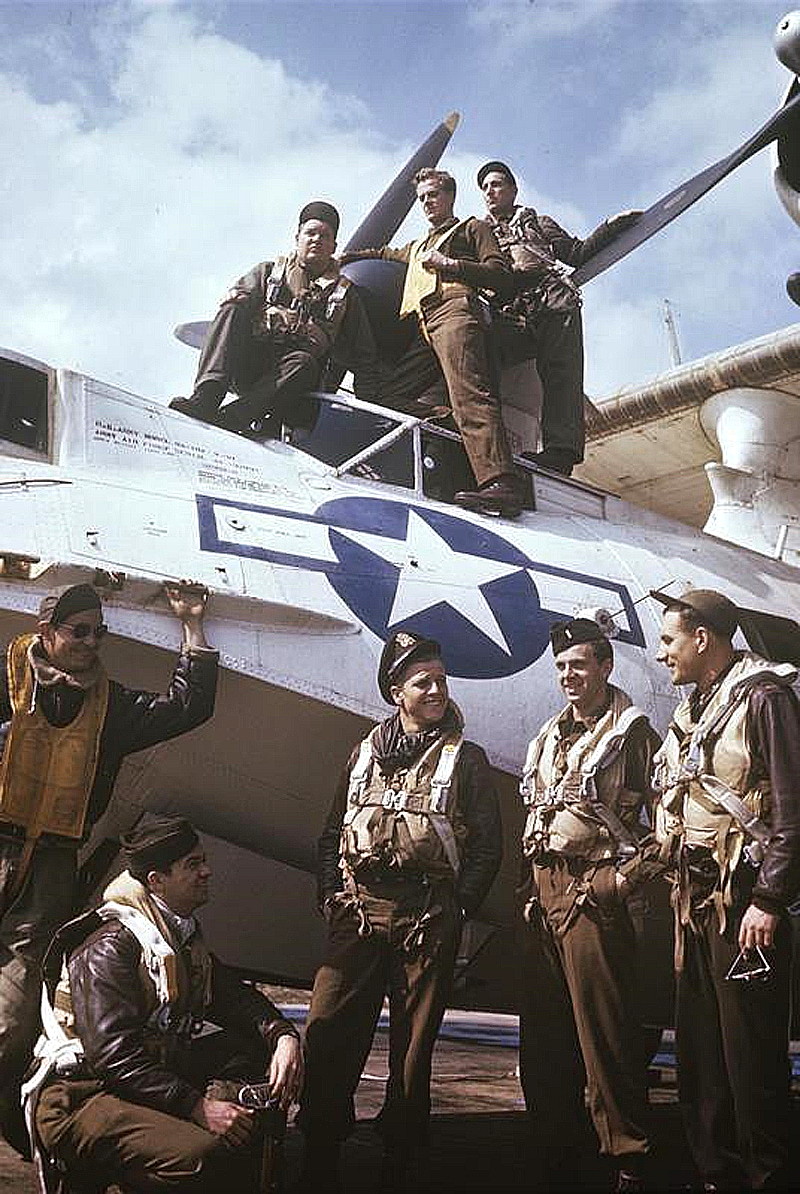
Photo One is of 489th Bombardment Group personnel gathered in front of a B-24 Liberator. Date unknown, from the American Air Museum.
Photo Two is of B-24s at their dispersals from 844th Bombardment Squadron in July 1944.
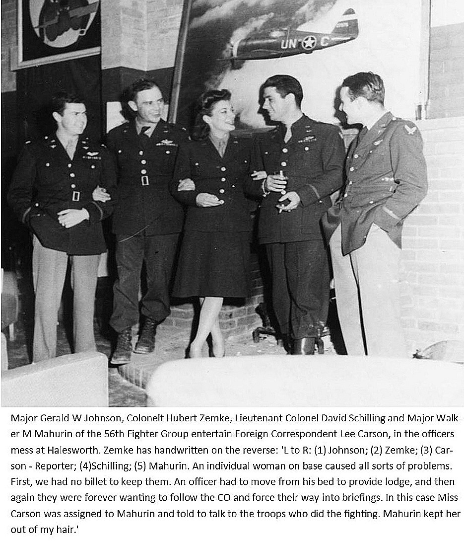
Photo Three: The caption tells the story behind this picture, obtained from the American Air Museum. The USAAF top brass were always very keen to promote and publicise their war effort by various means, and provide events of interest, including concerts, on their air bases in the UK to the crews based at these airfields. An approach to fighting a war which contrasts markedly with the RAF.
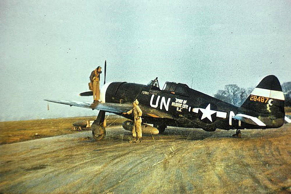
These three pictures are all from the American Air Museum. Photo Four is of Capt Walker 'Bud' Mahurin standing on the wing of his Thunderbolt, 42-8487. Date unknown.
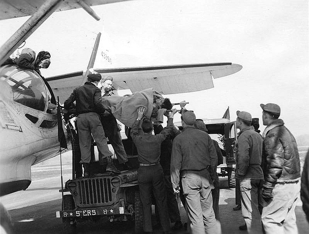
Photo Five shows a rescued RAF navigator being unloaded from the Catalina, 44-33915, on the 23rd March 1945. Photo Six is of an air-crew with their 5th Emergency Rescue Squadron OA-10 Catalina.
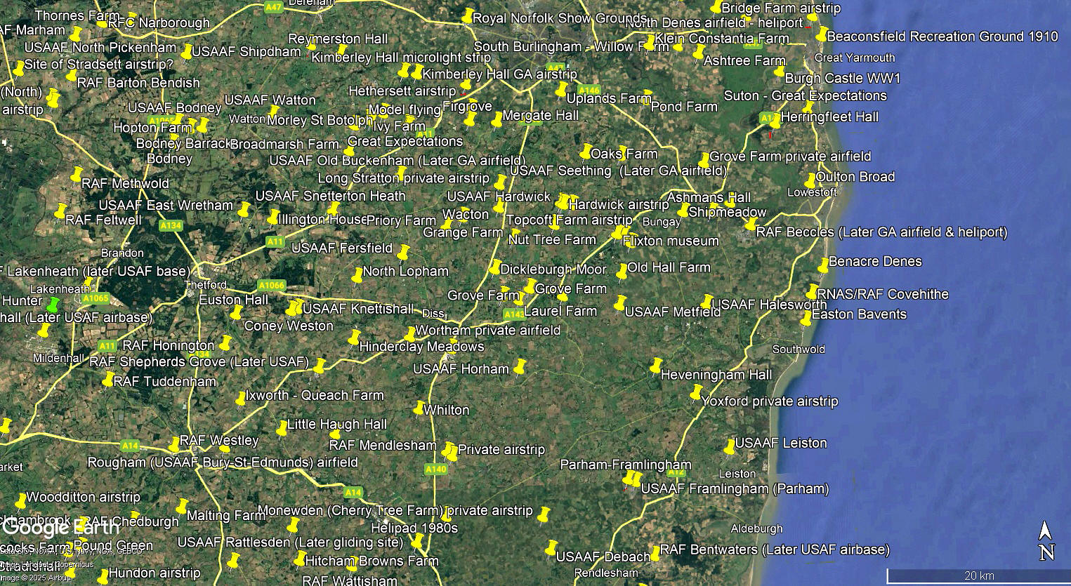
The local area and area views are from my Google Earth © derived database.
A BONUS PICTURE
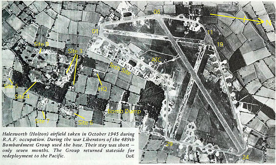
Photo Seven, another aerial vertical with caption, serves to illustate just how astonished I have been over the years to learn just how quickly all these USAAF air bases in WW2 were built. These being not just airfields but in effect self-contained 'townships' with all facilities provided that the inhabitants of most local villages could only dream about having.
NOTES: Amongst advice given to pilots in WW2 regarding landmarks to find this aerodrome was the River Blythe by moonlight. I now wonder how many pilots found this advice useful? Quite a few I expect.
My night flying experience is very limited, but on a clear night it is quite remarkable how easy it is to navigate due to many major roads and towns showing up really well as they are so well lit. In WW2 of course, with total black-out conditions in place, the situation was entirely more difficult.
We'd love to hear from you, so please scroll down to leave a comment!
Leave a comment ...
Copyright (c) UK Airfield Guide
