














Halfpenny Green
HALFPENNY GREEN: Military aerodrome now civil aerodrome (Aka BOBBINGTON)
(Later renamed WOLVERHAMPTON BUSINESS AIRPORT and in 2004 renamed again as WOLVERHAMPTON AIRPORT)
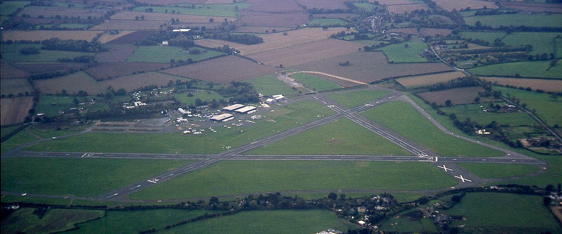
Note: Picture by the author.
Operated by: 1960s/2000s: Bobbington Estates Ltd
Military users: WW2: RAF Flying Training Command 25 Group
3 AFU - 3 AONS (Ansons, Lysanders & Martinets)
1545 BAT Flt (Oxfords)
Flying club/school: C & S Aviation, Central Aviation Training School, RJP Aviation, The Flight Centre, Midland Aviation Centre
Gliding: Listed as being undertaken in 1975
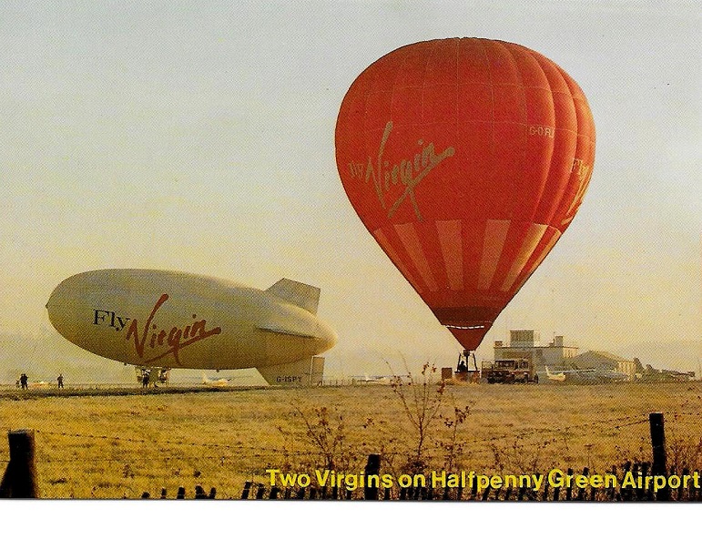
Notes:This picture from a postcard was kindly sent by Mike Charlton who has an amazing collection. See, www.aviationpostcard.co.uk
The Colt GA-42 airship, G-ISPY, was registered in June 1989, initially to Thunder and Colt Ltd, Oswestry, and then to Airship and Balloon in Telford, until being re-registered as G-ZEPI in April 1992. I cannot make out the registration for the balloon, but at least this gives us a three year time frame.
Location: NE of Bobbington and just S of Halfpenny Green villages, S of the B4176, 5nm ESE of Bridgnorth and 7nm SW of Wolverhampton town centre
Period of operation: Military 1941 to 1953. Civil from 1961(?) to -
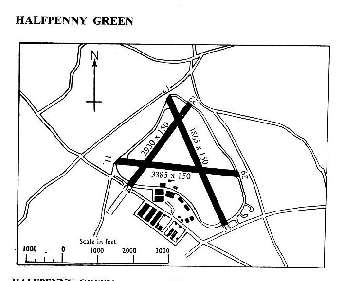
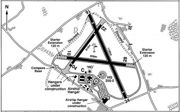
NOTE: These maps are reproduced with the kind permission of Pooleys Flight Equipment Ltd. Copyright Robert Pooley 2014.
Runways:
WW2: 04/22 1097x46 hard 10/28 1052x46 hard 16/34 1132x46 hard
1965: 04/22 893x46 hard 11/29 1032x46 hard 17/35 1178x46 hard
1990: 04/22 640x23 hard 10/28 775x23 hard 16/34 1178x23 hard
2000: 04/22 610x18 hard 10/28 800x23 hard 16/34 1195x23 hard
NOTES: A great many people, myself included, generally speaking deplore the loss of traditional aerodrome names and Halfpenny Green is a good example, being always replaced with innocuous and unimaginative titles. I’m told that detractors have been referring to Wolverhampton Business Airport as Wolverhampton Spaceport! If this name was adopted I’d be slightly tempted to agree as it does have that edge of very British idiosyncracity worthy of becoming recorded for posterity. But, for many older pilots, (like me), it will always be Halfpenny Green. I find it rather interesting that in my road atlas, (which is fairly recent), the airfield is referred to as Halfpenny Green.
In 2004 plans were afoot to build a new 1695m runway. Probably to invite ‘exec jets’ to land here? And why not? Long before the banking collapse in 2008/9 many regional airfields were fighting to survive. The traditional income based on a flying school/club or two and some GA maintenance wasn’t covering costs. Many local councils around the UK had invariably, but wrongly, appear to believe that private pilots must be all very wealthy individuals, so the local aerodrome could be viewed as a ‘cash cow’ to exploit. In fact, nothing can be further than the truth of the matter, as a general rule.
To me at least it seems astonishing that preconceptions arising from the 1920s and 1930s still exist. In those days with few exceptions only the wealthy, mostly gentry (?), owned aircraft and flew for the fun of it.
PERSONAL MEMORIES AND PICTURES
Note: All pictures by the author unless specified
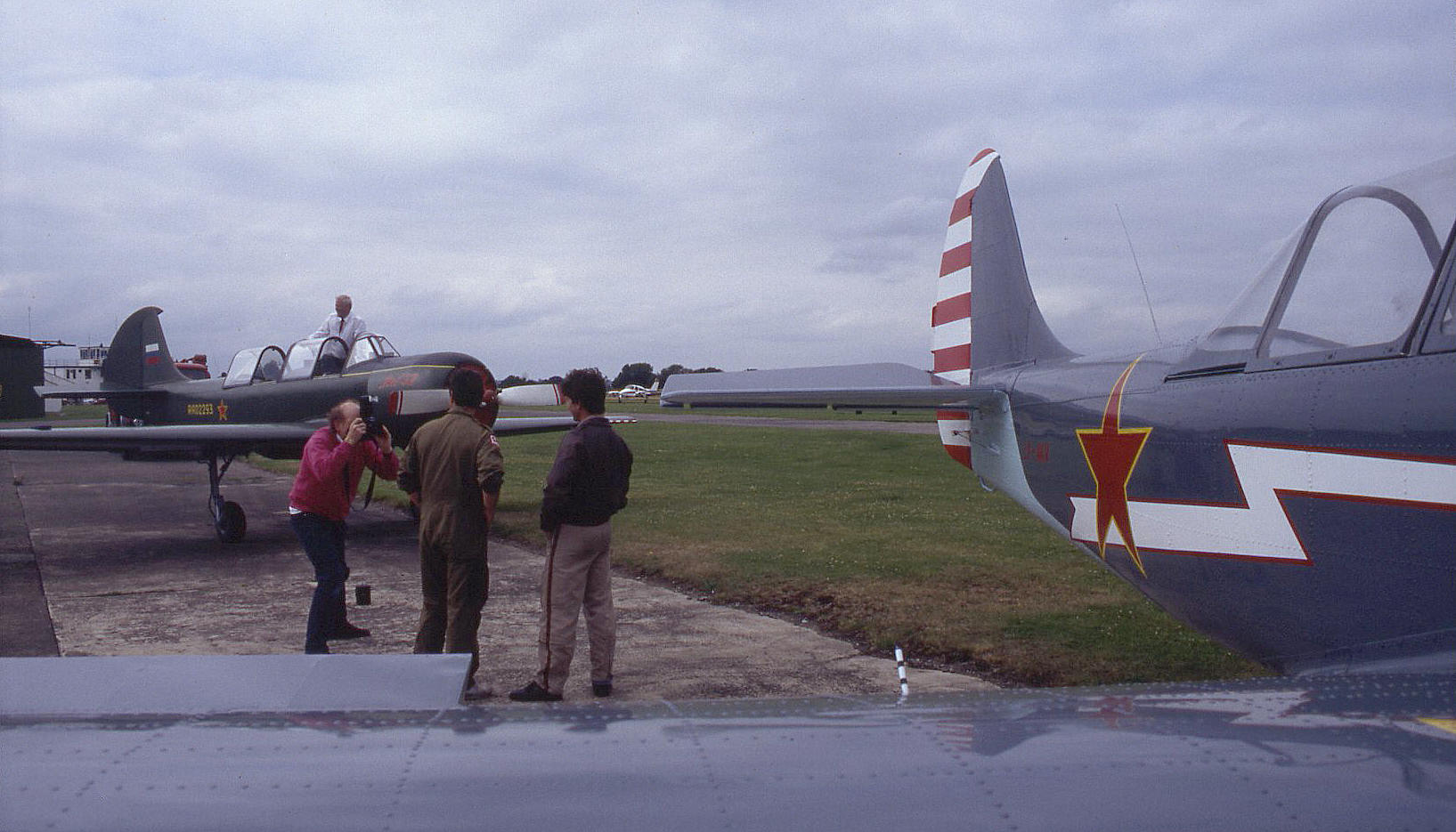
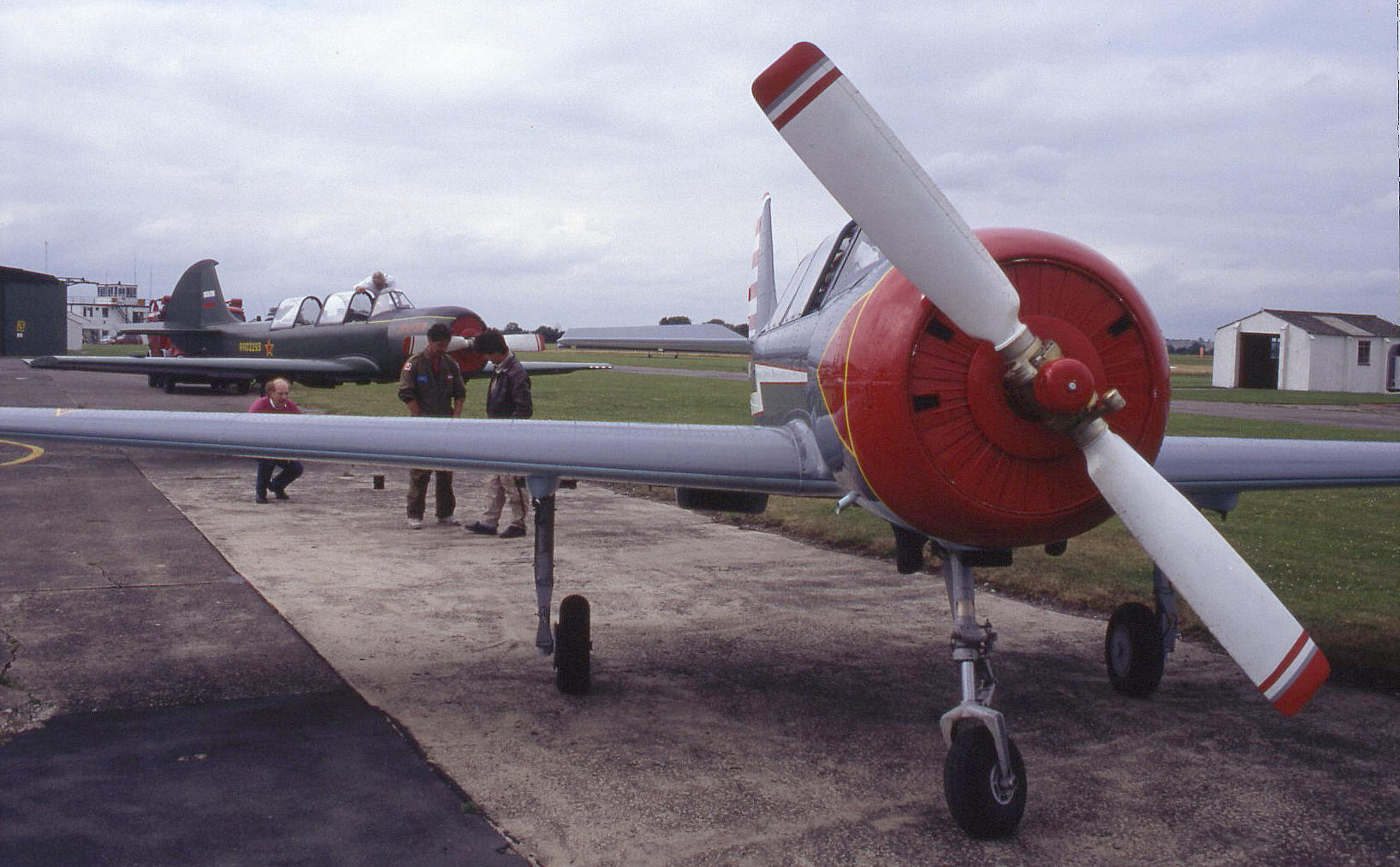
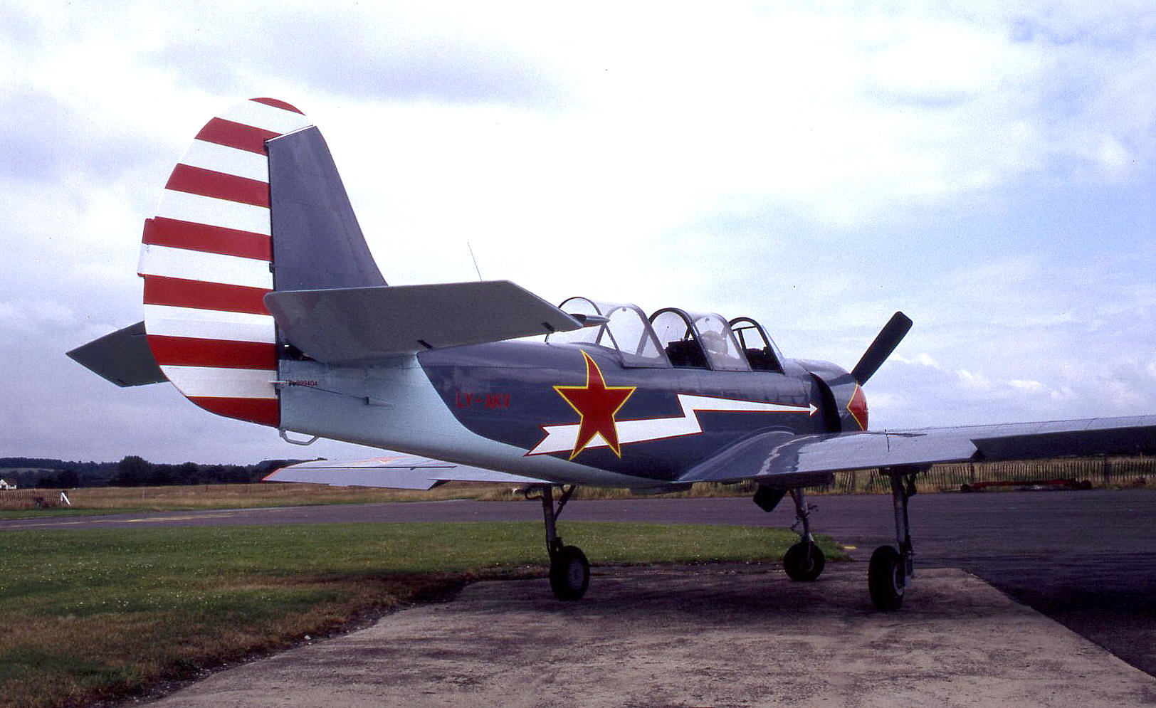
I flew down to Halfpenny Green on two or three occassions for air-to-air photographic sorties with Aussie Brown for Flyer magazine. For example, on the 20th July 1993 we flew down from Top Farm in the Cessna 172 G-AXBH to photograph two Yak 52s flying in formation.
Timothy Foster
This comment was written on: 2020-08-22 14:42:26I must be a jinx! In August1972 I took my wife and family to an airshow here, in the days when the Red Arrows flew Gnats. We were unfortunate enough to witness the crash that killed Prince William of Gloucester soon after take off in an air race. I can't recall what the event was.
John Taylor
This comment was written on: 2021-03-05 20:42:26Hi I flew into Halfpenny Green on my cross-country for my PPL around 1965 so it was civil then. According to Wikipedia it re-opened for civil use in 1961. John Taylor
We'd love to hear from you, so please scroll down to leave a comment!
Leave a comment ...
Copyright (c) UK Airfield Guide
