


Hunsdon Lea
HUNSDON LEA: Private microlight airfield (Aka LUNSDON FARM and MARJERY CROSS)
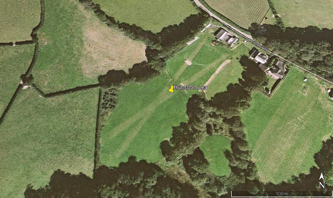
Aerial view 2002
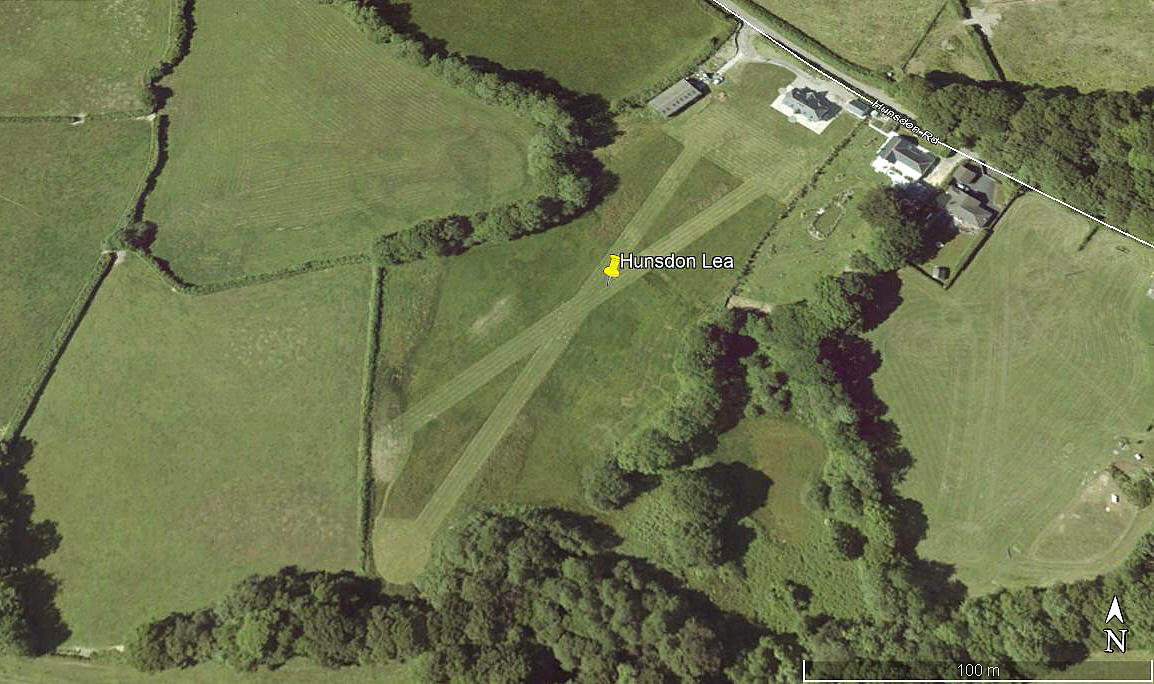
Aerial view 2010
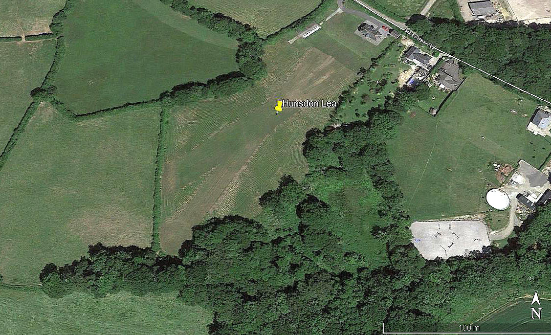
Aerial view 2018
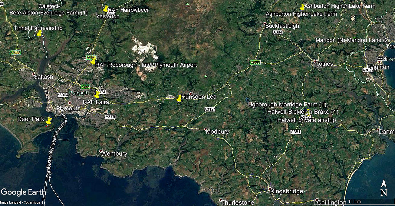
Area view
Note: All four of these pictures were obtained from Google Earth ©
Location: S of the A38, just SW of Ivybridge and 8.5nm E of Plymouth city centre
Period of operation: 1990s (?) to -
Runways: 03/21 210 grass 05/23 190 grass
NOTES: If anybody can kindly offer more advice, this will be most welcome.
We'd love to hear from you, so please scroll down to leave a comment!
Leave a comment ...
Copyright (c) UK Airfield Guide
