














Inverurie flying sites
INVERURIE and EAST BALHALGARDY: Temporary aerodromes
Operated by: Mr W A Hadden
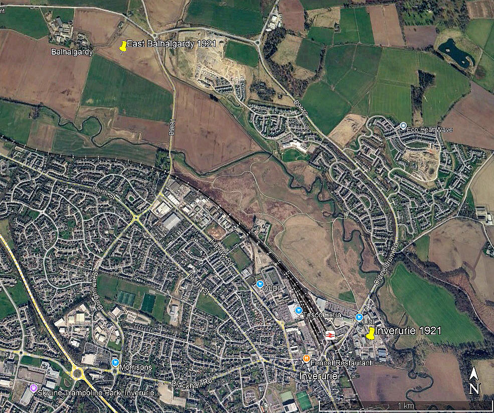
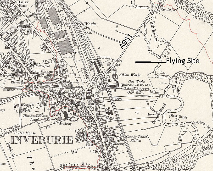
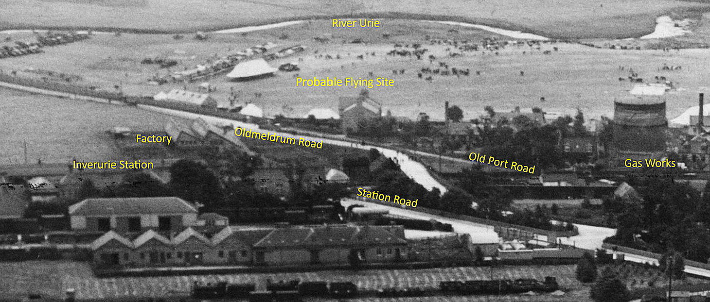
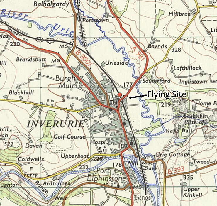
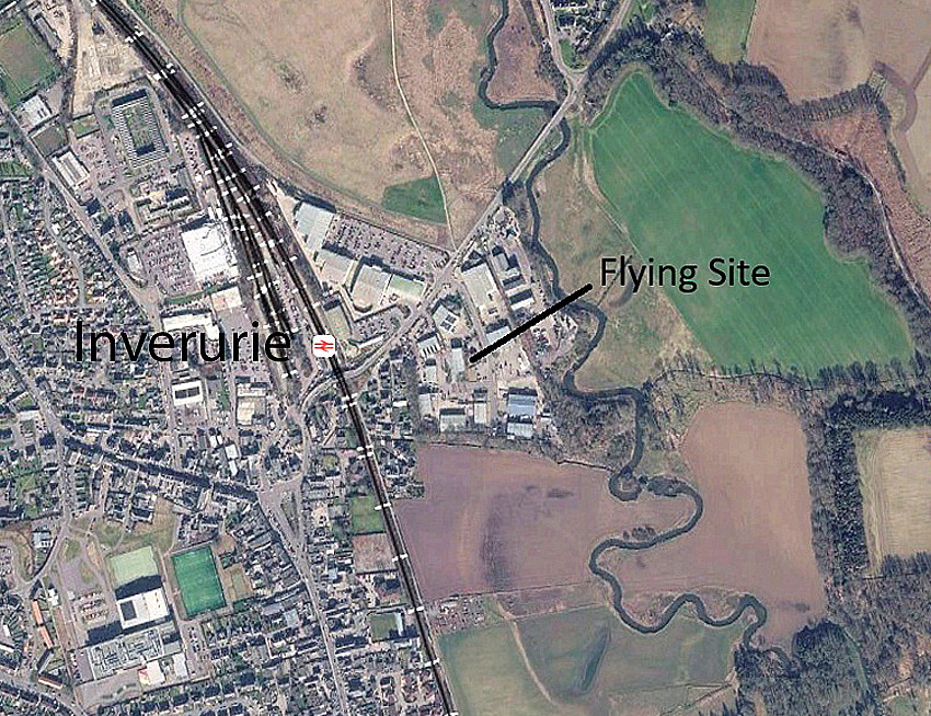
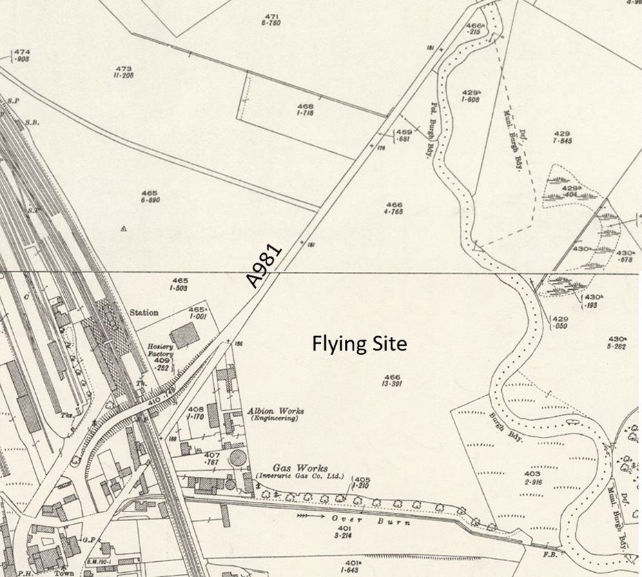
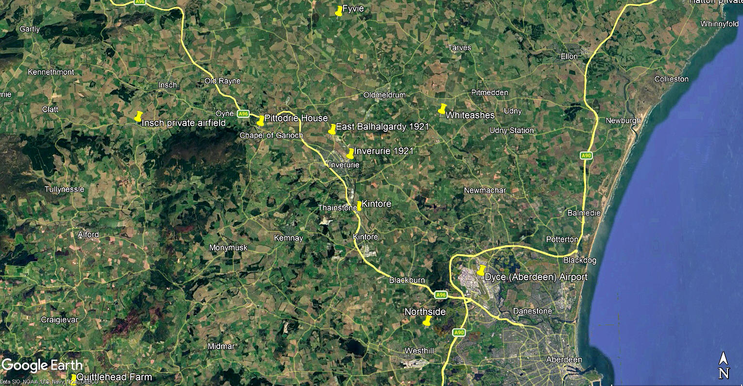
Locations: The Inverurie venue was probably just SE of the A981, (now the B9170?), and just NE of Inverurie town centre
The East Balhalgardy venue was probably just E of the village, W of the B9001, and just NNW of Inverurie town centre
Note: Inverurie is on the modern A96 and about 15nm NW of Aberdeen city centre
Period of operation: 10th September 1921
SPECIAL NOTE: This situation appears very unusual indeed and quite possibly unique? Two venues being used in one day using just one aeroplane, situated about 1.5nm apart. Presumably there must have been an obvious reason at the time, but to date we can find no evidence. If anybody can kindly offer advice and information, this will be very much appreciated.
TWO LEADING ITEMS
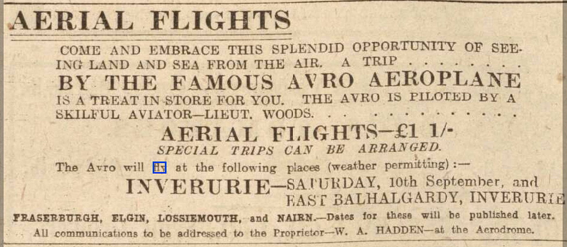
The advert was placed in the Aberdeen Press and Journal on the 9th September 1921 and clearly shows that the two venues were pre-planned to be visited on the 10th September.
A MICHAEL T HOLDER GALLERY
Once again we have Mike Holder, a great long-term friend of this 'Guide', to thank for both discovering this most unusual set of circumstances and providing the following items to illustrate the two venues.
BUT FIRST, THE AEROPLANE THAT WAS USED
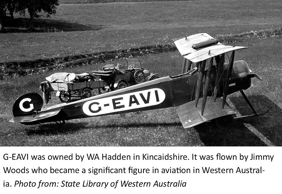
Photo from the Library of Western Australia via Airhistory.net.
G-EAVI (ex E1644) was an Avro 504K converted to carry two passengers, most probably by the Avro company themselves who, after WW1 made a significant number. It was registered to W A Hadden from 23.03.20 until it was declared WFU (Withdrawn From Use) 12.08.24.
INVERURIE
EAST BALHALGARDY
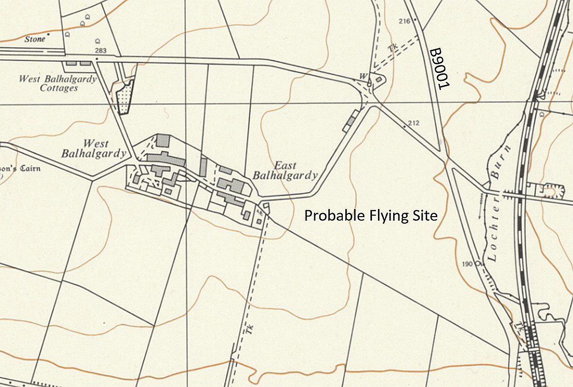
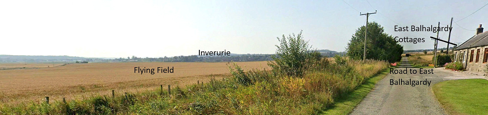
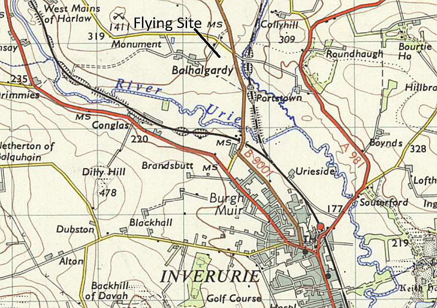
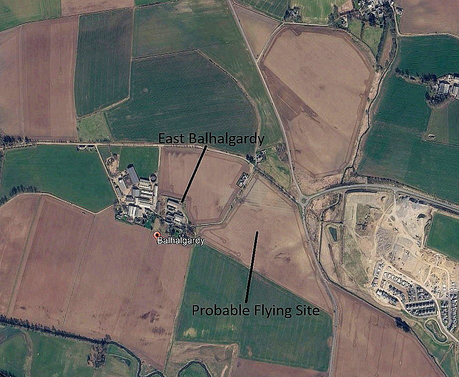
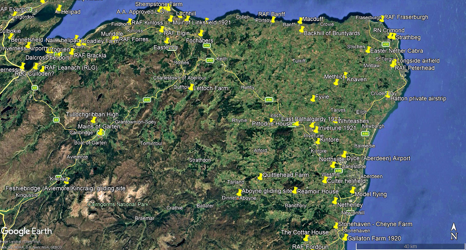
The local area and area views are from my Google Earth© derived database.
FINAL NOTES: As Mike pointed out to me, W A Hadden was himself a farmer in this region of Scotland, so it is quite plausible that he received an inviitation to pay a visit from another farmer, (or farmers), he was well acquainted with and arrange for a flight or two?
As alluded to above, we do not know for certain which fields were actually used on the 10th September. If anybody can kindly offer advice and information, this will be most appreciated.
We'd love to hear from you, so please scroll down to leave a comment!
Leave a comment ...
Copyright (c) UK Airfield Guide
