


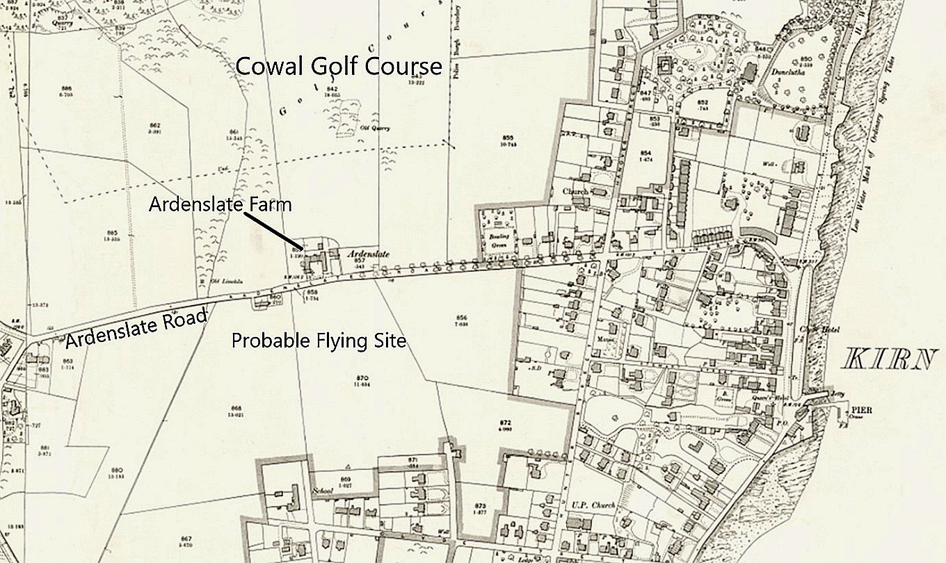
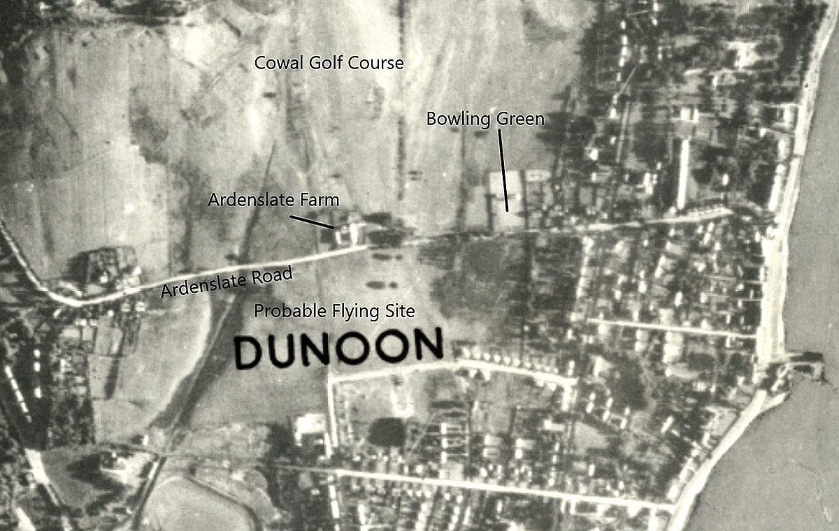
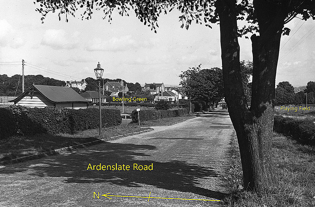
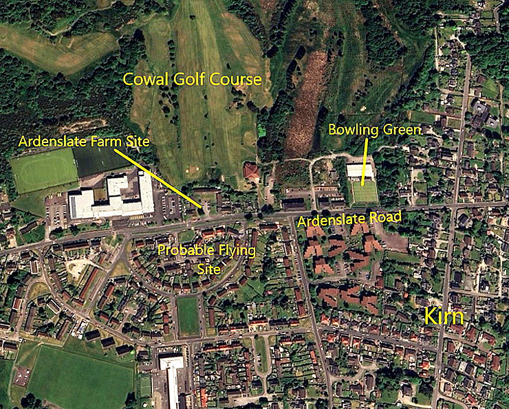
Kirn
KIRN: Seasonal joy-riding aerodrome? (Aka ARDENSLATE and DUNOON)
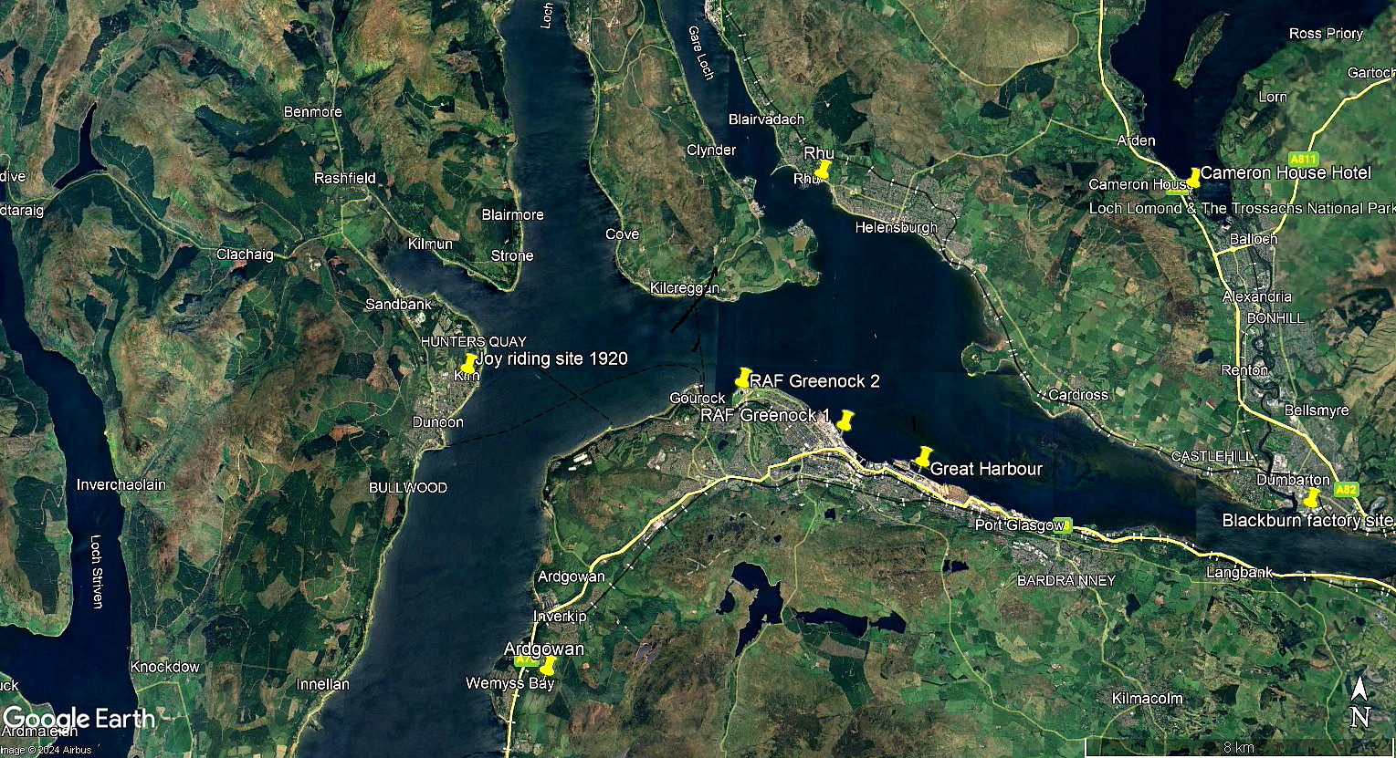
Note: This picture, from my Google Earth © derived database, only shows the location of Kirn.
Operated by: (?)
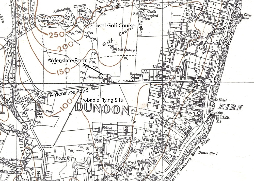
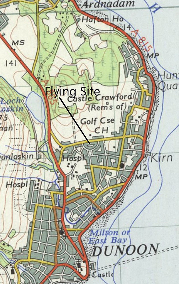
Location: Kirn is just roughly N to NNE of Dunoon, about 6nm WNW of Greenock town centre
Period of operation: Possibly or even probably (?) from March to July 1920
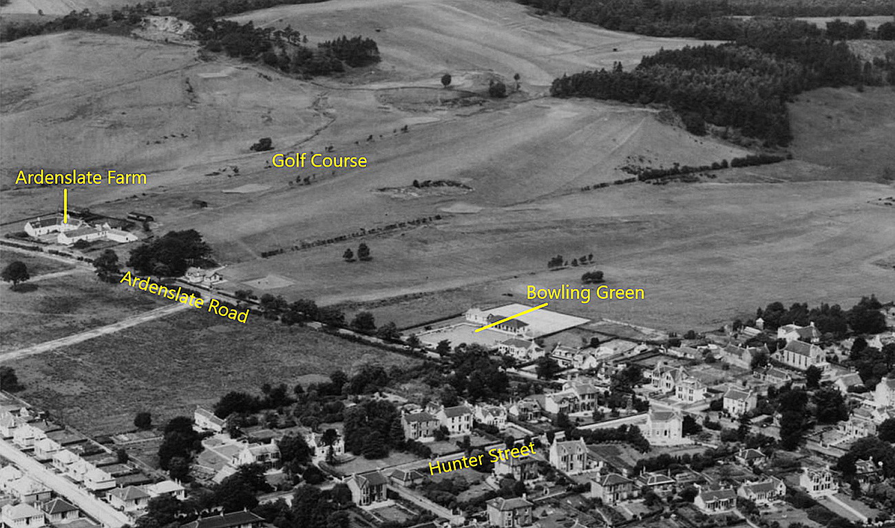
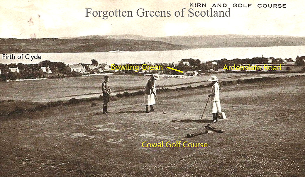
NOTES: We have Mr Graham Frost, a great friend of this 'Guide', to thank for finding evidence of this location being used. After WW1 many pilots were keen to keep flying and several if not many, opted to go into business offering joy-rides. Avro, then very much engaged in such operations themselves, had been converting their 504 types, mainly the Avro 504K and Avro 504N, to carry two passengers in the front cockpit, and were offering them for sale to others.
The main problem was that, despite their best intentions, very few had any ideas about how to run a business, especially one relying on just the summer season for earning revenue. We do not know why this pilot/operator decided to set up at KIRN. In those days especially the amount of customers in this area would have been limited, hence the short period of operation. But, did the business close down, or, did it move elsewhere?
If anybody can kindly offer advice and information, this will be much appreciated. Having made this request Mr Mike Holder, another great friend of this 'Guide', presented us with the following gallery:
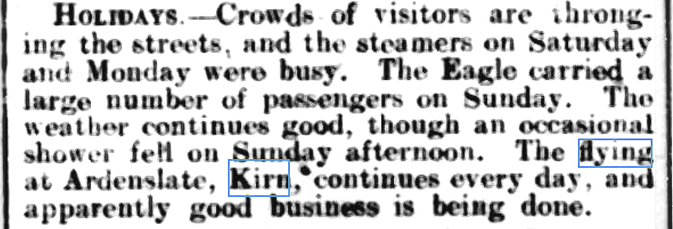
The article was published in the Oban Times and Argyllshire Advertiser on the 10th April 1920.
We'd love to hear from you, so please scroll down to leave a comment!
Leave a comment ...
Copyright (c) UK Airfield Guide
