


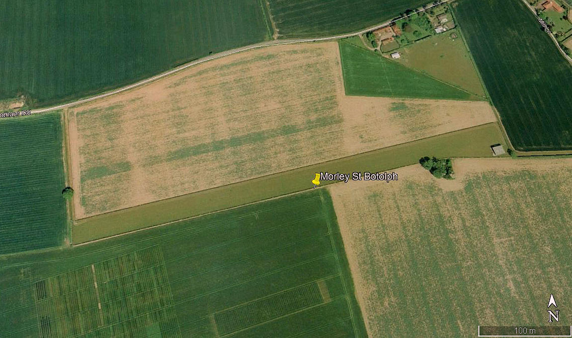
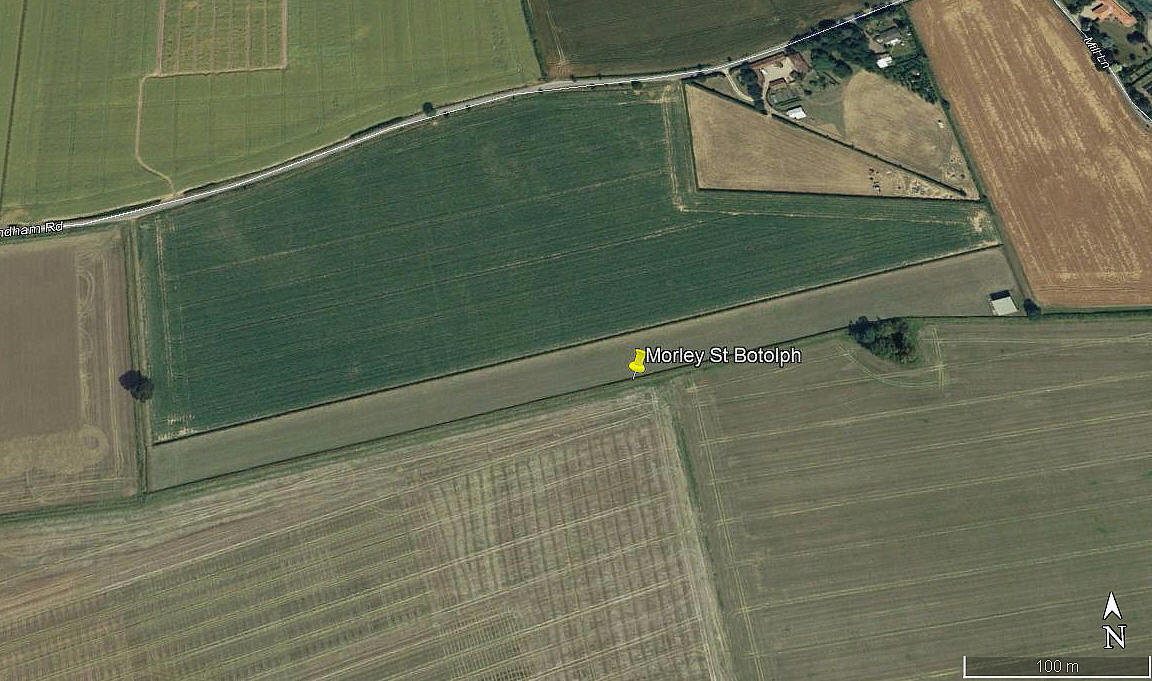
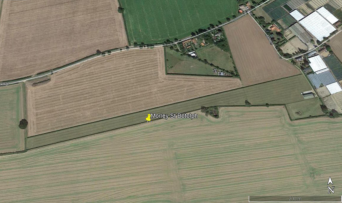
Morley St Botolph
MORLEY St BOTOLPH: Private airstrip (Aka COCKLES FARM)
Note: All four of these pictures were obtained from Google Earth ©
Location: Just NW of Morley St Botolph village, 3nm WSW of Wymondham town centre
Period of operation: 1990s (?) to -
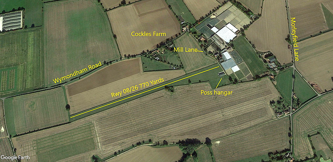
Runway: 08/26 700 grass
NOTES: Virtually nothing known. As always in this 'Guide' if anybody can kindly offer advice, this will be most welcome.
SOMETHING TO CONSIDER?
A couple of years ago, when researching the WW2 USAAF base at DEOPHAM, Mike Holder, a great friend of this 'Guide', discovered this airstrip. Not knowing that I already had it listed as MORLEY St BOTULPH, he very kindly provided these items to locate the exact site.
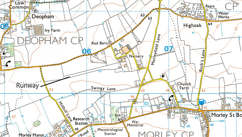
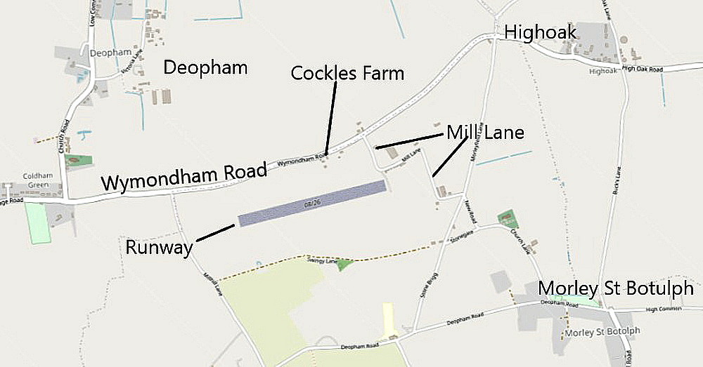
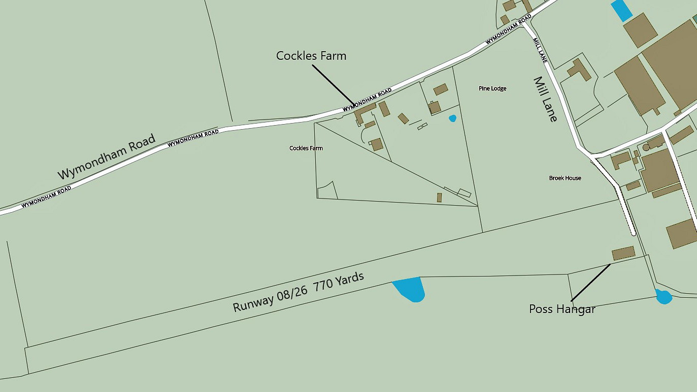
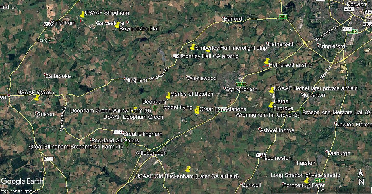
* This local map was obtained from Britain from Above.
I have always loved maps from a very young age. Indeed, am so sad a case that I always click the Satnav map on, in my car, even when on a local trip. And, yes, do look it at from time to time. When I started driving professionally back in the late 1960s, all over the U.K. and then Europe, that's all we had to navigate by - maps! Plus stopping to ask advice of course. Tricky in Europe needless to say.
The reason for including these examples, is just to show how, graphically, the exact same location can be depicted. I do wonder how, these days, how many younger people have been taught to read a map? Or indeed, when travelling, even bother to have one?
We'd love to hear from you, so please scroll down to leave a comment!
Leave a comment ...
Copyright (c) UK Airfield Guide
