














Oaks Farm
OAKS FARM: Private airstrip (Aka WOODTON)
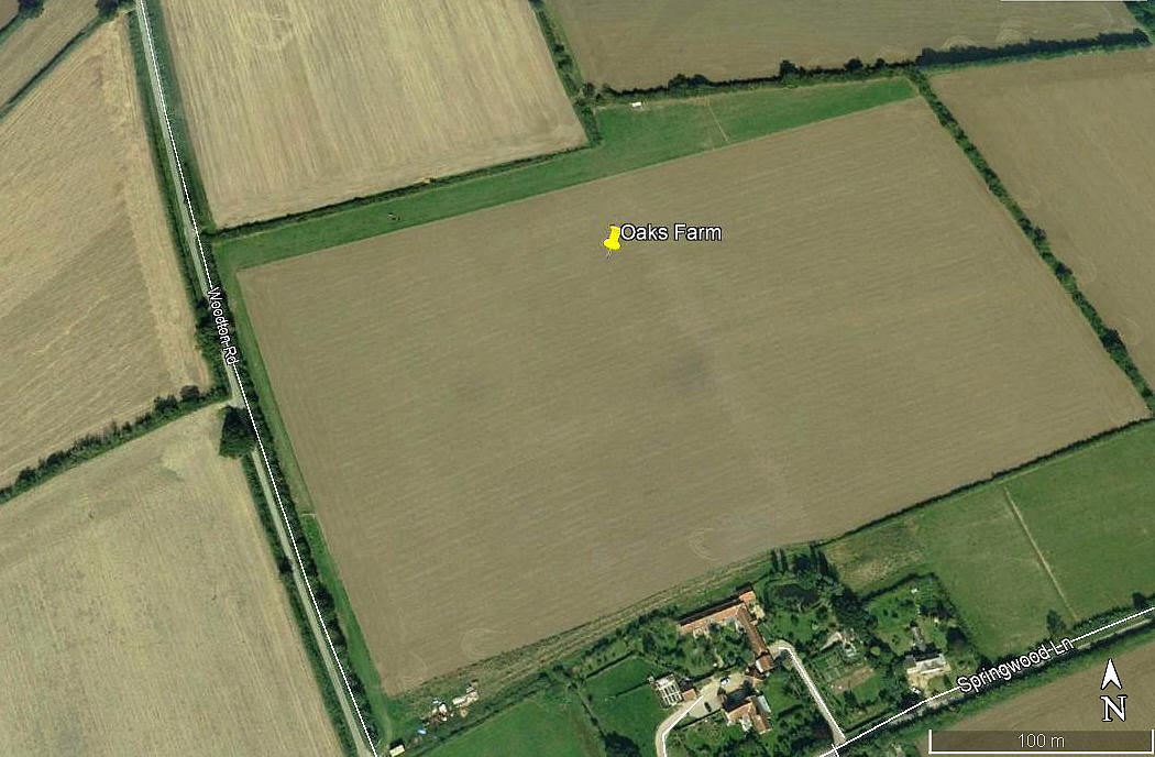
Aerial view 2006
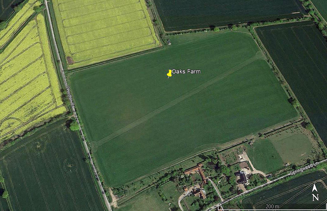
Aerial view 2017
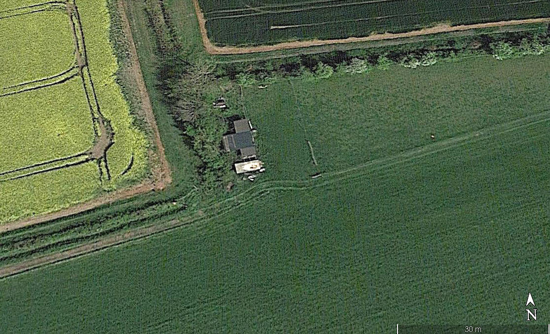
Aerial detail 2017
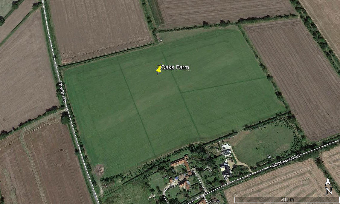
Aerial view 2019
Note: All four of these pictures were obtained from Google Earth ©
Location: About 1.5nm NW to NNW of Woodton village. 5.5nm NW of Bungay town centre
Period of operation: 2006 to -
Runways: 2006 = 08/26 420 grass
2017 = 06/24 420 grass
In 2019 both runways being used?
NOTES: This location is most unusual - it seems to pose more questions than answers. For example, looking at the Google Earth pictures above, it appears that by 2017 a hangar is clearly visible, but by 2019 it had gone. But, the two runways used do appear to be still visible.
MORE INFORMATION
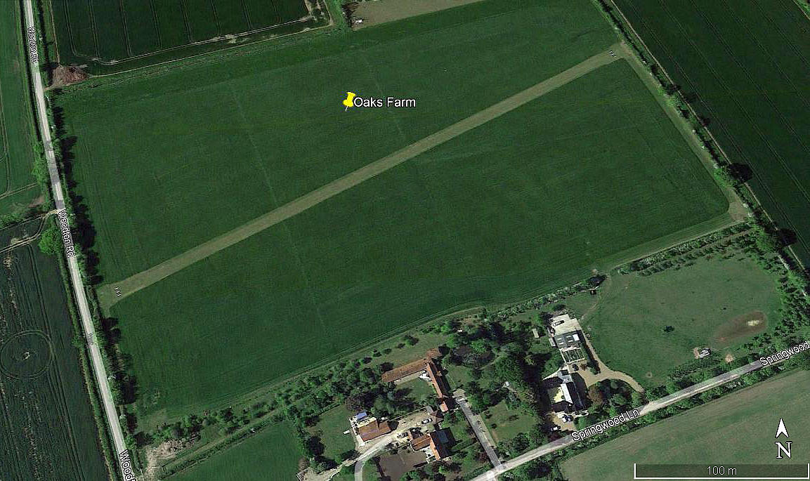
Aerial view 2021
Note: In November 2022 I was kindly contacted by Mr Mark Taylor who told me the 06/24 runway is now clearly visible and marked, the hangar now being on the farm buildings site. This picture from Google Earth © clearly illustrates the changes.
As always in this 'Guide', if anybody can kindly offer more advice, this will be much appreciated. Pictures are of course always welcome.
Michael Day
This comment was written on: 2026-04-10 20:54:46The strip is mine and is available for use at pilots risk The strip is 425m long x 18m wide and only the 06/24 aligned strip is for use, it has threshold markers and side markers both side, it is essentially level and smooth grass. There is a wind sock on the northern boundary, I ask for rectangular circuits either north or south at min 600ft agl. On either downwind please look down the lane on the western boundary for any horses on the lane. Please also be aware there are cable 75m west of 04 albeit at 25ft agl. An email to the attached would be appreciated by users, whilst I don't mind PFL's (some instructors use it) please take off and b***er off afterwards, and as always stay clear of houses as far as possible , mine is the farmhouse to the south and is accessed from the threshold of 04 along the headland.
We'd love to hear from you, so please scroll down to leave a comment!
Leave a comment ...
Copyright (c) UK Airfield Guide
