


Paddock flying sites
Note: For convenience I have labelled these two sites 'North' and 'South'. The Google map gives the location of PADDOCK (NORTH)
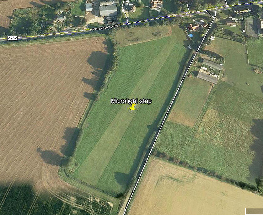
PADDOCK (SOUTH): Microlight airstrip
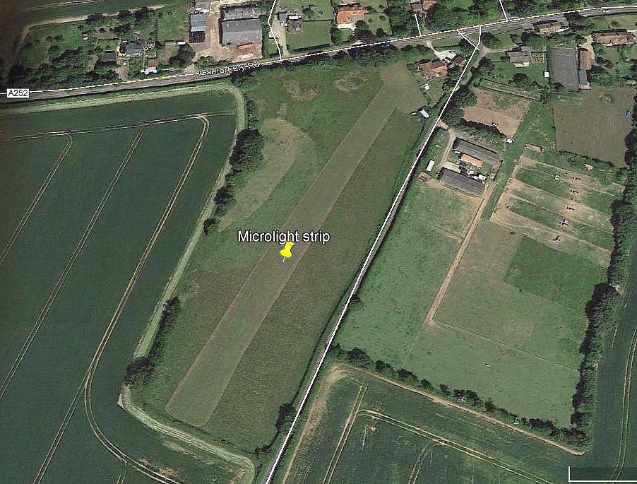
Note: Both of these pictures were obtained from Google Earth ©
Location: In Paddock village, just S of the A252 and roughly 1nm NE of CHALLOCK gliding site and roughly 4nm NNW of Ashford town centre
Period of operation: 2007 to 2015?
Runway: 03/21 240 grass
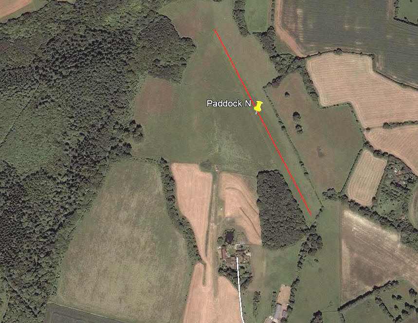
PADDOCK (NORTH): Private airstrip(s)
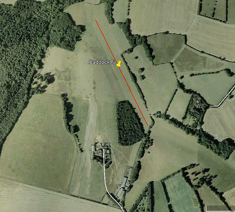
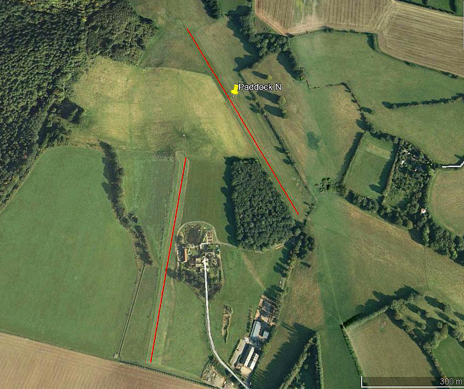
Note: All three of these pictures were obtained from Google Earth ©
Location: N of Paddock village, roughly 2nm NE of CHALLOCK gliding site and about 5.5nm NNW of Ashford town centre
Period of operation: Early 2000s only(?) to –
Runway(s): 2003 = 16/34 675 grass
2008: 16/34 550 grass 01/19 410 grass
2014: 16/34 600 grass
Note: Looking at Google Earth images, except for the 2008 picture, it seems hard to determine for how long the 01/19 was being used.
NOTES: On a visit to the area in February 2013, when delivering a Tipsy Nipper nearby, I had noticed the microlight strip (listed above as PADDOCK - SOUTH ) when driving along the A252 and locals also told me about this strip, PADDOCK - NORTH. However, it was not clear exactly what category of aircraft used this strip. It could of course be used by a wide variety of GA types.
Oddly perhaps, I can see no evidence of a hangar. If anybody can kindly offer advice, this will be most welcome.
We'd love to hear from you, so please scroll down to leave a comment!
Leave a comment ...
Copyright (c) UK Airfield Guide
