


Papplewick Moor
PAPPLEWICK MOOR: Military Landing Ground in WW1 later WW2 airfield with few if any facilities it seems by the end of 1944
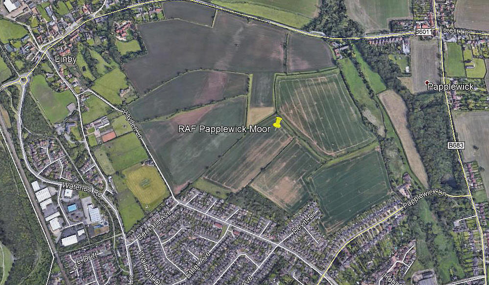
Note: This picture (2010) was obtained from Google Earth ©
This picture is of the site given in Military Airfields in the British Isles 1939-1945 by Steve Willis and Barry Hollis. The location given on the Airfields of Britain Conservation Trust web-site places the airfield to the E of Papplewick. Any advice will be most welcome.
Military users: WW1: RFC NLG [Night Landing Ground] for 38 (Home Defence) Sqdn
Also DLG [Day Landing Ground] for HUCKNALL
WW2: RAF Flying Training Command 21 Group
EFTS (RLG)
Location: SE of Lindby, N of Hucknall, SW of Papplewick, 6nm N of Nottingham
Period of operation: WW1: 1916 to 1917 WW2: 1941 to 1945
Site area: WW1: To date no dimensions known
Runways: WW2: Grass (No dimensions known, listed as an emergency landing ground and low flying area)
So presumably an 'all-over' grass aerodrome
NOTES: I am of course assuming the WW1 and WW2 sites were on the same location? Can anybody kindly advise on this?
Ady Stimpson
This comment was written on: 2017-12-05 21:22:11Hello. I have a magazine article pertaining to Papplewick Moor. Happy to send a pdf copy if you don't mind letting me have an email address. I live about 2 miles from the airfield. Regards.
Reply from Dick Flute:
Hi Ady, Will welcome this. My e-mail is: dick.flute@ukairfieldguide.co.uk Best regards, Dick
We'd love to hear from you, so please scroll down to leave a comment!
Leave a comment ...
Copyright (c) UK Airfield Guide
