


Penston
PENSTON: Military aerodrome
A MICHAEL T HOLDER GALLERY
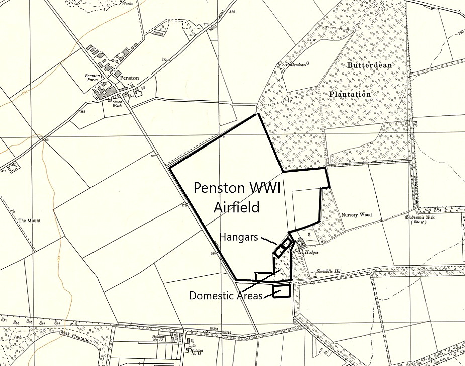
Local map
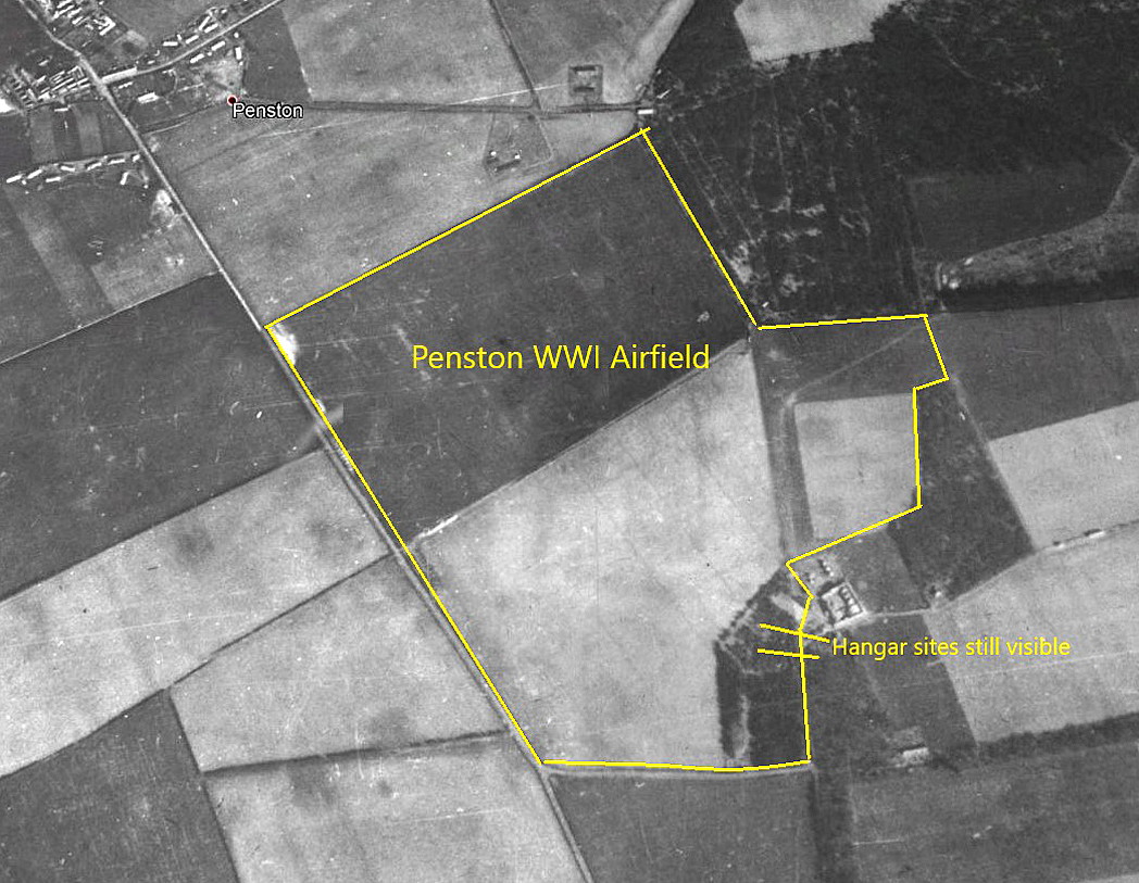
Aerial photo c.1945
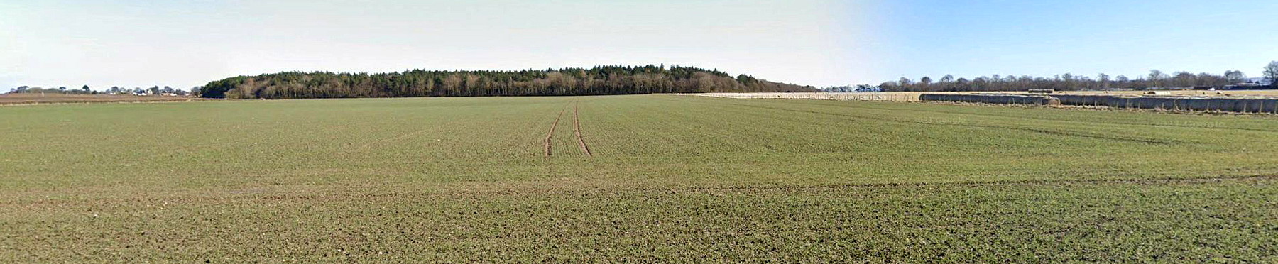
Google ground view
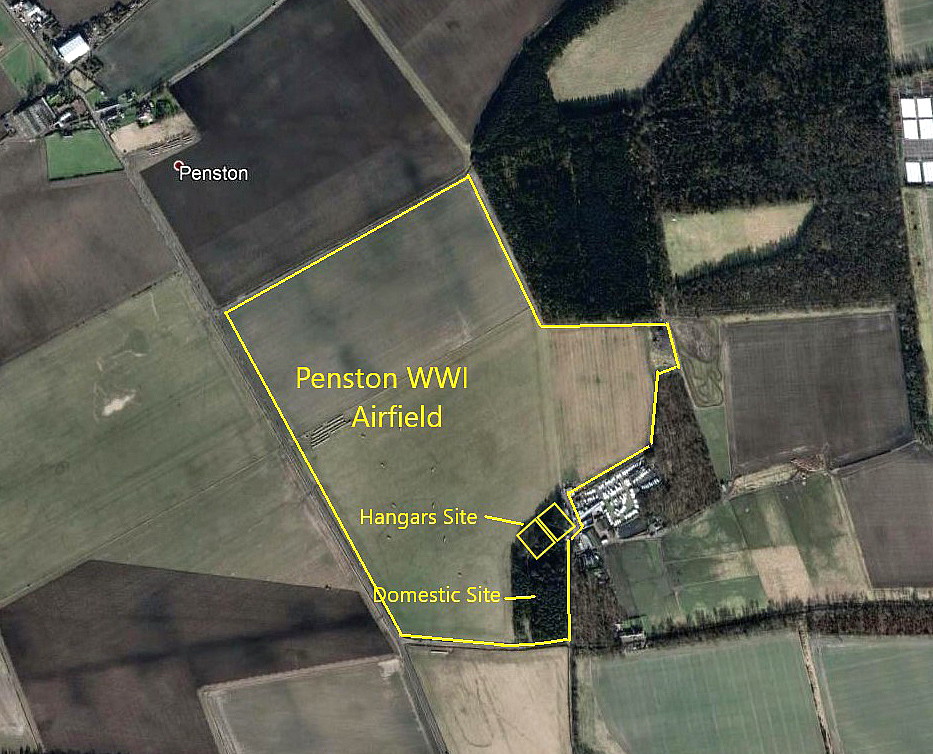
Google Earth © view
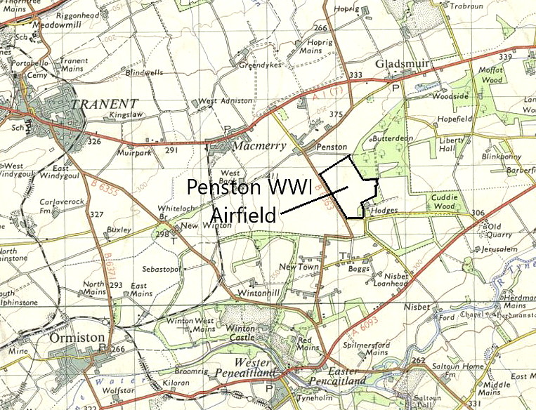
Local area map
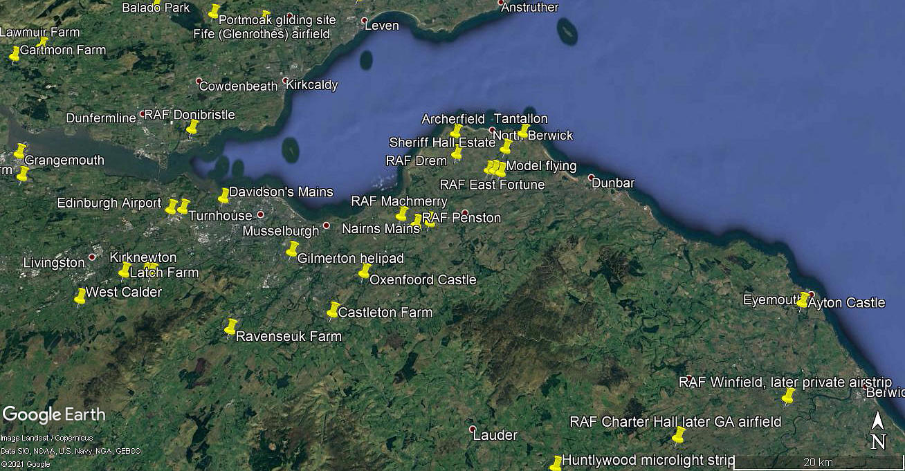
Area view
Note: I have added the area view.
Military users: RFC/RAF (Royal Flying Corps / Royal Air Force)
Home Defence Flight Station: 1917 to 1919
77 [Home Defence Squadron] (Royal Aircraft Factory B.E.2 and B.E.12 types)
Location: In/near Penston just S of the A199, about 12nm E to ESE of Edinburgh city centre
Period of operation: 1917 to 1919
Site area: 106 acres 823 x 640
NOTES: It would appear that after using HOPRIG MAINS for about a year, which was roughly a mile or so north, the decision was taken that another nearby site at PENSTON was more suitable.
We'd love to hear from you, so please scroll down to leave a comment!
Leave a comment ...
Copyright (c) UK Airfield Guide
