


Pershore flying sites
Note: This map gives the location of the WW2 airfield.
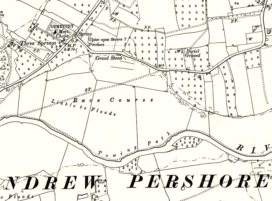
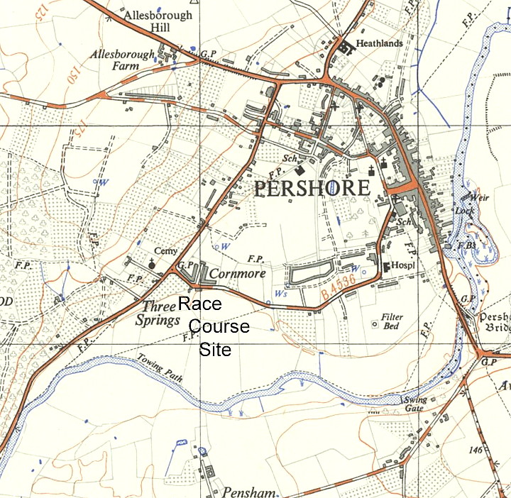
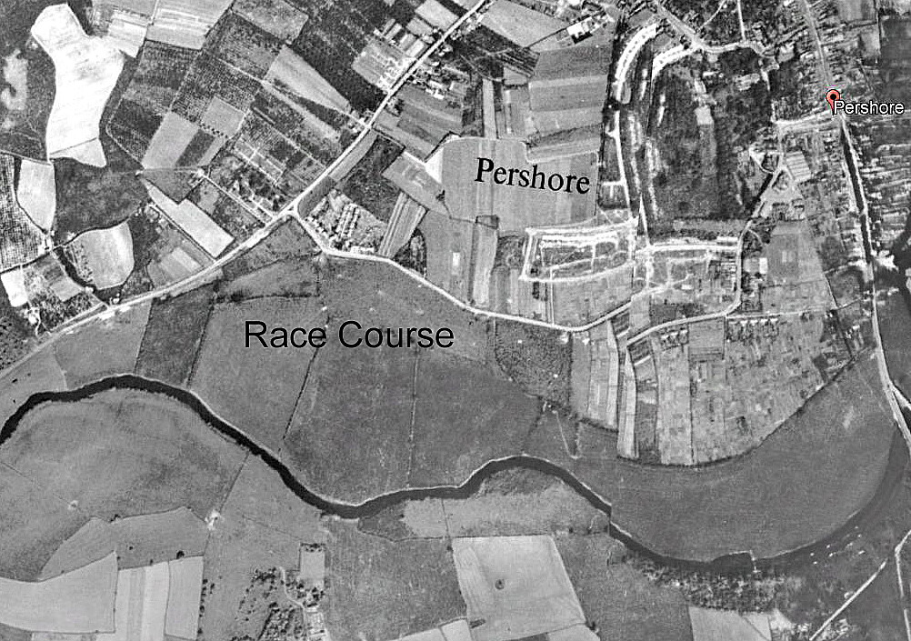
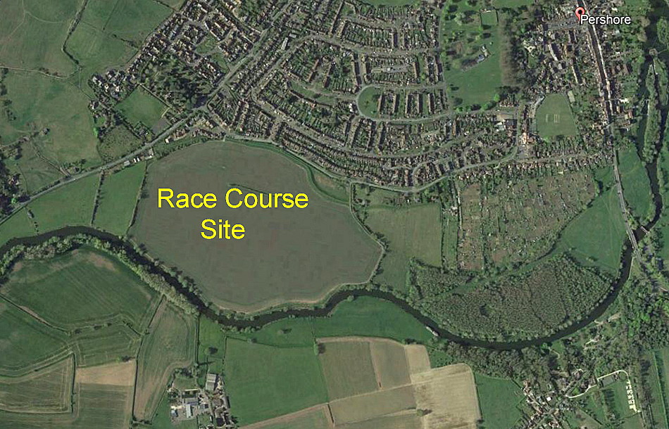
PERSHORE RACECOURSE: Temporary aerodrome
Operated by: Western Aviation, Sir Alan Cobham’s National Aviation Day UK Display Tour
Location: Just SW of Pershore town centre
Period of operation: Western Aviation 11th to 16th July 1931. Cobham 26th August 1932
A MICHAEL T HOLDER GALLERY
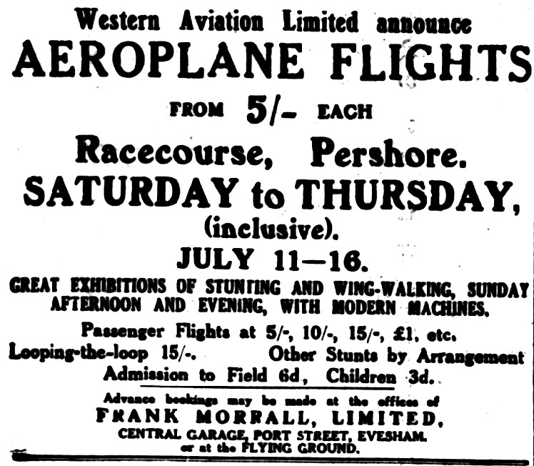
Note: The advert was published in the Evesham Standard & West Midland Observer on the 11th July 1931.
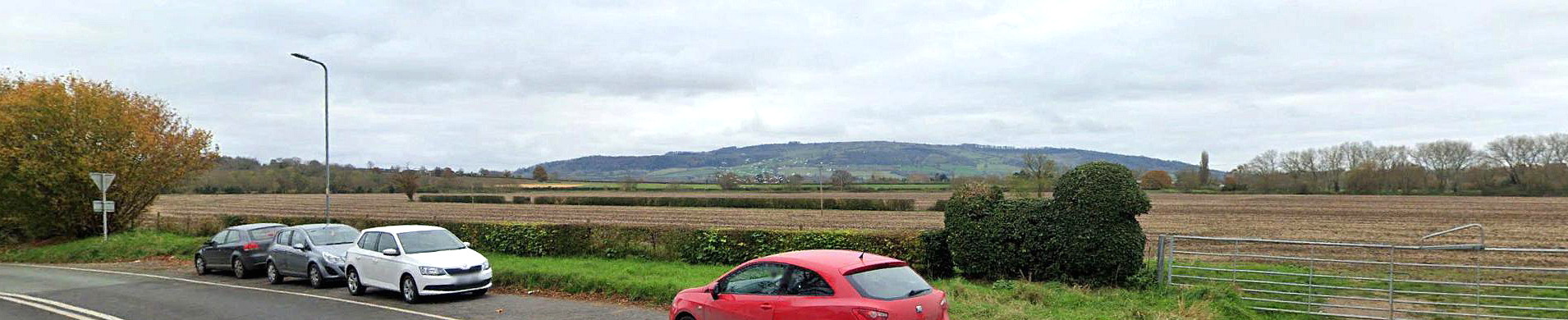
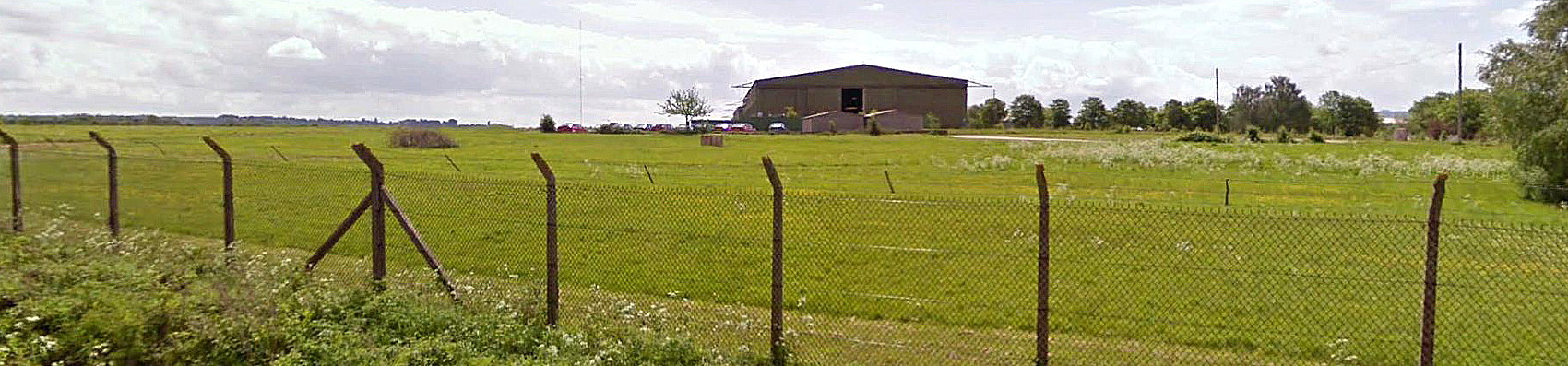
Note: The Google ground view was taken looking south from the B4536.
NOTES: The 1932 itinerary gives the address for Cobham's 126th venue on the 26th August as the Pershore Racecourse, Evesham. The problem is that Pershore is a small town in its own right, about 5nm WSW of Evesham.
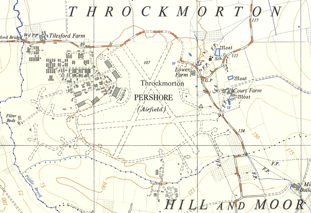
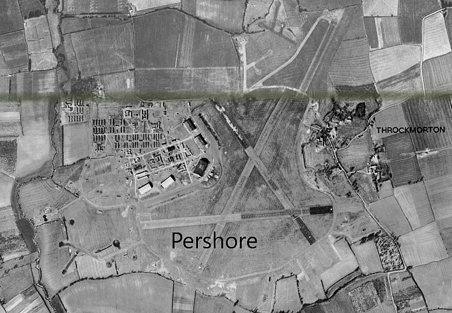
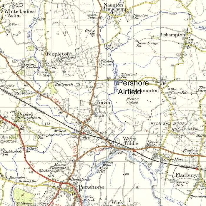
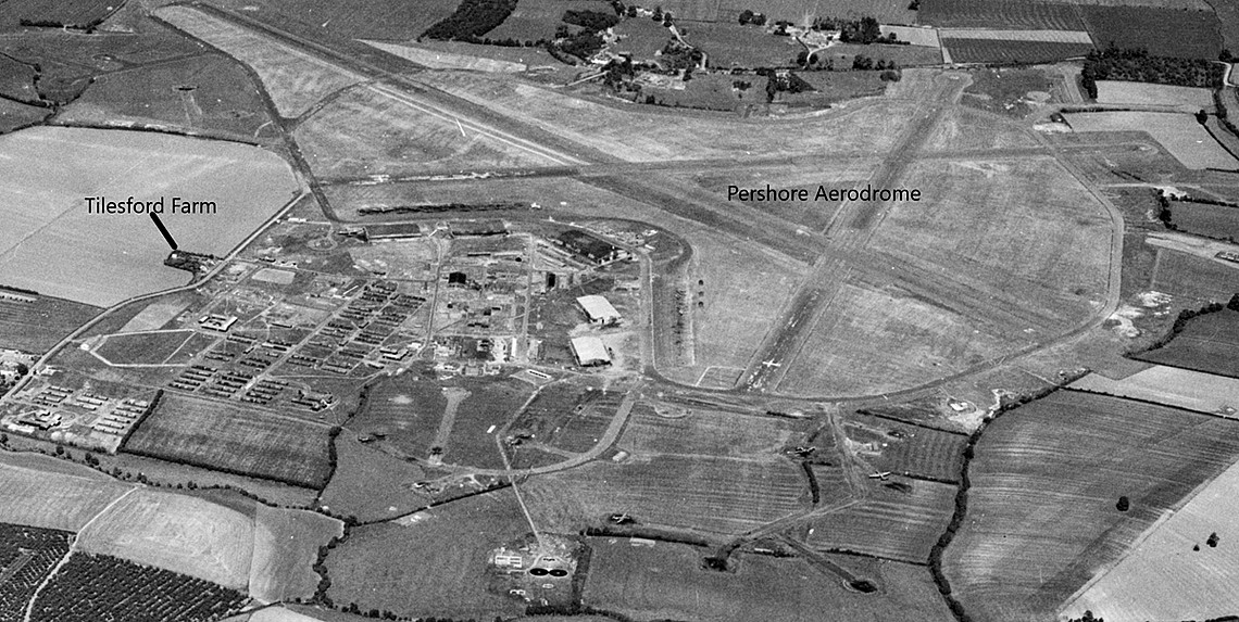
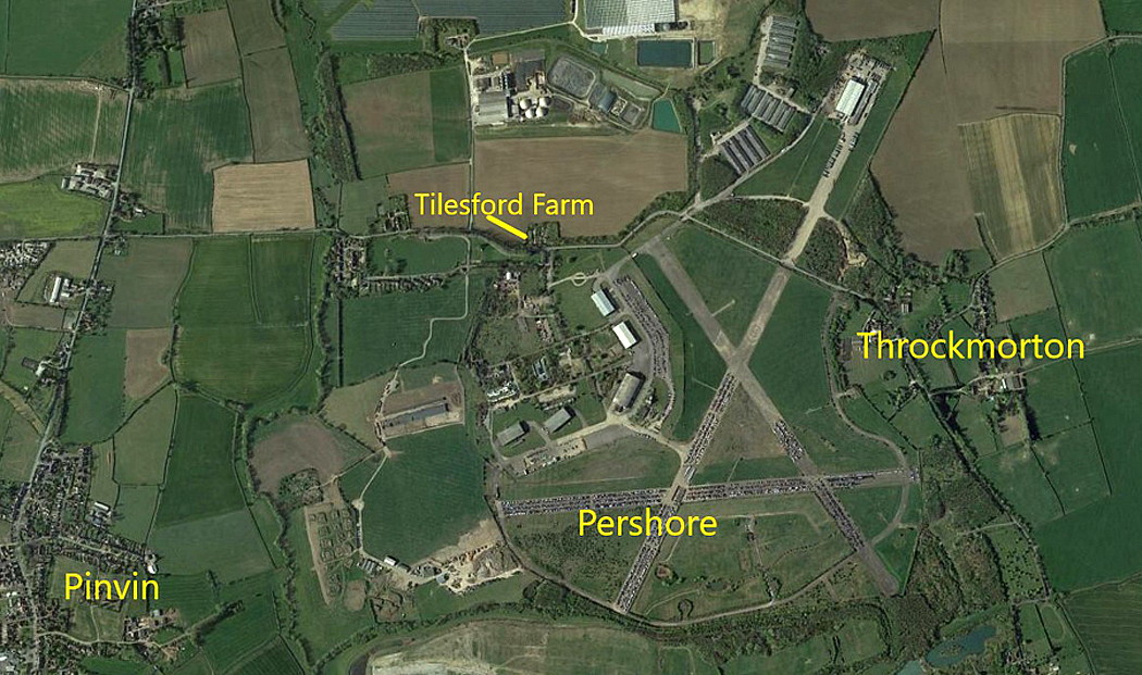
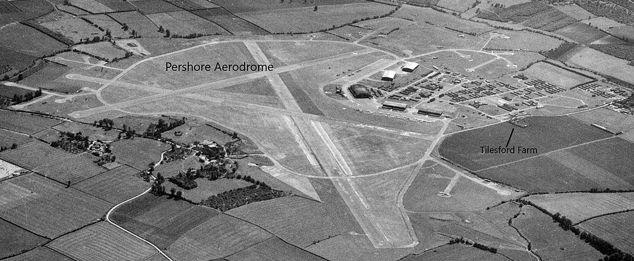
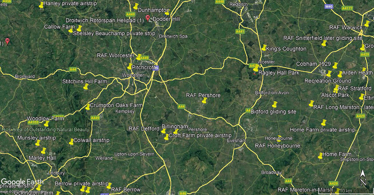
PERSHORE: Military aerodrome, and later still, gliding site
Note: Apparently known as RAF THROCKMORTON before becoming RAF PERSHORE, subsuming the older TILESFORD FARM aerodrome which was situated in the northwest sector.
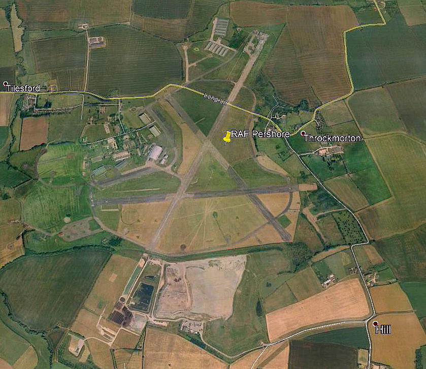
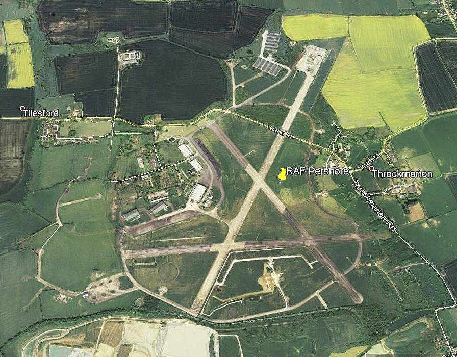
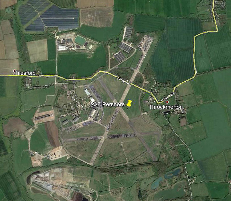
Note: These three pictures were obtained from Google Earth ©
The extent of the WW2 airfield, and indeed later additions, is still remarkably well preserved.
Civil users: Pre 1940: Worcestershire Flying Club (See TILESFORD FARM)
Military users: WW2: RAF Transport Command 44 Group
1 FCP (and/or) No.1 Ferry Unit
23 OTU (Vickers Wellingtons)
15 Air Transportable Signals Unit
Post WW2
'V' Bomber dispersal airfield
10 AFTS (Airspeed Oxfords)
1975: RRE (English Electric Canberras, Vickers Viscounts and Handley Page Hastings)
Note: I would much appreciate information regarding what the RRE was involved with.
Gliding: Listed as operating in 1975 (presumably military?)
1981: R.S.R.E. Flying Club
Operated by: 1980s: Defford Gliding Club
Location: E of the B4082, N of the B4084, W to SW of Throckmorton village, NW of Evesham, about 8nm ESE of Worcester
Period of operation: Military from 1940 to 1978. Civil gliding to ?
Runways: WW2: 03/21 1829x46 hard 09/27 1372x46 hard
15/33 1280x46 hard
A MICHAEL T HOLDER GALLERY
Mike Holder is a great friend of this 'Guide' and uses his skills, honed as a RAF navigator on Vulcans through to Nimrods, (plus other skills such as finding newspaper articles etc), much to our benefit. Having contributed to the PERSHORE RACE COURSE listing, (above), I asked if he could kindly take a look at the RAF PERSHORE listing in August 2022.
Note: The article was published in the Pershore Times. The local area view is from my Google Earth © derived database.
NOTES:
No. 10 A.F.T.S. closed down in 1954 operating Airspeed Oxfords
FLYING CIRCUS VENUE
The venue address (30th July 1934) for Alan Cobham’s Tour of the UK is ‘AERODROME, PERSHORE’. The next year Cobham’s No.2 Tour paid a visit on the 24th September 1935. This was on the TILESFORD FARM aerodrome, situated on the northwestern side of RAF PERSHORE. See seperate listing.
PRIVATE FLYING
In 1977 the Beagle A.61 Terrier G-ATHU of the Defford Aero Club and the Piper PA.18 Super Cub 90 G-AYPS were based here.
THROCKMORTON
Without too much doubt the microlight airfield known as THROCKMORTON is situated at the NE corner of the old WW2 airfield? See seperate entry.
Paul Harrison
This comment was written on: 2021-03-13 23:45:51I have some information relevant to your airfield entry for Pershore, if you are still interested in such information? Just email me if so.
Dick Flute
This comment was written on: 2021-03-13 23:54:58Hi Paul, I am always keen to learn more. Please offer advice. Regards, Dick
We'd love to hear from you, so please scroll down to leave a comment!
Leave a comment ...
Copyright (c) UK Airfield Guide
