














Picton Castle
PICTON CASTLE: Military airstrip
(Aka, PICTON FARM, PICTON HOME FARM, PICTON HOUSE FARM, and THE RHOS)
Military user: US Army Field Artillery aircraft
Location: Unknown? See Notes
Period of operation: 1943 and/or 1944 only?
NOTES: This site is commonly known today as Picton Castle, a manor house built with castellated features and quite typical of the sort of property favoured by the military top brass for an HQ or similar in WW2. There may well have been a war going on but the top officer class, (especially Americans?), saw no reason to forsake comparative luxury. They never have!
Another clue is that it is situated close to a location, barely a village, known as the The Rhos which is just to the NW. If these deductions are correct the site is about 1.2nm S of the A40, roughly 3nm SSE of Haverfordwest town centre. Looking at the location today on Google Earth it appears quite clear that any even half-competent Piper Cub pilot could still land here.
THE ANSWER
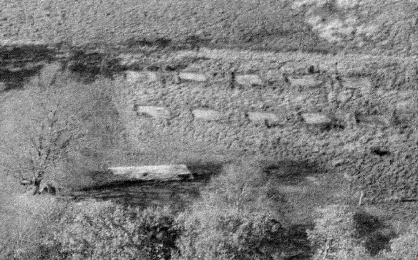
One of the reasons for presenting many listings, such as this example, in a manner which illustrates to some extent at least, is how information has been gathered over many years. Thank heavens I had the good sense when starting this project, (over 25 years ago in 2025), to call it a 'Guide'. It has been my good fortune to find so many very kind and generous people to assist with the quest. Not least Mike Holder who, when I asked if he could find any evidence, promptly supplied the following.
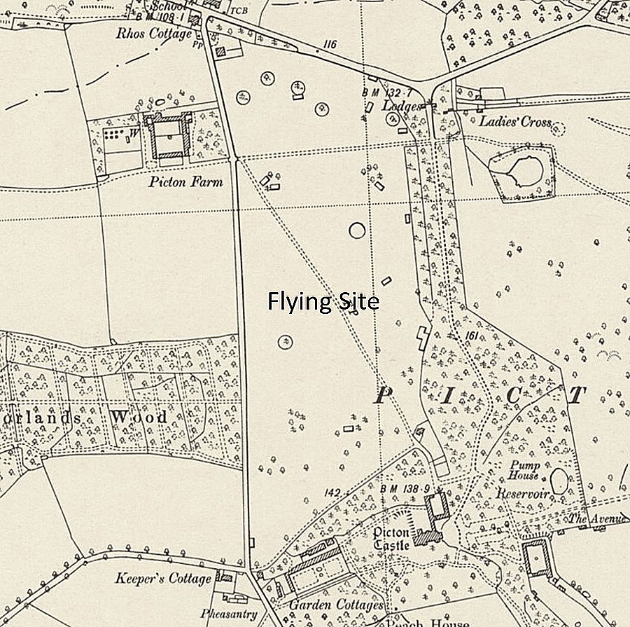
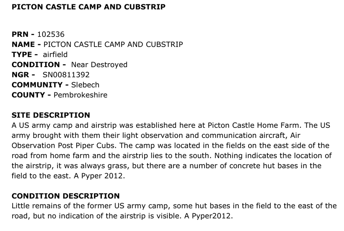
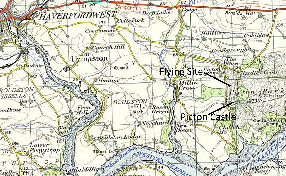
The excerpt was obtained from: Twentieth Century Military Sites and Airfields, Dyfed Archaeological Trust.
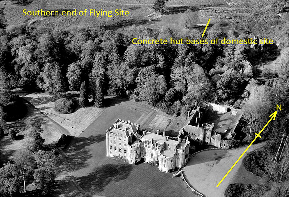
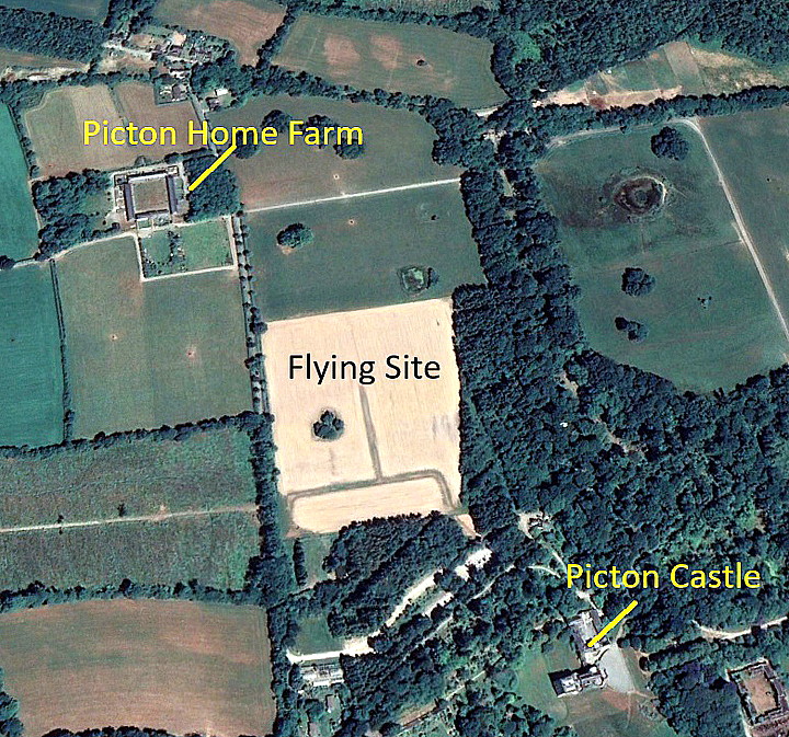
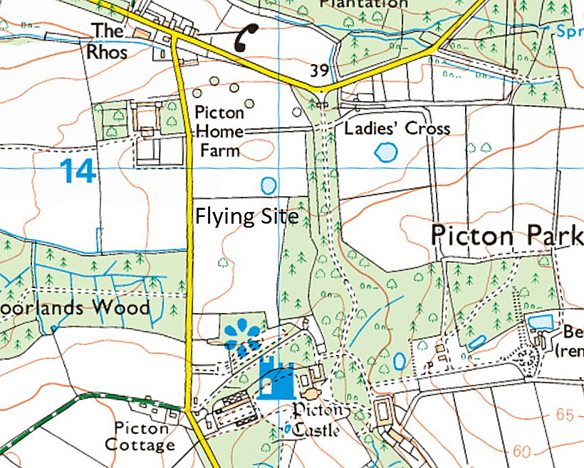
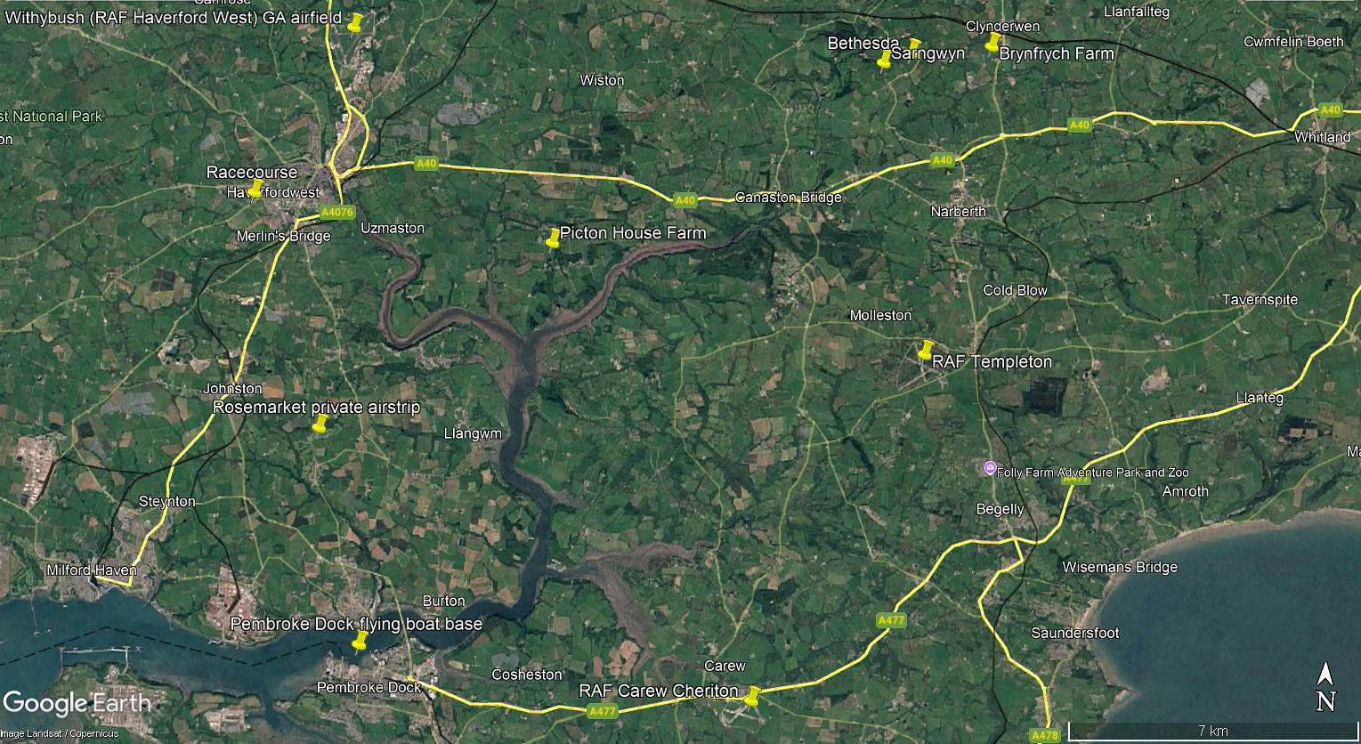
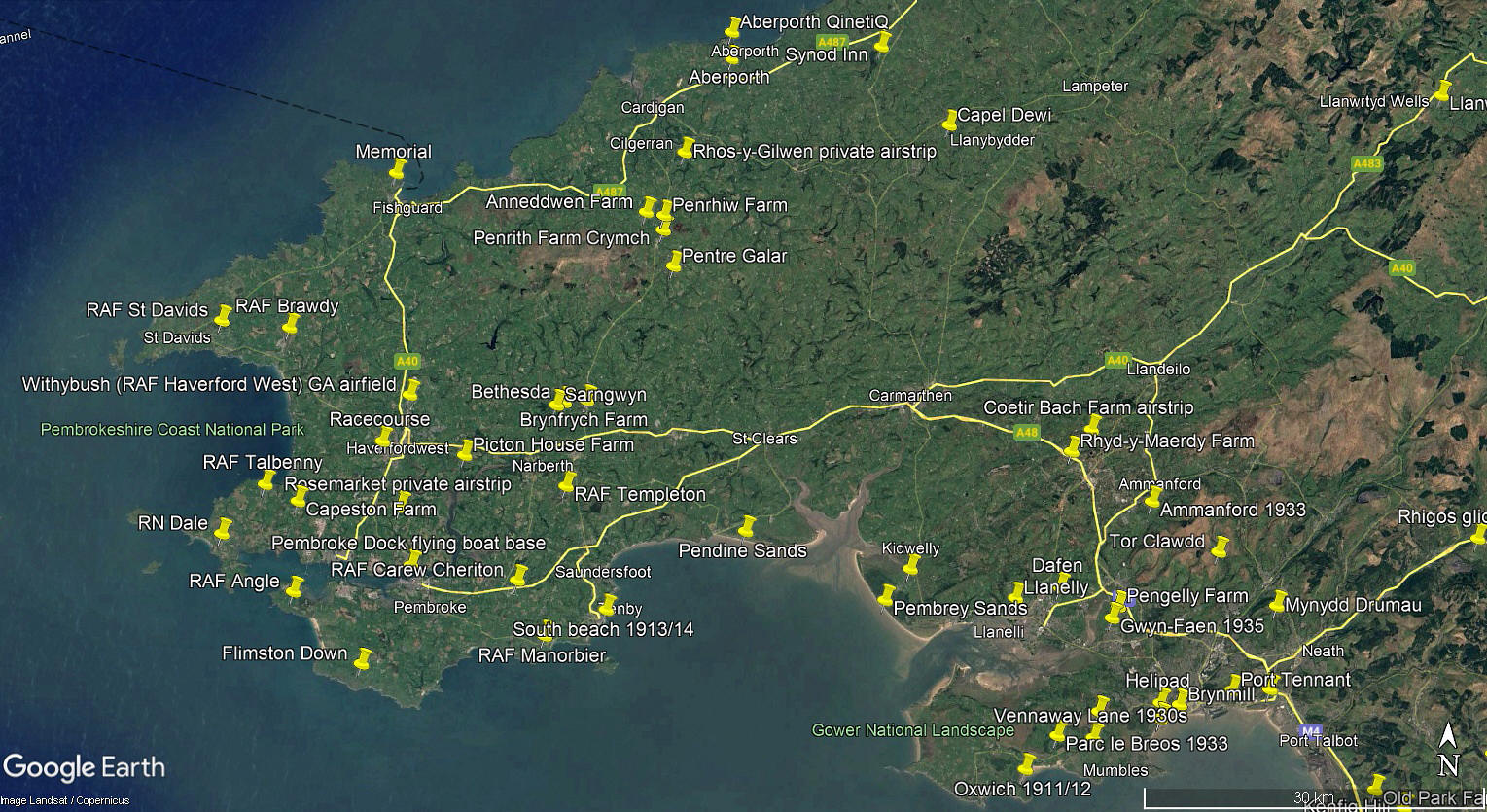
The local area and area views are from my Google Earth© derived database.
END NOTES
One of the vital and most important aspects of WW2 was communications. Especially so in the lead up to D-Day in southern England, and the unsung heroes very often were the pilots flying unarmed light aircraft above the usually clogged up roads. Very often during the push towards Germany, taking maps and messages, and senior officers, up to and from the front lines. Therefore, in this 'Guide', I have tried to identify some of the airstrips used
We'd love to hear from you, so please scroll down to leave a comment!
Leave a comment ...
Copyright (c) UK Airfield Guide
