


Pottington
POTTINGTON: Temporary aerodrome
Operated by: Henri Salmet
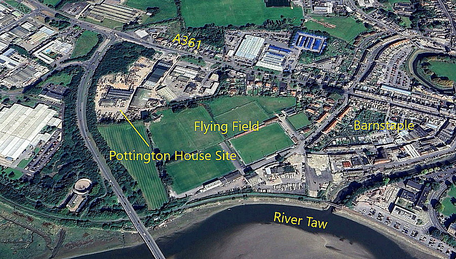
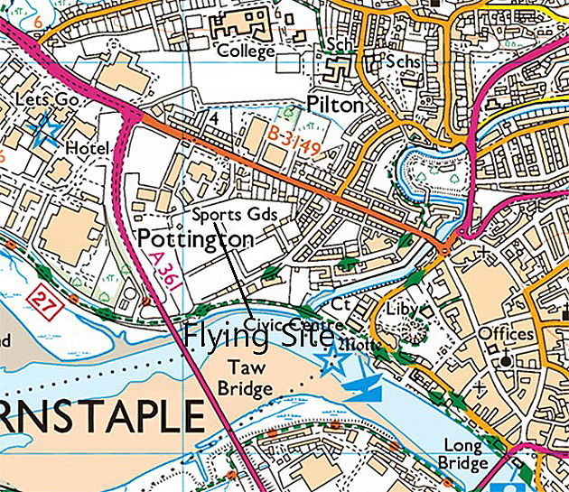
Location: S of the A361, just NW of Barnstaple town centre
Period of operation: 28th April to the 1st May 1914
A MICHAEL T HOLDER GALLERY
We have Mike Holder, a great friend of this 'Guide', to thank for both discovering and researching this location and providing the following items.
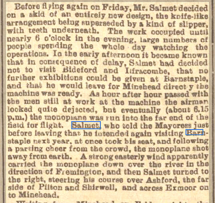
The short article was published in the Western Morning News on the 2nd May 1914.
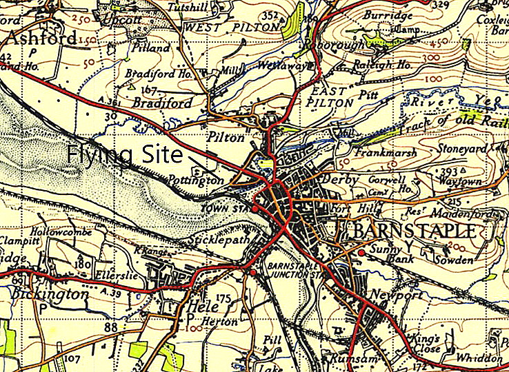
Note the rapid expansion of Barnstaple illustrated in these two maps. As is well known the industrial revolution resulted in the considerable expansion of our major cities, but here we can plainly see that by the end of the Victorian era, it had even reached Barnstaple.
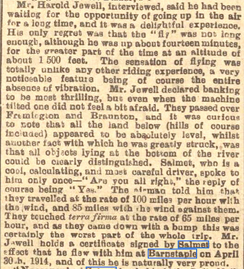
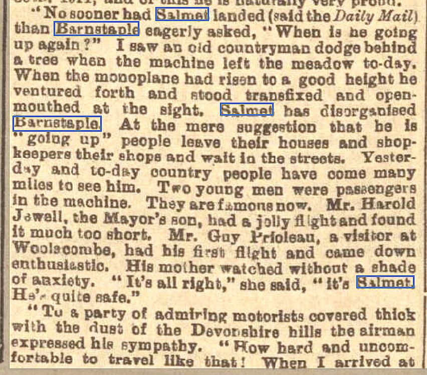
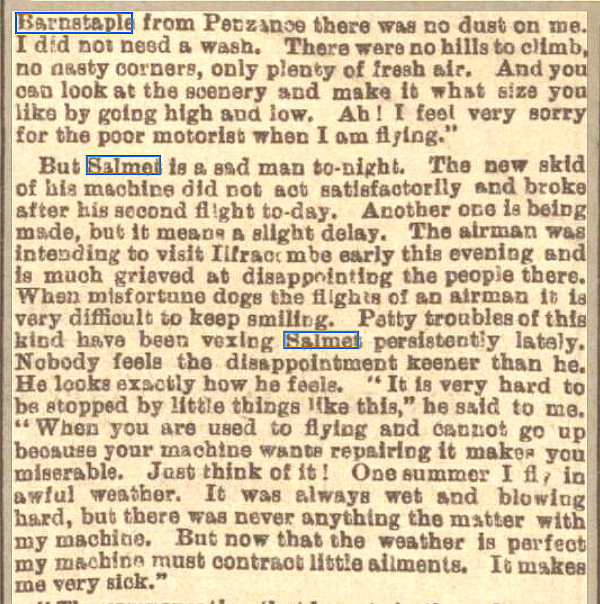
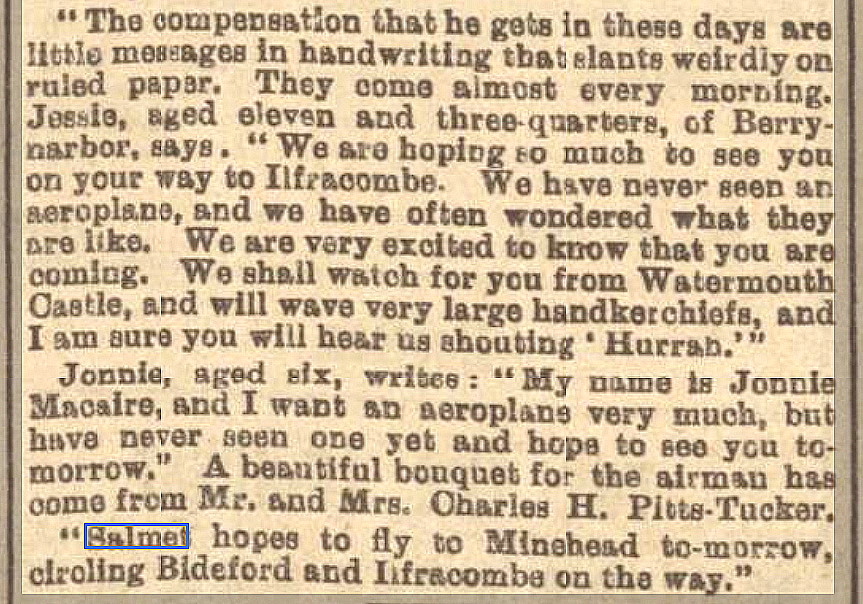
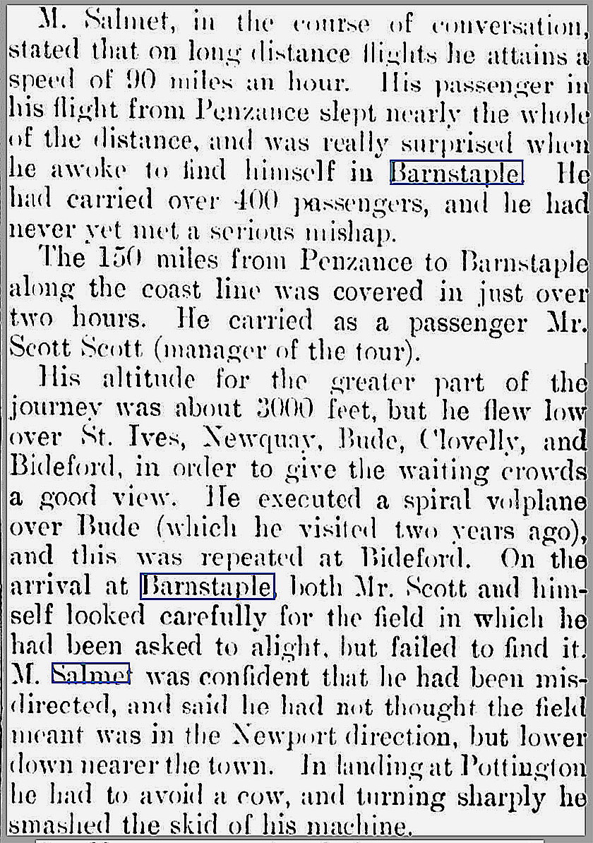
This article, in six parts, was published in the North Devon Journal on the 7th May 1914.
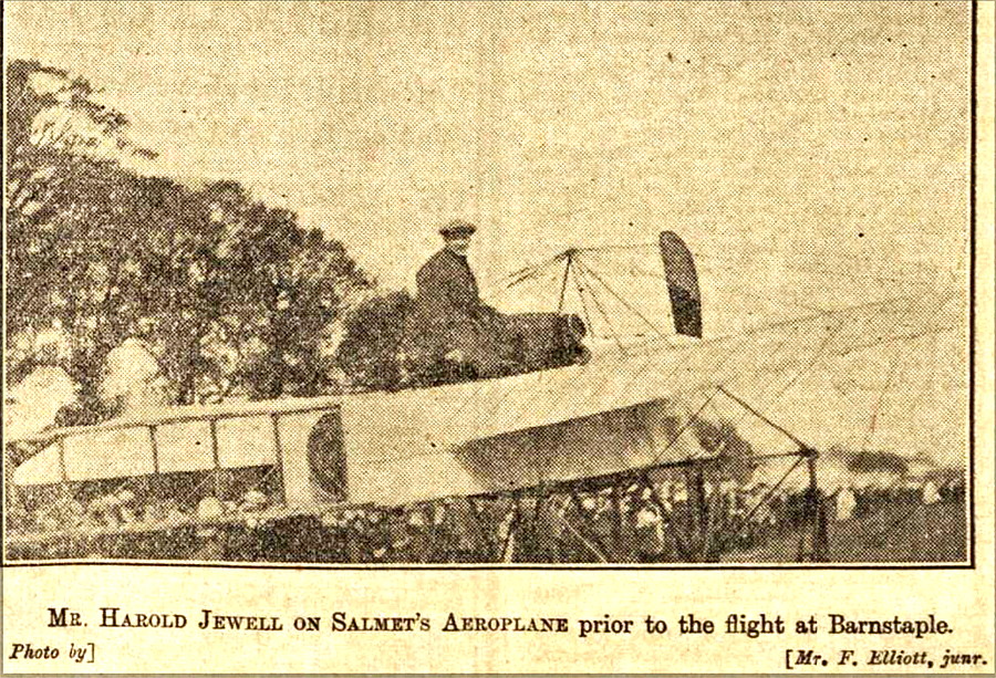
The photo was also published in the North Devon Journal on the 7th May 1914.
The second short article was published in the Hartland and West Country Chronicle on the 16th May 1914.
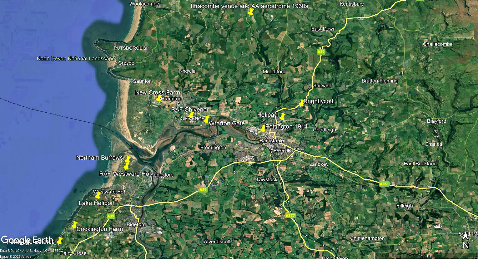
The local area view is from my Google Earth © derived database, Many of the locations listed in this 'Guide' are not 'pinned' on the database.
NOTES: The trials and tribulations Salmet suffered at this time must have been immensely frustrating for him. By then this French aviator had become a household name in the UK, having made two previous long tours sponsored by the Daily Mail in 1912 and 1913. Diminuative in stature, physically, his feats of piloting were of the most impressive - he was a giant in aviation.
One aspect of his determination to impress the public, where and whenever possible, was by nearly always flying between venues. In this respect he certainly pioneered the early arts of navigation. Most of the other major aviators at that time usually transported their machine, as aeroplanes were then known, by rail over the longest sectors, to then be assembled at the venue where an 'exhibition of flying' was planned.
Operated by: Henri Salmet
Location: S of the A361, just NW of Barnstaple town centre
Period of operation: 28th April to the 1st May 1914
A MICHAEL T HOLDER GALLERY
We have Mike Holder, a great friend of this 'Guide', to thank for both discovering and researching this location and providing the following items.
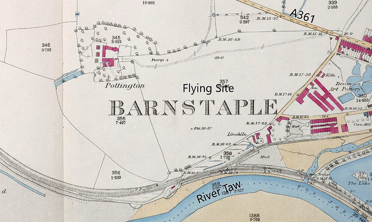
Local map c.1890
Short article
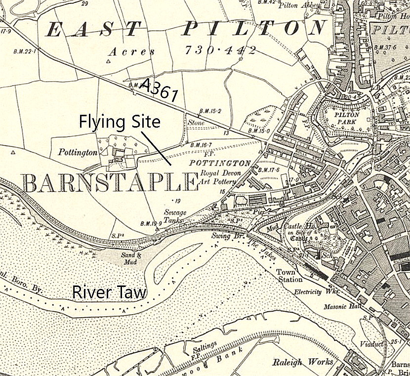
Local map c.1905
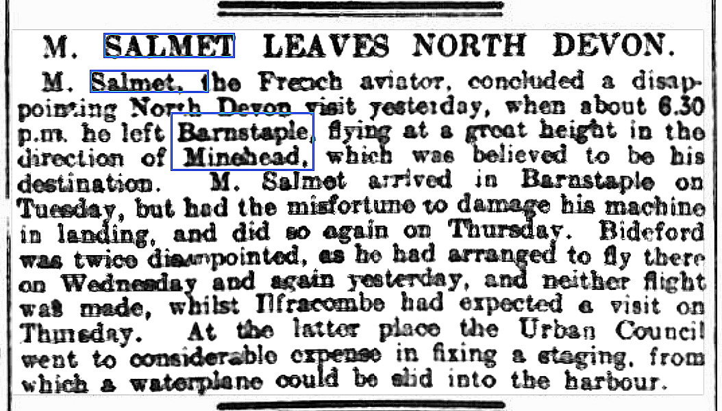
The short article was published in the Western Morning News on the 2nd May 1914.
Note the rapid expansion of Barnstaple illustrated in these two maps. As is well known the industrial revolution resulted in the considerable expansion of our major cities, but here we can plainly see that by the end of the Victorian era, it had even reached Barnstaple.
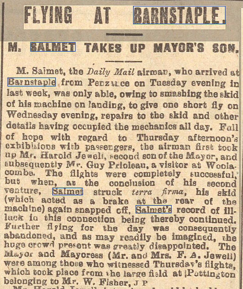
Article, Part One
Article, Part Two
Article, Part Three
This article, in six parts, was published in the North Devon Journal on the 7th May 1914.
Article, Part Four
Article Part Five
Article, Part Six
Local area map c.1946
Short article
Photo
The photo was also published in the North Devon Journal on the 7th May 1914.
The second short article was published in the Hartland and West Country Chronicle on the 16th May 1914.
Google Earth © view
Modern map
Local area view
The local area view is from my Google Earth © derived database, Many of the locations listed in this 'Guide' are not 'pinned' on the database.
NOTES: The trials and tribulations Salmet suffered at this time must have been immensely frustrating for him. By then this French aviator had become a household name in the UK, having made two previous long tours sponsored by the Daily Mail in 1912 and 1913. Diminuative in stature, physically, his feats of piloting were of the most impressive - he was a giant in aviation.
One aspect of his determination to impress the public, where and whenever possible, was by nearly always flying between venues. In this respect he certainly pioneered the early arts of navigation. Most of the other major aviators at that time usually transported their machine, as aeroplanes were then known, by rail over the longest sectors, to then be assembled at the venue where an 'exhibition of flying' was planned.
We'd love to hear from you, so please scroll down to leave a comment!
Leave a comment ...
Copyright (c) UK Airfield Guide
