


Pouts Meadow
POUT'S MEADOW: Temporary Landing Ground
On the 15th August 1912, Henri Salmet, the by then very famous 'Daily Mail' sponsored aviator, made a fleeting visit to Whitstable whilst en route from Broadstairs to Folkestone. The winds and weather what not at all favourable for flying his Blériot two-seater monoplane, but he persevered. The newspaper articles below give us a good account of the visit.
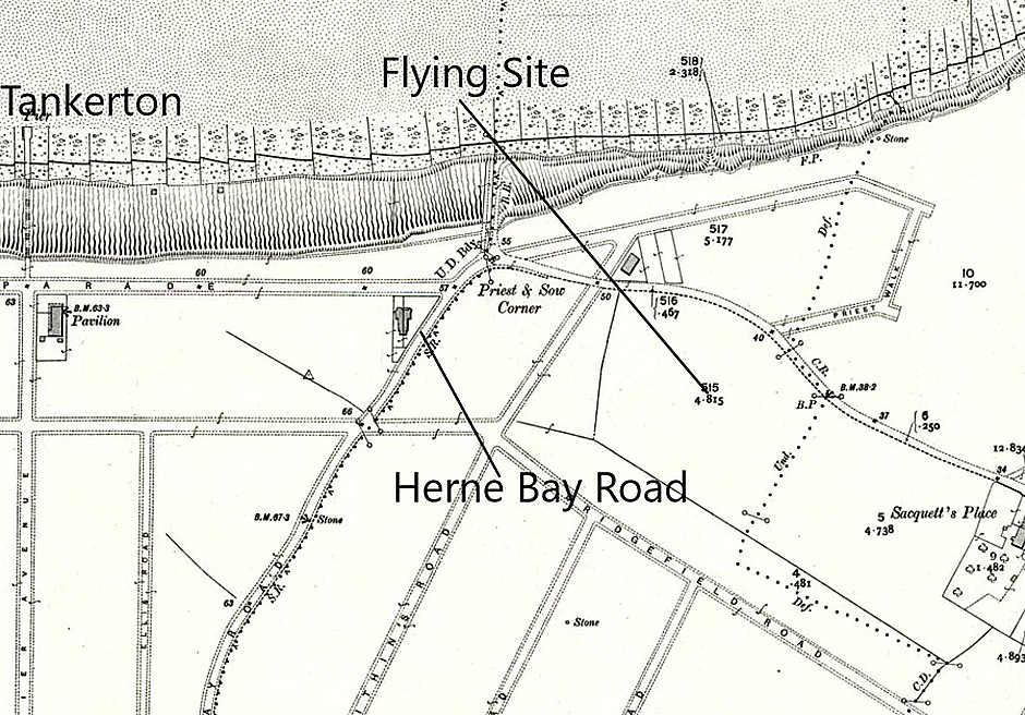
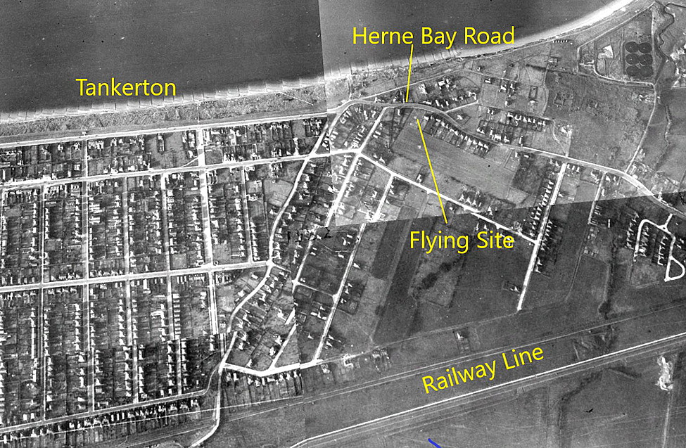
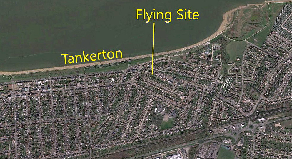
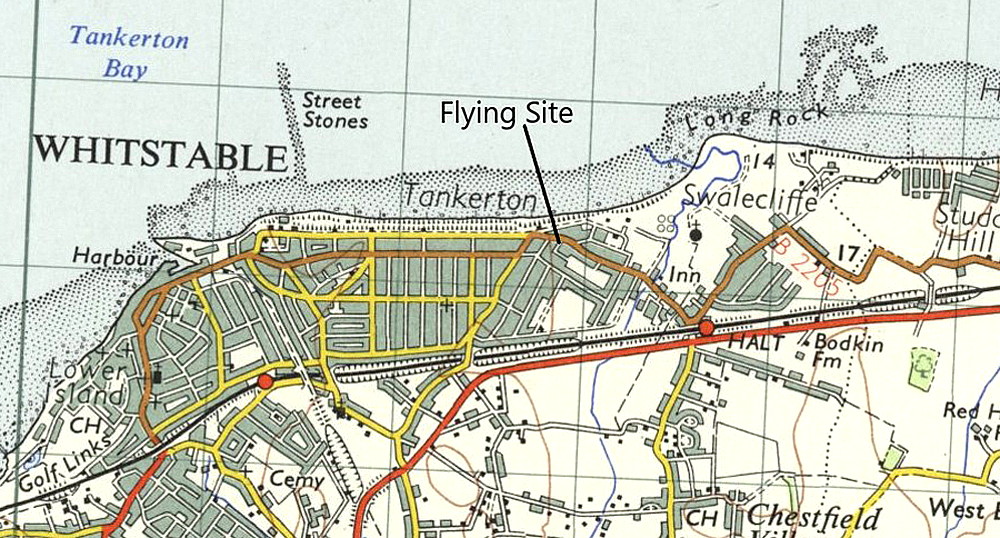
He alighted on POUT'S MEADOW, which is on the east side of Tankerton, just west of Swalecliffe. Roughly one mile east of Whitstable town centre. It can be a tad difficult today, given global media, radio and television etc, let alone the internet, (none of which existed in those days of course), to apprecate the impact just a single aeroplane, offering a public exhibition of flying, had on the general public. Thousands would turn out to witness these daring feats. This was just a fleeting visit, but for longer displays the whole town would get involved, the aviator usually being féted with a major civic function and banquet at the town hall.
A MICHAEL T HOLDER GALLERY
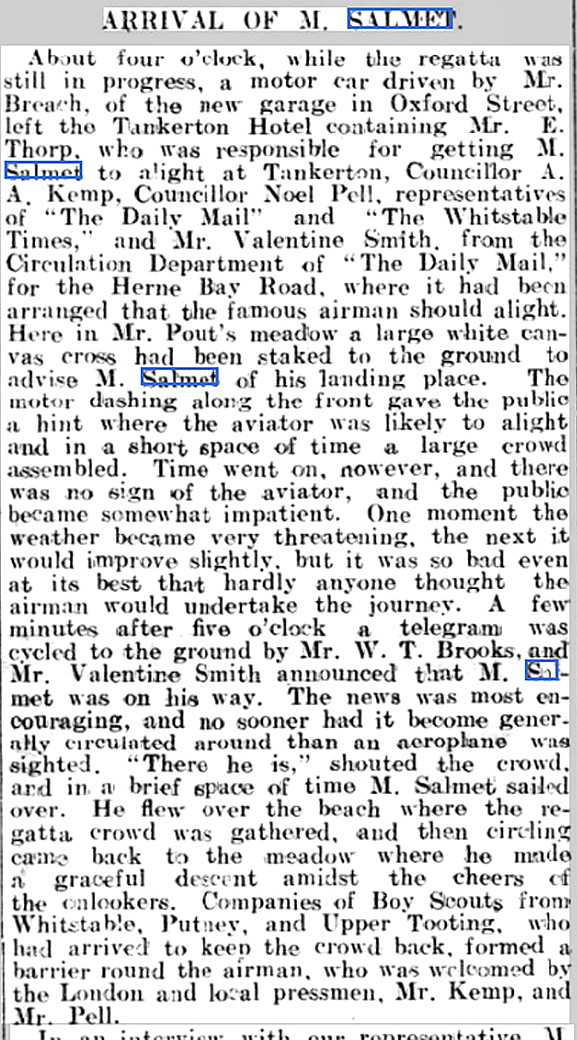
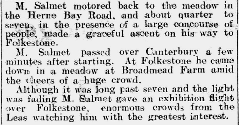
Note: The two newspaper items were published in the Whitstable Times and Herne Bay Herald on the 17th August 1912.
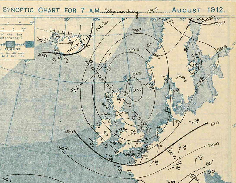
Note: The synoptic chart is for the exact day of this visit on the 15th August 1912. I am not in the slightest bit in denial of global warming, but, in our situation on a small island on the eastern edge of the Atlantic, virtually nothing has changed in the last hundred years. Extreme weather events have been quite commonplace during this period, and indeed, as in this example, high summer weather can often be a very mixed bag.
Indeed, I was interested to learn that the August Bank Holiday weather in southern England during the so called 'Battle of Britain' in 1940, was identical to that I often experienced flying a light aircraft across the Channel some sixty years later!
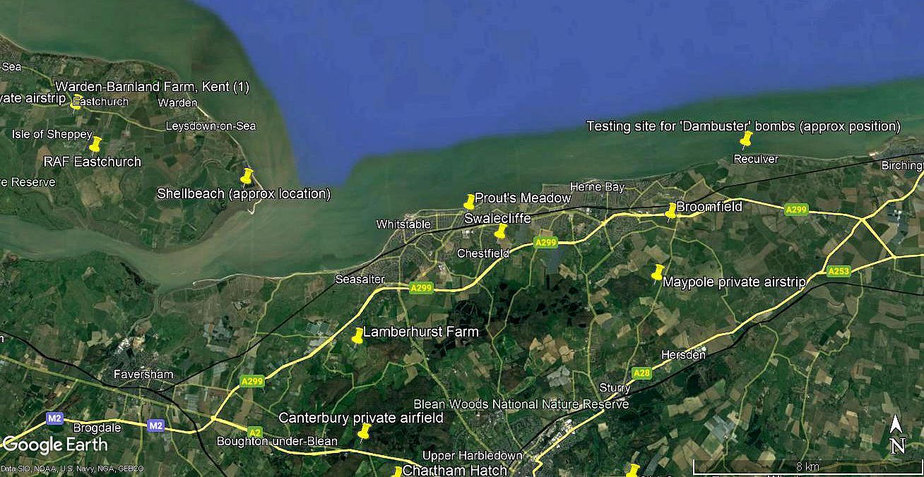
The eighth item has been added from my Google Earth © derived database.
We'd love to hear from you, so please scroll down to leave a comment!
Leave a comment ...
Copyright (c) UK Airfield Guide
