














RAF Harlescott
RAF HARLESCOTT: Aircraft Repair Depot
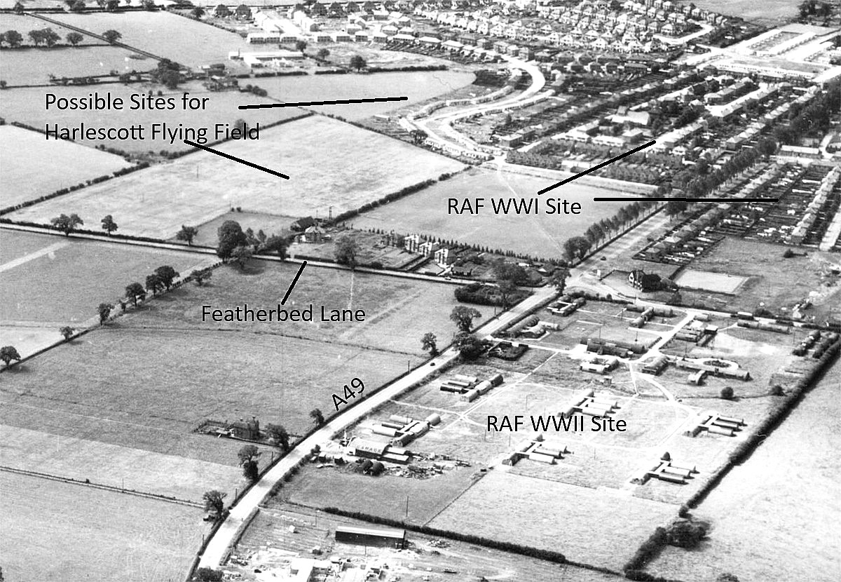
Note: Although this location is generally referred to as RAF HARLEsCOTT, our interest is because it was most probably (?) also a flying site during WW1, and comes before the RAF was created. In those days badly damaged aircraft would have been delivered either by road or rail. Then, according to many records of other ARDs, after being repaired, assembled and fully rigged, subjected to a test flight regime. In a location such as this, without much doubt, most of the aircraft would have then been flown to their operational base. Unfortunately, so far, no pictures have been found to support this proposal.
HOWEVER
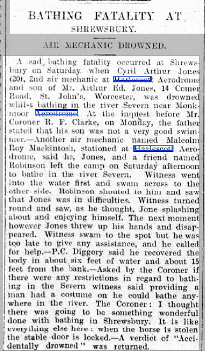
As pointed out on the home-page, this 'Guide' will never be finished. Not least because new evidence continues to emerge, often years after an initial listing has been made. In this case Mike Holder discovered, late in June 2026, this article published in the Bridgnorth Journal on the 16th August 1919. It sadly relates the death of an 2nd Air Mechanic due to drowning in the River Severn. But.....the article states that he was serving at the HARLESCOTT aerodrome.
Location: Mostly W of the old A49, roughly 2nm NNE of Shrewsbury town centre
Period of operation: 1917 to 1919 (As Aircraft Repair Depot)
Note: Mechanical Transport Repair Depot from 1919 until 1932.
A MICHAEL T HOLDER GALLERY
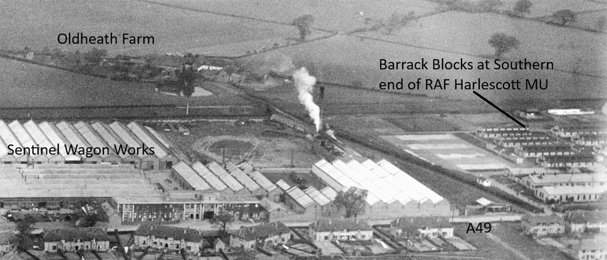
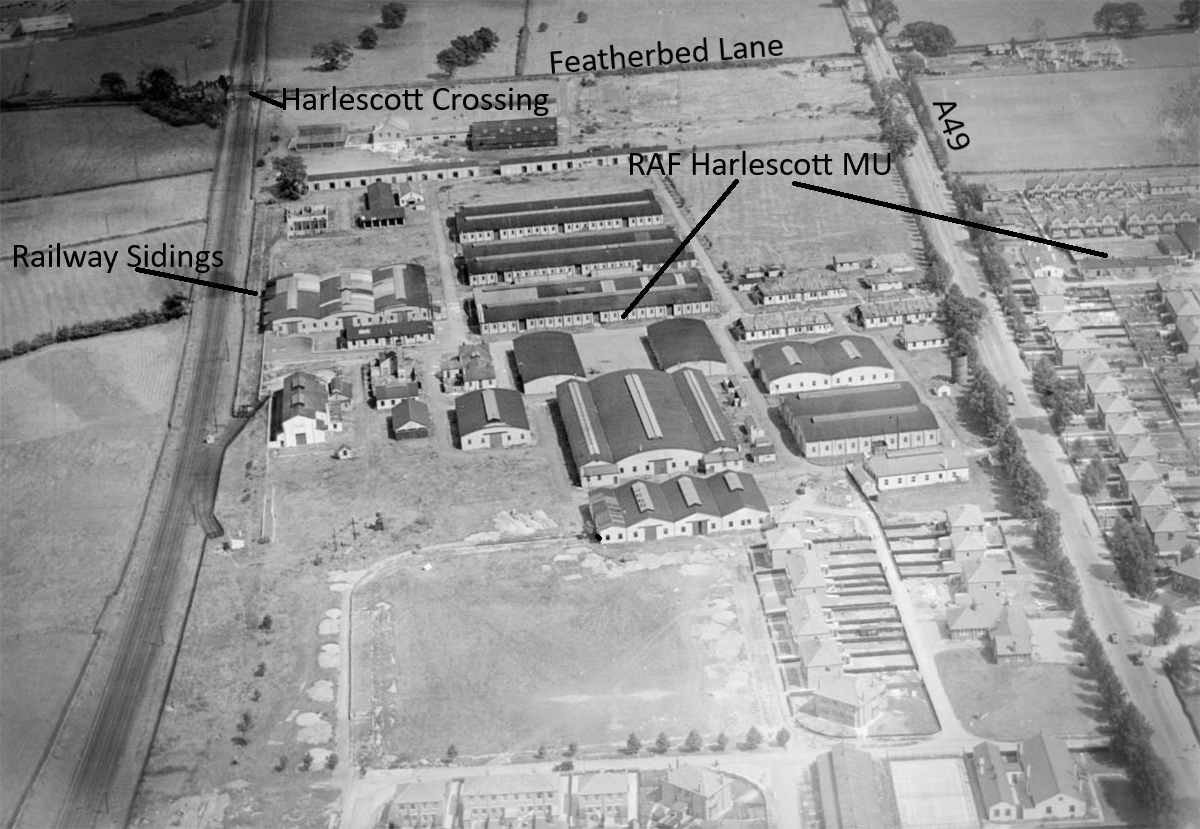
We have Mike Holder, a great long term friend of this 'Guide', to thank for providing the following items, most of which relate to the period when RAF HARLESCOTT became a Mechanical Transport Repair Depot in 1919, closing in 1932. However, the aerial photos may well show buildings that were built and used during 1917 to 1919
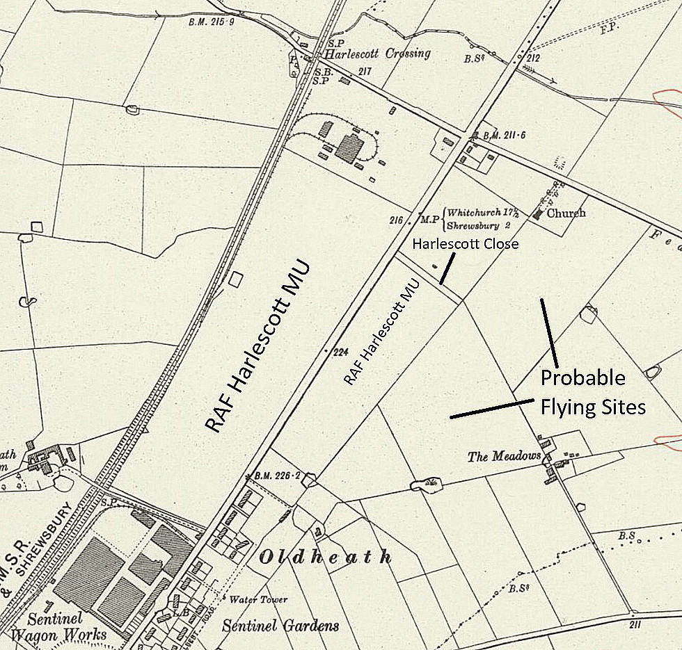
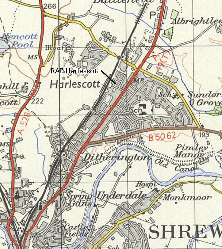
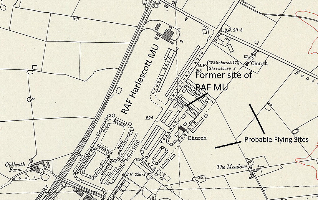
It is the first map that interests me as it appears to show a large open area to the south of the main facility. Ideal for an aerodrome?
However, Mike Holder had given this subject a lot more thought than I have, and believes it is more likely that fields to the east of the old A49, marked on the 1925 and 1938 maps, makes more sense.
THE SENTINEL WAGON WORKS
The nearby Sentinel Wagon Works produced steam powered machines for a variety of uses, agricultural of course but also for haulage, often used over long distances drawing up to three trailers! Even today a few signs, (I have seen one in Dorset), on small 'humpty-back' bridges in rural areas warn that if anyone was guilty of driving one of these over the bridge, the driver could be deported! Just how the hapless driver was expected to extricate himself and his drawbar vehicle train, on a narrow country lane, is not explained.
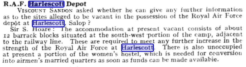
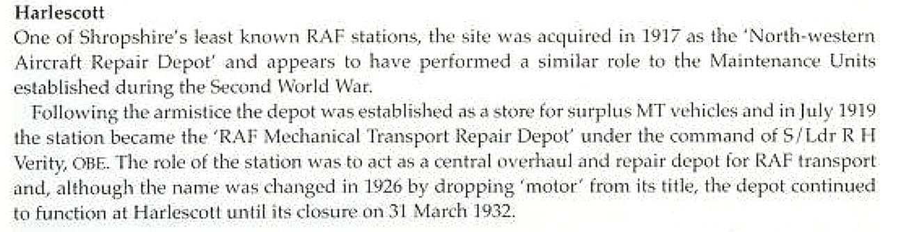
The short article was published in Flight magazine on the 21st December 1922. The excerpt is from Pancakes and Prangs by Thomas Thorne.
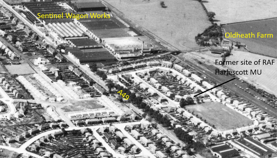
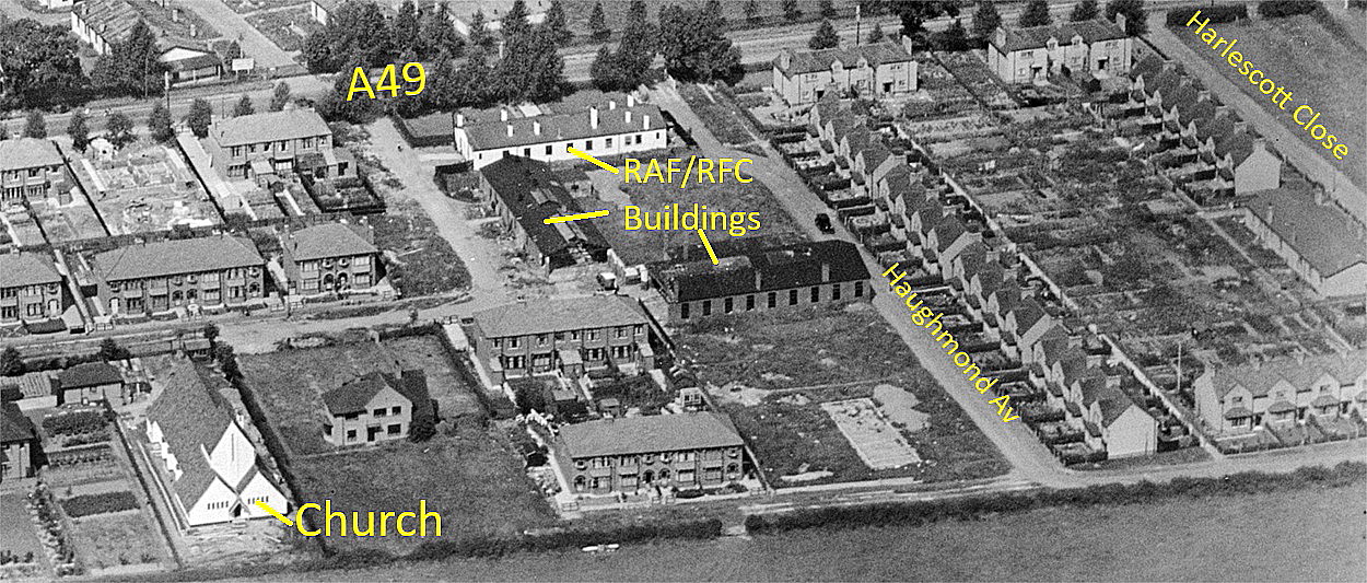
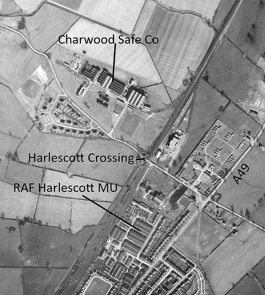
The 1936 aerial detail shows buildings on the east side of the old A49.
MORE VIEWS
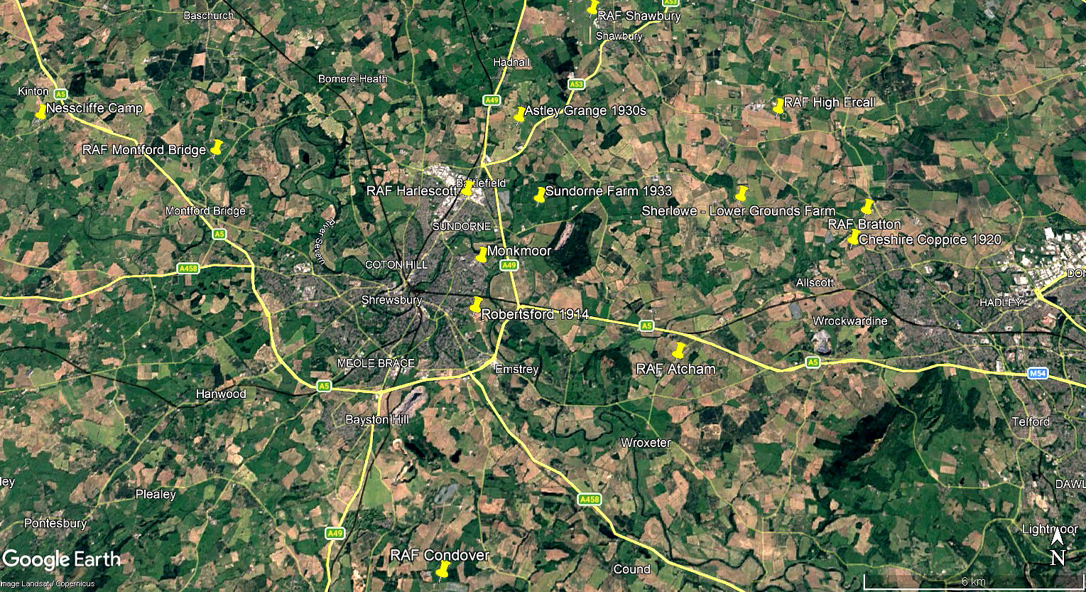
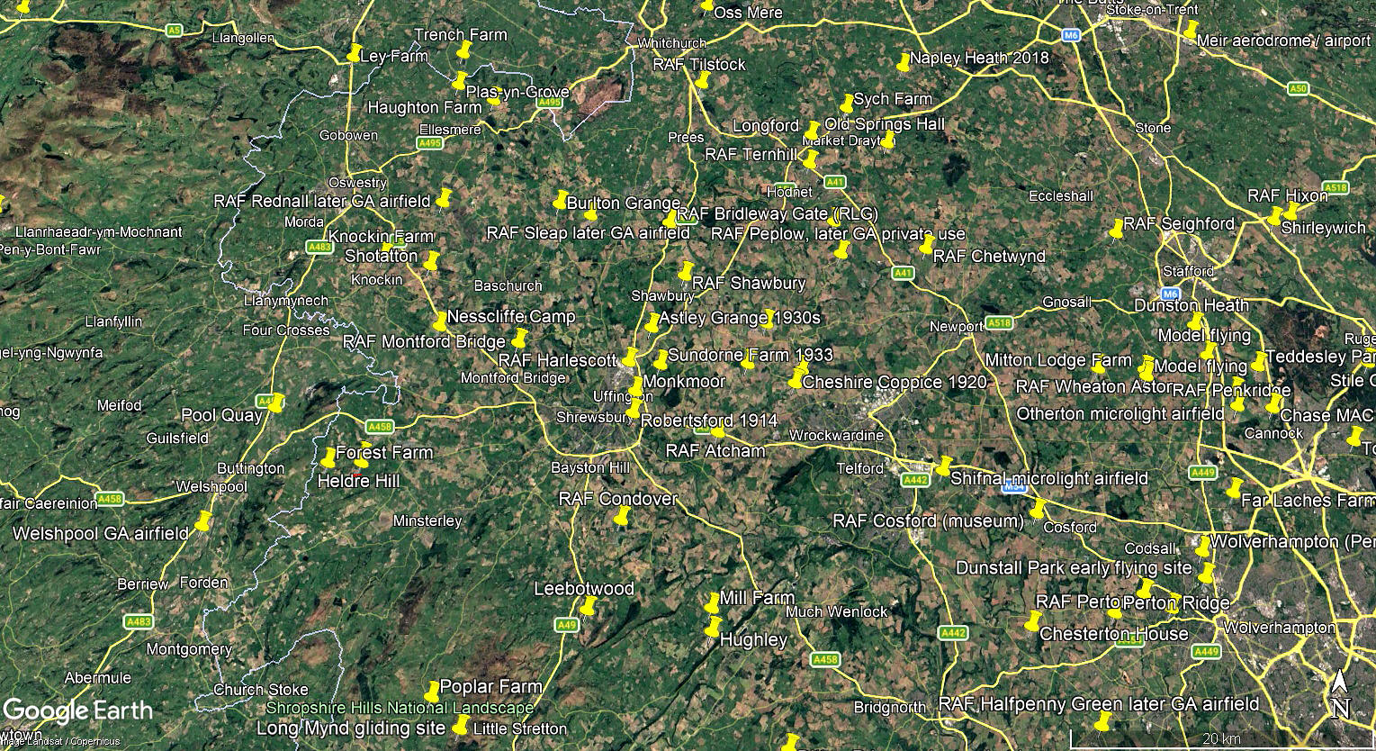
The local area and area views are from my Google Earth© derived database.
NOTES:
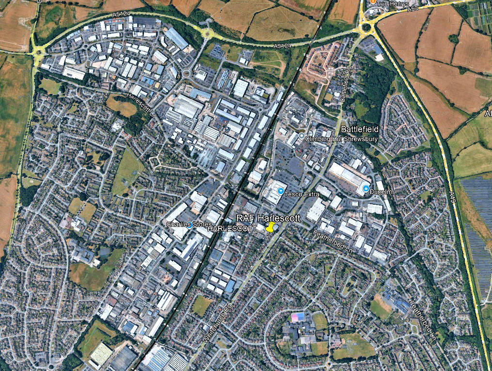
This picture is quite typical of showing how so many locations featured in this 'Guide' have been consumed within relentless urban sprawl from our towns and cities. Fortunately, when I started this project, now over a quarter of a century ago, I had the good sense to call it a 'Guide' and therefore is often as much about posing questions as seeking to provide answers. This location being a fine example.
As always, if anybody can kindly offer advice and information, this will be much appreciated.
We'd love to hear from you, so please scroll down to leave a comment!
Leave a comment ...
Copyright (c) UK Airfield Guide
