


Rackheath
RACKHEATH: Military aerodrome
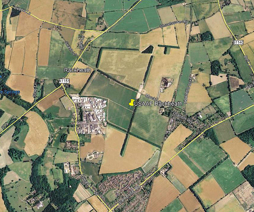
Note: This picture (2011) was obtained from Google Earth ©
Unlike so many other WW2 airfields, very little evidence remains. The 03/21 runway can still be mostly seen, and at the top of it just a trace of the 08/26 runway. Below the industrial estate one of the dispersals can be seen.
Military user: 8th USAAF 96th Bombardment Wing
467th Bomb Group
788, 789, 790 & 791 Sqdns (Consolidated B-24 Liberators)
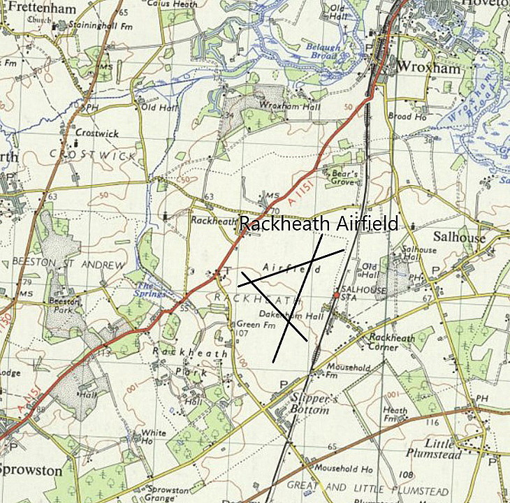
Location: E of A1151, SE of Rackeath & NW of Salhouse villages, 5nm NE of Norwich
Period of operation: 1943 to 1945
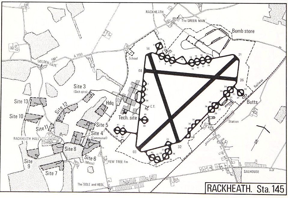
Runways: 03/21 1829x46 hard 14/32 1280x46 hard
08/26 1280x46 hard
A MICHAEL T HOLDER GALLERY
Not, as far as I can make out, one of the better known USAAF air bases in East Anglia during WW2, Mike Holder has very kindly looked into what is available to illustrate this location.
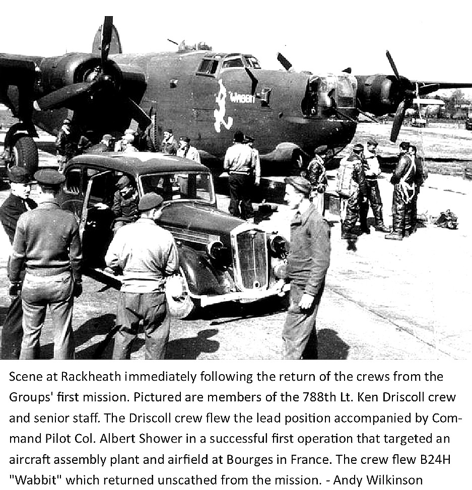
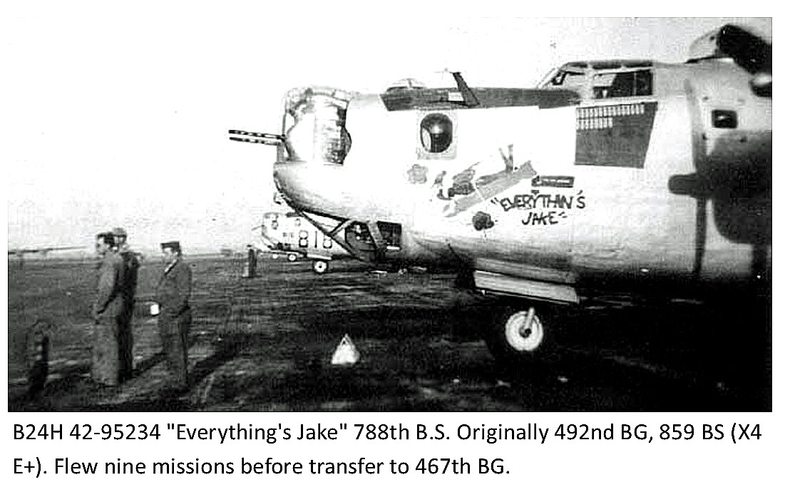
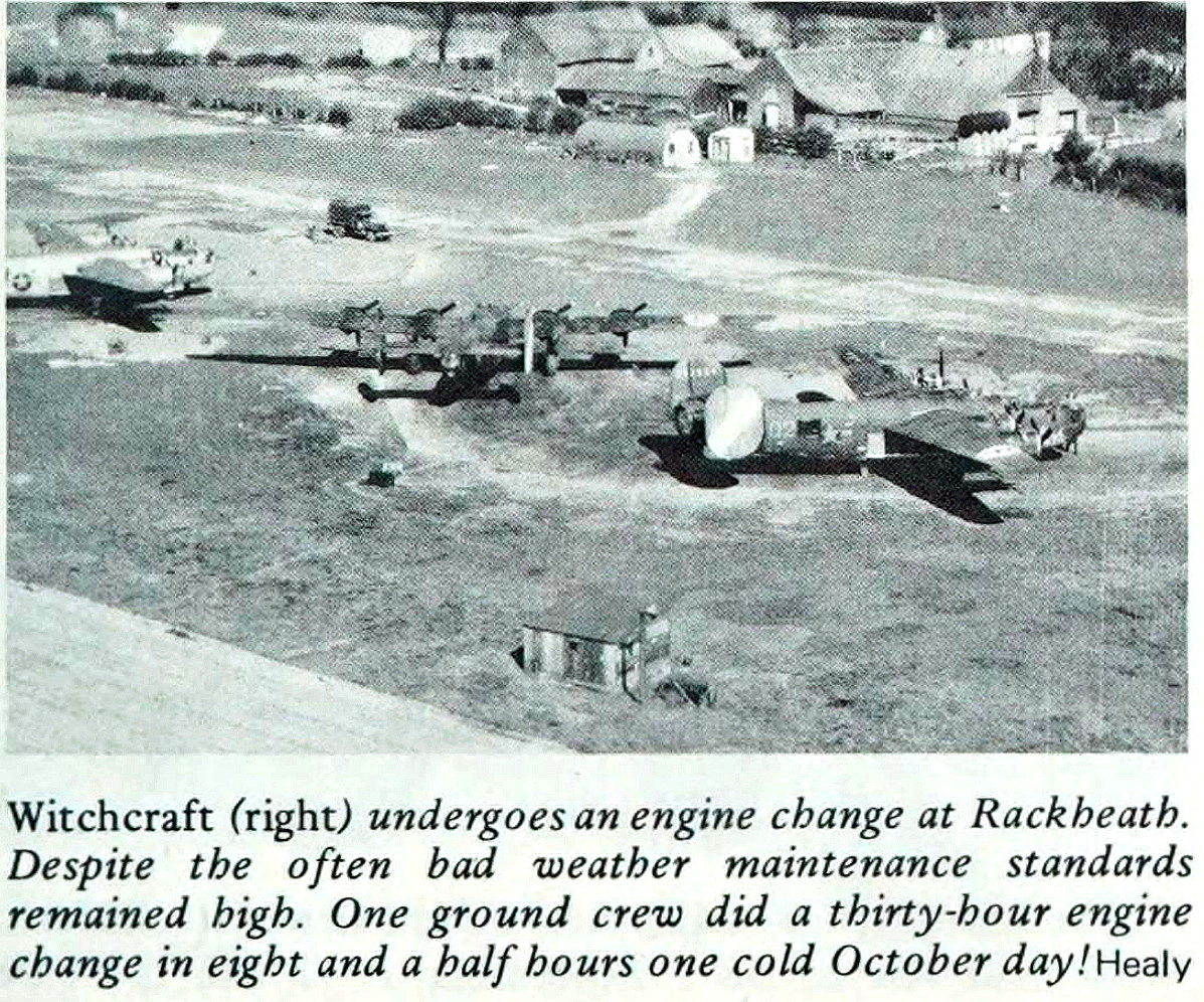
The Photo One, Two and Three are from the American Air Museum, (AAM).
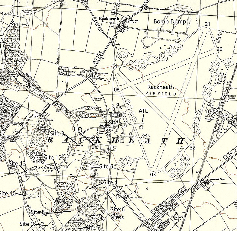
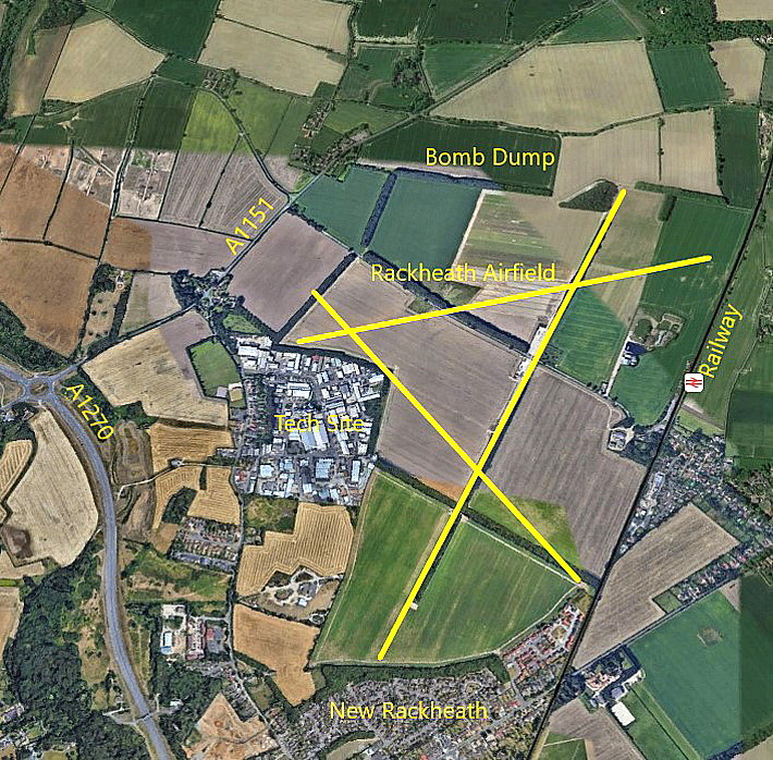

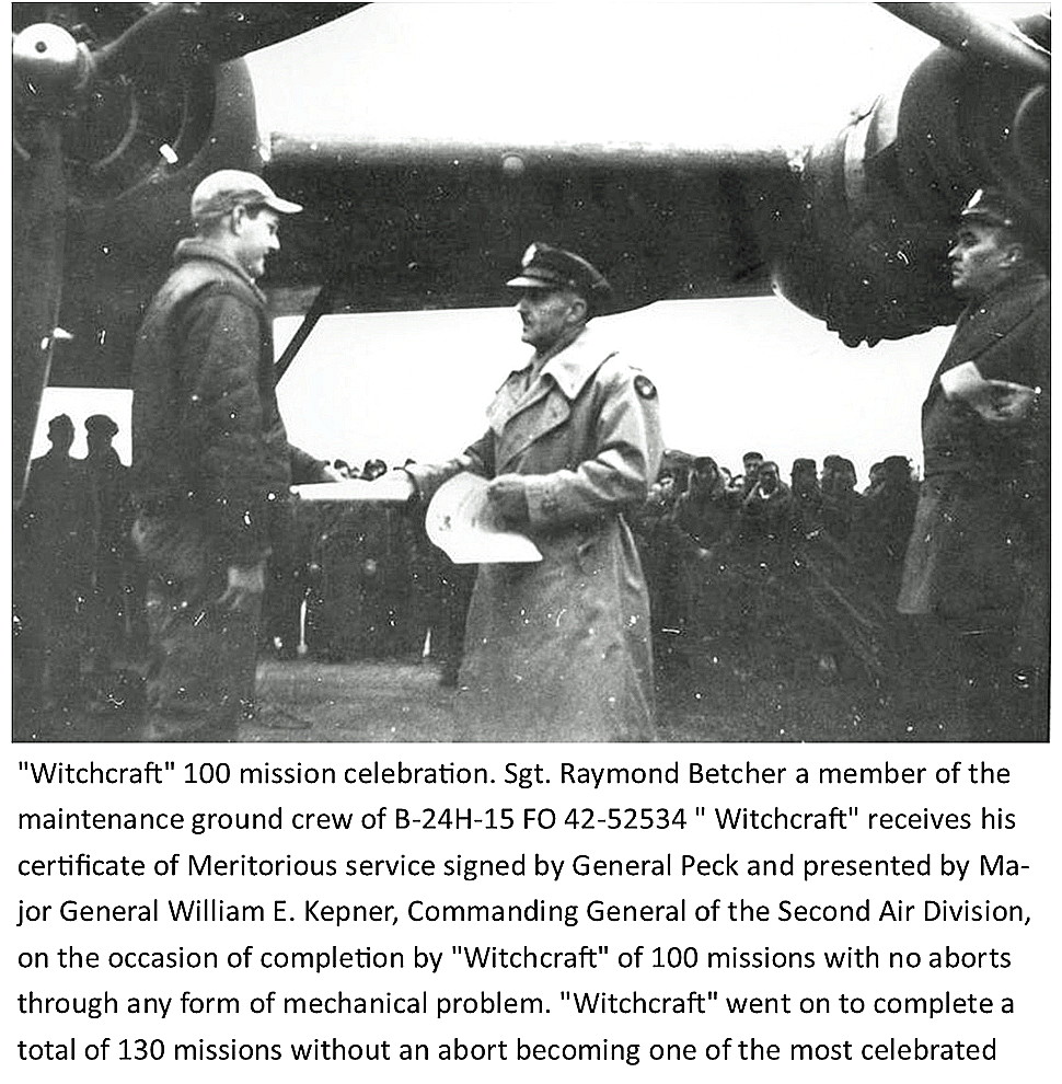
Photo Four, also from the American Air Museum, illustrates, I think, a very important difference of approach to warfare compared to the British military forces, in the UK at least. The British would award medals for exceptional acts of sacrifice, but, the USAAF as in this case, also thought that dedication to duty by ground crews should also be recognised. Bloody right too of course! Just a piece of paper, as is a university degree, but of great value to the individual person concerned.
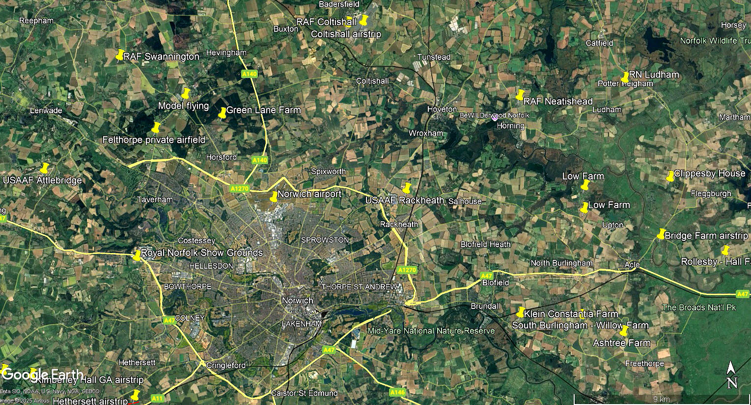
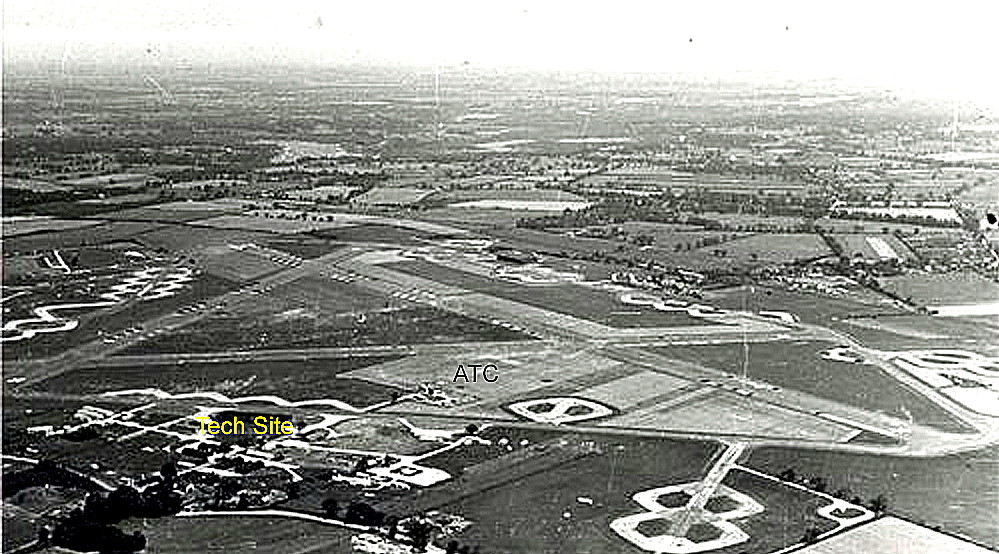
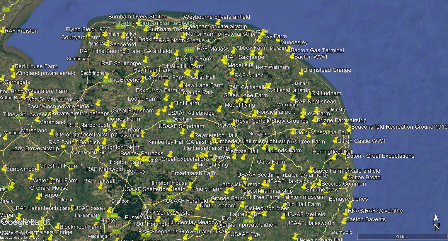
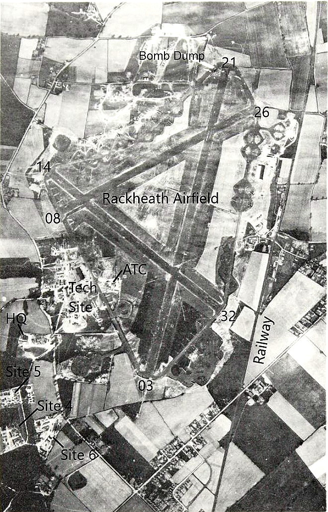
The local area and area views are from my Google Earth © derived database. The aerial photo is from the Norfolk County Council archive.
NOTES: It would appear that in late 1944 the standard complement of exactly 2894 personnel required by the 8th USAAF at their bomber bases were on station here.
In 1944 there were 426,000 US Airmen stationed in NORFOLK and SUFFOLK on front line duties plus a great many more elsewhere in the UK.
We'd love to hear from you, so please scroll down to leave a comment!
Leave a comment ...
Copyright (c) UK Airfield Guide
