


Rattlesden
RATTLESDEN: Military aerodrome later gliding site
Note: These four pictures were obtained from Google Earth ©
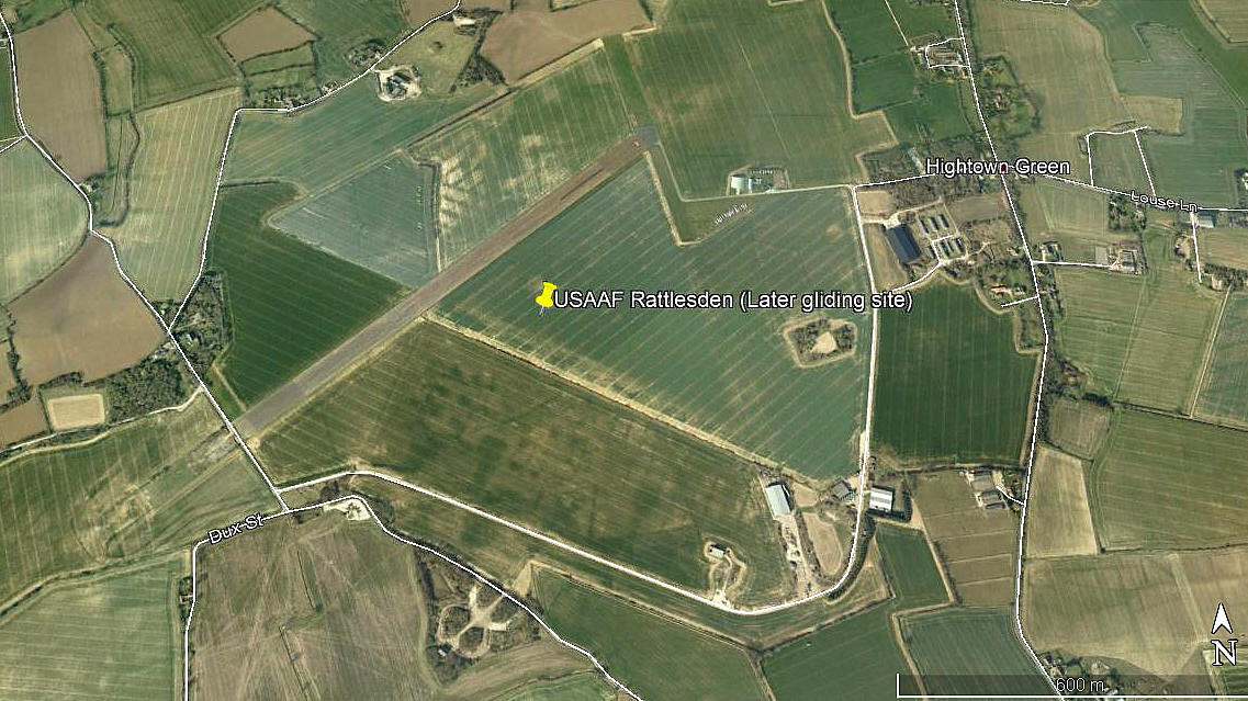
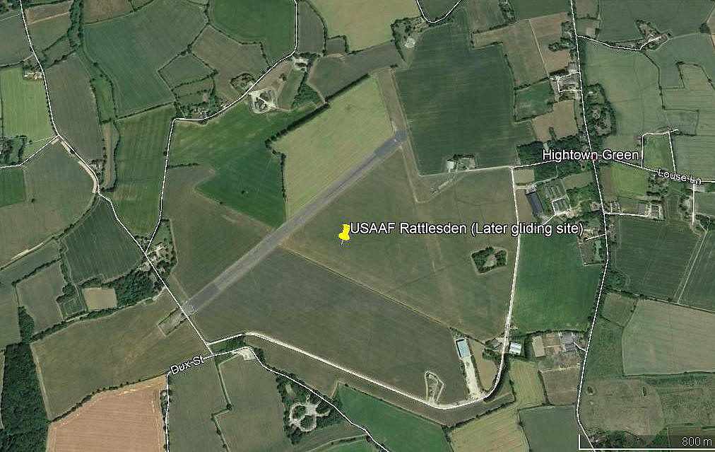
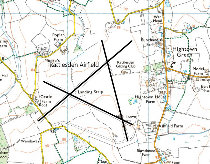
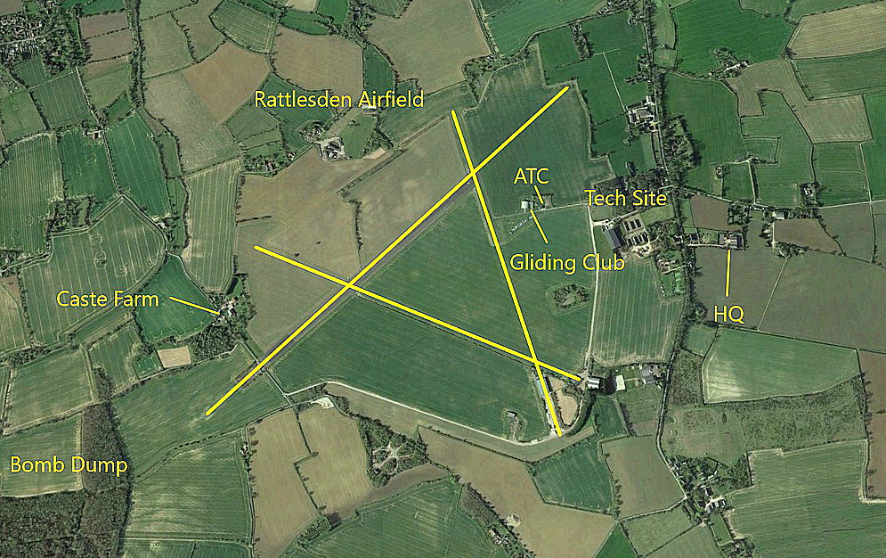
Another example of just how clearly the remains of this WW2 airfield can still be seen seventy years later. And indeed, even a couple of the dispersals have survived.
Military user: 8th USAAF
4th Bombardment Wing 447th Bomb Group
708, 709, 710 & 711 Sqdns (Boeing B-17 Flying Fortresses)
Note: The 447th Bomb Group arrived on the 29th November 1943. It's first mission was on Xmas Eve and they completed 256 missions.
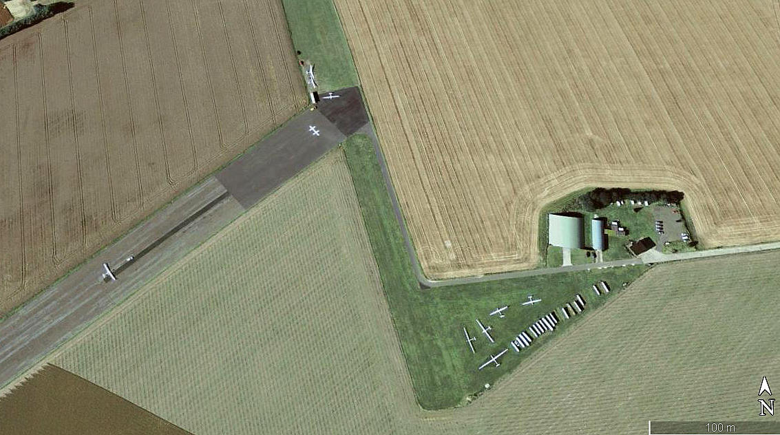
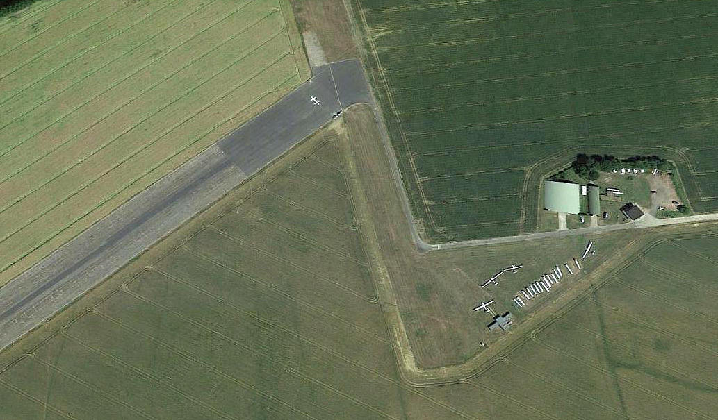
Operated by: 1980s to - : Rattlesden Gliding Club
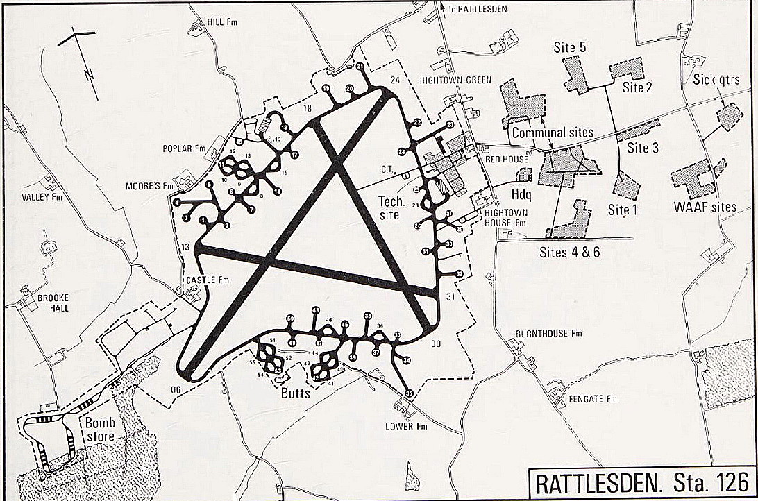
Location: SW of Hightown Green, 8nm SE of Bury St. Edmunds
Period of operation: Military: 1942 to 1945 Civil: 1970s to -
Runways: WW2: 06/24 1829x46 hard 17/35 1280x46 hard
13/31 1280x46 hard
A MICHAEL T HOLDER GALLERY
Once again in this 'Guide' we have Mike Holder to thank for providing the following items.
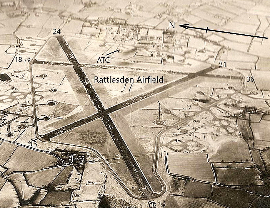
The aerial photograph, date unknown, is from the American Air Museum.
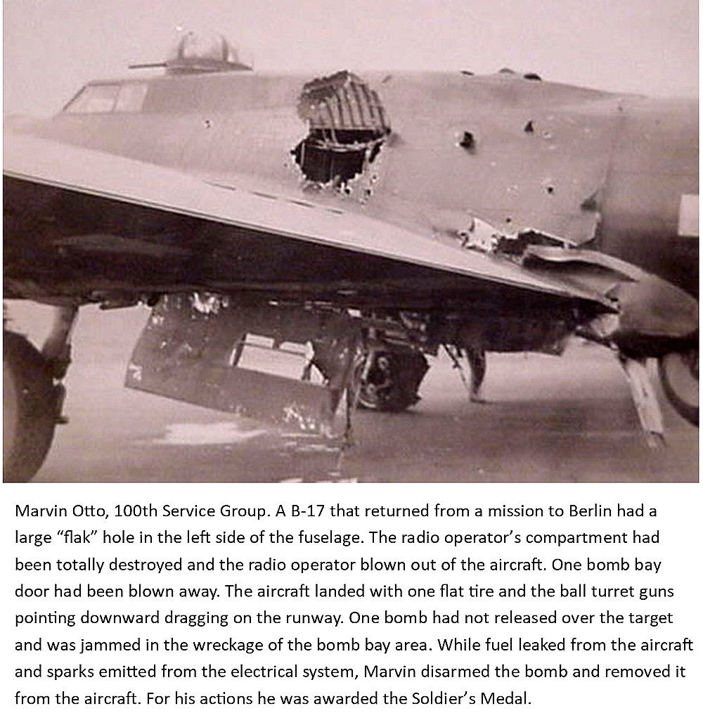
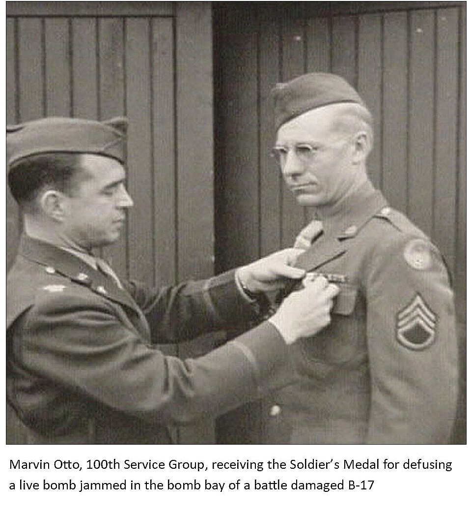
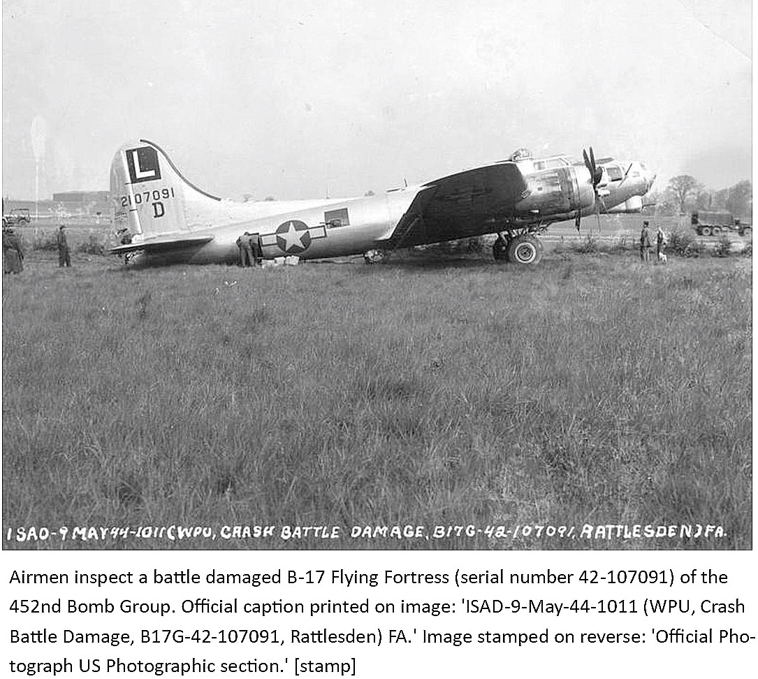
These three pictures are also from the American Air Museum. Photo Two shows Marvin Otto receiving his medal.
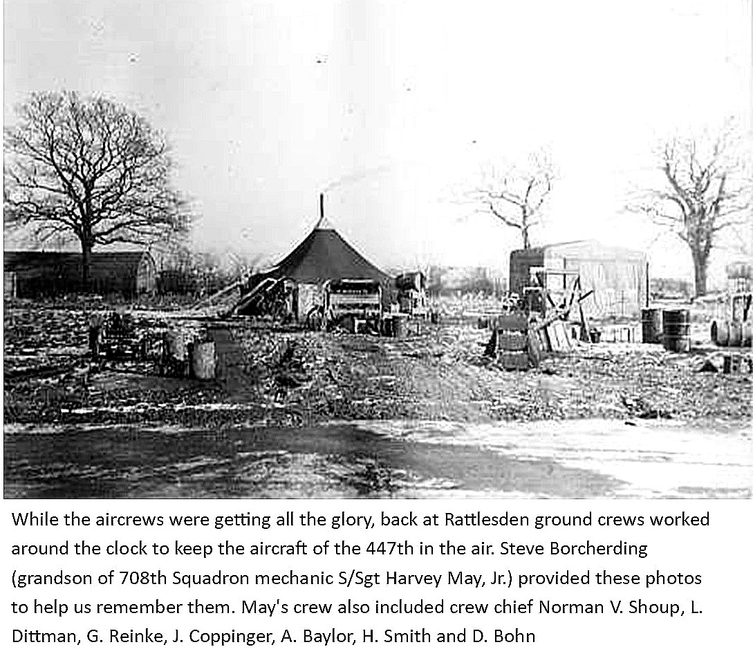
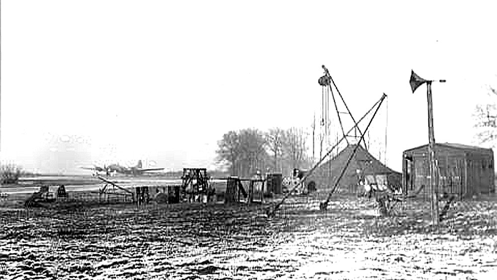
Two more pictures from the American Air Museum showing their primitive ground crew facilities. As the caption for Photo Four states, it is certainly the aircrews that get all the credit.
But, for every aircrew member getting into the skies, (and this still applies of course in both military and civil operations), a formidable 'army' of ground support people are required. And, invariably much of this work takes place out in the open, in all weathers throughout the year.
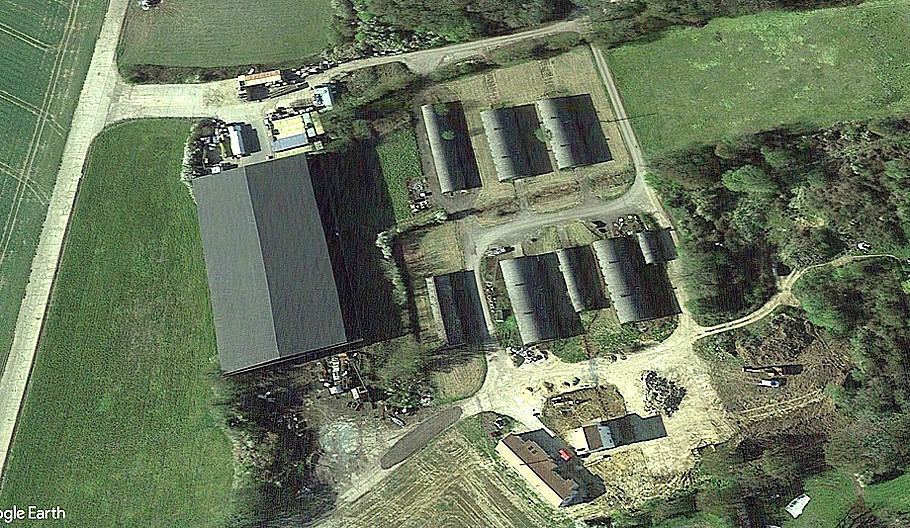
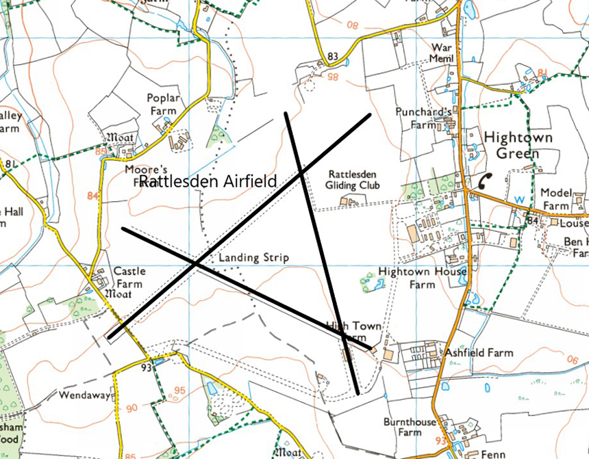
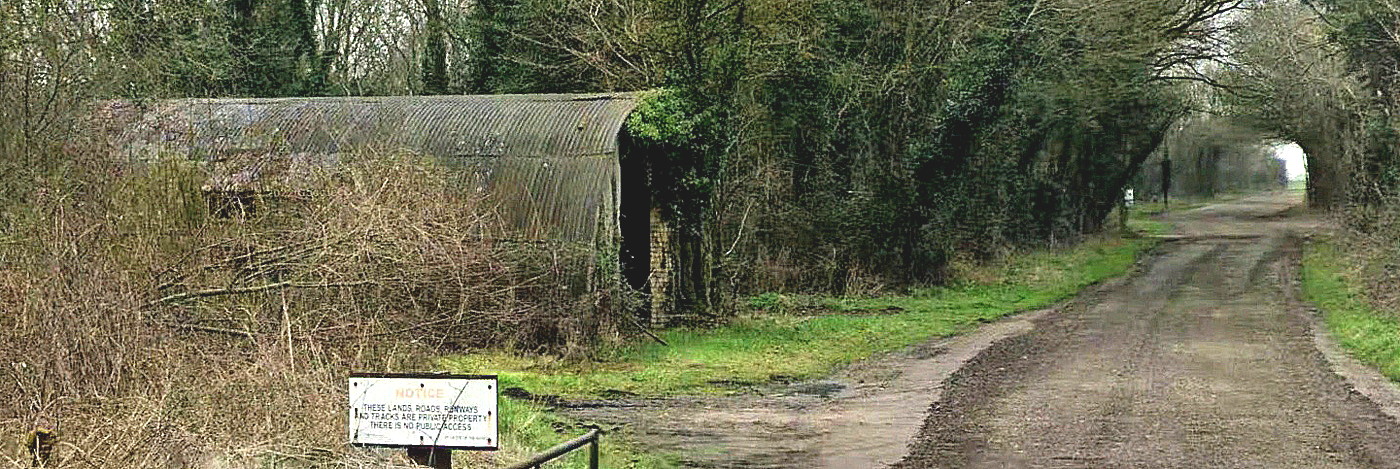

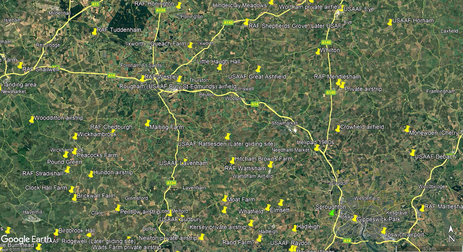
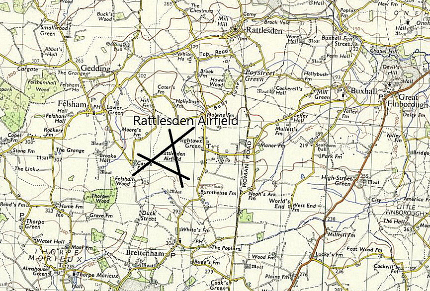
The local area and area views are from my Google Earth © derived database.
NOTES: Here again, a typical USAAF WW2 bomber base probably long since forgotten by most, but in its day populated by 2894 USAAF personnel in late 1944 according to official records.
SPOTTERS NOTES
In the mid 1970s it appears that two powered aircraft were based here: The SF-25 Motorfalke G-AVBK and Slingsby T.61 Falke G-AYUN. Both types having close associations with gliding activity of course
We'd love to hear from you, so please scroll down to leave a comment!
Leave a comment ...
Copyright (c) UK Airfield Guide
