


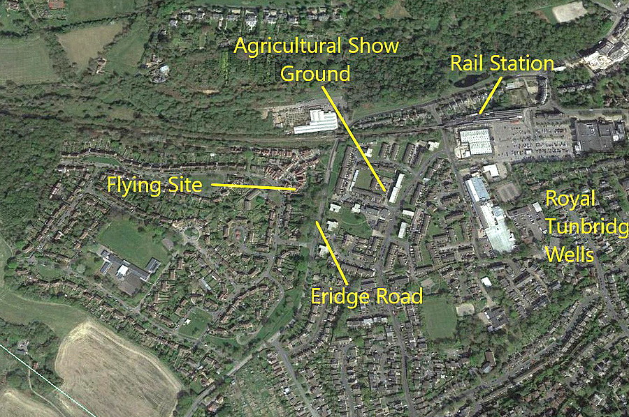
Royal Tunbridge Wells
Note: This map only shows the position of Royal Tunbridge Wells within the UK.
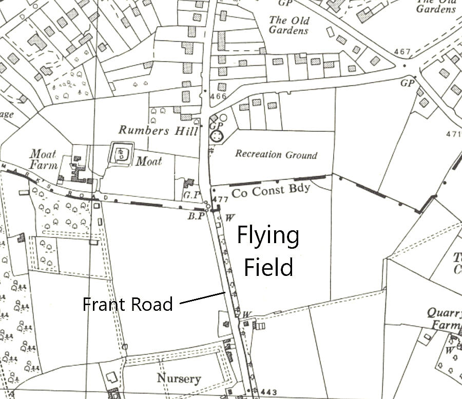
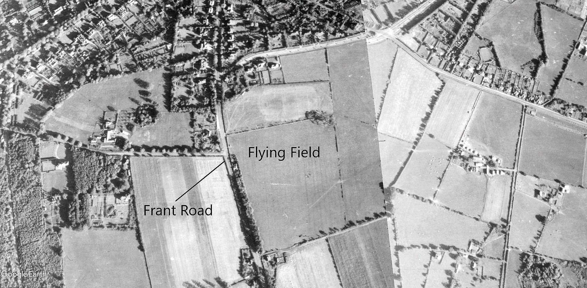
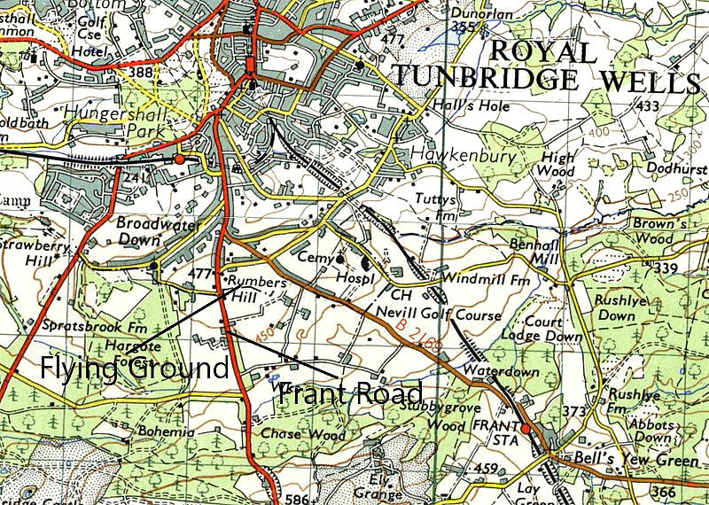
ROYAL TUNBRIDGE WELLS: Temporary Landing Grounds
AN AIR PAGEANT IN 1927
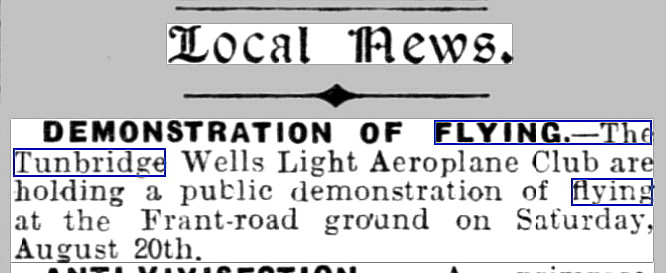
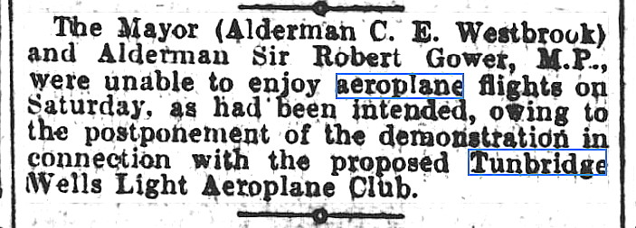
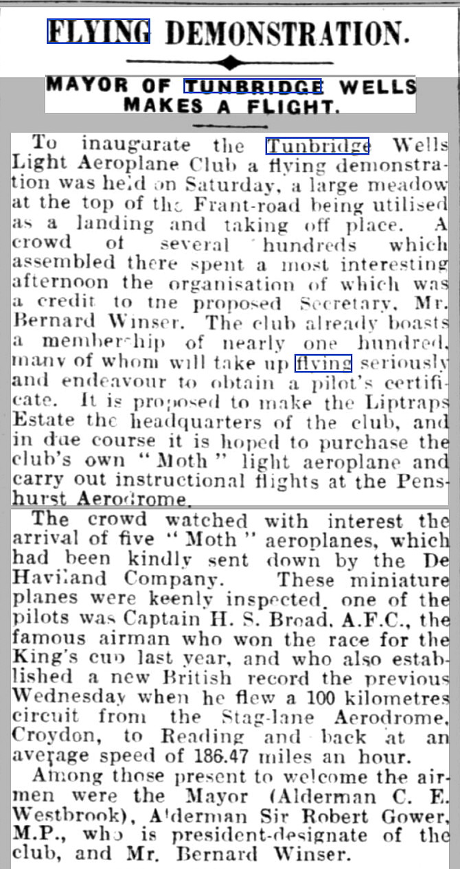
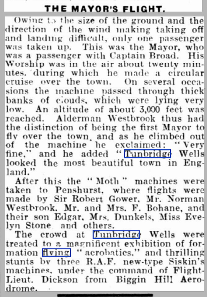
The Tunbridge Wells Light Aeroplane Club had originally planned to hold an Air Pageant on the 20th August 1927, but it had to be postponed until the 27th. The venue was a field just east of Frant Road, which was roughly 1nm S of Royal Tunbridge Wells town centre. After the mayor had been taken for a flight it was decided that the field was too marginal for passenger operations, and these were transferred to PENSHURST aerodrome.
A MICHAEL T HOLDER GALLERY
Note: The second item, an advert, was published in the Kent & Sussex Courier on the 12th August 1927.
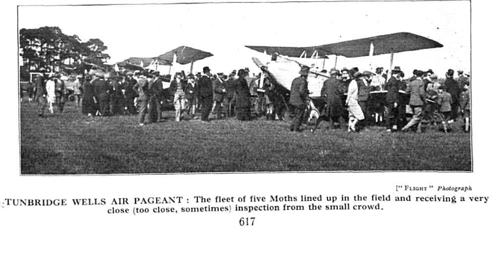
The fourth item was published in the Sevenoaks Chronicle and Kentish Advertiser on the 26th August 1927. The sixth item is a photo taken at Frant Road published in Flight magazine on the 1st September 1927.
Note: The two parts are of an article published in the Kent & Sussex Courier on the 2nd September 1927.
NOTES: In August 1929 ROYAL TUNBRIDGE WELLS was the planned 54th venue for the Sir Alan Cobham's Municipal Aerodrome Campaign. Starting in May and ending in October, one hundred and seven venues were intended to be visited. Mostly in England, two venues were in Wales and eight in Scotland. In the end Cobham managed to visit 97venues, which was of course still a magnificent achievement.
Without much doubt this Tour led to several aerodromes / regional airports being commissioned - but not in Royal Tunbridge Wells. Although it is strongly suspected that Cobham probably also used the field opposite the Agriculural Show Ground, if anybody can kindly offer advice regarding the location of this venue, this will be much appreciated.
The aircraft Cobham used for this Tour was the DH61 'Giant Moth' G-AAEV, named 'Youth of Britain'. The punishing schedule he set himself seems astonishing today. See STOCKTON-on-TEES for more information. Better still, read his memoirs in A Time To Fly.
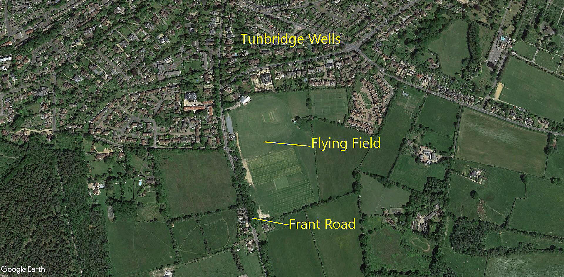
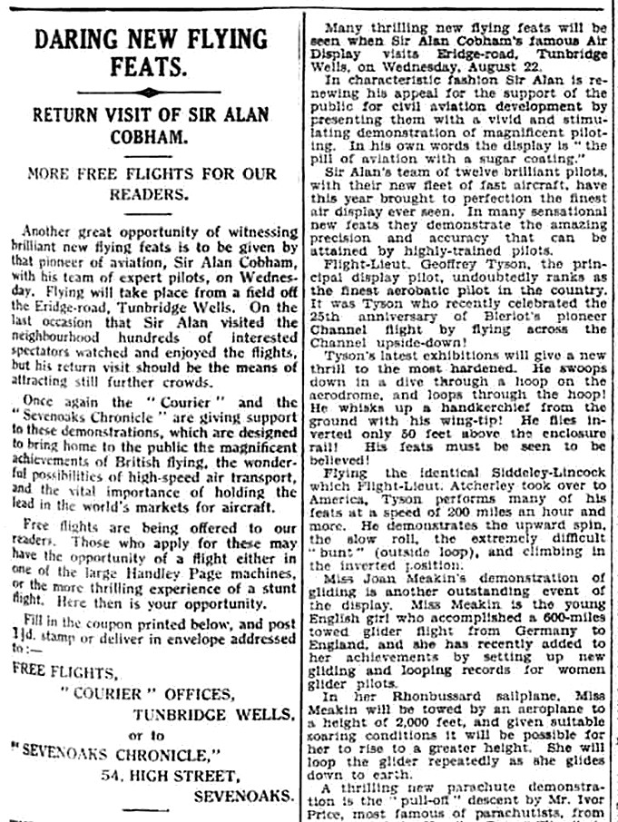
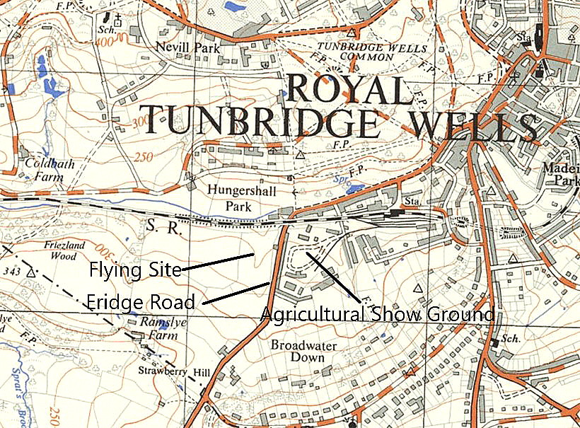
ERIDGE ROAD
Location: On the W side of Eridge Road, (A26), opposite and W of the Agricultural Show Ground, just SW of Royal Tunbridge Wells town centre
Period of operation: Positive proof has been found of the Cornwall Aviation Company using this site on the 16th April 1929, and Sir Alan Cobham's National Aviation Day display tour on the 22nd August 1934. This tour started on the 14th April and ended on the 30th September with 159 venues planned to be visited, this being the 121st venue. It is not known if they managed to display at every planned venue, but they certainly visited the vast majority.
A MICHAEL T HOLDER GALLERY
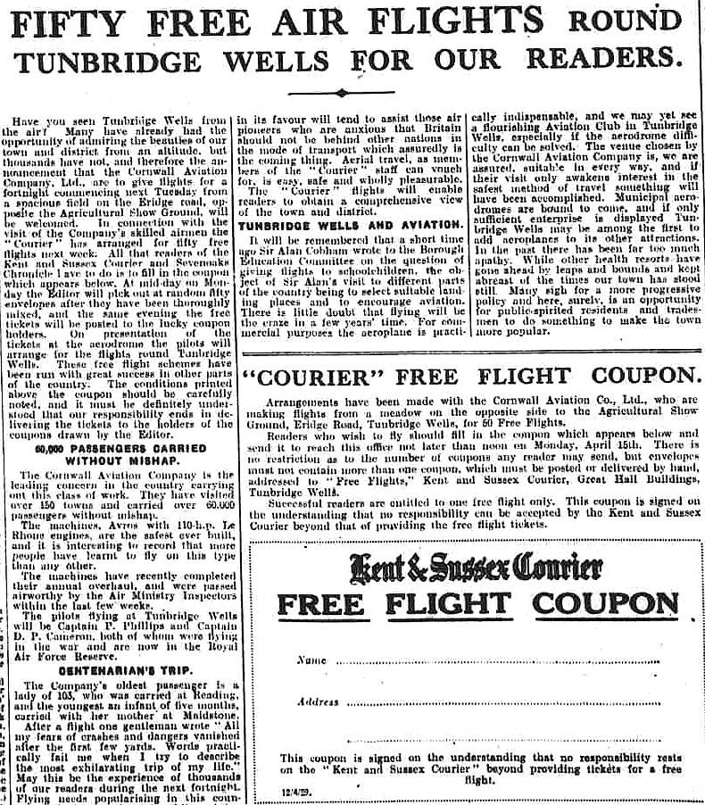
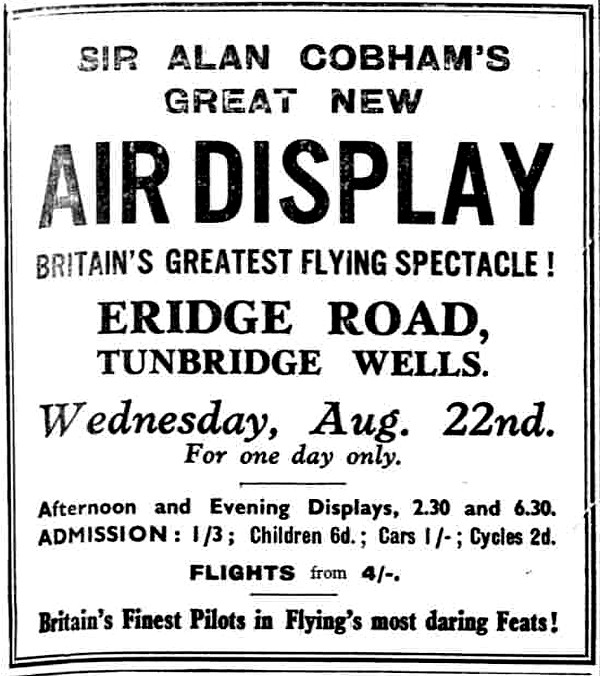
Note: The first item was published in the Sevenoaks Chronicle on the 12th April 1929. The third item is an advert placed in the Kent and Sussex Courier on the 17th August 1934, and this was accompanied by an article, the fourth item.
Note: The seventh item was published in the Kent and Sussex Courier on the 24th August.
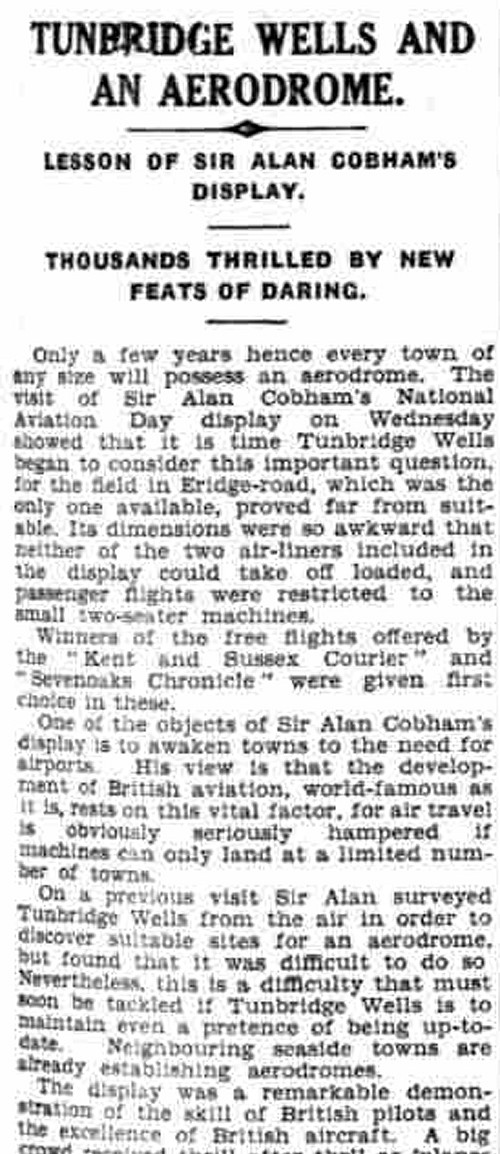
NOTES: It is perhaps not widely known that all flying sites involving public displays and joy-riding had to be officially licensed aerodromes, even if used for only one day. In the earlier days a couple of men from the Ministry would arrive by car in advance and conduct a site survey. Even if approved, the Ministry men would often impose some operational limitations for some, or even all the aircraft intended to be used.
Later on, the most respected and professional operators were allowed to become, in effect, self certifying - simply needing to inform the Ministry of their intentions. This, of course, would not prevent a snap inspection being made on the day of the display. A few operators employed airliners, both as part of the display but especially for earning revenue carrying passengers on local sight-seeing flights.
In this case it must have been especially galling to Cobham not to use his two airliners earmarked for this display, (see last article above), because the field was too small.
What we don't appear to know, is what airliner types Cobham had planned to use for this display. For the 1934 tour, National Aviation Displays Ltd owned three larger types: Two Handley Page W.10s, G-EBMM and G-EBMR, plus the Handley Page HP.35 Clive G-ABYX. All three of which, if my memory serves correctly (?) ex-Imperial Airways.
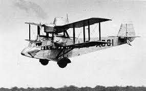
Note:This thumbnail picture was obtained from Wikipedia.
What I think is doubly interesting is that they also operated two Airspeed AS4 Ferry types. (G-A BSI and G-ABSJ). A design commissioned by Cobham specifically as a STOL ten-passenger carrying medium sized airliner. If even one of these could not be used, it certainly proves just how small this field was. The Ferry is a very good example which disproves the age old adage in aviation, that; "if it looks right - it is right". This was a very ungainly, if not ugly machine, but in fact proved ideal for its purpose, and it seems was very robust and reliable.
Michael T Holder
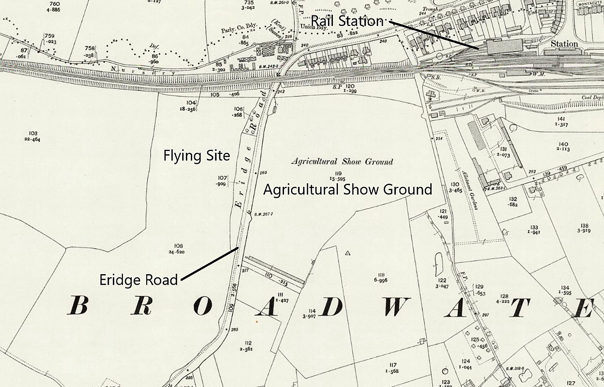
This comment was written on: 2020-05-21 14:39:46From the Kent & Sussex Courier - Friday 17 August 1934 - Sir Alan Cobham's Great New Air Display Wednesday 22 Aug 1934 Eridge Road, Tunbridge Wells. The road is on the SW side of town and passes just north of the railway station before turning left under the railway line and heads south to strawberry Hill. The Agricultural Showground is in the field on the left just past the railway and there is a large field on the right. Take your pick.
We'd love to hear from you, so please scroll down to leave a comment!
Leave a comment ...
Copyright (c) UK Airfield Guide
