


Saddleworth Manor Farm
SADDLEWOOD MANOR FARM: Private airstrip
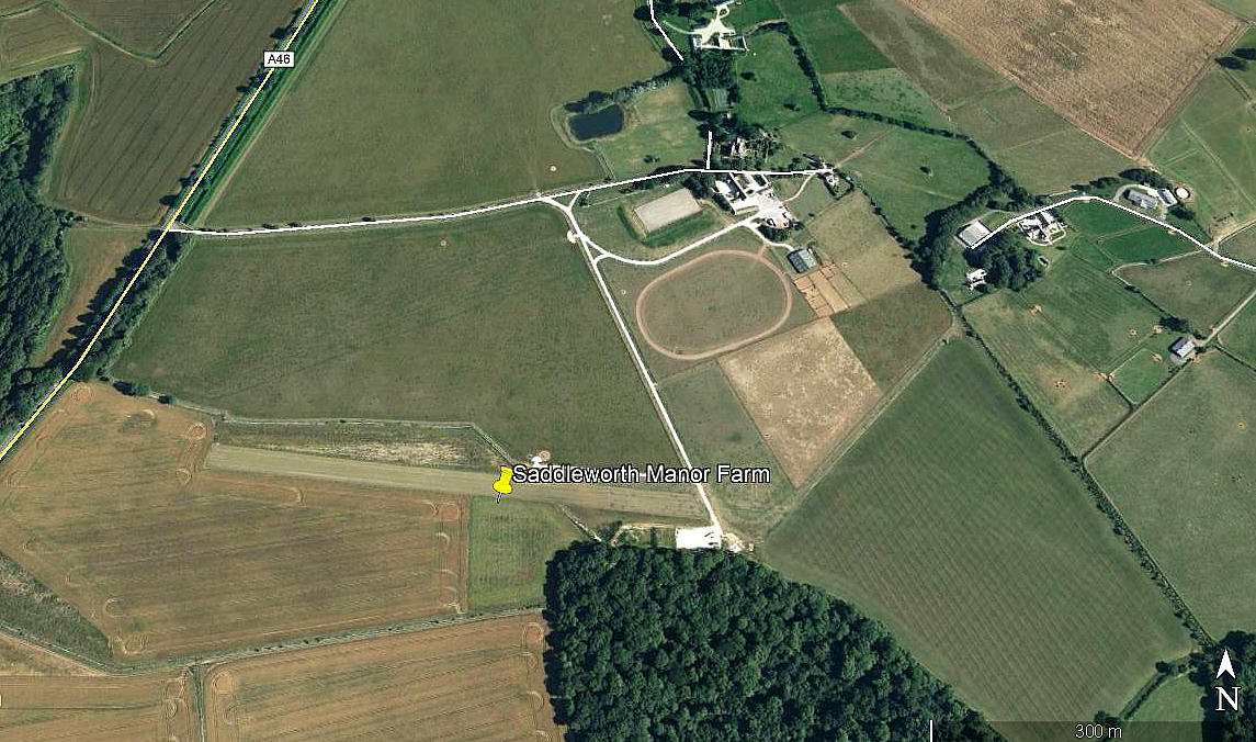
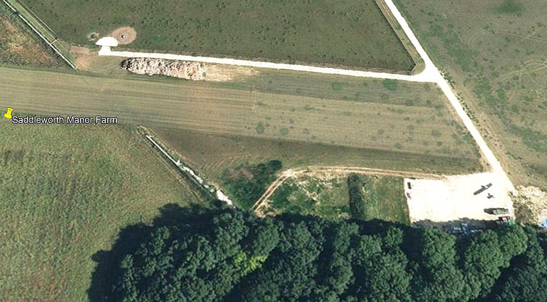
Note: Both these pictures were obtained from Google Earth ©
Location: Just E of the A46, about 1.5nm SW of Leighterton, about 8nm SW of Tetbury
Period of operation: 2007 (?) to 2012?
Runway: 09/27 635 grass
2008: 09/27 490 grass
Note: Looking back through Google Earth images, in 2006 there is no evidence of this airstrip, and likewise in 2013.
NOTES: Initial info source AAIB report EW/G2007/04/04. Although the AAIB report states the runway was 635 metres long, the Google Earth picture shows it was 490 metres long in 2008. This said, there is a slight indication it might have been 570 metres long at one point previously.
Having read the AAIB report I wondered if a Cirrus SR-22 could handle a strip of this length. Looking up the performance data, published on-line, the landing distance at sea level was given as 715 metres. So, if correct, obviously this pilot should never have attempted to land here. What is interesting though, is that the take-off distance at sea level is given as 485 metres.
As a general rule with many, if not most light aircraft, the take-off distance exceeds the landing distance. For example, I have often landed a Cessna 172 within 150 metres - but needed, (lightly laden in both cases), around twice that distance to take-off.
Over the years I have noticed that many pilots able to afford high performance machines, (fixed wing and rotary), appear to have such a high opinion of themselves, and their abilities, that they often fail to 'go back to basics' and end up in trouble, sometimes with fatal results.
The Google Earth detail is rather interesting as it appears to show, on the 'hard' apron at the eastern end of the runway, what looks like the remains of an aircraft, possibly burnt out?
If anybody can kindly offer advice, this will be much appreciated.
We'd love to hear from you, so please scroll down to leave a comment!
Leave a comment ...
Copyright (c) UK Airfield Guide
