


Sandridge
Note: Some time ago I made this comment: "This map only shows the position of Sandridge within the UK. Almost no information appears available so any advice will be much appreciated." In November 2018 I was kindly contacted by Grant Peerless - see 'Comment' below. The map above has now been adjusted.
SANDRIDGE: Military Emergency Landing Ground (ELG)
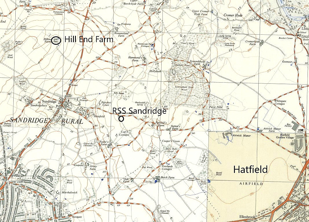
Local area map
Note: This map was kindly sent by Mr Michael T Holder
Military user: RAF Flying Training Command
Apparently used by an EFTS (Elementary Flying Training School). But used by whom?
(See 'Comment' below)
Location: Near Sandridge village on the B651, roughly 2nm NNE of St Albans town centre and 1.5nm SSE of Harpenden
Period of operation: WW2 only?
Grant Peerless
This comment was written on: 2018-11-27 13:54:05Sandridge was a Relief Landing Ground (RLG) for RAF Holwell Hyde/Panshanger from about 1940 to 1945. It was used mainly by the Tiger Moths of 1 EFTS and was located at Hill End Farm, NGR TL160105
Reply from Dick Flute:
Hi Grant, Many thanks. Regards, Dick
Grant Peerless
This comment was written on: 2020-09-01 15:09:11Dear Dick I have to correct the location of Sandridge RLG as more information has now come to light. Its exact grid ref is TL165115. A landing ground at Pound Farm was used by the DH School of Flying and/or London Aeroplane Club in the 1930s and may have been the same site as the WW2 RLG.
We'd love to hear from you, so please scroll down to leave a comment!
Leave a comment ...
Copyright (c) UK Airfield Guide
