


Scalford
Note: This map should give an exact location. If anybody can kindly confirm this, this advice will be most welcome.
SCALFORD: Military Landing Ground (aka MELTON MOWBRAY & THE OLD AERODROME)
Note: See the seperate listing for THE OLD AERODROME used as a 'Flying Circus' venue in the 1930s.
Note: These items were kindly provided by Mike Holder, a great friend of this 'Guide'.
Military users: RFC/RAF (Royal Flying Corps / Royal Air Force)
38 [Home Defence] Sqdn (Royal Aircraft Factory FE.2b)
90 [Home Defence] Sqdn (Possibly flying Sopwith Dolphins?)
Activities: Initially night landing ground near to 38 Squadron’s HQ - Melton Mowbray
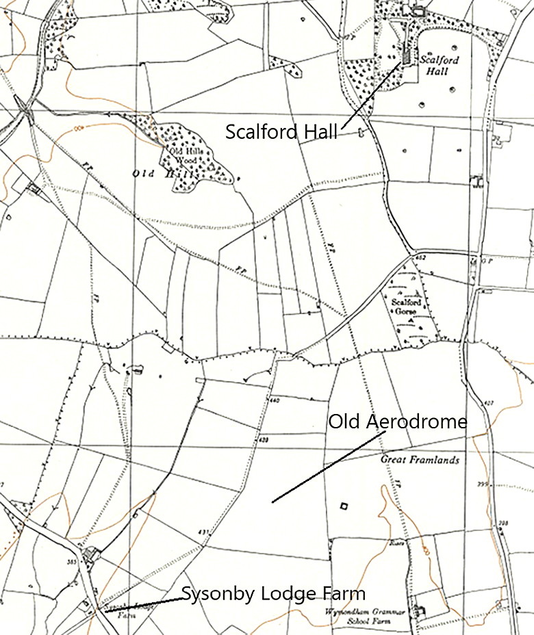
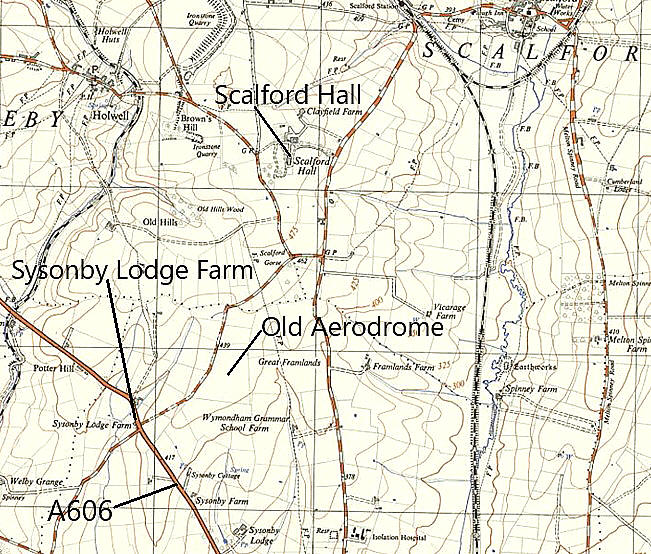
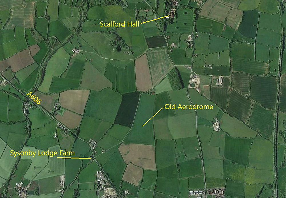
Location: Scalford Road east of Sysonby Lodge Farm about 1 to 1.5nm NNW of Melton Mowbray.
Period of operation: 1916 to 1918 and briefly in 1933 (See OLD AERODROME listing)
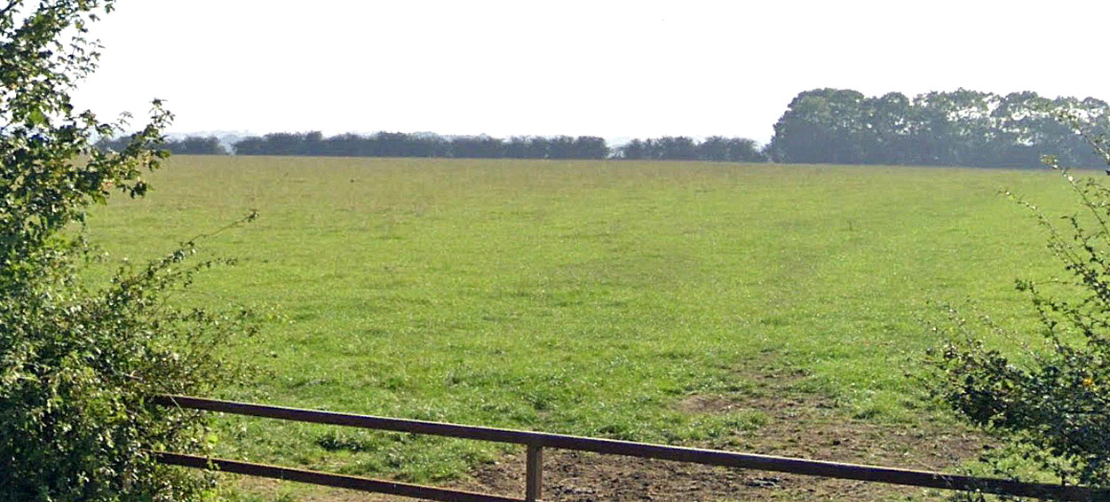
Site area: WW1: Officially 45 acres all-over grass airfield, although it seems it was actually later closer to 60 acres
640 x 549 (Many WW1 airfields were expanded during operation)
NOTES:
Much of this information has been later confirmed and added to from: YESTERDAY IN MELTON MOWBRAY: THE LANDING GROUNDS (johnmcquaid.co.uk)
As he tells us, ".....(SCALFORD)....was a quite important base which was established about 1½ miles from Melton railway station which was nearer to Melton Mowbray than the village it was named after. Sited off the main A606 Nottingham Road on the minor road from Sysonby Lodge Farm and towards the rear of Scalford Hall, it comprised at least 45 acres - 700 x 600 yards." (My note: 640 x 549 metres)
John McQuaid quotes this from Roy Bonser: "Established initially as a night landing ground it replaced a similar type of field which 38 Squadron had previously used at Brentingby to the east of Melton Mowbray." (My note: See seperate listing for BRENTINGBY). "One factor which in all probability influenced the change and choice of site was the fact that the squadron's headquarters were moved from Castle Bromwich to a new home at Scalford Road, Melton Mowbray. The use of a landing ground in close proximity to unit headquarters would be of great value for communication and liaison purposes, especially as the three flight stations of the Squadron were some distance away in Lincolnshire."
"The field was used by the unit from late 1916 until it departed for a tour of duty in France in May 1918. To fill the gap left by this move, 90 Squadron formed at Buckminster assumed responsibility for Scalford until it was closed down following the German capitulation."
(My note: The Armistice was declared on the 11th November 1918.)
It appears this site was used by Alan Cobham’s 1933 No.1 Tour of the UK. Known then as 'THE OLD AIRFIELD'.
Zoe Eggleston
This comment was written on: 2018-01-31 11:24:28Regarding Scalford Airfield, this is owned by my husband and myself and has been in the family since 1917, although the field is now only 34 acres. The council owns the other 26. Otvis part of Sysonby Lodge Farm and is further south than shown on the map. It's still called the airfield and the old air raid shelter is still there too. Please feel free to contact me for updated location and any other info
Reply from Dick Flute:
Hi Zoe, Many thanks, I shall keep this advice posted. Best regards, Dick
We'd love to hear from you, so please scroll down to leave a comment!
Leave a comment ...
Copyright (c) UK Airfield Guide
