


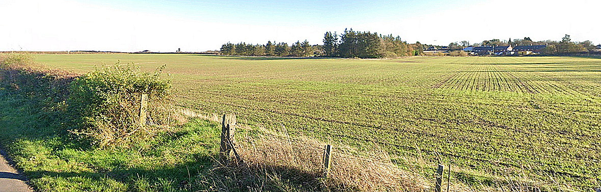
Scremerston
SCREMERSTON: Temporary Military Landing Ground in 1914.
Note: Later used by private pilots in the 1930s, and plans to form a flying school here were put forward but I doubt anything came of this?
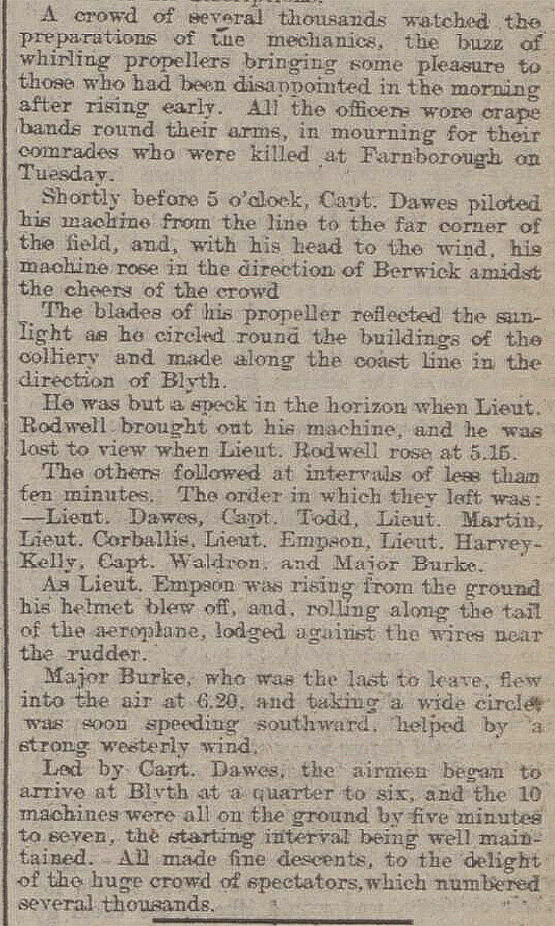
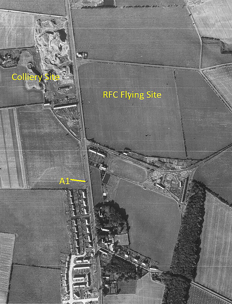
In the run up to WW1, which was very much expected by the top echelons of the military and naval forces, several major exercises were carried out around the UK. No.2 Squadron based at MONTROSE were ordered to fly south and this was one of their staging posts. It also appears that, in order to deploy airships around the UK, they also used this Landing Ground.
Period of operation: Military = May and early August 1914. Note: The UK declared war on the 2nd August 1914
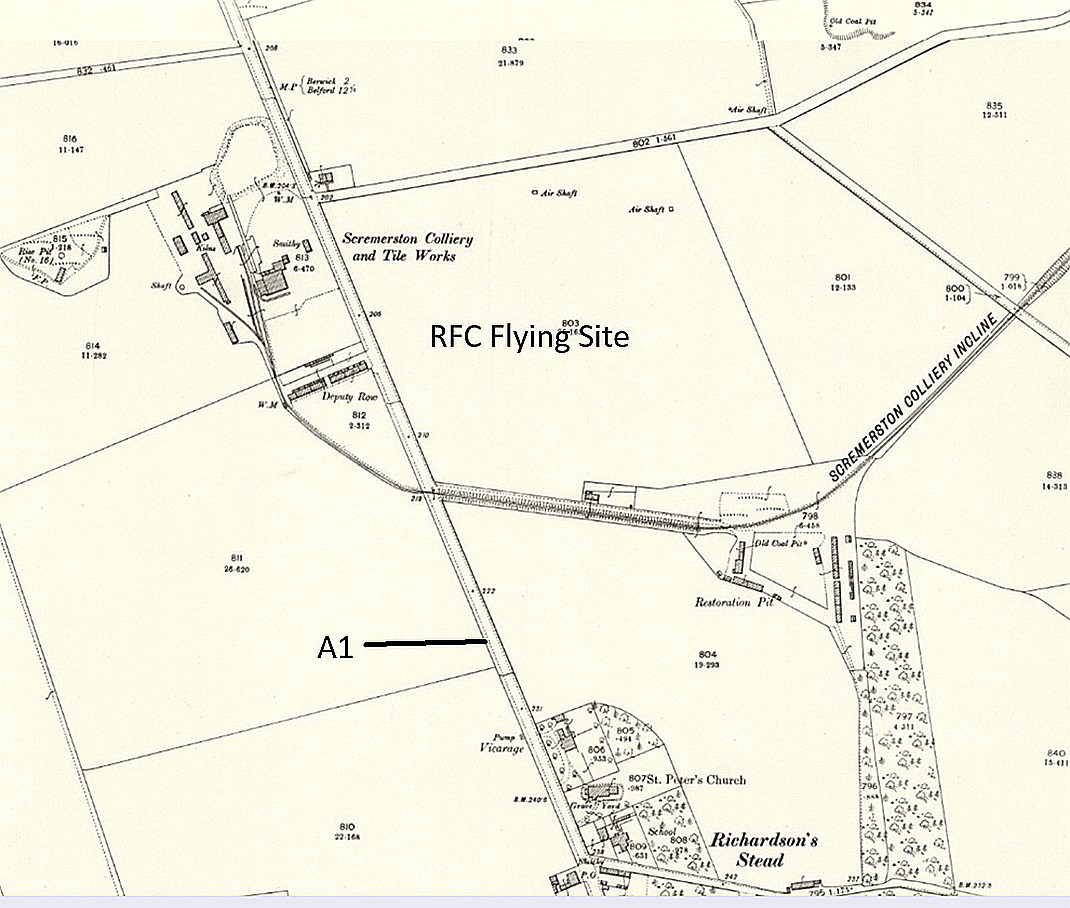
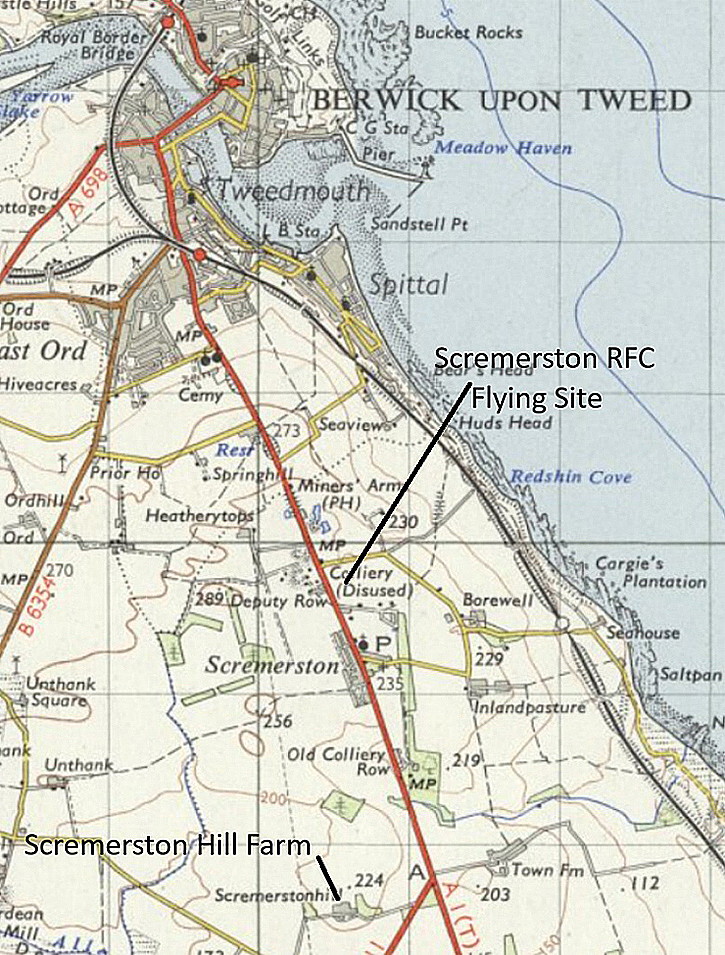
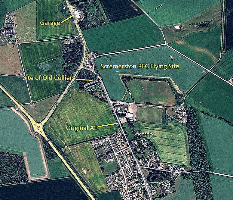
Location: Just E of the old A1, just N of Scremerston village, about 2nm S to SSE of Berwick-upon-Tweed town centre
A MICHAEL T HOLDER GALLERY
We have Mike Holder, a great friend of this 'Guide', for both discovering this location and then researching the subject; providing the following.
The short article was published in The Scotsman on the 23rd July 1914.
NOTES: As is often the case in compiling this 'Guide', quite often the history becomes complicated. With regard to the short article above, it does appear, in a minor exercise in July 1914, that perhaps they used another nearby field?
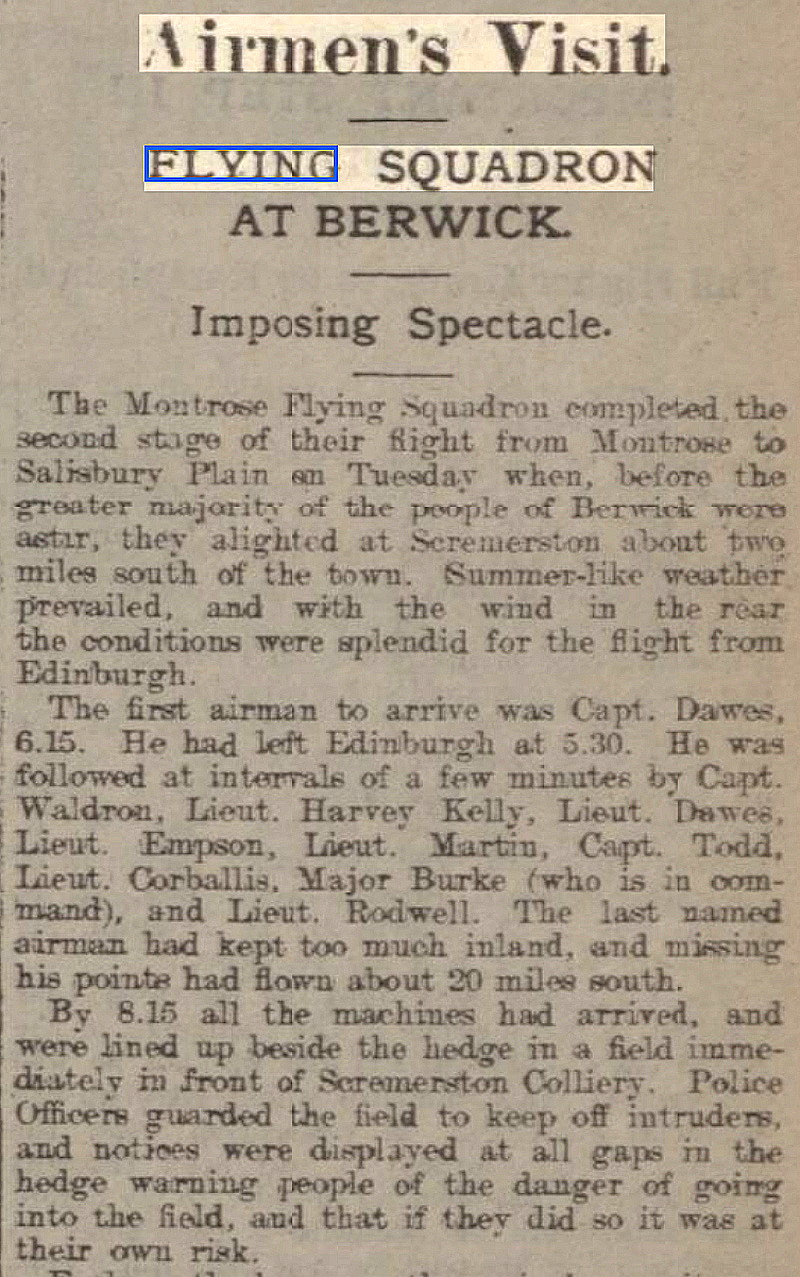
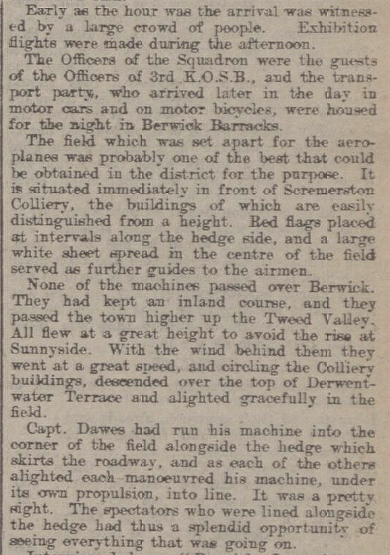
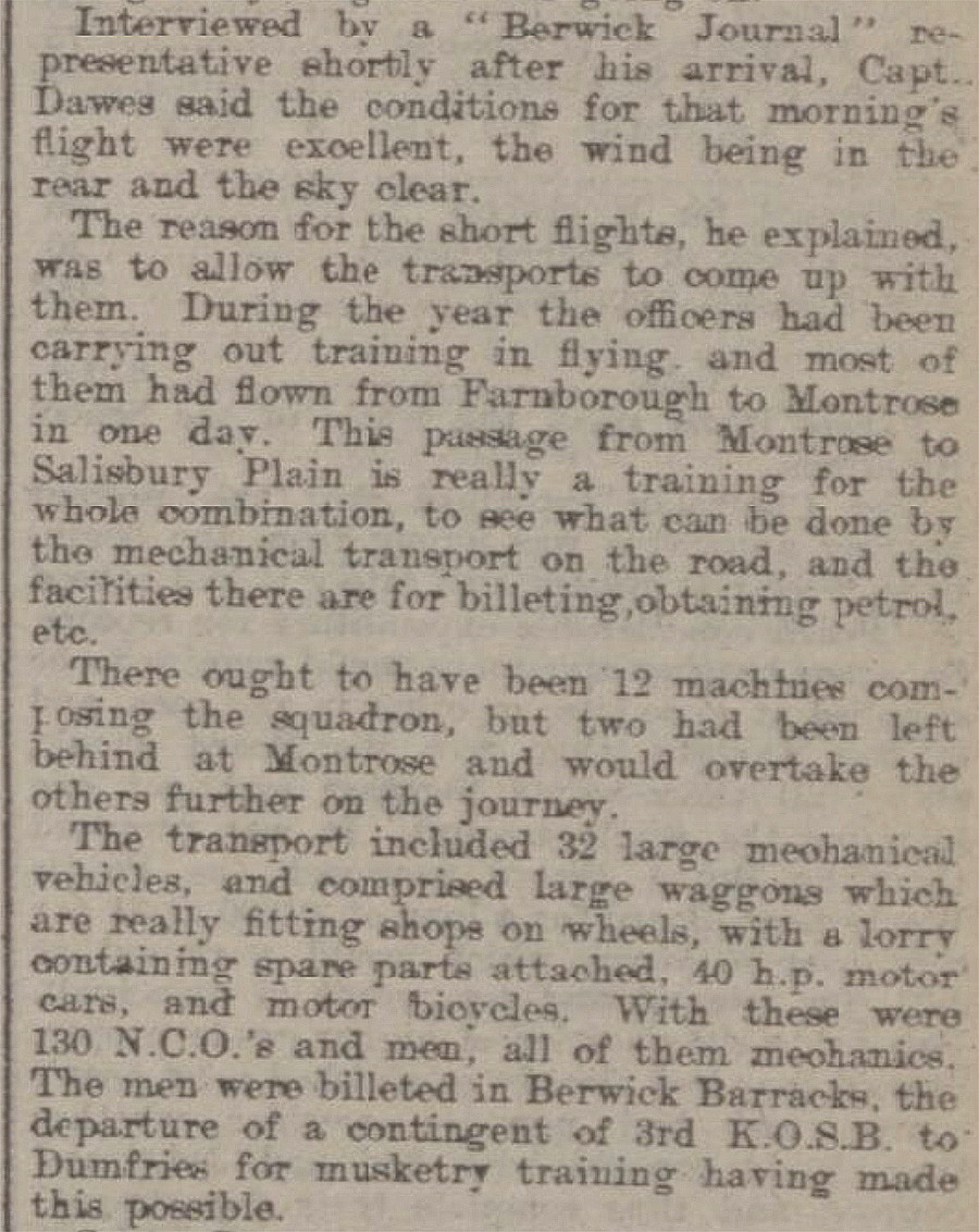
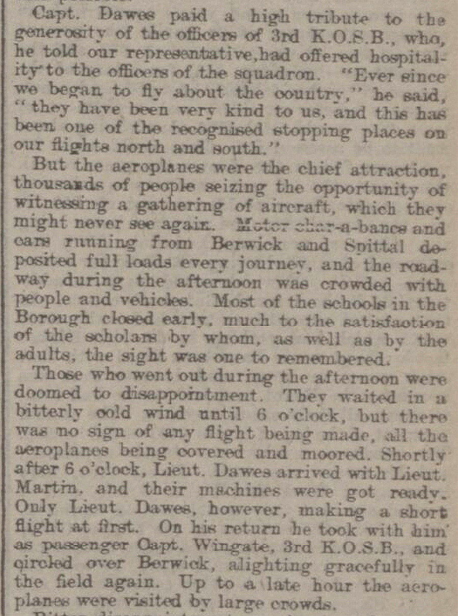
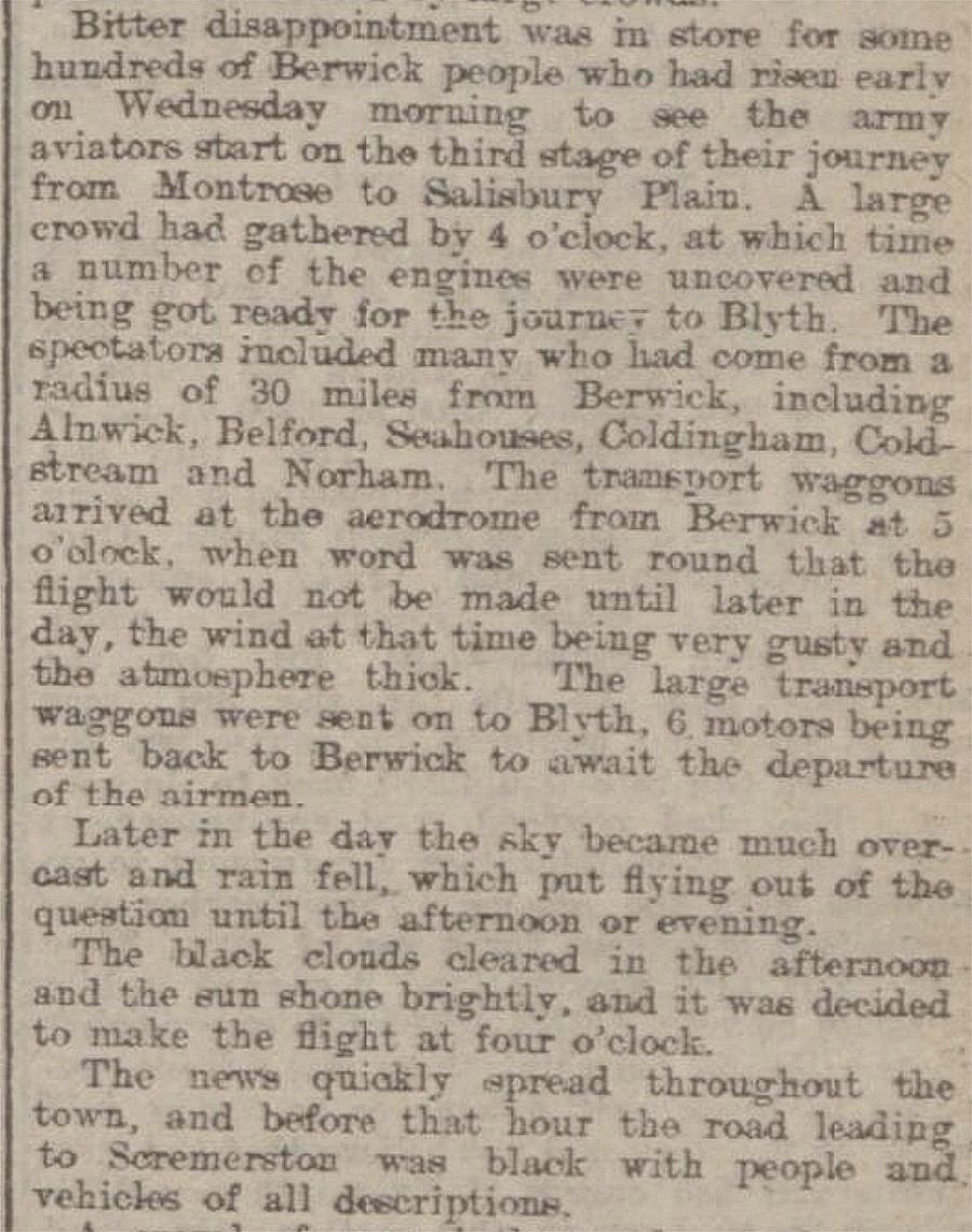
The Berwickshire News and General Advertiser made a big thing about this happening, publishing this article on the 19th May 1914.
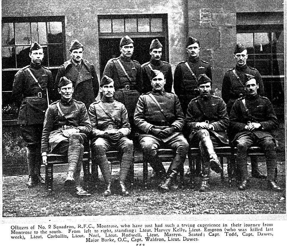
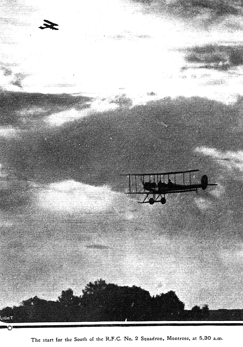
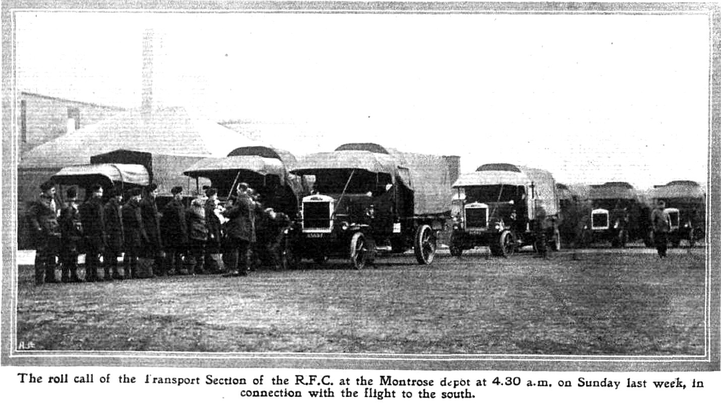
PICTURES FROM FLIGHT MAGAZINE, 22nd MAY 1914
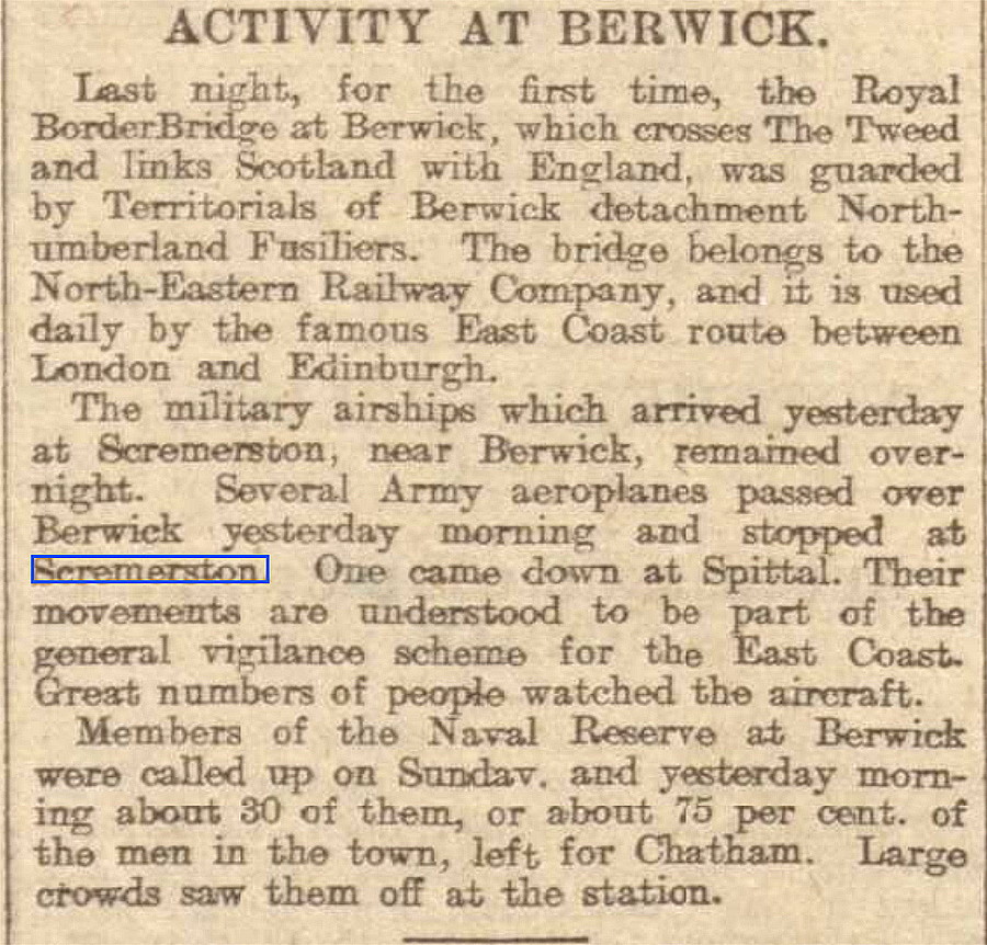
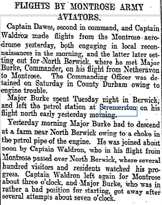
The second short article was published in the Newcastle Journal on the 9th August 1914.
FAST FORWARD TO THE 1920s AND 30s
As far as we are aware, (to date in 2025), after 1914 no other flying activity took place here, until 1928?
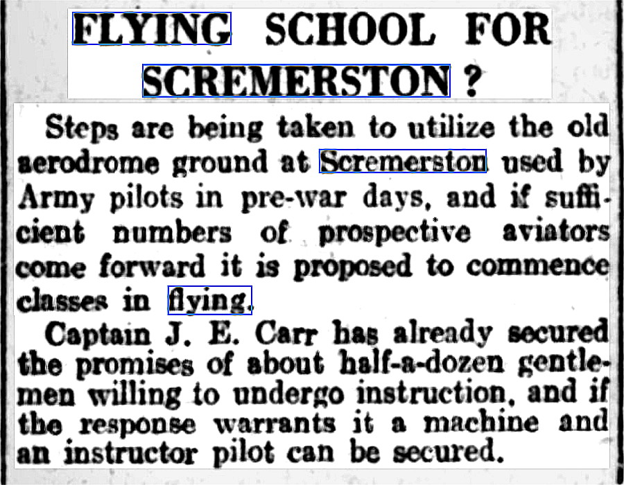
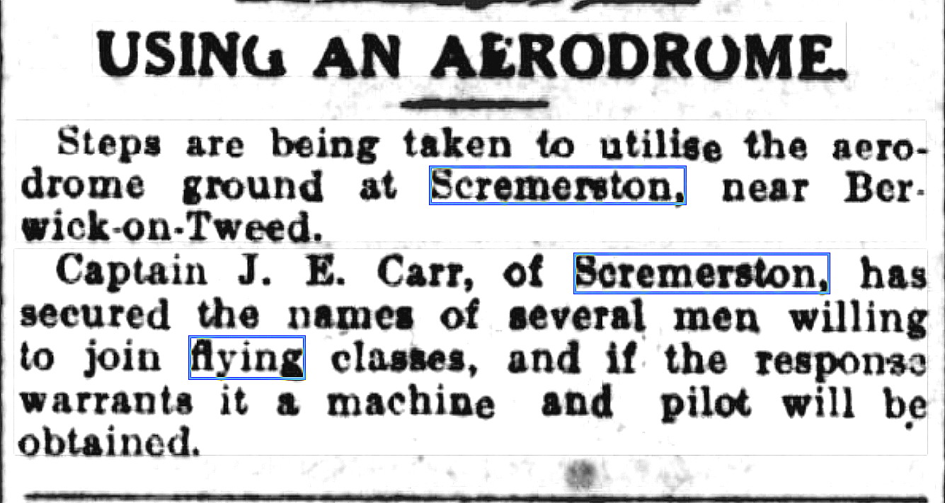
Notice One was published in the Newcastle Journal on the 16th March 1928. The short article was published in the Berwickshire News and General Advertiser on the 2nd June 1931.
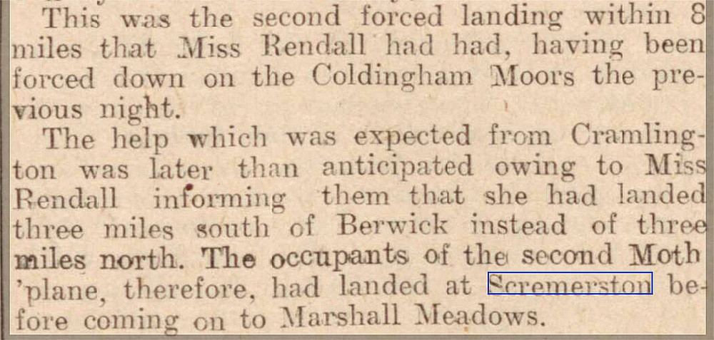
Notice Two was published in the Shields Daily News, also on the 16th March 1928. When I was being taught to fly in the late 1980s, it was emphasised that pilots never get lost! But, you may be temporarily uncertain of your position. Certainly the case for Miss Rendell in the short article above. Seems odd that she hadn't noticed Berwick-upon-Tweed as she flew past, but, in those days, with virtually no controlled airspace or restricted areas, it was quite common to fly very low under a low cloudbase in poor visibilty. Obviously it is pure conjecture, but generally the practice was to follow line features such as main roads, rivers and railways - by far the best line feature being the coast of course.
So, perhaps she was flying low up the coast? Perhaps, also, sea fog was setting in, forcing her to quickly divert and land. The de Havilland DH60 Moth was designed to land, just like even the WW1 fighters, in fairly rough unprepared fields. Now see below:
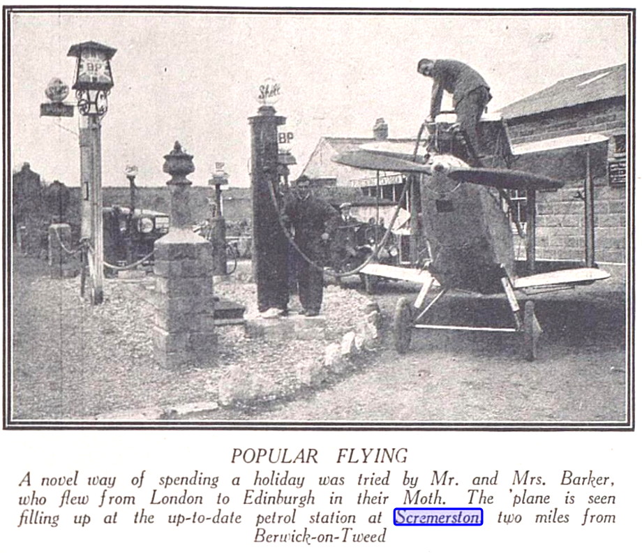
This picture of a DH60 Moth being refuelled at a roadside filling station was published in The Bystander on the 3rd April 1929. And raises many questions. Did they land in a field next to the filling station, fold the wings and push it in? Rather than on the old WW1 site and have the aircraft towed in? Seems unlikely, and anyway, surely it was easier to supply fuel to the aircraft in the latter case. So, looking at it in great detail of course, we seem to have at least a couple of fields in this vicinity being used. Also, does anybody know the registration of this Moth?
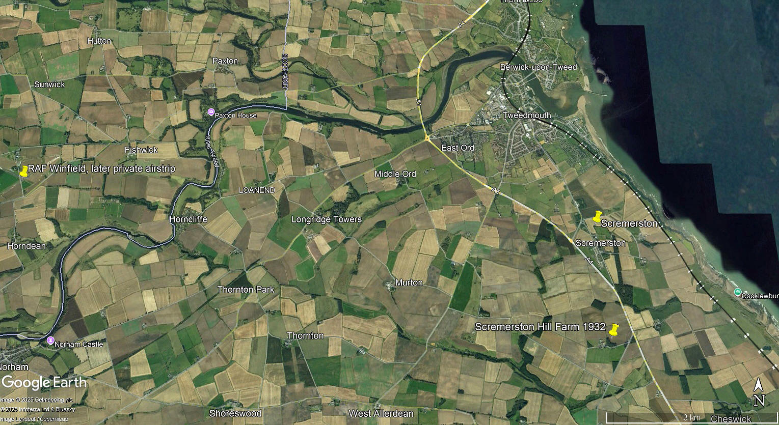
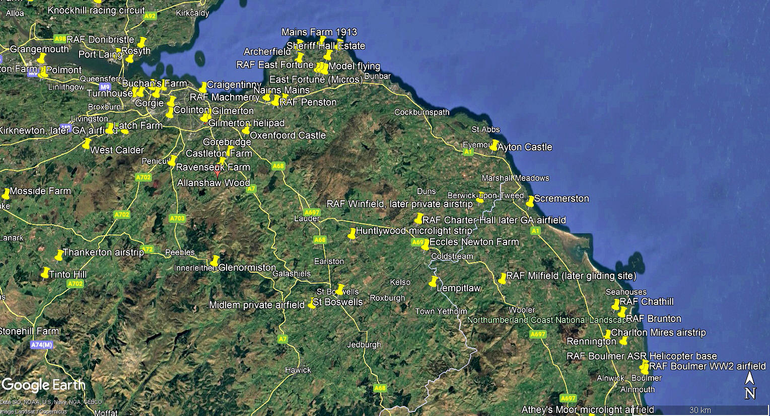
The local area and area views are from my Google Earth © derived database. Please note that a great many locations listed in this 'Guide' are pinned on the database.
We'd love to hear from you, so please scroll down to leave a comment!
Leave a comment ...
Copyright (c) UK Airfield Guide
