


Scremerstone Hill Farm
SCREMERSTONE HILL FARM: Temporary aerodrome
Operated by: Sir Alan Cobham’s 1932 National Aviation Day UK Display Tour
Location: Just W of the old A1 Newcastle Road and the junction with the B6526, (ex A6111), about 3nm S to SSE of Berwick-upon-Tweed town centre
Period of operation: 2nd October 1932
A MICHAEL T HOLDER SHORT GALLERY
We have Mike Holder, a great friend of this 'Guide', to thank for providing the following items.
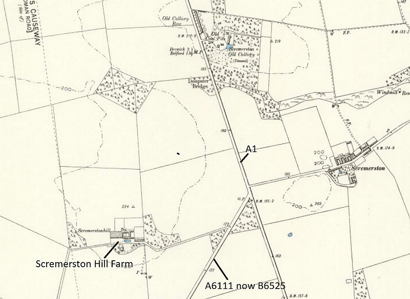
Local map c.1915
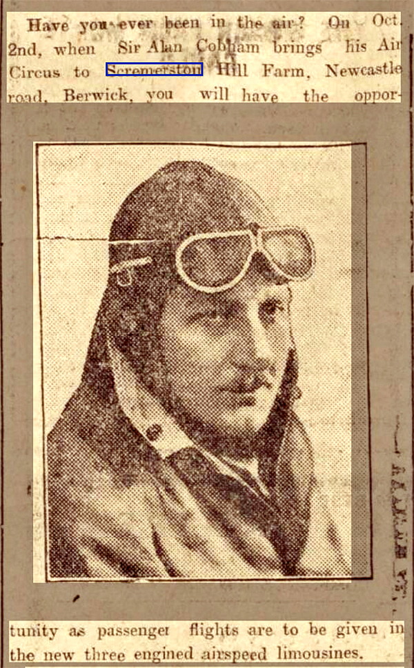
Photo + caption
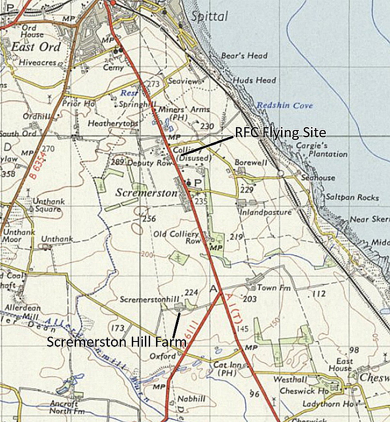
Local area map c.1961
The photo plus caption was published in the Berwickshire News and General Advertiser on the 20th September 1932.
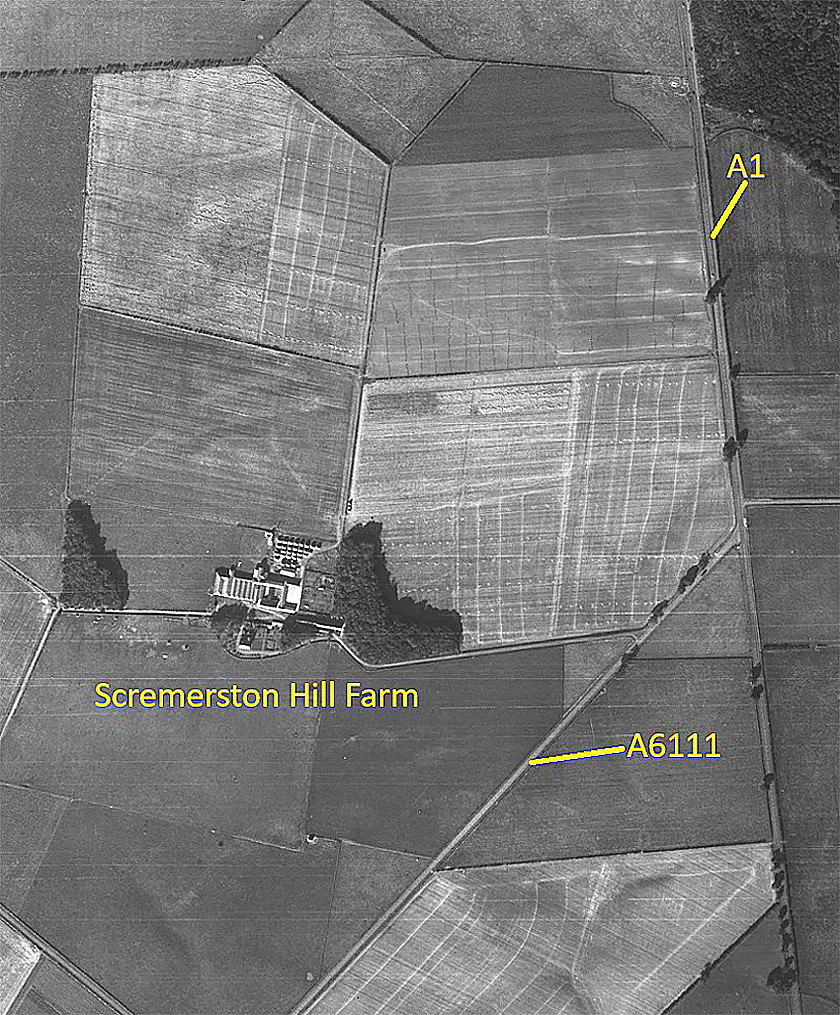
Aerial vertical c.1951
The science, and indeed art of aerial photography came into its own in the early years of WW1, before aerial combat evolved. The primary purpose of aeroplanes in the Royal Flying Corps was for reconnaissance purposes to assist the Army, and photography soon became a very important aspect of the conflict. Today of course we have satellite imagery, but up until the 1980s, at least, most of the world was being photographed from above.
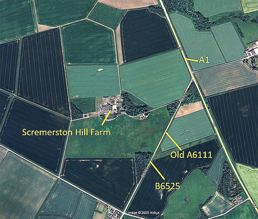
Google Earth © view
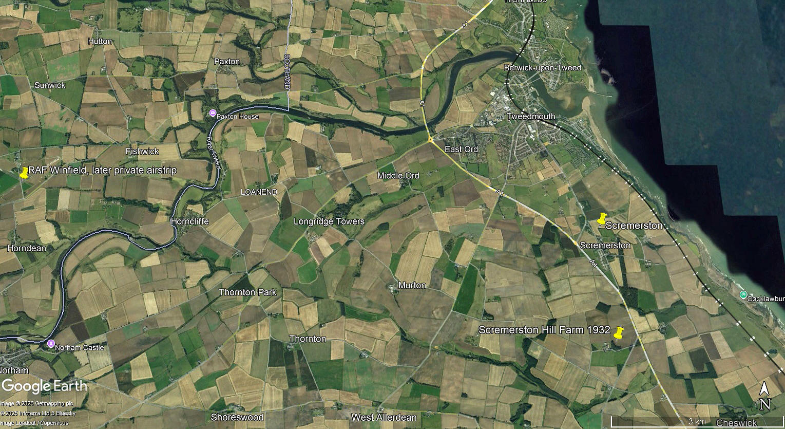
Local area view
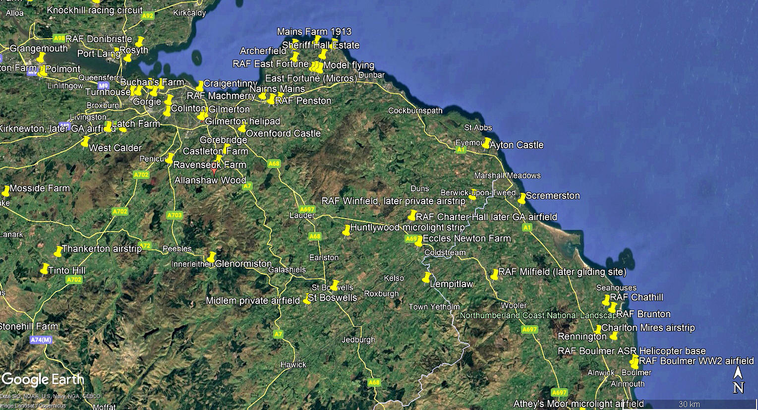
Area view
We'd love to hear from you, so please scroll down to leave a comment!
Leave a comment ...
Copyright (c) UK Airfield Guide
