


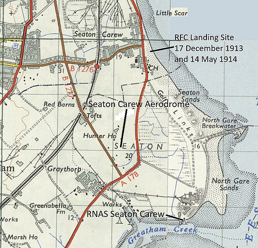
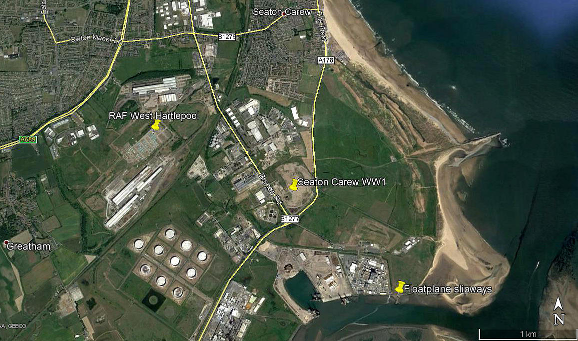
Seaton Carew flying sites
Note: This map shows the location for the WW1 airfield, the second listing below.
AN INTRODUCTION
This listing is for three locations, the first being for flying activity prior to WW1, then two others, a RFC/RAF aerodrome and a RNAS Seaplane Station during WW1 and just after. As has invariably been the case, the initial pieces of information have been gathered across many years. However, in early 2015, Mr Michael T Holder , a great friend of this 'Guide', has very kindly taken it upon himself to see what else might be available. And indeed, it turns out that there is quite a surprising amount.
In a departure from my normal practice, in order to cope with this; instead of providing a single gallery, I have divided it into three seperate sections. Part One, Two and Three. I have left my initial contributions in place, simply because, (hopefully?), you may find it of interest to see how the story evolves.
SEATON CAREW BEACH: Temporary Landing Ground
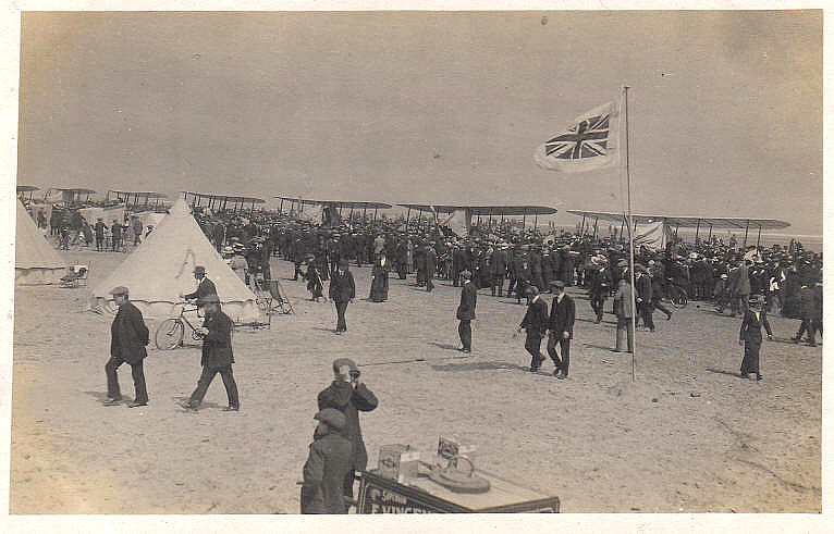
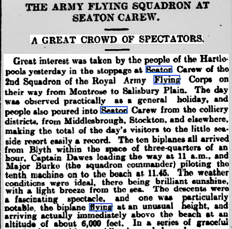
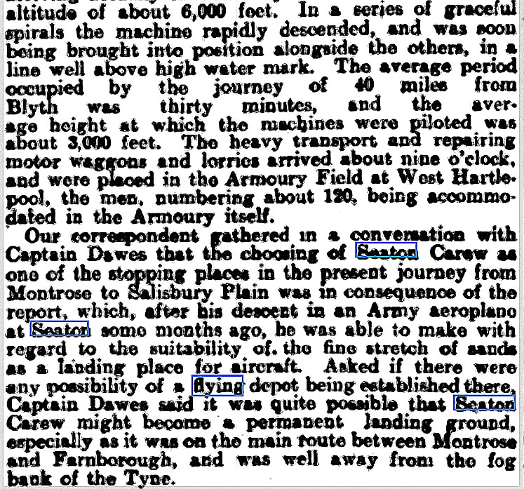
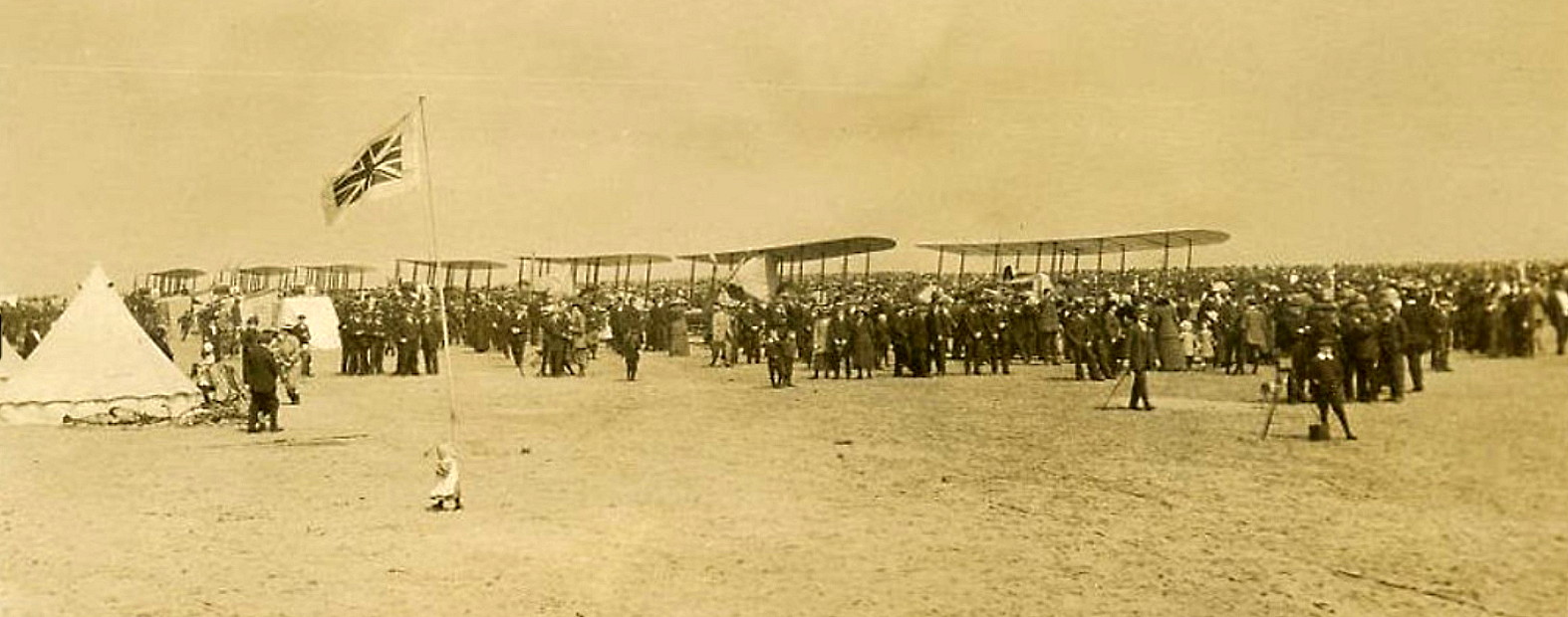
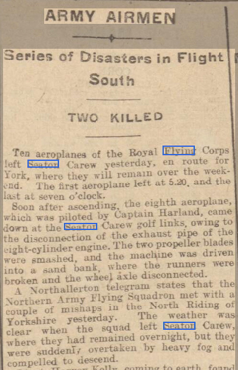
NOTE: This picture was kindly provided by Mike Charlton, a great friend of this 'Guide'. It shows ten Royal Aircraft Factory B.E.2 types of No.2 Squadron, that were being flown from MONTROSE in Scotland, to Salisbury Plain. Presumably to participate in Army manouevres. The announcement of their arrival on the 14th May had been made days in advance and a great deal of excitement and interest had been generated. Indeed, as the 14th was a Thursday, many people had been given time off work to view the spectacle.
We must bear in mind that is entirely possible that many of the people in this picture may never have seen an aircraft. Or, if they had, it would most probably have been just a single aeroplane, two at most. Indeed, an exhibition of flying in those days, prior to WW1, could generate huge crowds, even though just one aeroplane was being displayed. There had been major flying meetings held around the country, at Blackpool, Bournemouth and Doncaster for example, and regular events with many aircraft were being held at HENDON north west of London. Nevertheless, in this part of the world, bearing in mind that the majority of people didn't usually travel very far, the sight of ten aeroplanes arriving at once would have provided a major attraction.
Plus of course, in all probability, many if not most of the people would have been aware that the storm clouds of a major war were gathering across Europe, and one in which, for the first time ever, military aeroplanes would be participating. It didn't take much longer either as Great Britain entered World War One, as we now call it, (or the Great War), on the 28th July 1914.
THE MICHAEL T HOLDER GALLERY - PART ONE
The obvious point to make here, as Mike discovered, is that the RFC used the sands whilst in transit, on two seperate occassions, the first being on the 17th December 1913, then once again on the 14th May 1914.
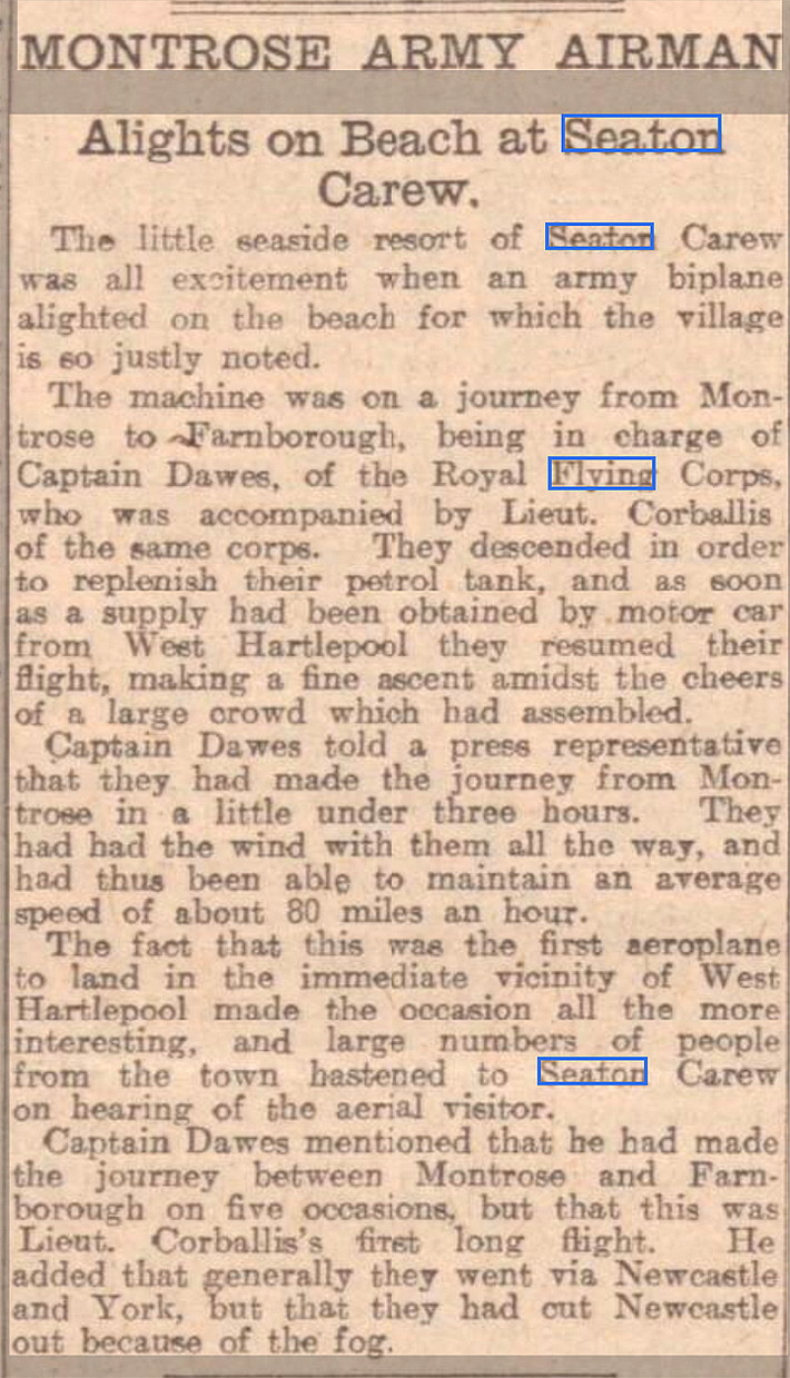
Article One was published in the Dundee Evening Telegraph on the 18th December 1913.

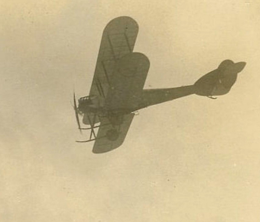
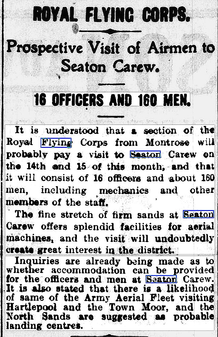
Photo One and Photo Two are from Hartlepool History, Then and Now. The short article was published in the Daily Gazette for Middlesborough on the 4th May 1914.
Article Two in two parts was published in the Yorkshire Post and Leeds Intelligencer on the 15th May 1914. Photo Three is also from Hartlepool History.
The Article Three, in three parts, was published in the Western Times on the 16th May 1914.
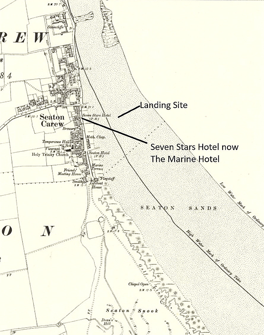
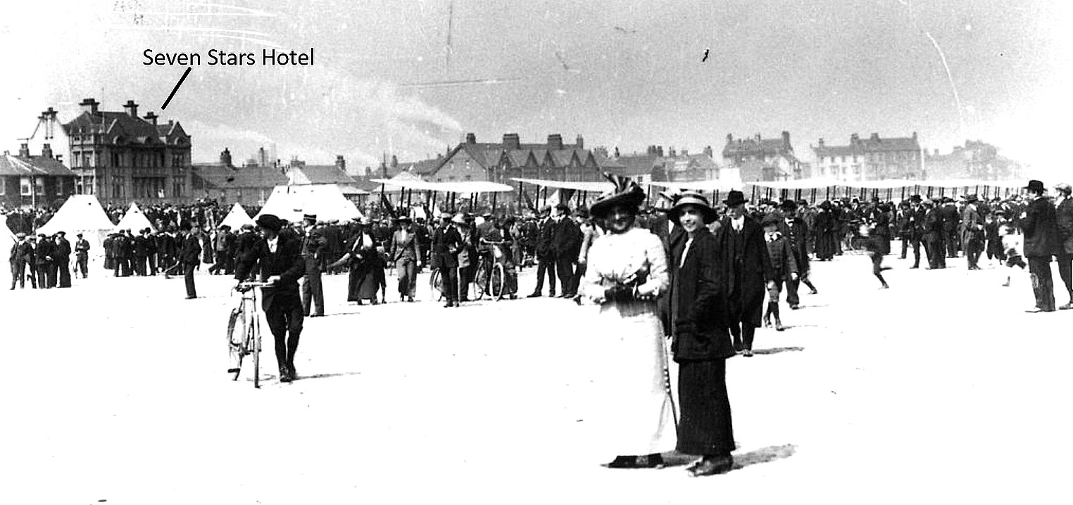
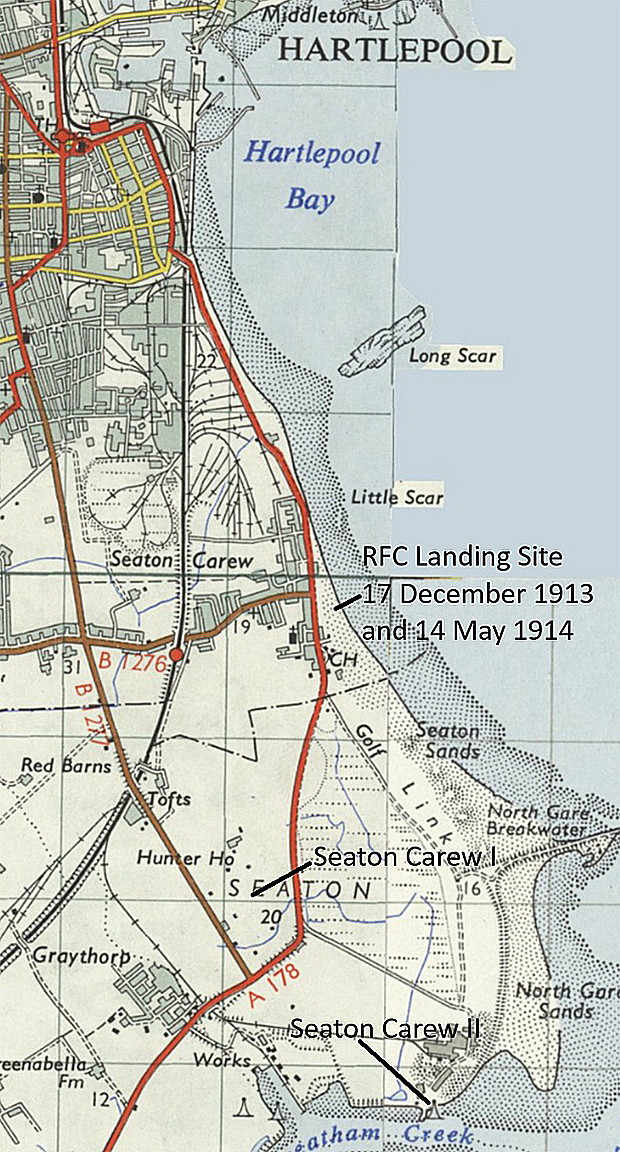
Photo Four is also from Hartlepool History.
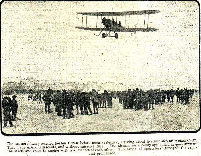
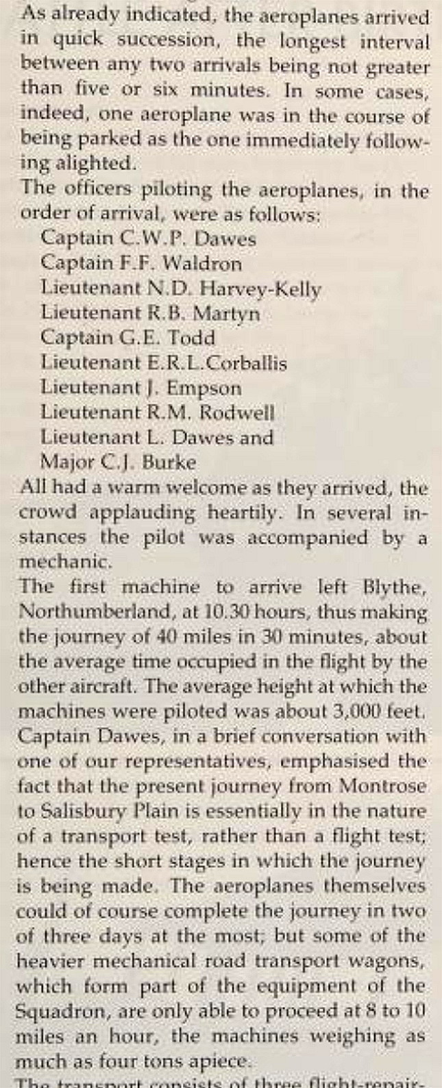
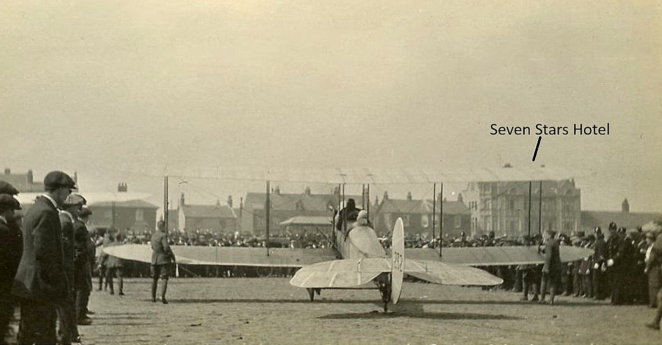
Photo Five is from the Northern Echo published on the 15th May 1914.
The excerpt is from Second to None, the history of No.2 (AC) Squadron, Royal Air Force, by Haris Onderwater. Photo Six is once again from Hartlepool History.
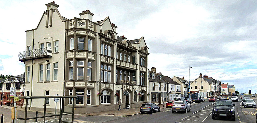
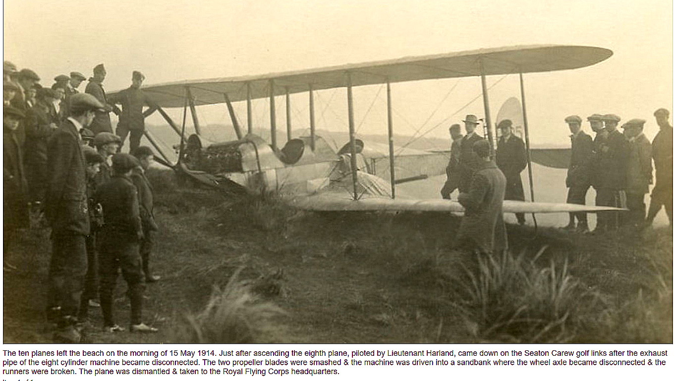
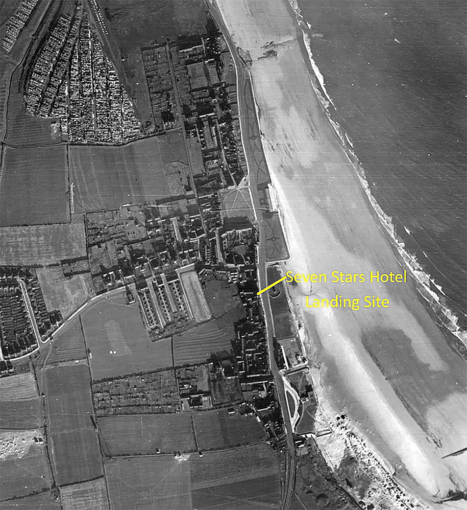
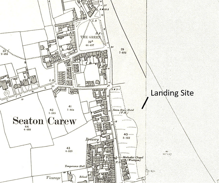
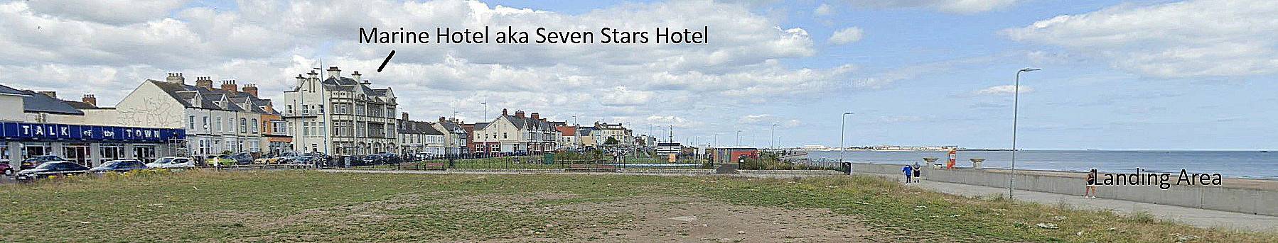
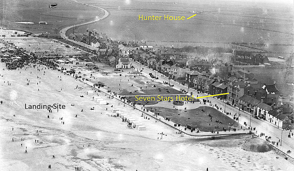
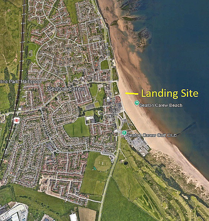
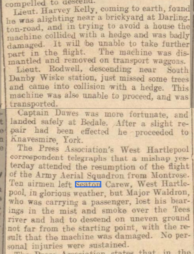
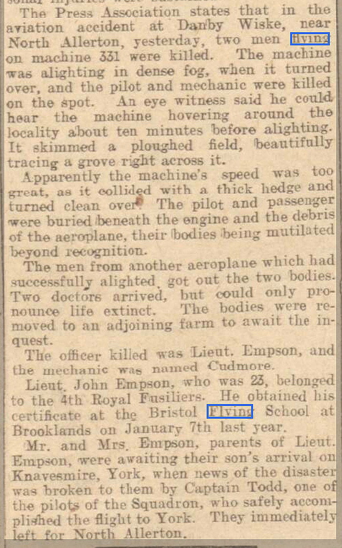
The Google Street View is of the Marine Hotel, previously the Seven Stars Hotel. Photo Seven shows the BE2c that Lt. Hartland pranged after engine failure shortly after taking off from the beach at Seaton Carew.
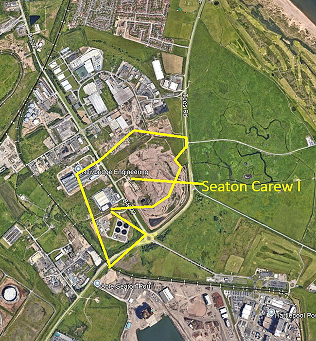
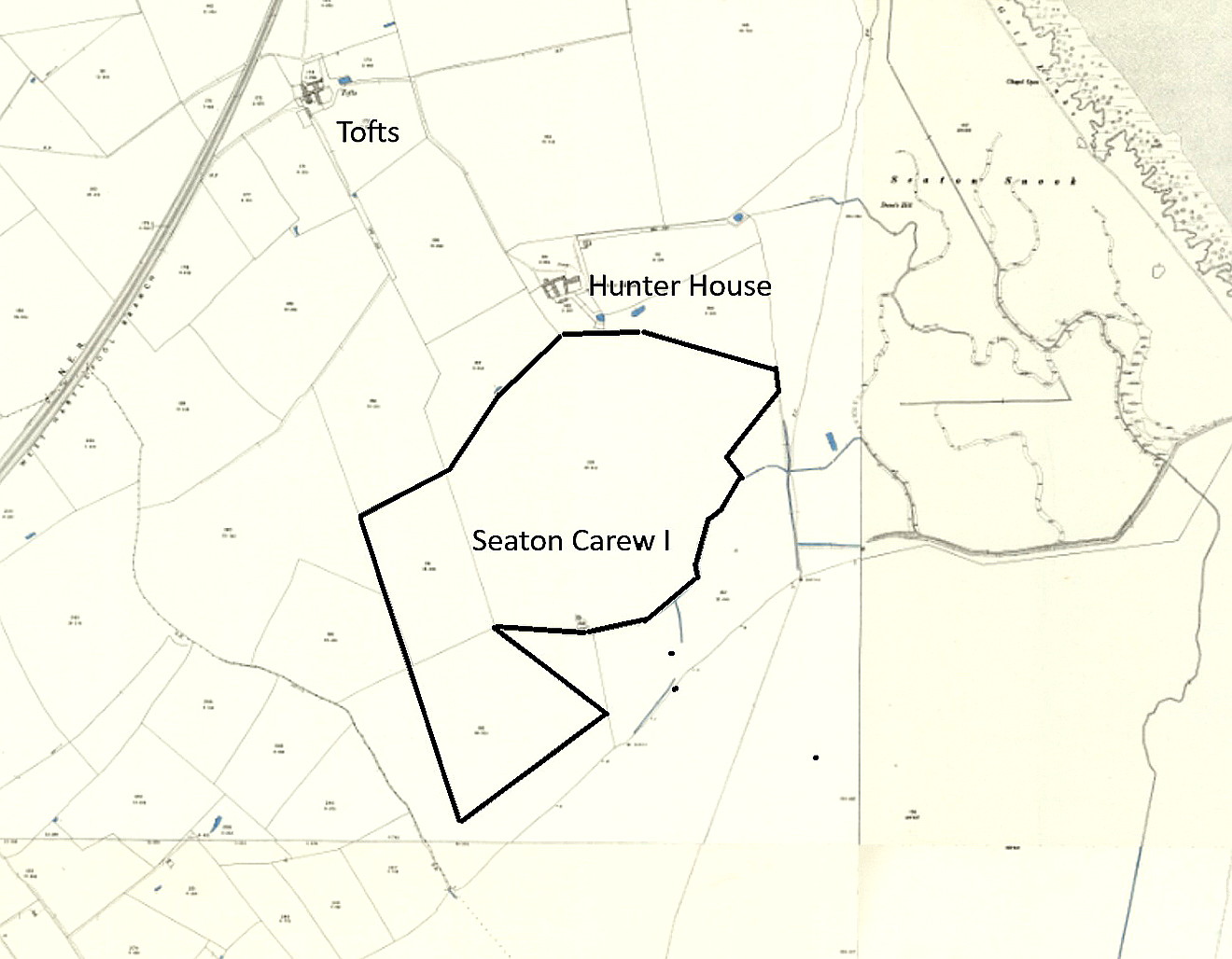
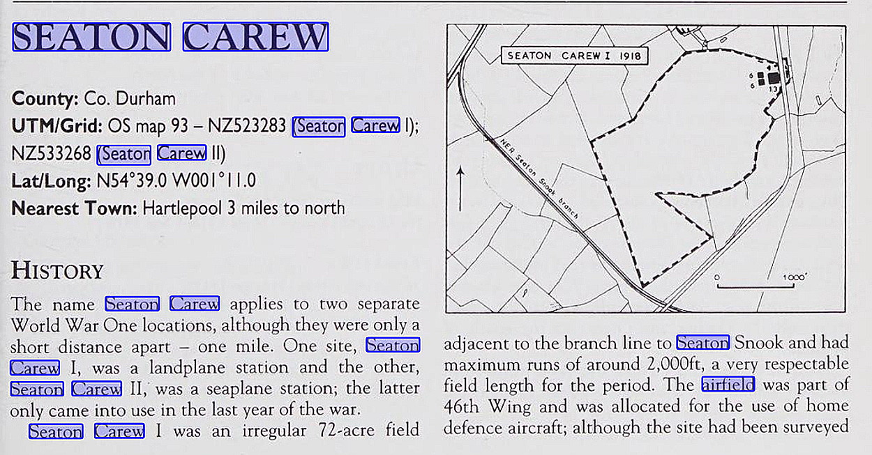
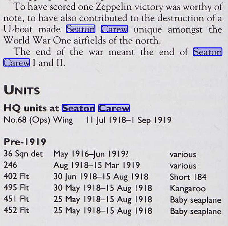
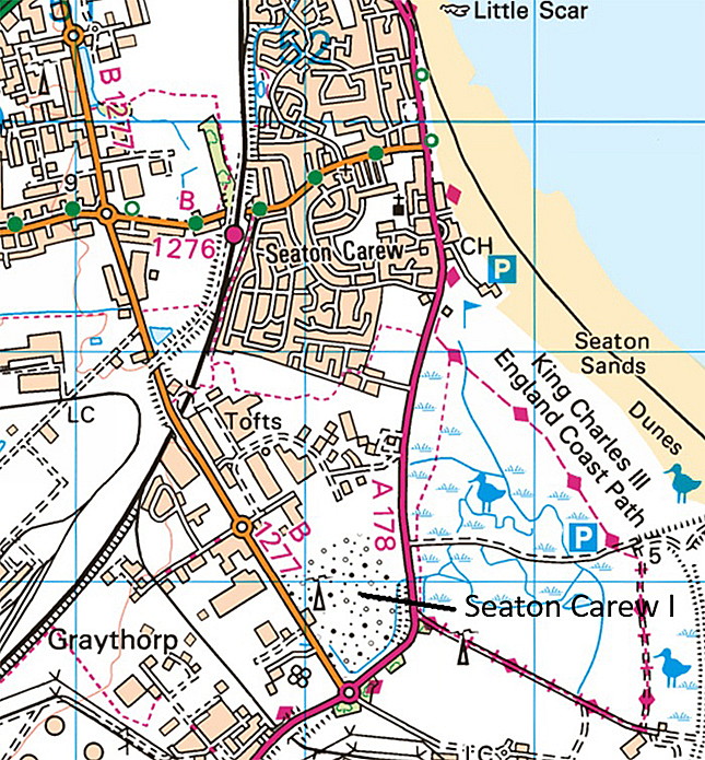
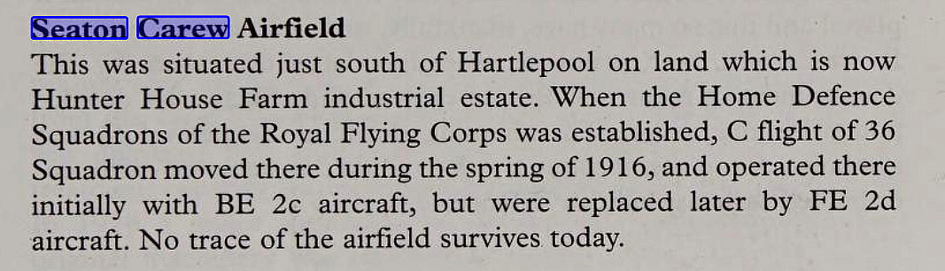
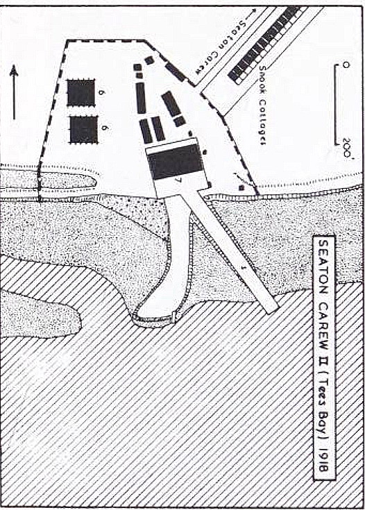
SEATON CAREW: Military aerodrome
Note: Both of these pictures were obtained from Google Earth ©
Military users: RFC/RAF Home Defence Flight Station
36 Sqdn (B.E.2c’s & B.E.12s) 1916 to 1919
RAF Marine Operations Station 1918 to 1919
Location: On/near Tofts Farm West Industrial Estate, W of the B1277, N of Graythorp, roughly 2nm SSE of Hartlepool town centre?
Period of operation: 1916 to 1919
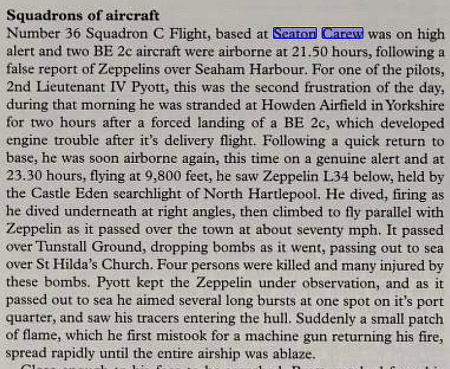
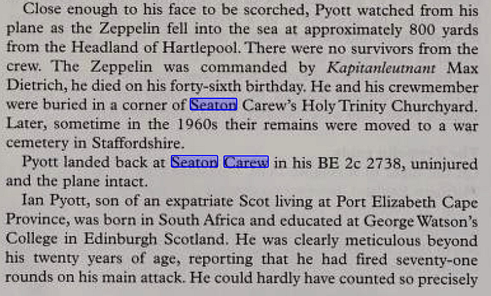
Site area: 72 acres 549 x 731
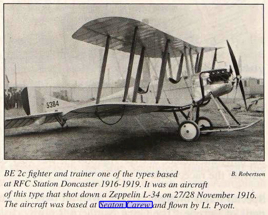
NOTES: It was from here in November 1916 that Lt Pyrott destroyed Zeppelin LZ34 which crashed into the mouth of the River Tees. The next recorded action by 36 Sqdn seems to be an unsuccessful attack on Zeppelin L42 over Hartlepool on New Years Day 1918. But, did this action also take place from SEATON CAREW? This sounds to me like a very boring job for 36 Sqdn patrolling the night skies looking for Zeppelins between Whitby and north of Newcastle. No doubt the pilots would disagree these days, telling me that flying around at night, with no electrical system for lighted instruments, in most weathers, freezing cold at altitude, cannot be described as being boring! However, it was usually a very tedious task just trying to stay alive!
THE MICHAEL T HOLDER GALLERY - PART TWO
I was surprised to hear that there is still some debate regarding where this aerodrome was situated. However, with much help and research, I am happy to place it here.
This article in five parts is from Military Airfields of Britain, Northern England, by Ken Delve.
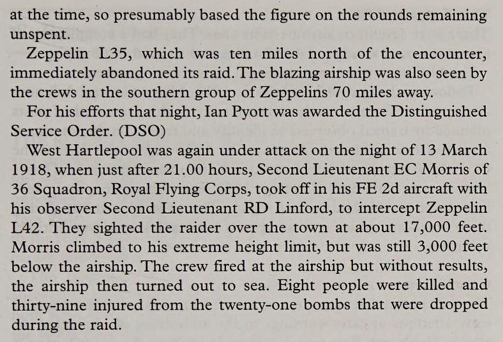
SHOOTING DOWN A ZEPPELIN
It may seem hard to believe, especially after the public coping so well with the Blitz in WW2, just how much fear was created by just a few bombing raids over England by these giant airships, which, mostly, caused very little damage and injury by comparison. So, when one was attacked and brought down by a single light fighter aircraft with a very brave pilot, it was a cause of much celebration.
Excerpt One is from Aspects of Teeside, discovering local history. The Photo One is from Aviation in Doncaster, 1909 to 1992, by Geoffrey Oaks. Excerpt Two is from Surviving the Skies by Joe Barnford.
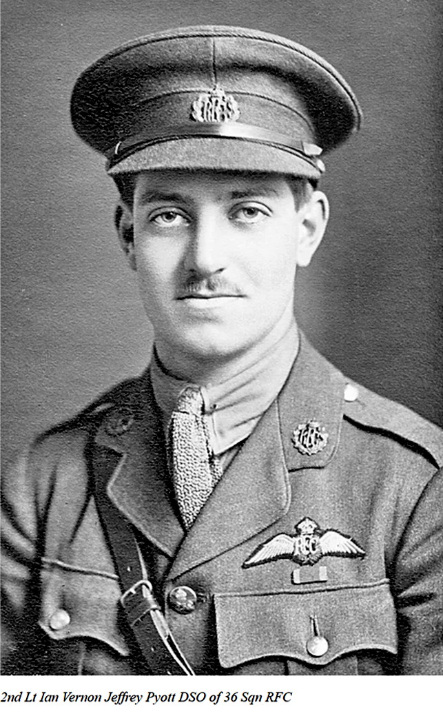
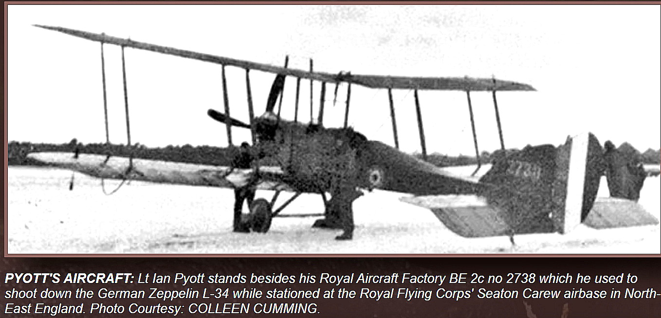
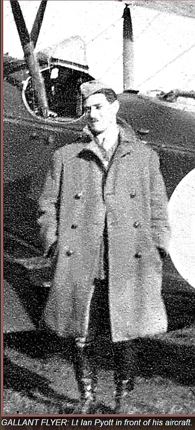
Photo Two is from the 36 Sqdn Aircraft Investigation web-site. Photo Three and Photo Four are both from the Ivor Markman web-site.
This article, in three parts, is from Aspects of Teeside - discovering local history.
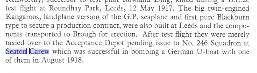
THE BLACKBURN KANGAROO
Certainly one of the contenders for the most ungainly bomber design of WW1? It was not a success.
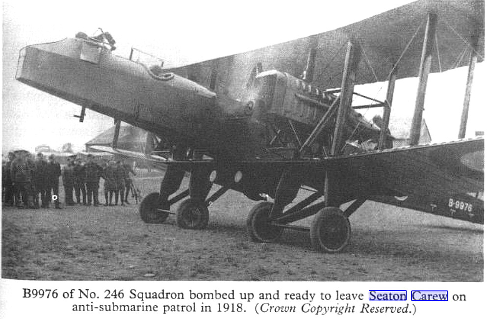
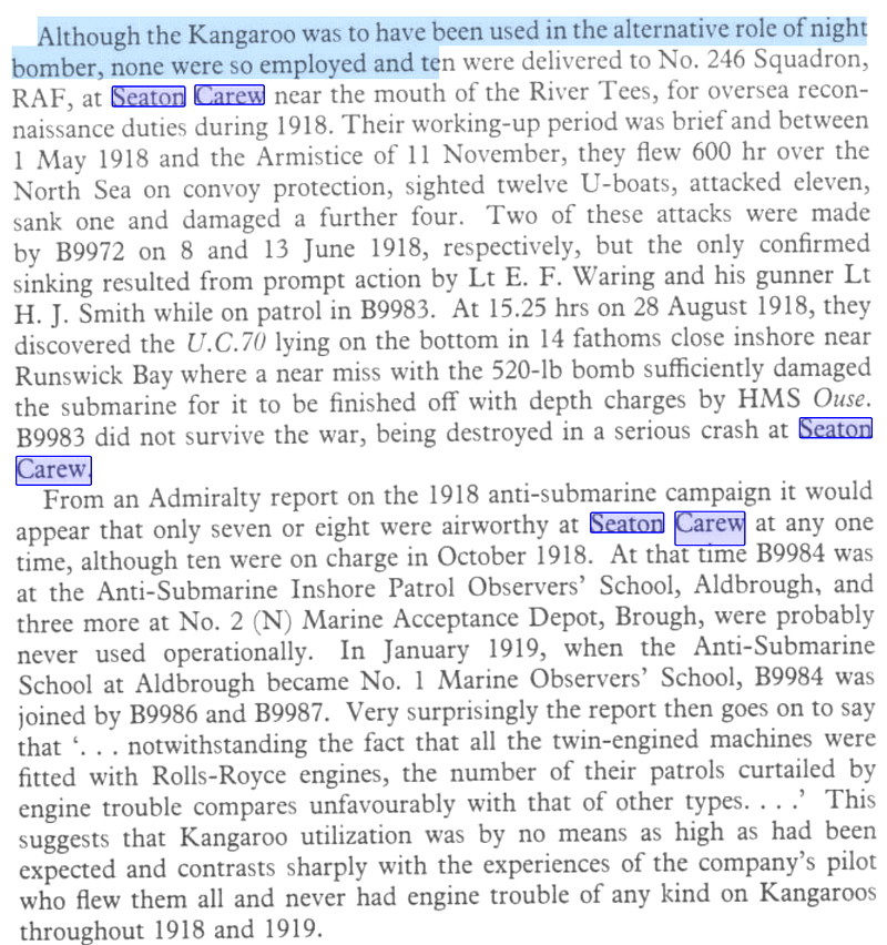
This three items are from Blackburn Aircraft by A Jackson.
SINKING A U-BOAT
For the British public the German U-Boat threat was of little interest. It was 'Zeppelins' they feared. Giant airships dropping bombs more or less at random over populated areas. But, even in WW1, more so in WW2 of course, the U-Boats were a distinct threat to our shipping supply lines and a lot of effort was made to deter them. This was a combined or joint operation, involving mostly the Royal Navy and the Royal Naval Air Service. Indeed, the rapid development of air-to-ground radio equipment and techniques were largely as a result of this.
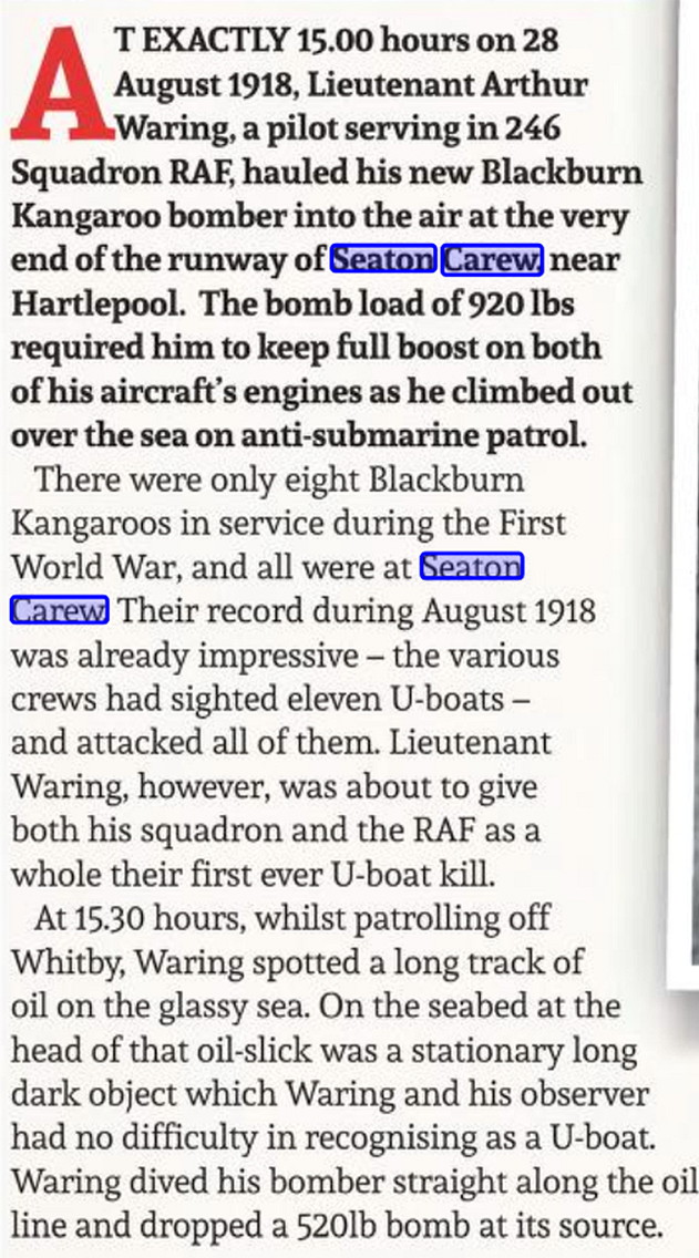
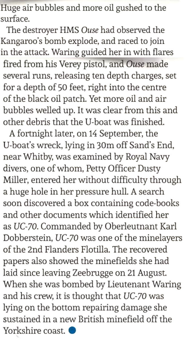
This article in three parts, is from the Britain at War books.
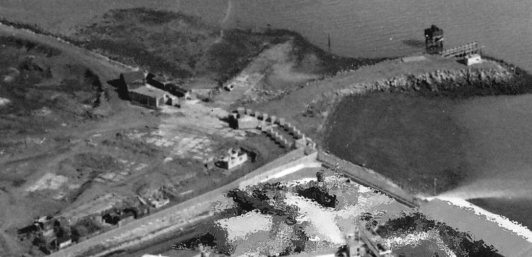
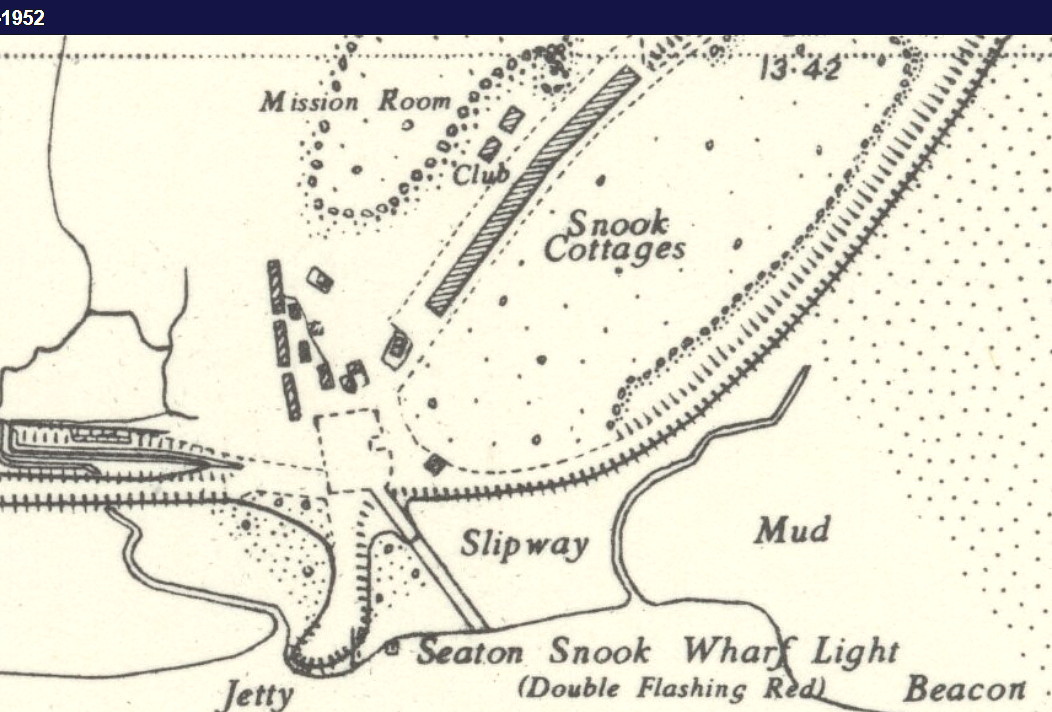
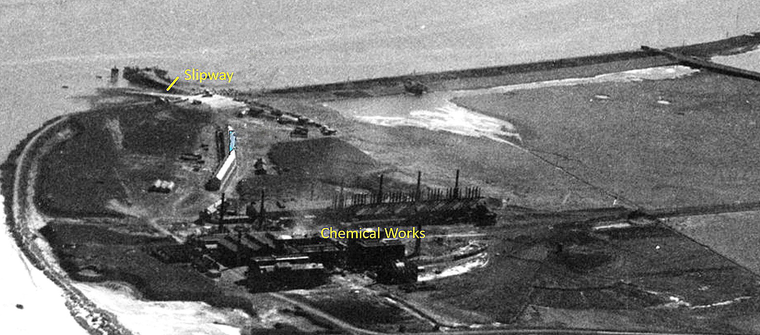
SEATON CAREW: Military Marine Operations Seaplane Station
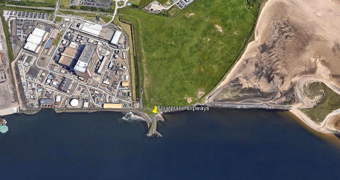
Note: This picture (2018) was obtained from Google Earth ©
Note: I have Mr Peter Edwards to thank for these. (See 'Comments' below).
Military users: RNAS/RAF (Royal Naval Air Service & Royal Air Force)
Location: Just SE of a power station. (Many WW1 flying sites later became power stations) On the north bank of the Seaton-on-Tees Channel leading into Tees Bay. About 3.5nm or more, SSE of Hartlepool town centre
Period of operation: 1917 to 1919
Site area: 7 acres
NOTES: Many years ago I made this comment. "Today a slipway is shown on O/S maps on the extreme SE corner of the power station site. Could this be the same slipway used by the RNAS & RAF in WW1?" As it turns out, I was correct. But, incorrectly captioned the Google Earth picture above as having slipways. There was only one. As experience has since taught me, interpreting pictures can be tricky.
THE MICHAEL T HOLDER GALLERY - PART THREE
IN CONCLUSION
So, dear reader, I do hope you find this listing of some interest. It certainly has been for me. Indeed, the task goes on of trying to provide, as said with a great deal of help, a 'Guide' to our flying sites. It is of course an impossible project that can never be finished, (until our world ends of course), but at least a start has been made.
When I started this project, now over twenty fives years ago, I thought I knew a thing or two about our aviation history. And, was spot on as it turns out. I did indeed know a thing or two - but nothing more! Indeed, my education proceeds week by week for most of each year when at home. Just wish I could remember most of it.
Peter Edwards
This comment was written on: 2018-12-26 22:26:51The airfield would have been outside the Power Station perimeter. The whole of the power station land was mud and pools in the 1960s and was raised from +5ft to +16ft before the station was built. The area to the east had been reclaimed by 1915 by creation of slag walls in the period 1850 - 1900. The remains of the slipway are still present but much decayed. The area contained a row of houses and a school and a number of fishermen's huts, two remain but are decayed, later the area was the dump site for the chemical works, and was covered over in the 1980's with soil. 7 acres is a small parcel of this reclaimed land, now used to graze horses. The slipway is accessible at low tide but the area is sticky mud and decayed slag.
We'd love to hear from you, so please scroll down to leave a comment!
Leave a comment ...
Copyright (c) UK Airfield Guide
