


Sedgewick Park
SEDGEWICK PARK: Private airstrip
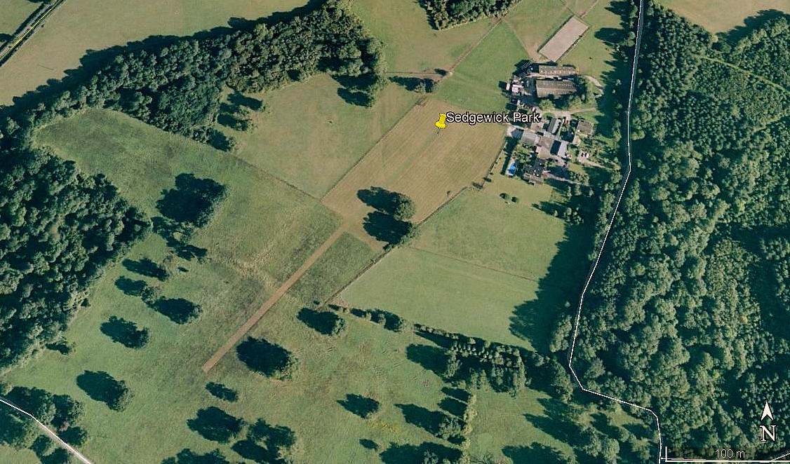
Aerial view 2001
Aerial view 2005
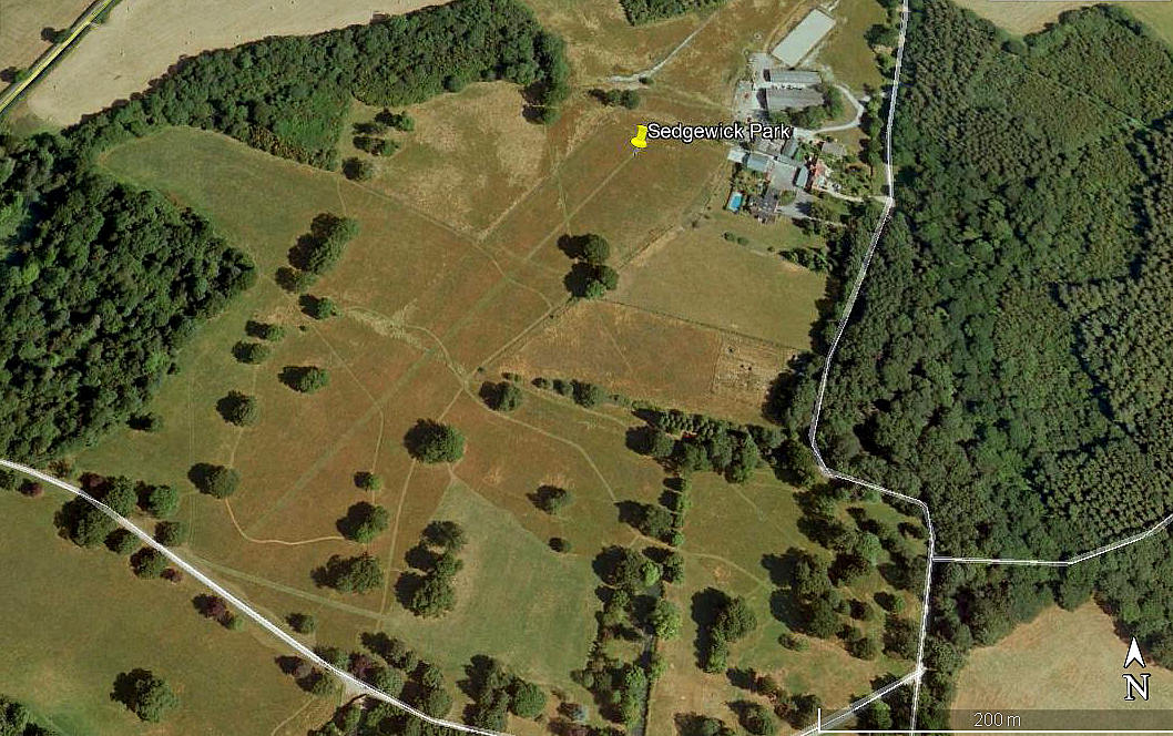
Aerial view 2012
Aerial view 2012
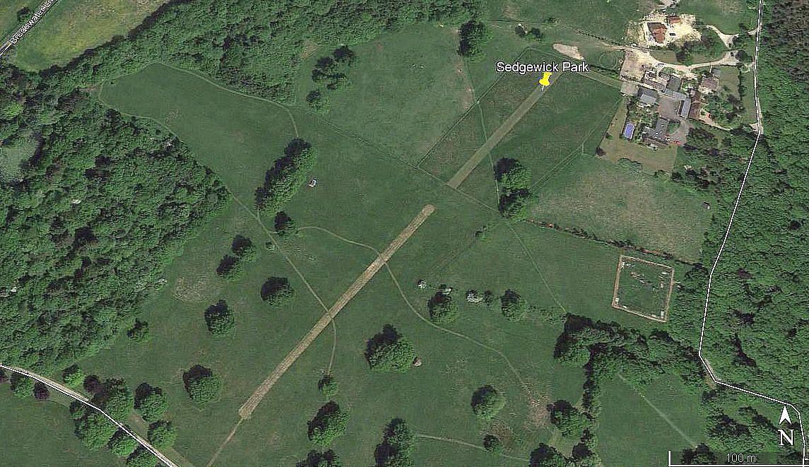
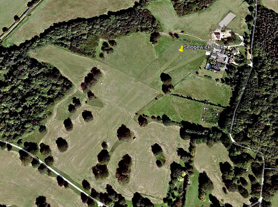
Aerial view 2013
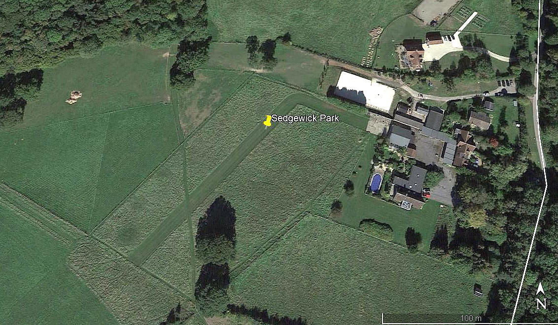
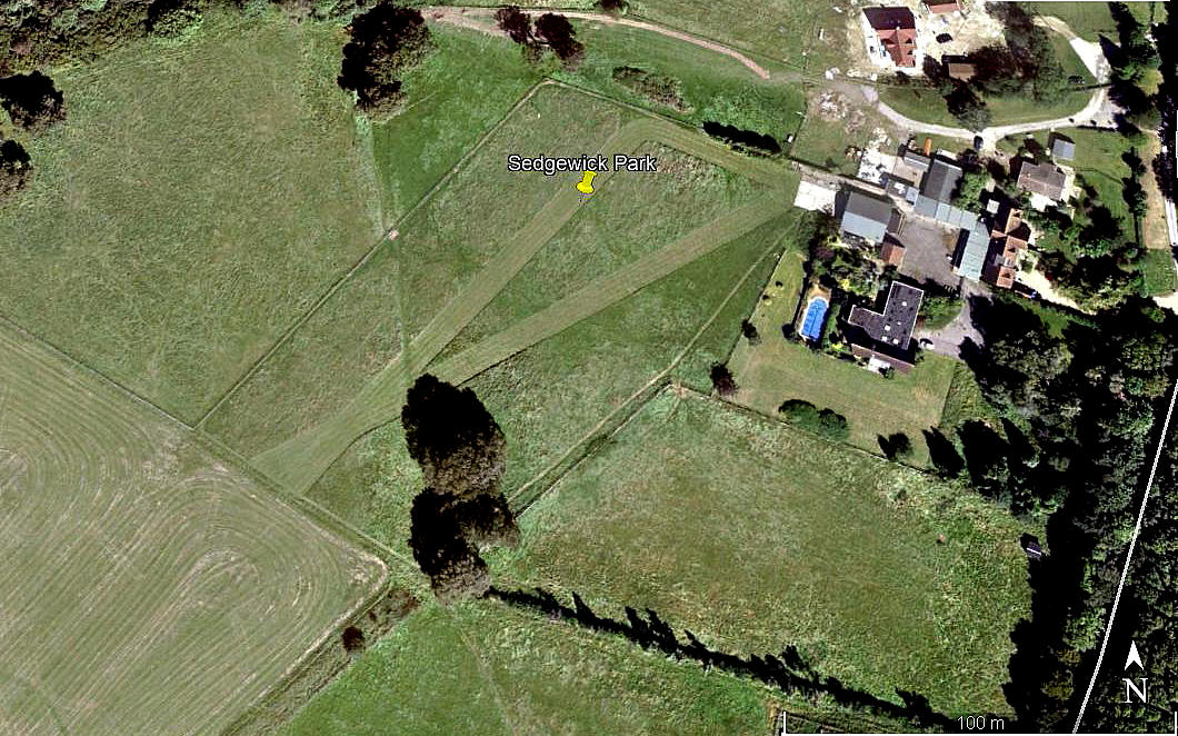
Aerial view 2018
Note: These six pictures were obtained from Google Earth ©
Location: About 2nm NE of Southwater and roughly 2nm SSE of Horsham town centre
Period of operation: 1990s (?) to -
Runway: 04/22 grass (Varied in length)
2001: 340 metres 2012: 400 metres 2018: 150 metres
Note. The 2012 picture shows another runway orientated: 06/24 170 grass
I have never seen anything like this before; in the 2013 picture there are two quite seperate runways in line with each other.
NOTES: If anybody can kindly offer more advice and information, this will be most welcome.
We'd love to hear from you, so please scroll down to leave a comment!
Leave a comment ...
Copyright (c) UK Airfield Guide
