














Selsey
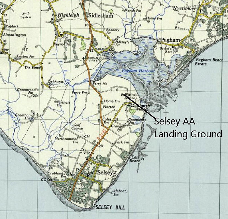
SELSEY: A.A. (Automobile Association) Approved Landing Ground, later WW2 Advanced Landing Ground
IMPORTANT NOTE: When I first made a listing in this 'Guide', many years ago, for the WW2 ALG, I had no idea that part of this, at the eastern end, was previously an A.A. approved Landing Ground. Discovering this, thanks to Mike Holder in 2023, has meant a major re-write of this listing, and the latest version was completed in July 2026. Who knows (?), possibly more to come?
Location: A.A. Landing Ground just N of Church Norton village, the WW2 ALG mostly W of Church Norton. Roughly 5nm S of Chichester city centre
Period of operation: A.A. Landing Ground 1932 until 1939?.
WW2 ALG: 1943 to 1945? (Might have been a shorter period?)
A MICHAEL T HOLDER GALLERY
We have Mike Holder, a great long-term friend of this 'Guide', to thank for investigating this location and providing the maps and pictures. In effect the subject can be easily divided into two seperate eras, the 1930s and WW2. But.....not one to leave any 'turn unstoned' he has also discovered what is probably the very first example of an aviation related incident concerning SELSEY.
AUGUST 1913
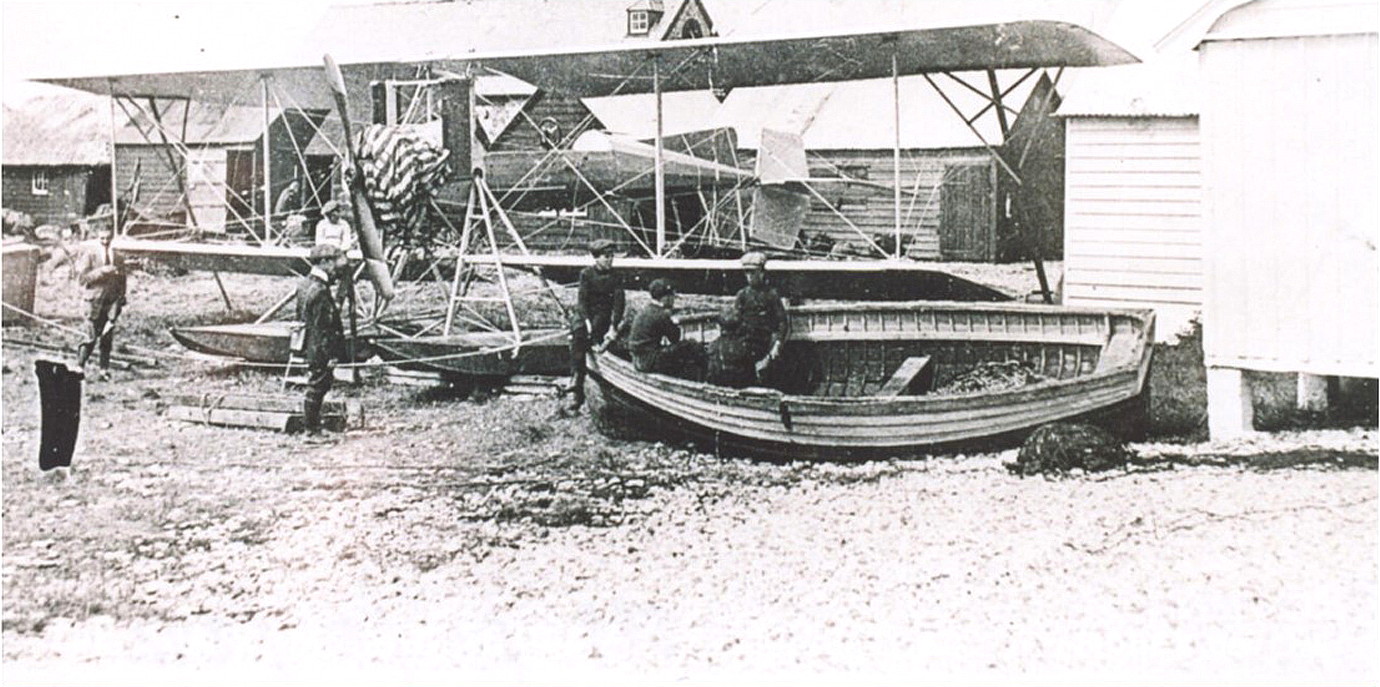
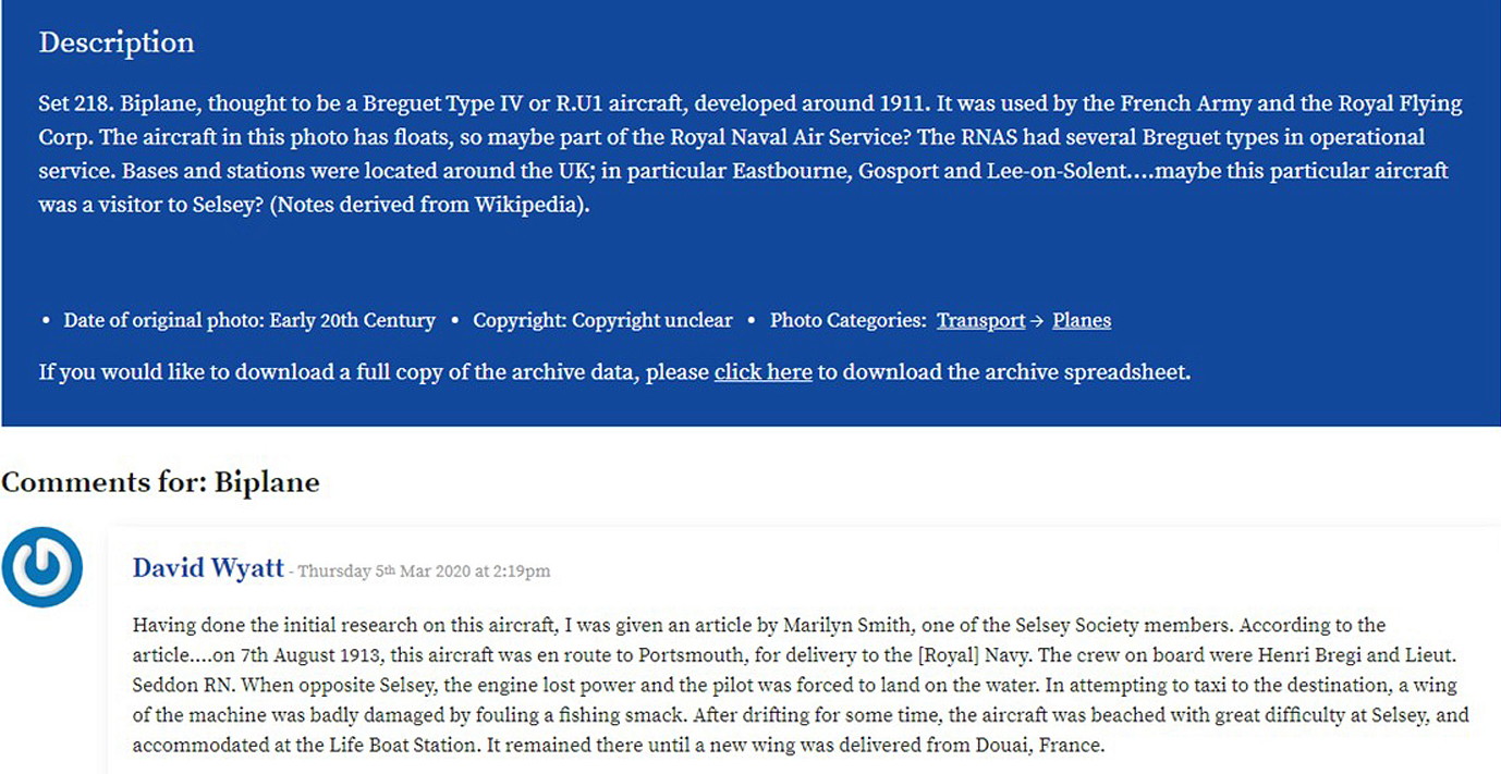
These items were obtained from the Selsey Photo Archive.
1930s
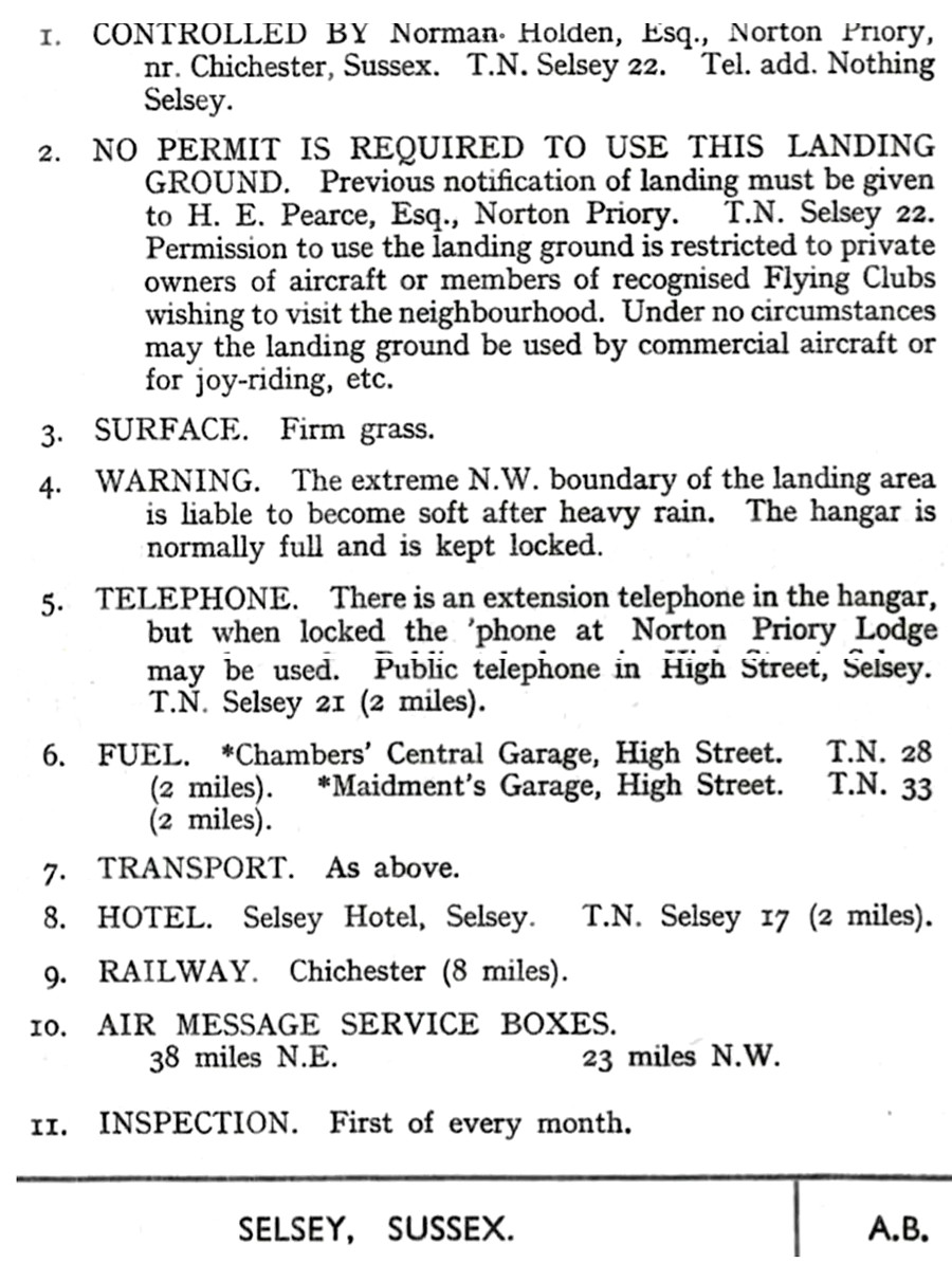
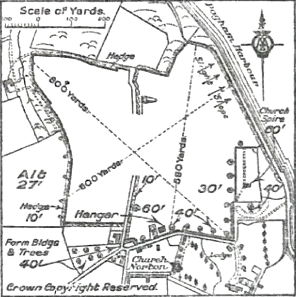
A.A. Approved Landing Ground from 1932 . Situated just north of Church Norton village. No doubt closed in 1939 when WW2 was declared?
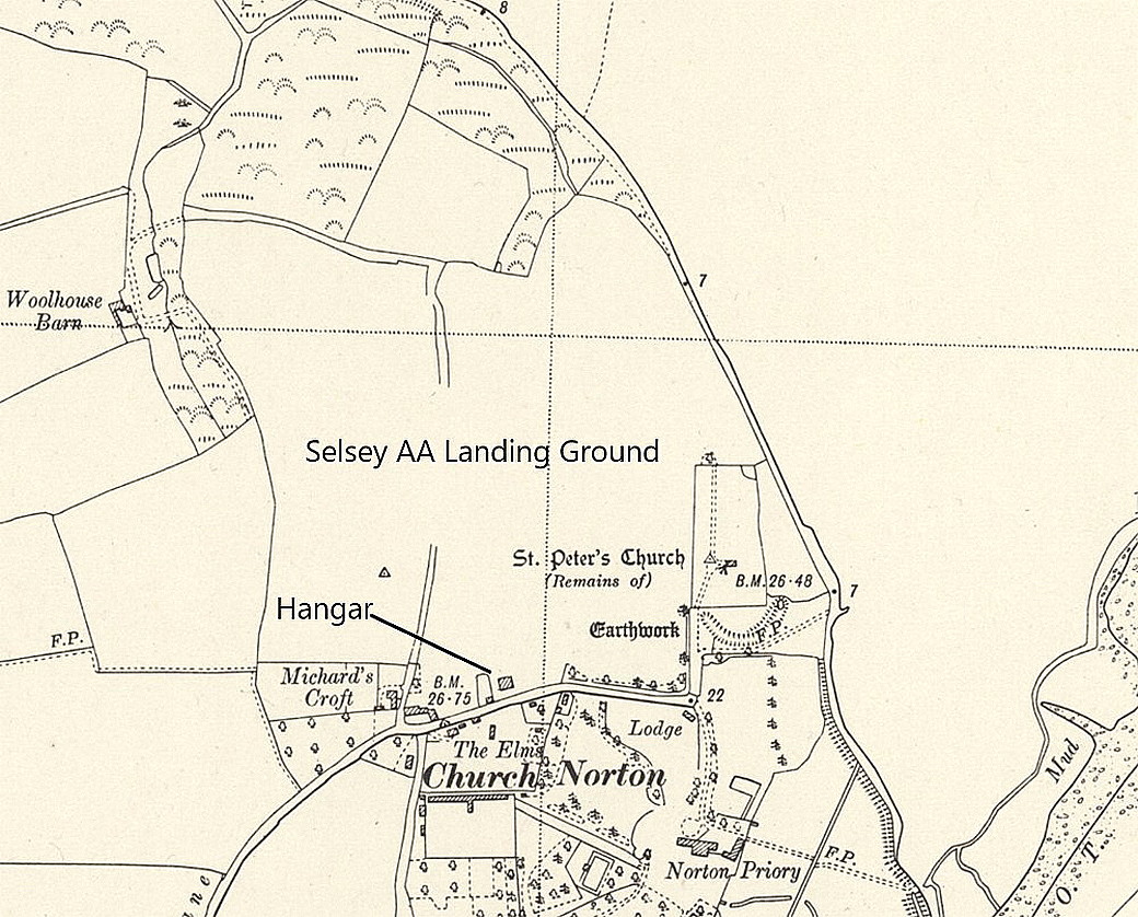
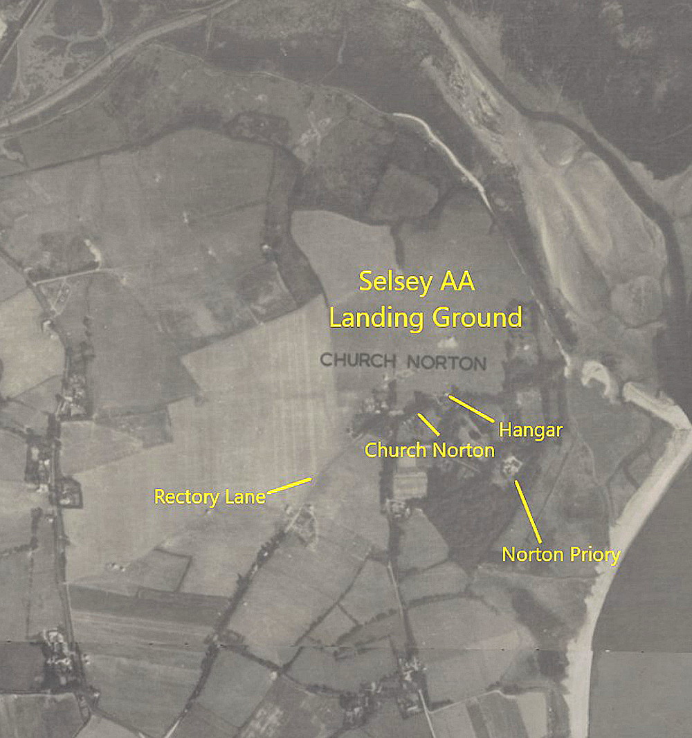
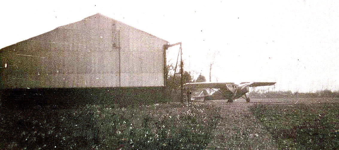
The photo was obtained from the Selsey Photo Archive. I have no idea if the aircraft in this picture is a DH.80A Puss Moth or a DH.85 Leopard Moth, or if it was based here or just visiting.
A COUPLE MORE ITEMS
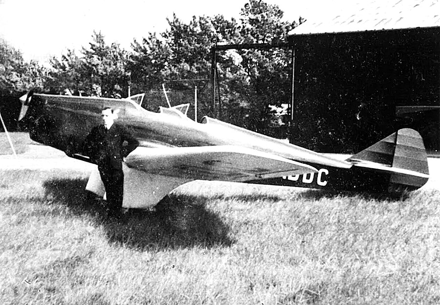
This photo of the Miles M.2H Hawk Major G-ADDC was acquired from the Destination Selsey web site. It was registered, brand new, to Capt. (later Major), J.C. Hargreaves from April 1935 until October 1936. It has been captioned as having Capt. Hargreaves standing in front, but I have seen correspondence by his son refuting this. He then said it was sold abroad, but it wasn't, going instead to Mr Leslie C. Lewis who based it at BROOKLANDS from 16.10.36 until September 1937 when it was then sold abroad.
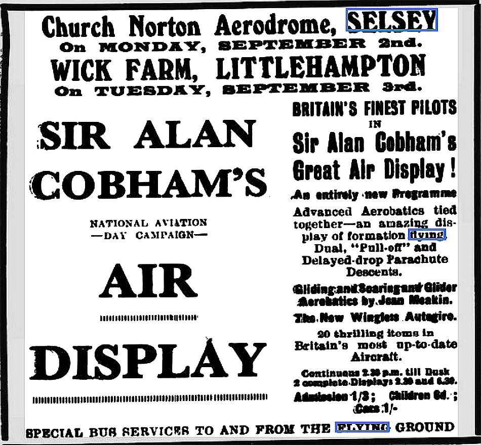
This advert was placed in the Chichester Observer on the 21st August 1935. The display on the 2nd September was the 63rd planned venue for the No.1 Tour. The Tour started at Titchfield Road, Fareham in Hampshire on the 12th April and, had 72 venues planned until it split into two Tours on the 1st July. The No.1 Tour having 88 venues planned and the No.2 Tour 84, giving a total of 244. It was the last of the National Aviation Day series of Tours arranged by Sir Alan Cobham and his company, the first being in 1932.
WW2 and the ALG (Advanced Landing Ground)
As I understand the situation, these ALGs, around southern England, were prepared in advance for the D-Day Landings which commenced on the 6th June 1944. It was a truly massive undertaking and the sheer amount of planning involved was astounding in itself.
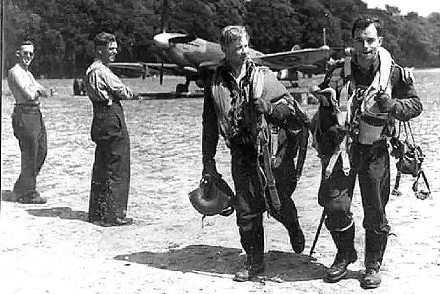
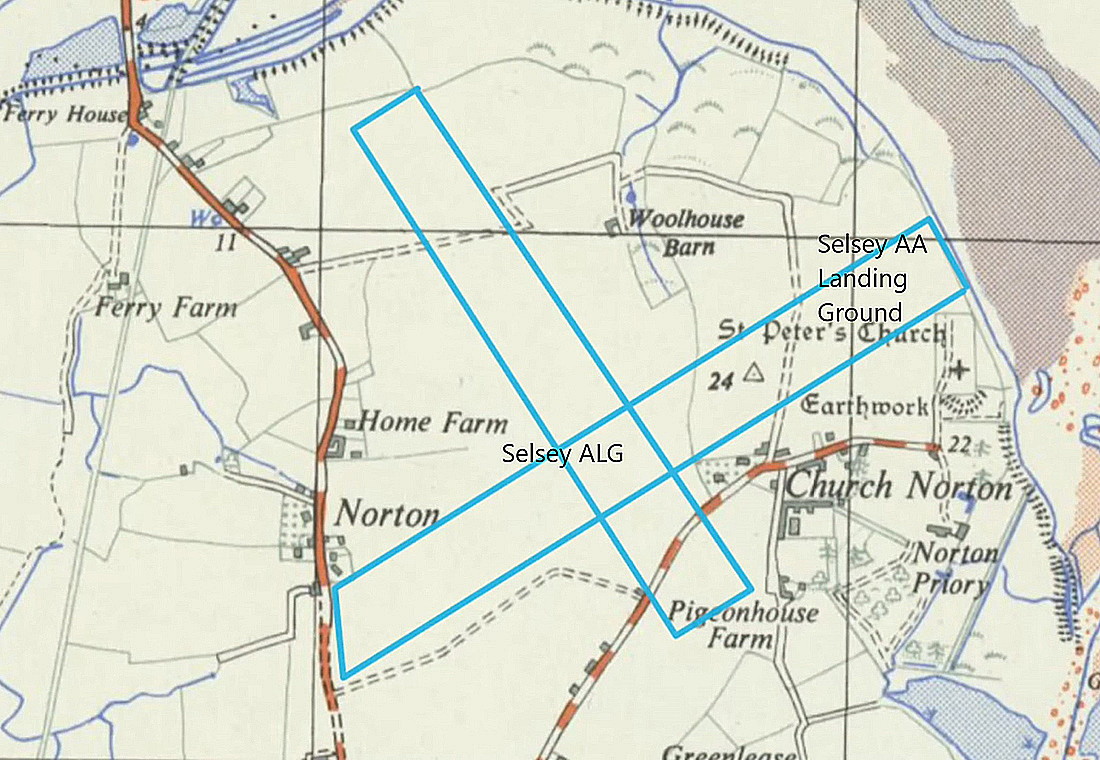
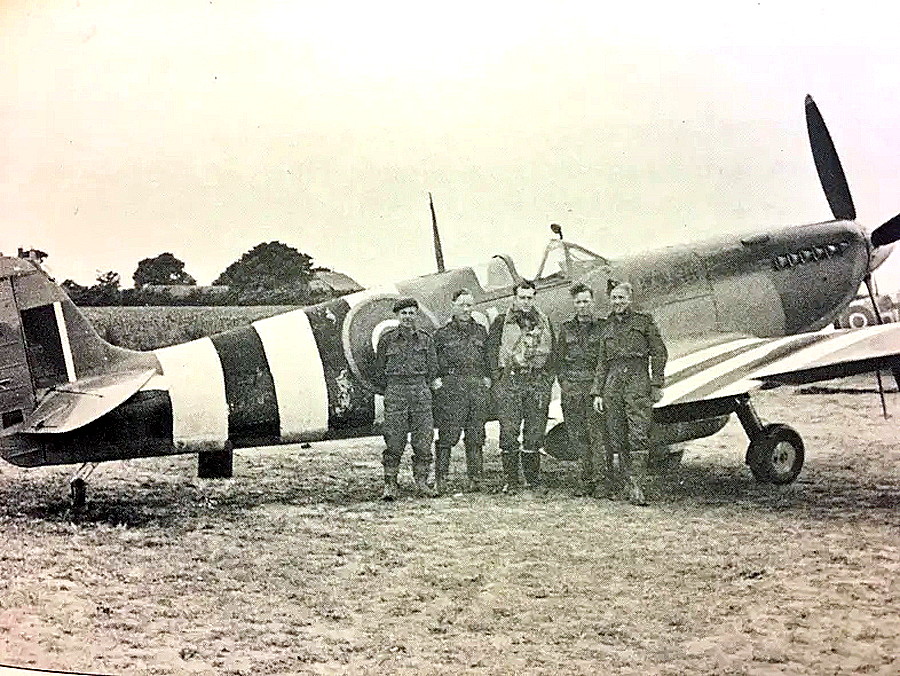
Photo One and Photo Two were obtained from the Destination Selsey web site. The Spitfire in Photo Two is a Mk.IX.
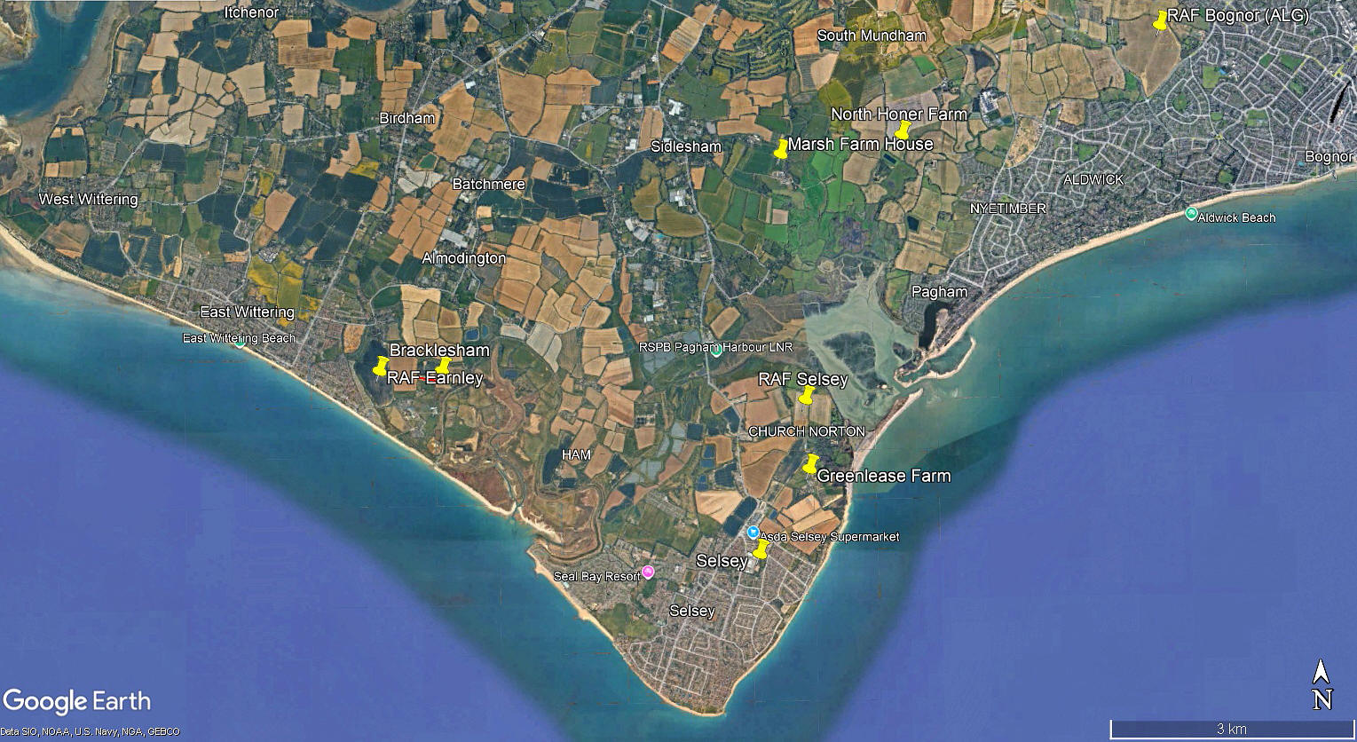
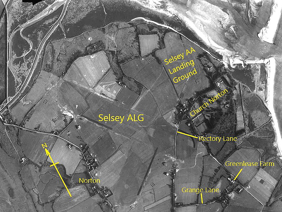
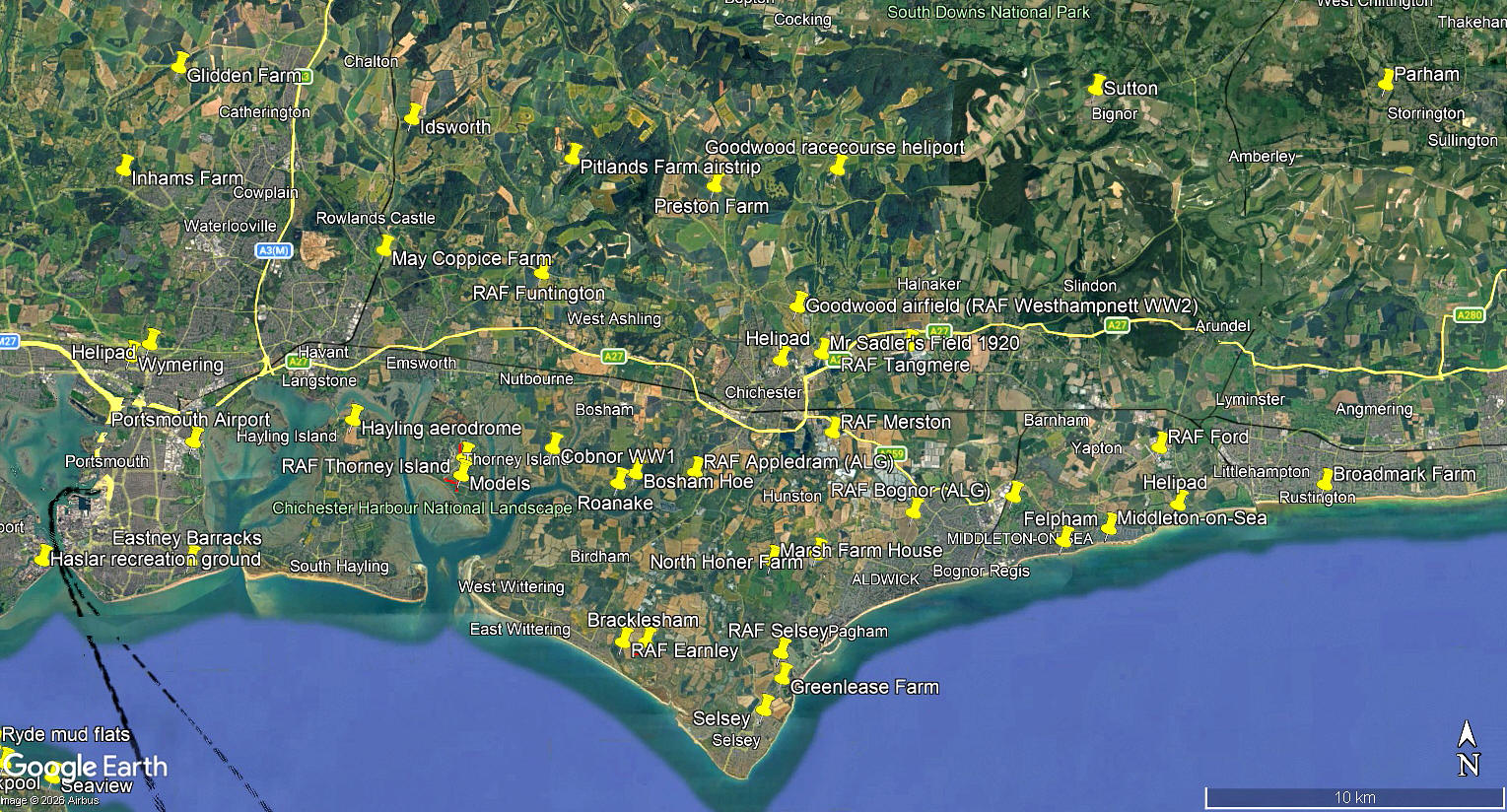
The local area and area views are from my Google Earth© derived database. Note how well the runways were disguised in the 1944 photo, despite the chances of any aerial attack by the Luftwaffe in those days being slim to nil?
NOTES: In June 2019 I was very kindly contacted by Martin Humphry. As a young lad he lived in a house, now The Pink Cottage Nursery on the B2145 Chichester Road.
In those days none of the buildings we see today existed and they had a clear view of the airfield. Martin told me he has vivid memories of watching the light aircraft operating. These were without too much doubt, USAAF Piper L-4 Grasshoppers, although they might have been Stinson L-5 Sentinels - or a mixture of both.
David Crowhurst
This comment was written on: 2020-03-06 17:43:01Hi there, I was birdwatching in Pagham Harbour with a group earlier this week and someone reminded me that there was an ALG in the area so I looked at my copy of "Action Stations, Vol. 9 - Military Airfields of the Central South and South-East". In that volume the ALG is described as being where you have placed RAF Selsey, i.e.between the B2145 and Rectory Lane, Church Norton. I don't think there was a second airfield and I can only think that Martin Humphry's memory must be playing tricks on him. As there were far fewer buildings in the vicinity during the war he probably could see right across to the airfield which I have just described. However, I should be interested to hear your thoughts. Regards, David Crowhurst PS - The Action Stations series give a very good account of this country's military airfields even though those airfields which were still operational when the books were published in the 1980s are, in many cases, now no longer operational.
Dick Flute
This comment was written on: 2020-03-06 21:20:58Hi David, I am quite happy that Martin's memories are correct. 'Action Stations' does not cover airstrips, (British and U.S.), and aircraft storage sites. Best regards, Dick
Martin HUMPHRY
This comment was written on: 2020-03-29 21:53:31Martin would like to reassure David that that his memory is very much intact despite his advancing years. Selsey ALG was situated between Rectory Lane and Chichester Road to the west , ‘Blythe Cottage’ however, (his grandmother’s house) which stood opposite, what is today, the ‘Old Piggery and Farm Shop’, on Chichester road, was demolished as it was considered a safety hazard for aircraft take-offs and landings. Before the decision was made, Martin remembers seeing, from an upstairs easterly window, Spitfires dispersed on the airfield nearby. When ‘Blythe Cottage’was pulled down, his grandmother moved to ‘The Elms’, now the ‘Pink Cottage day nursery’ opposite the entrance of ‘Golf links Lane’. From his new ‘upstairs bedroom easterly window’ Martin could plainly see the ‘Grasshoppers’, mentioned by Dick, operating from a grass strip to the SSE. The strip would have been approximately where Mountwood road is today. Martin also witnessed, from the same viewpoint, the P47 Thunderbolt crash, as well as the Halifax which went down in flames, out to sea, off the east beach. He would be delighted to provide other details (in writing or over the 'phone),should one so wish.
We'd love to hear from you, so please scroll down to leave a comment!
Leave a comment ...
Copyright (c) UK Airfield Guide
