


Sparkhill
SPARKHILL: Temporary landing ground
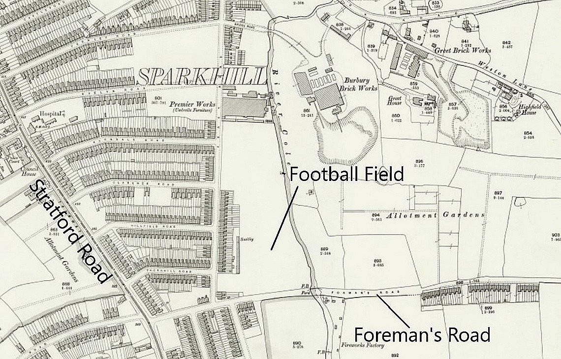
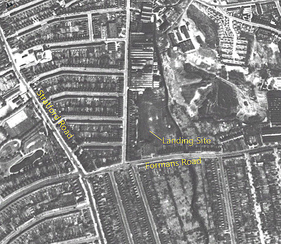
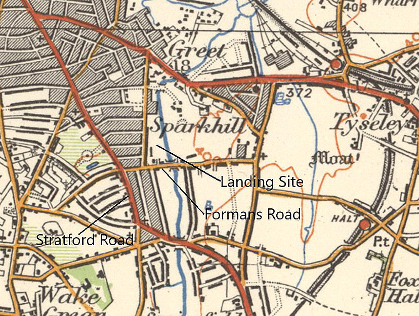
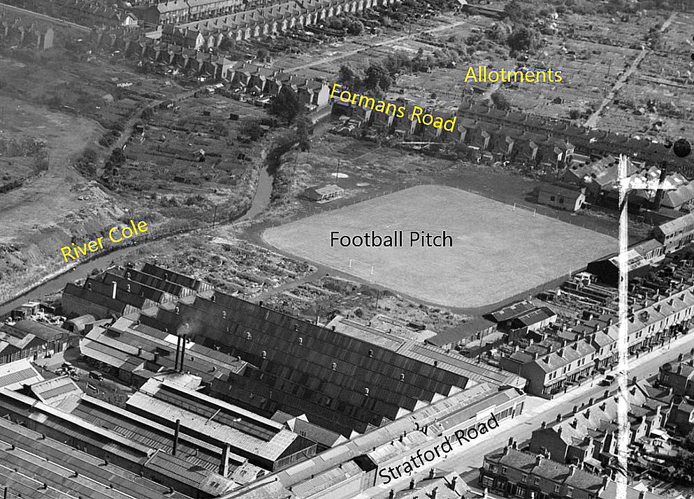
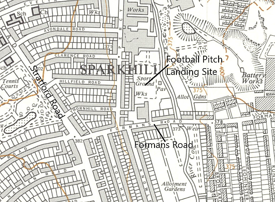
Location: Football field in Sparkhill, just NE of the junction of Formans Lane and the Stratford Road. Roughly 3nm SE of Birmingham city centre and about 3.5nm NE to NNE of Bourville
Period of operation: 17th April 1911
NOTES: The Birmingham Aero Club had invited Claude Grahame-White to open their aviation model exhibition in Bournville, so he decided to fly up in his 50hp Gnome powered Farman.
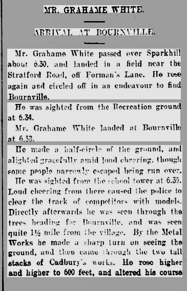
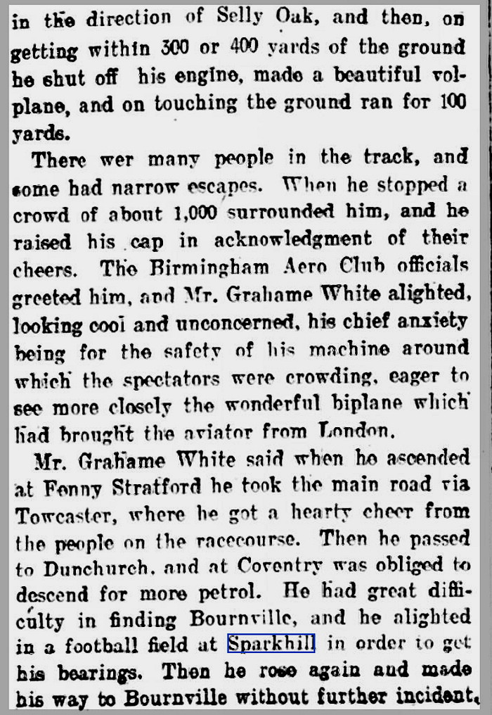
Leaving HENDON at 05.45 he followed the railway from Harrow to FENNY STRATFORD where thick mist forced him to land. See the listing for DRAYTON PARSLOW for much more information. Not least because he caused some damage to his airframe on landing. Setting off again at 16.15 he routed via Bletchley, Towcester and WHITLEY COMMON, (some sources state DUNCHURCH), where he landed briefly to acquire more petrol. Reaching the outskirts of Birmingham he landed on a football field in SPARKHILL to ask directions to BOURNVILLE where he touched down at 18.35.
A MICHAEL T HOLDER GALLERY
In September 2023 Mike Holder, a great friend of this 'Guide', took it upon himself to trace this site - and succeeded.
The article, in two parts, was published in the Birmingham Mail on the 17th April 1911.
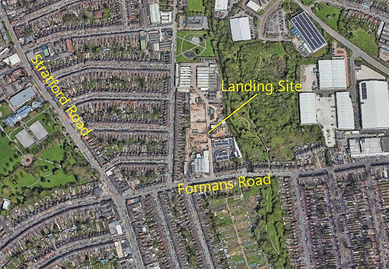
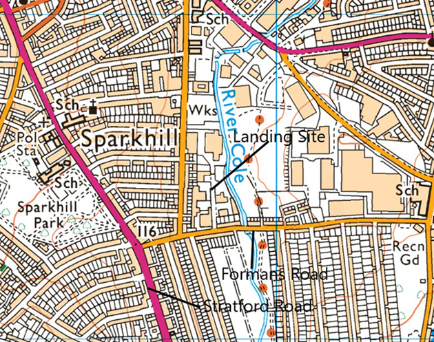
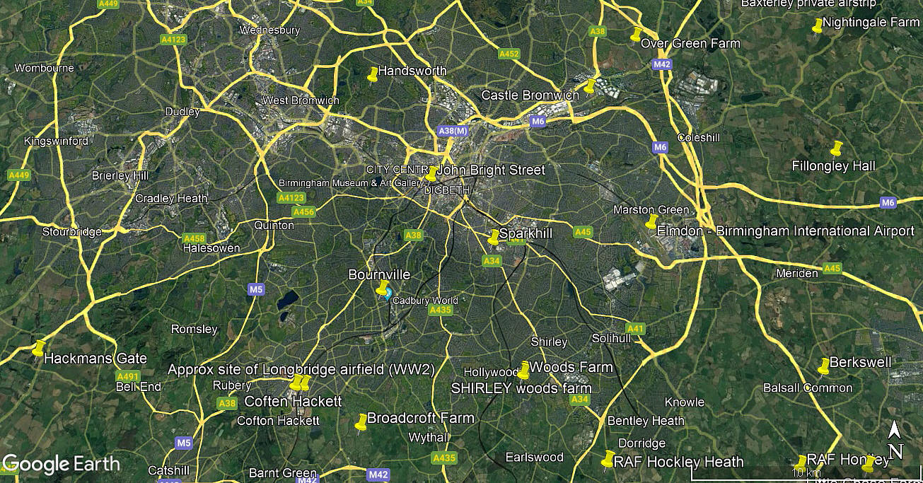
The area view is from my Google Earth © derived database.
NOTES: In those days a flight of this duration was almost impossible to achieve, even in the best of weather conditions. They had no instruments and, sitting out in the open, map reading was not an option. So navigation was rudimentary at best, more guess work and luck. The small fuel tanks restricted range so landing to pick up more was a common practice. Invariably willing help soon arrived, often with quite large crowds gathering to get a look at the amazing aerial contraption.
We'd love to hear from you, so please scroll down to leave a comment!
Leave a comment ...
Copyright (c) UK Airfield Guide
