


St Erth
Note: This map only shows the position of St Erth village within the UK. If anybody can kindly provide a more exact location, this will be much appreciated.
St ERTH: Civil regional airport
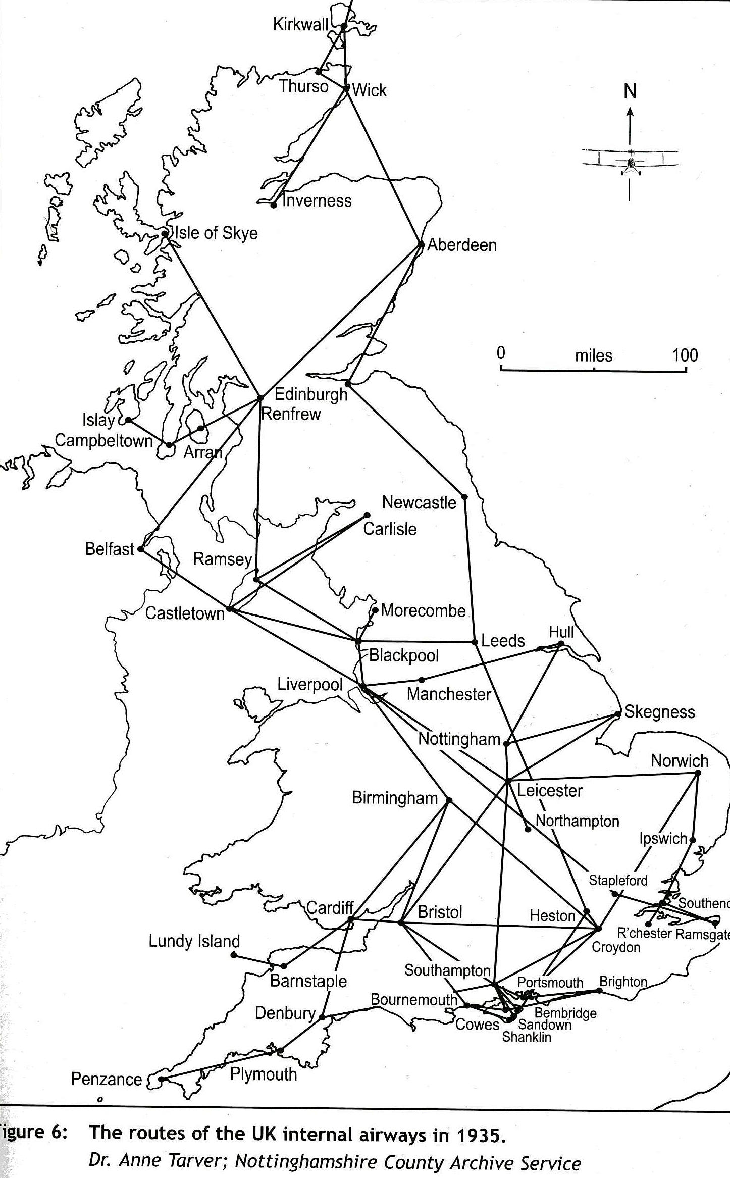

Notes: The first illustration was provided by Dr Anne Taver; Nottinghamshire County Achive Service. The second illustration was provided by Maurice J Wickstead which clearly shows Penzance as being on their route system.
This advert clearly shows that the list of destinations in the south-west of England given on the Wikipedia entry for Provincial Airways is incorrect.
NOTES: During 1935 Provincial Airways listed their Penzance destination as St ERTH Aerodrome. This was, it seems, the only year that Provincial Airways services extended this far west. In that year the services from CROYDON also called at Portsmouth, Southampton, Bournemouth, Torquay and Newquay.
But, looking at a map, why was St ERTH named as Penzance? It is much closer to Hayle and St Ives. I suppose the answer is that in those days, Hayle and St Ives had yet to arrive as desirable holiday destinations?
Was this 'airport' also the destination for Channel Air Ferries and Western Airways in the 1930s? If anybody can kindly offer advice on this subject, it will be much appreciated.
We'd love to hear from you, so please scroll down to leave a comment!
Leave a comment ...
Copyright (c) UK Airfield Guide
