


Stenness
Note: This map only gives the position of Stennes village within the UK.
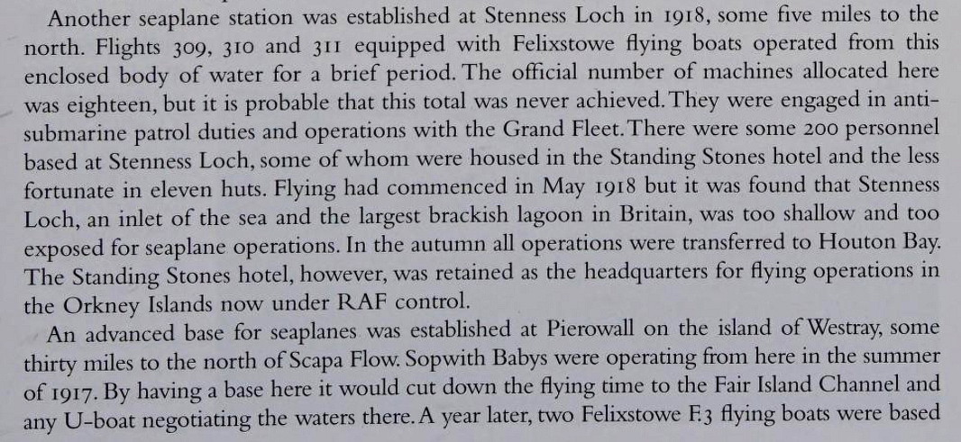
STENNESS: Military Flying Boat Station (Aka STENNES)
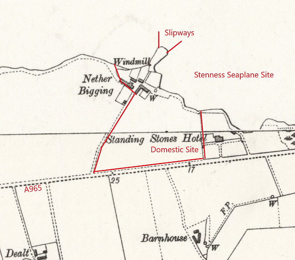
Local map
Narrative
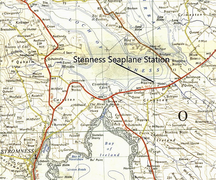
Local area map
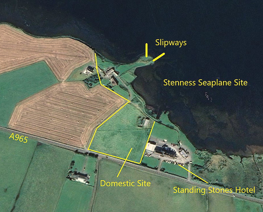
Google Earth © view
Note: These four items were kindly provided by Mr Michael T Holder, a great friend of this 'Guide'. He found the narrative in Scottish World War One Aerodromes.
Military user: RAF Marine Operations
Location: In the SE sector of the Loch of Stenness, NW of the A965 and B9055 junction
Period of operation: 1918 to 1919
Site area: 12 acres
NOTES: Can anybody today kindly add more details, especially regarding the aircraft types flown from here? Or does the 'narrative' above cover all these aspects?
We'd love to hear from you, so please scroll down to leave a comment!
Leave a comment ...
Copyright (c) UK Airfield Guide
