


Stoodleigh Barton
STOODLEIGH BARTON: Private airstrip
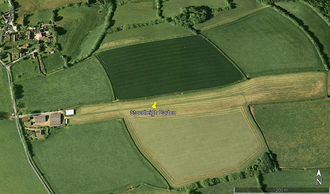
Aerial view 2006
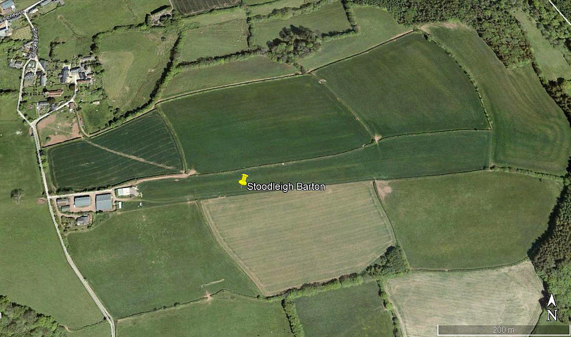
Aerial view 2010
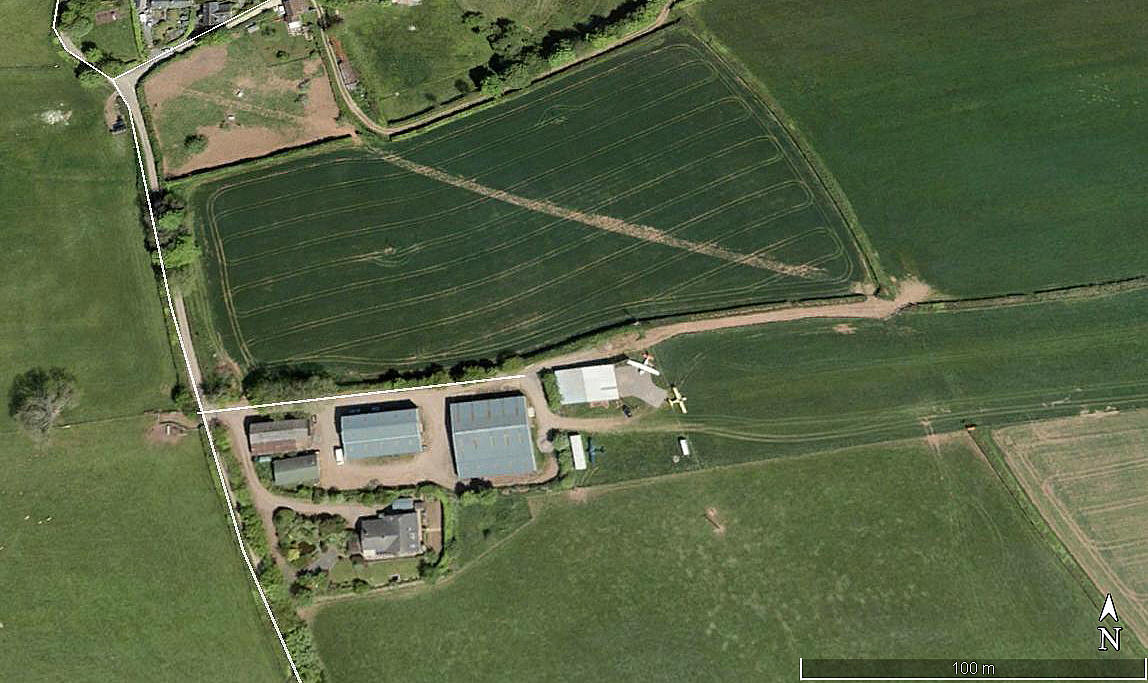
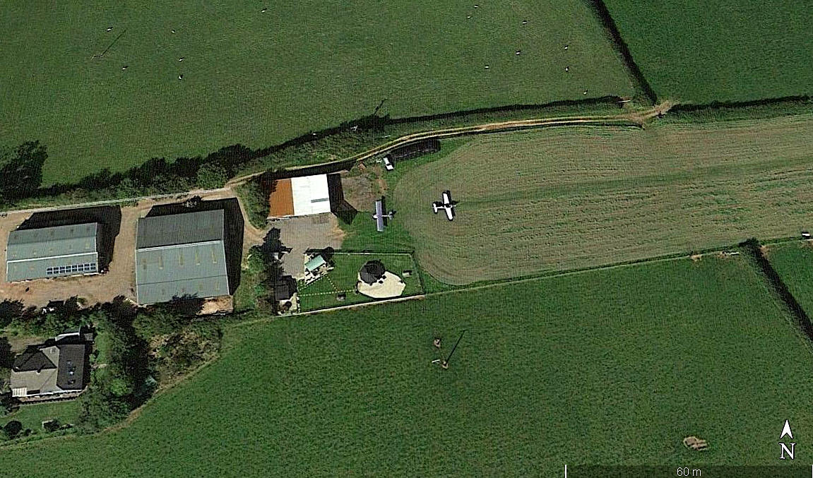
Aerial detail 2010
Note: All six of these pictures were obtained from Google Earth ©
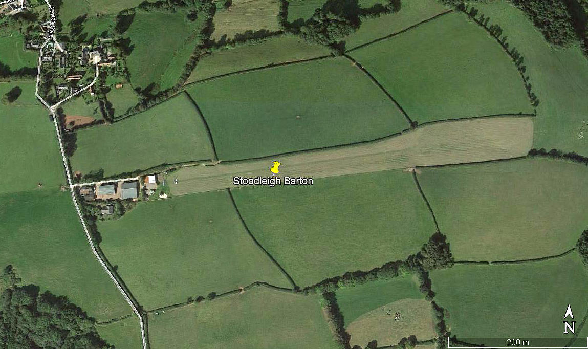
Aerial view 2019
Aerial detail 2019
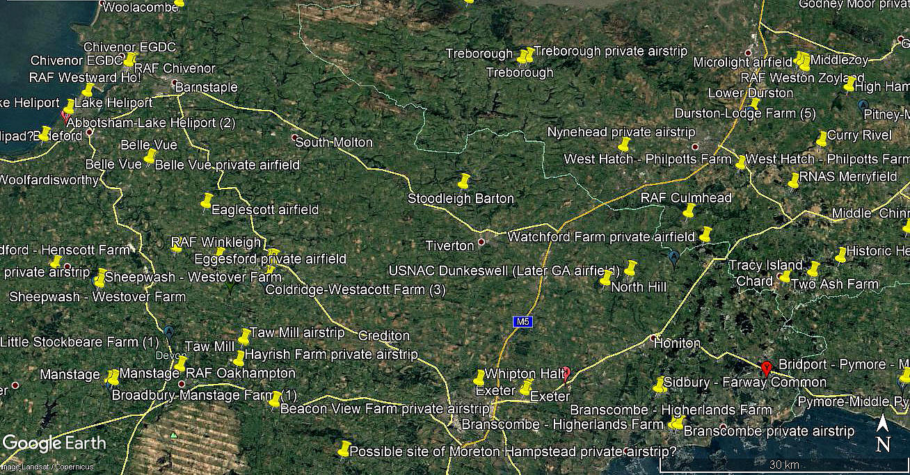
Area view
Operated by: 2001: Mr W Knowles
Location: 4nm NW of Tiverton
Period of operation: ? (No sign of this airstrip in 2002)
Runway: 08/26 550 grass
Note: I did find one account that stated the runway was: 09/27 800x75 grass
Looking at Google Earth © pictures and using their distance measuring device, this seems ridiculous?
NOTES: No landing fee required in 2001 (at least) but a donation to the RNLI much appreciated. As always in this 'Guide' a request for advice will be much appreciated.
We'd love to hear from you, so please scroll down to leave a comment!
Leave a comment ...
Copyright (c) UK Airfield Guide
