


Stretton-under-Fosse
Note: This map only gives the position of Stretton-under-Fosse village within the UK. If anybody can kindly give a more exact location for the WW1 airfield, this advice will be most welcome.
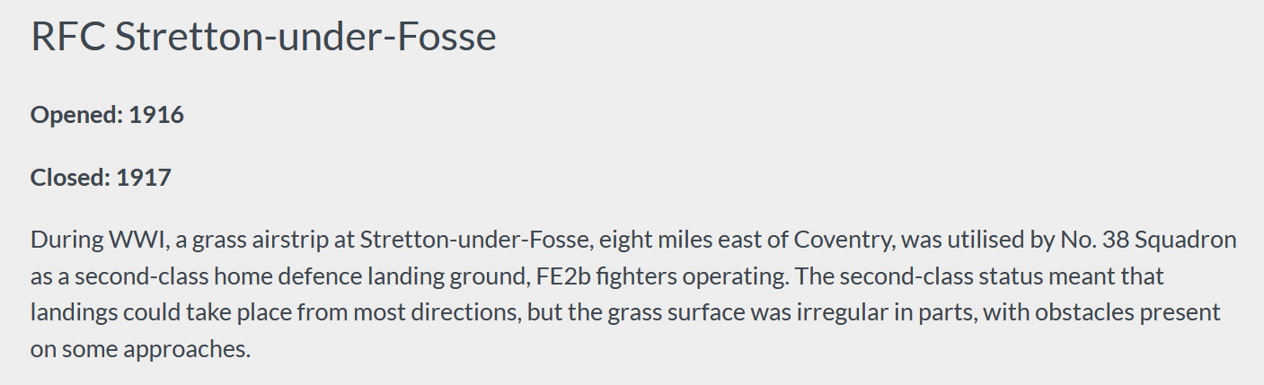
STRETTON-under-FOSSE: Military Landing Ground (also known as RUGBY)
Military user: RFC (Royal Flying Corps)
38 [Home Defence] Sqdn (Royal Aircraft Factory BE.2c and FE.2b types)
Location: Probably W of the B4455, (the Romans built the Fosse Way), S of the B4112, N of the A45, about 5nm WSW of Rugby town centre and about 7nm ESE to SE of Coventry city centre
Period of operation: 1916 to 1917
NOTES: I find this very interesting indeed. To date I have around 2,000 military flying sites listed as being operational, in the U.K.. during WW1 - and, I think, every location being identified. But, for some odd reason, not so in this case. (At least by 2025). Mike Holder. a great friend of this 'Guide', decided to have a look, and has told me that, he "has failed miserably." Being once a RAF navigator on Vulcans, Comets and Nimrods, if anybody can find a place - he can.
All he has found, so far, are the following items:
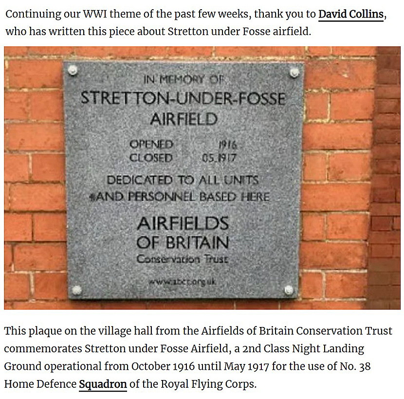
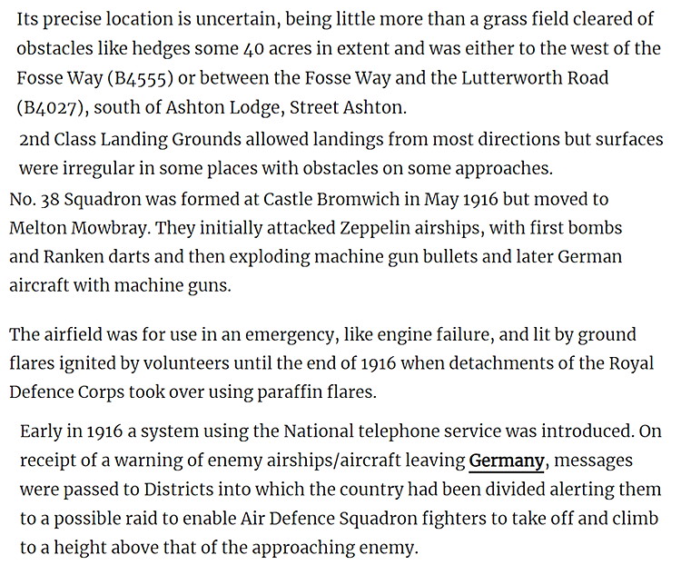
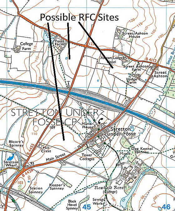
Excerpt One is from the Four Prop website, RAF in Warwickshire. Excerpts Two and Three are from the Warwickshire World web-site. As can be seen on the modern map, Mike has identified three likely locations.
As always, if anybody can kindly offer advice, this will be most welcome.
We'd love to hear from you, so please scroll down to leave a comment!
Leave a comment ...
Copyright (c) UK Airfield Guide
