


Stroma
Note: This map only shows the location of the island.
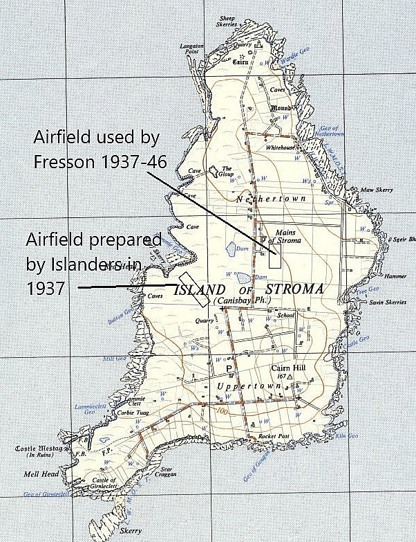
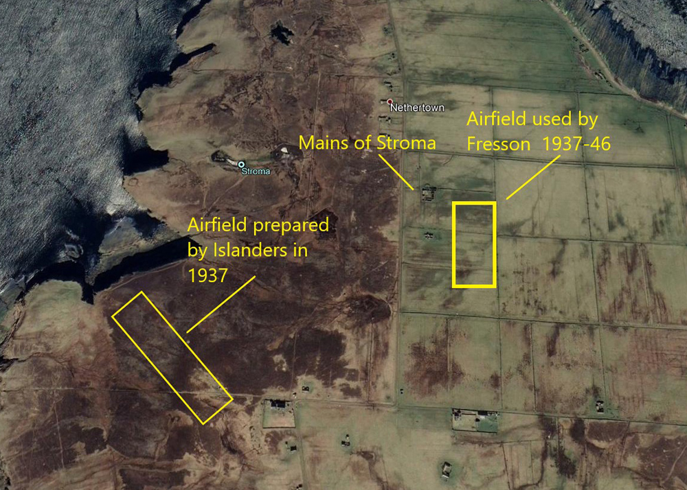
STROMA: 1930s Landing Grounds and a later lighthouse helipad

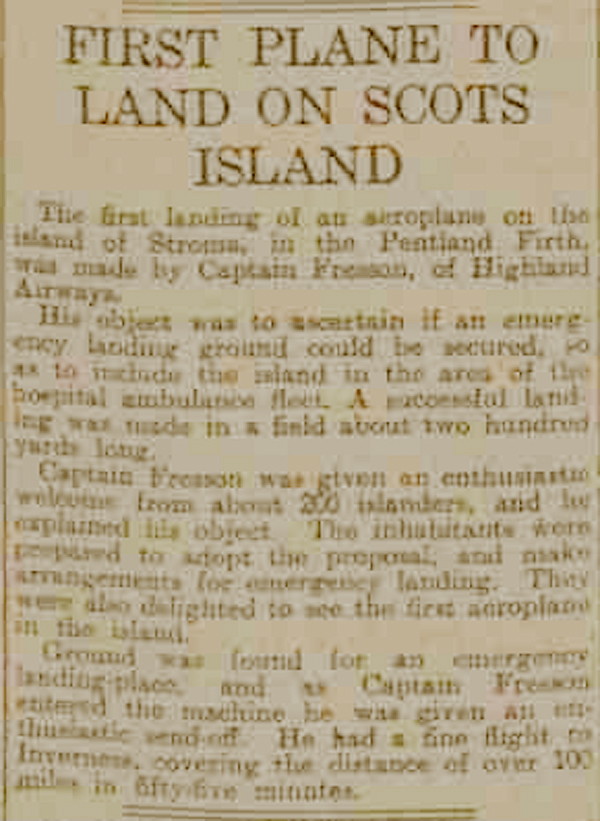
Note: The newspaper article was published in the Dundee Evening Telegraph on the 20th August 1937.
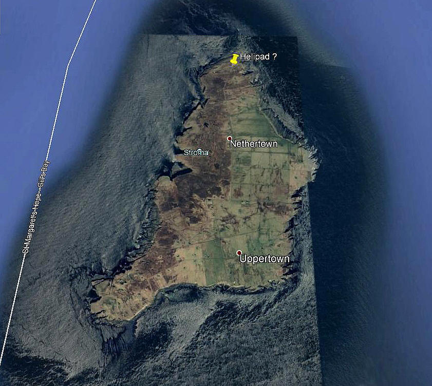
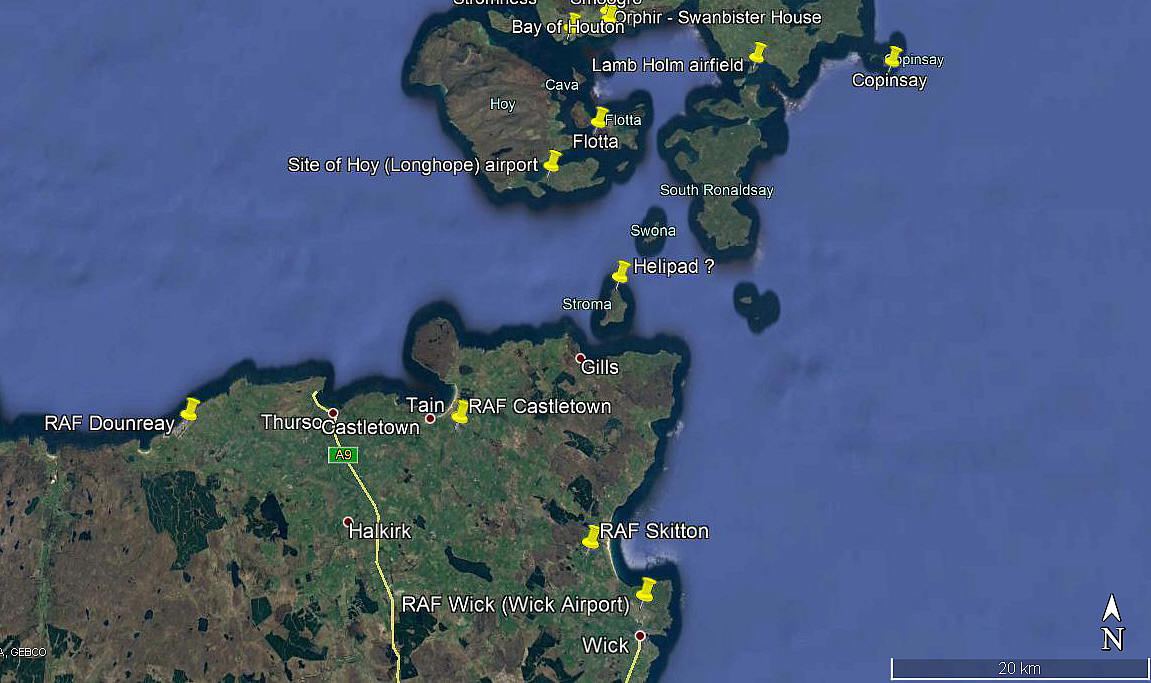
Note: The local area maps, newspaper article and lighthouse map were kindly provided by Mr Michael T Holder, a great friend of this 'Guide', and the three pictures were obtained from Google Earth ©
NOTES: We have to thank Mr Graham Frost, another great friend of this 'Guide', for pointing out that STROMA hadn't been listed.
This island is now uninhabited, the last of the population moving out over fifty years ago, leaving just the lighthouse keepers until the 1990s when it became 'automatic'. In the mid 1930s, E.E. Fresson of Highland Airways based at Inverness, showed an interest in including STROMA in his list of destinations that could be of great value for his air ambulance services. It appears he landed on the island to prove the point that it could be viable.
It appears he landed on a strip around 150 yards long near to Mains of Stroma. The aircraft probably being the DH60G Gipsy Moth, G-AAWO.
It seems that the islanders were so impressed they cleared an area of moorland on the west side of the island. The 1st 'official' filght was in June 1938, but no regular service was offered, and probably not needed. It is quite probable that the airstrip continued as a potential Landing Ground throughout WW2 as civilian flights in the north of Scotland were permitted to keep operating - albiet with the passenger windows blanked out. When BEA, (British European Airways), took over the Scottish routes, they had no interest in serving STROMA.
It would appear that Fresson was most impressed by the islanders attempt to create a useable airstrip. This one being around 450 yards long. It is said the site was pegged out and the islanders set about preparing it. In November 1937 Fresson heard that the site was nearing completion. He visited the island a second time on the 25th June 1938 and took a Mr Muir with him.
Fresson said, "The islanders had made a good job and had levelled off some 400 yards of moorland. They had removed the top layer of peat and uncovered a firm clay and gravel surface along the entire strip. The wet part had been drained and the islanders must have put in a tremendous amount of work."
So, why does it seem, another site, not so far away, was also used?
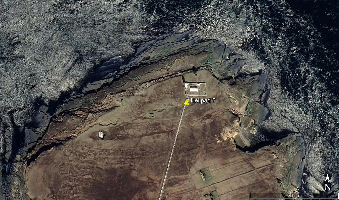
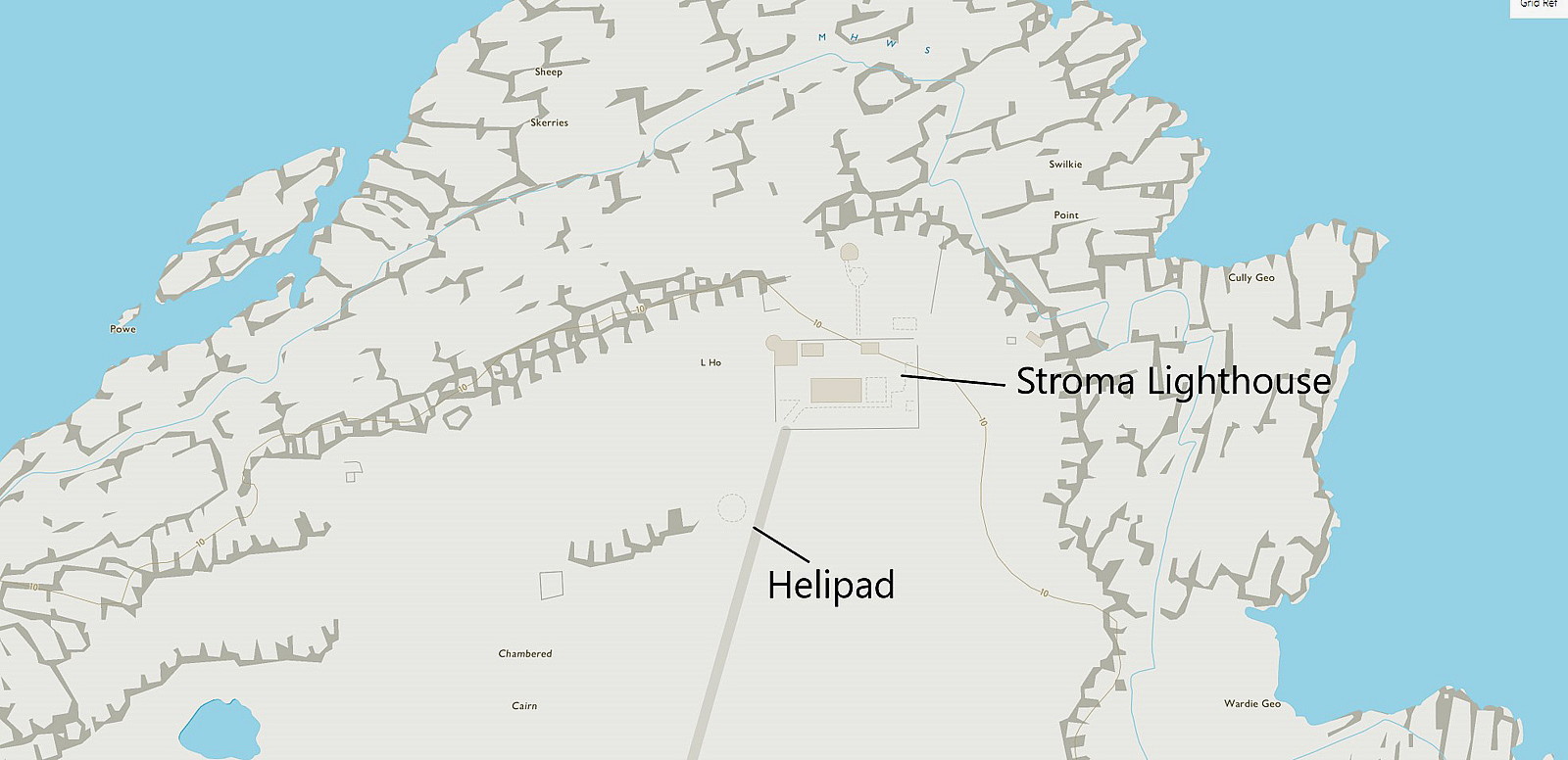
THE LIGHTHOUSE
When the value of using helicopters to serve remote lighthouses became a practical proposition, a helipad was constructed for the lighthouse on the northern end of STROMA, at Swilkie Point, in 1972. I think the circle, W of and next to my pointer in the first picture, is probably the location? In the late 1990s the lighthouse was converted to become 'automatic'. But of course, even these need some inspection maintenance, so presumably this helipad is still in use?
As always in this 'Guide', if anybody can kindly offer advice. This will be most welcome.
We'd love to hear from you, so please scroll down to leave a comment!
Leave a comment ...
Copyright (c) UK Airfield Guide
