


Tain flying sites
TAIN: Temporary aerodrome
NOTES: Some time ago I made this comment: "On the 17th May Sir Alan Cobham’s 1934 Tour displayed in/near Tain. Did the site they used, as often happened, later become the WW2 military aerodrome perhaps?" In October 2020, Mike Holder, a great friend of this 'Guide', came up with the answer. It was an entirely seperate site NW of Tain.
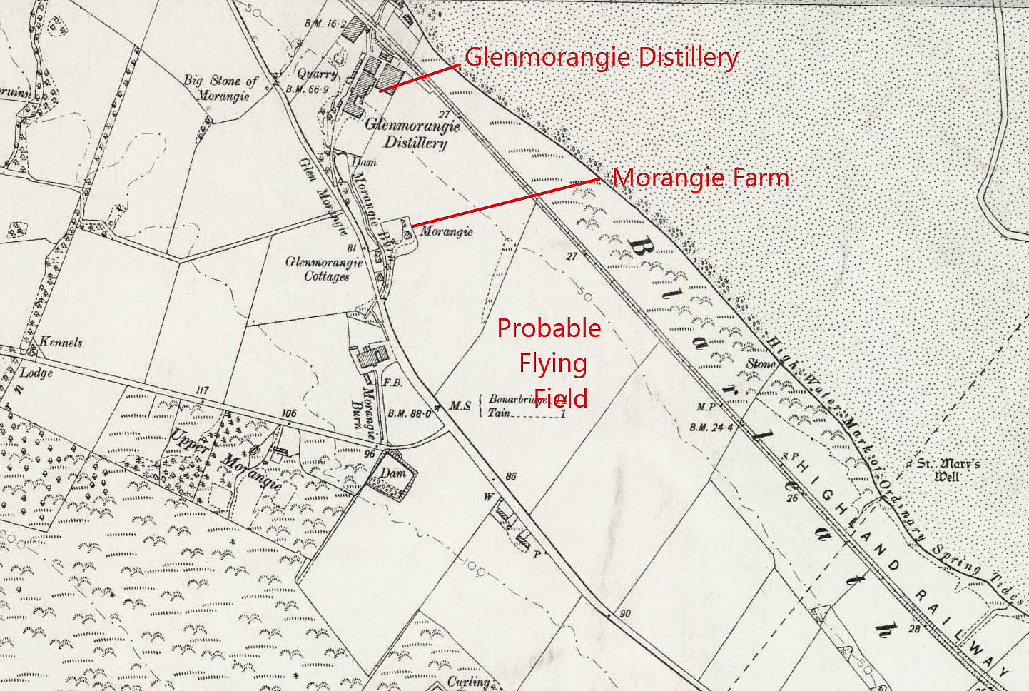
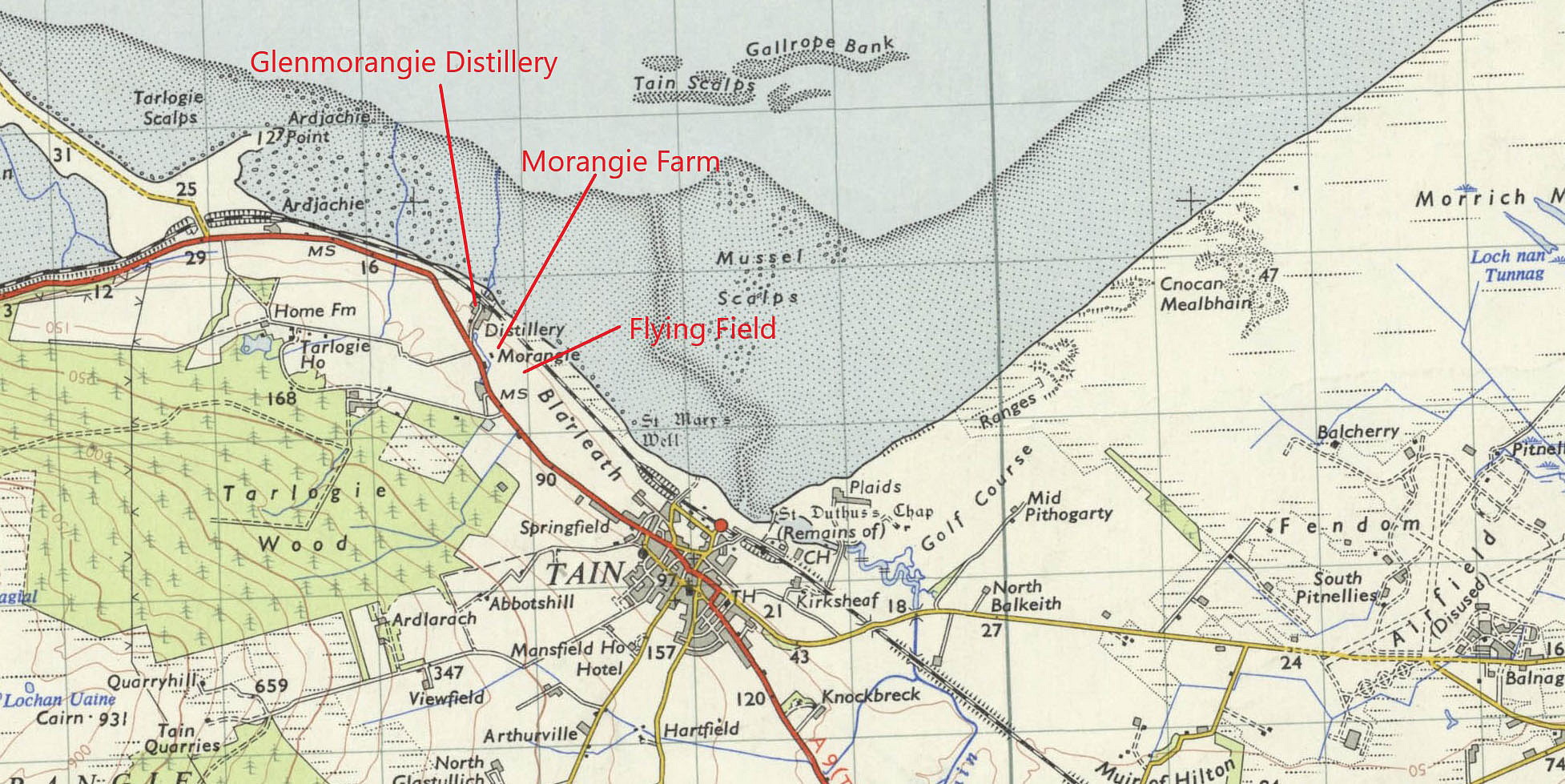
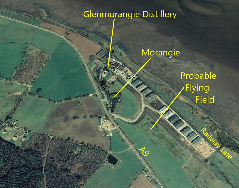
As Mike points out, he can only guess at the actual field used, and, on scant evidence decided to select this one. As always in this 'Guide', if anybody can kindly offer advice, this will be most welcome.
TAIN: Military aerodrome (previously Landing Ground?)
Note: Later microlight airfield (See later entry - TAIN microlight)
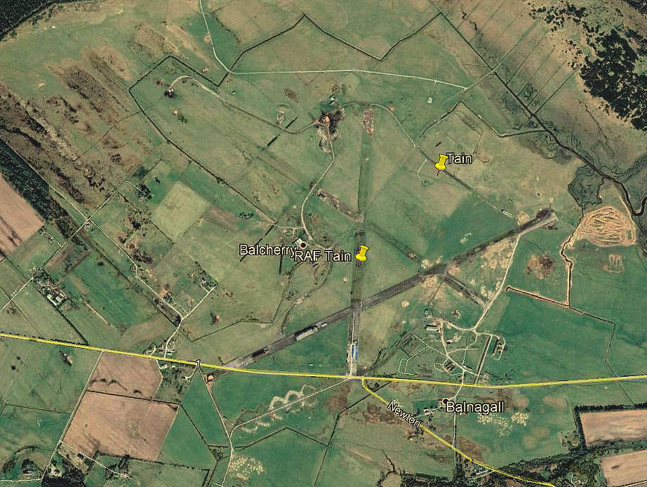
Note: This picture was obtained from Google Earth ©
Military users: RAF Coastal Command 18 (GR) Group
86 & 311 (Czech) Sqdns (Consolidated B-24 Liberators)
279 (ASR) Sqdn (Lockheed Hudsons & Vickers Warwicks)
489 (RNZAF) Sqdn (Handley Page Hampdens)
Location: NNW of Bainagall village, 3nm E of Tain
Period of operation: 1941 to 1946 according to one source (*probably used as a LG by 1938 at least?)
Runways: 07/25 1829x46 hard 13/31 1829x46 hard
01/19 1337x46 hard
NOTES: This aerodrome layout is most unusual in having two 2000 yard (1829 mtr) runways. Was there a reason for this?
*Records show that a Whitley of 51 Sqdn crashed here in August 1938.
The AAIB report EW/G2011/01/03 illustrates that microlight flying was taking place here using at least one grass runway, 16/34.
A QUESTION
A closer look at a map of the original British Counties shows that this airfield may well have been in a detached part of CROMARTYSHIRE which is not a County in any shape or form that most people would recognise. It stretches in areas of a variety of sizes, (I have counted twenty), from the east coast, Cromarty, to the west coast throughout ROSS-SHIRE, by far the largest segment being on the west coast.
Perhaps one day I’ll get round to investigating the history of detached areas in our County system. I had no idea they existed until starting this research and found they do exist all over the UK. CROMARTYSHIRE is by far the most bizarre example, it resembles an explosion!
Brian Fraser
This comment was written on: 2020-08-02 23:07:21Not only did counties sometimes have detached parts, the same was true of many parishes. Also, parish boundaries didn't always fit nicely inside the counties and it there are many examples of a parish straddling a county line (often marginally). Nearly all of this was tidied up in 1890 when County Councils were rolled out across the UK. The only detached part in Scotland to remain was an exclave of Dunbartonshire. In Wales, Flintshire was also divided in two. The 1890 boundaries are what form the basis of the land registration still in use today.
We'd love to hear from you, so please scroll down to leave a comment!
Leave a comment ...
Copyright (c) UK Airfield Guide
