


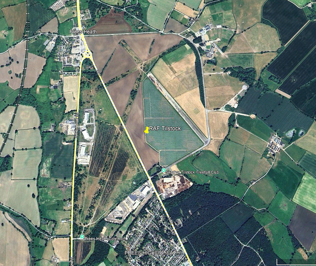
Tilstock
TILSTOCK: Military aerodrome later private airfield
(Originally known as RAF WHITCHURCH HEATH before June 1943)
These three pictures are from my Google Earth © derived database.
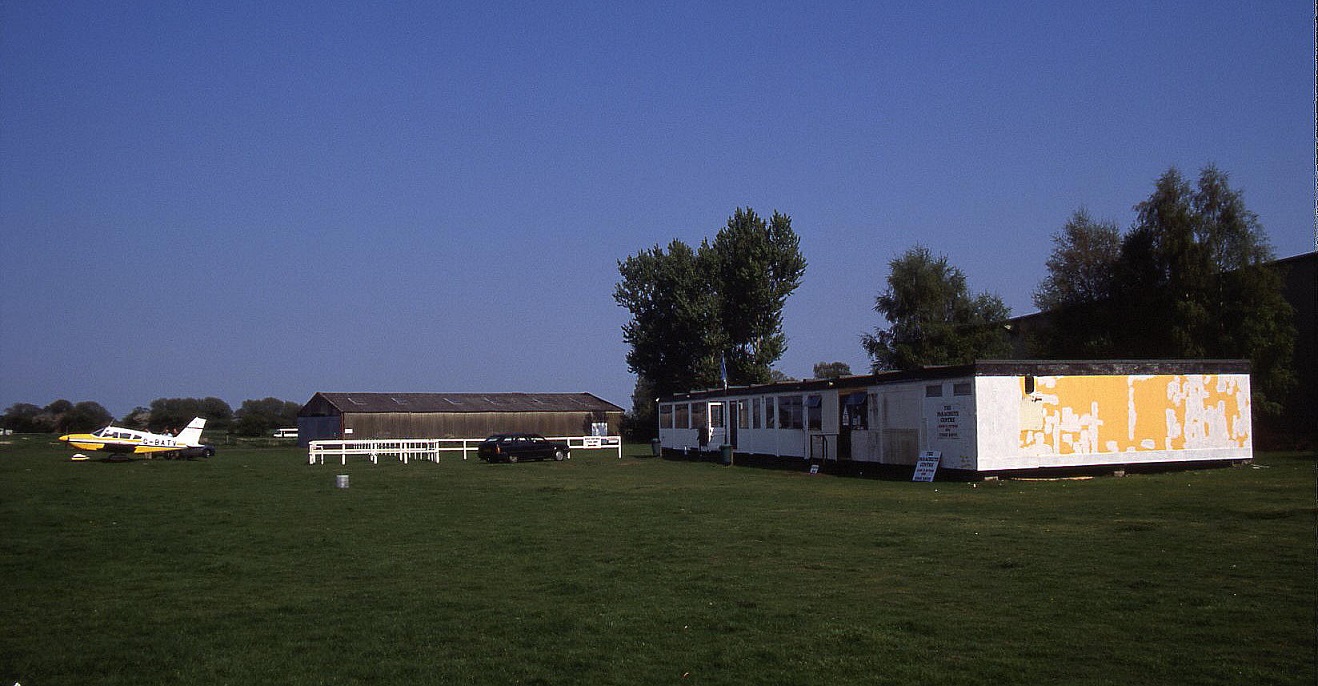
Note: Picture by the author.
Military users: WW2: Some say RAF Fighter Command – but surely Bomber Command? 38 Group
1665 HCU [Heavy Conversion Unit] (Short Stirlings)
81 OTU [Operational Training Unit] (Armstrong-Whitworth Whitleys & Vickers Wellingtons)
NOTE: Later in WW2 TILSTOCK became an important centre for glider towing training. Typically with Short Stirlings and Handley Page Halifaxes towing Airspeed Horsa's destined to carry troops and equipment after the D-Day invasion.
Operated by: 1980s to 2000: Mr R T Matson and The Sport Parachute Centre
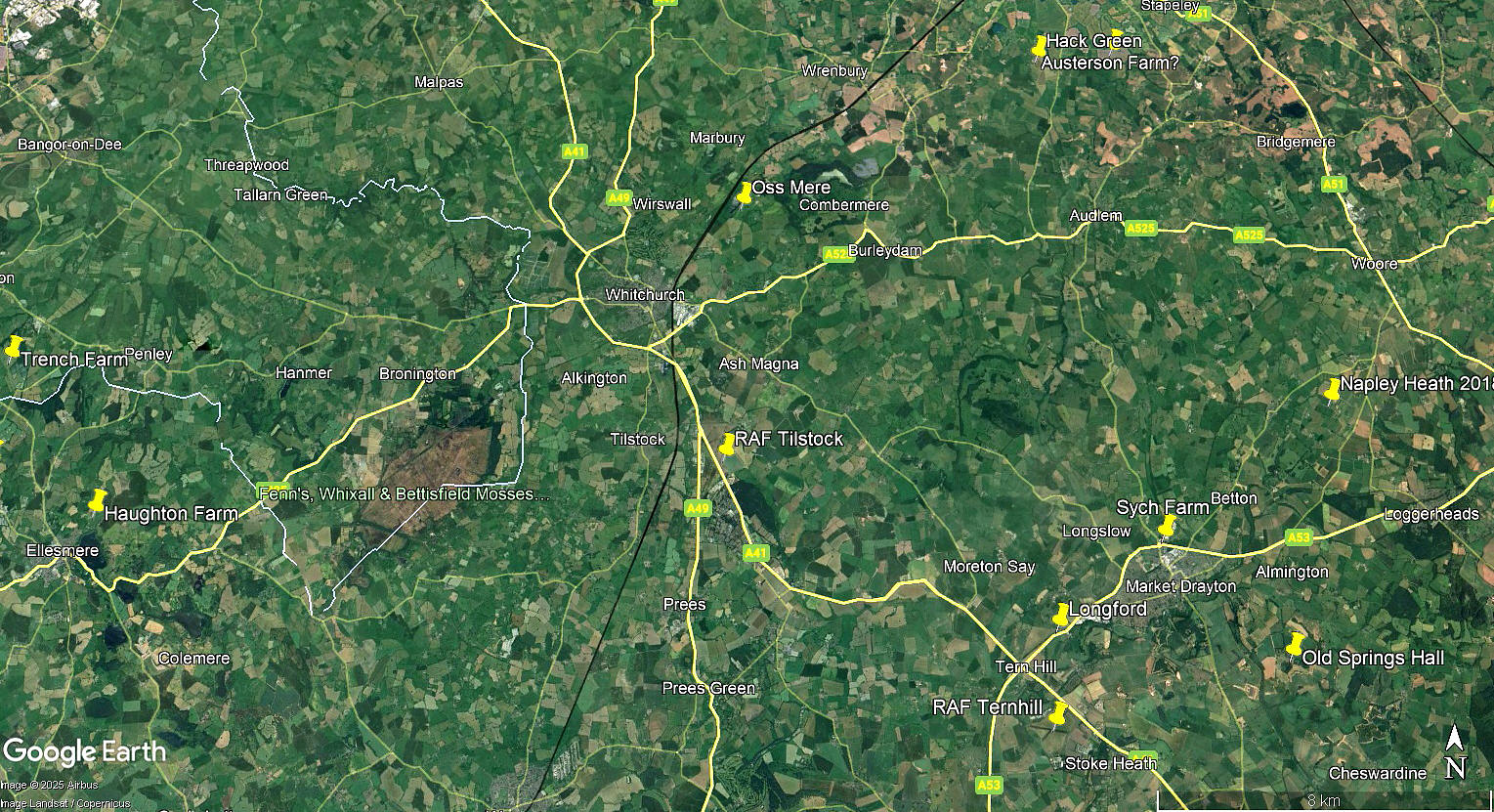
Location: Adjacent to & E of A41, E of Tilstock & NW of The Tremlows villages, 5nm NE of Wem & 3nm SSE of Whitchurch
Period of operation: Military: 1942 to 1946 Civil from ? to 2000s
Runways: WW2: 03/21 1829x46 hard 07/25 1280x46 hard
15/33 1280x46 hard
1990: 15/33 792x30 hard
2000: 15/33 750x30 hard
(Another listing in 2000 says) 15/33 600x30 hard
2001: 15/33 600x30 hard (And parallel) 15/33 792x 30 grass
NOTES: Operates mainly as a parachuting centre in later years.
It would appear that this aerodrome is situated barely 600 yards from the GREGORY FARM/ASH HALL site used by Alan Cobham for the 1933 NAD tour.
One note which I at least find quite extraordinary to believe - it seems pretty certain that the creation of this aerodrome necessitated the total closure of the A41 trunk road, (across the aerodrome only of course), during WW2. Aircrews training here nicknamed it “Frog Hollow” due to the mud and puddles.
In May 2025, Mr Graham Frost, a great friend of this 'Guide' sent me info about sources of further pictures.
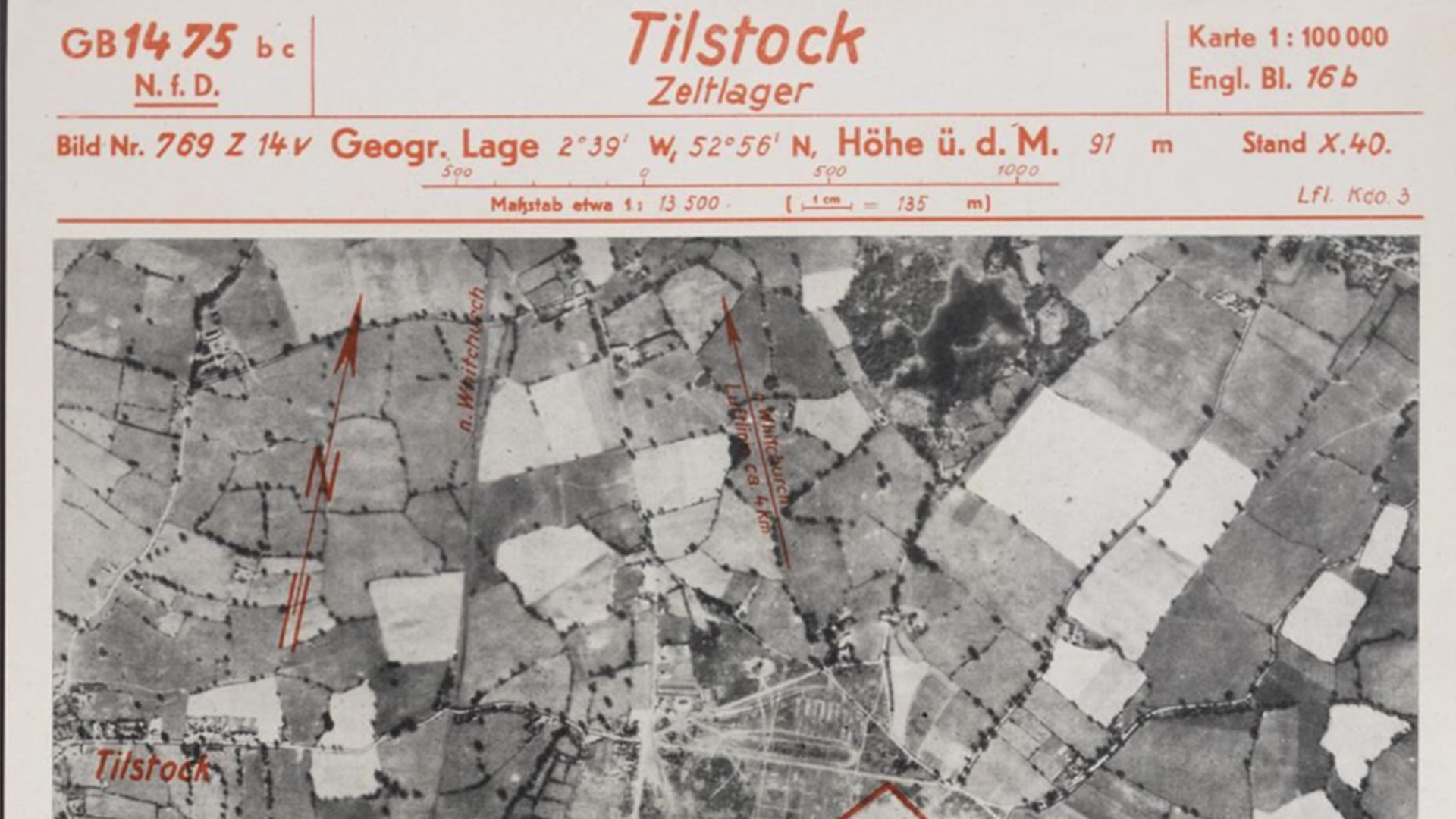
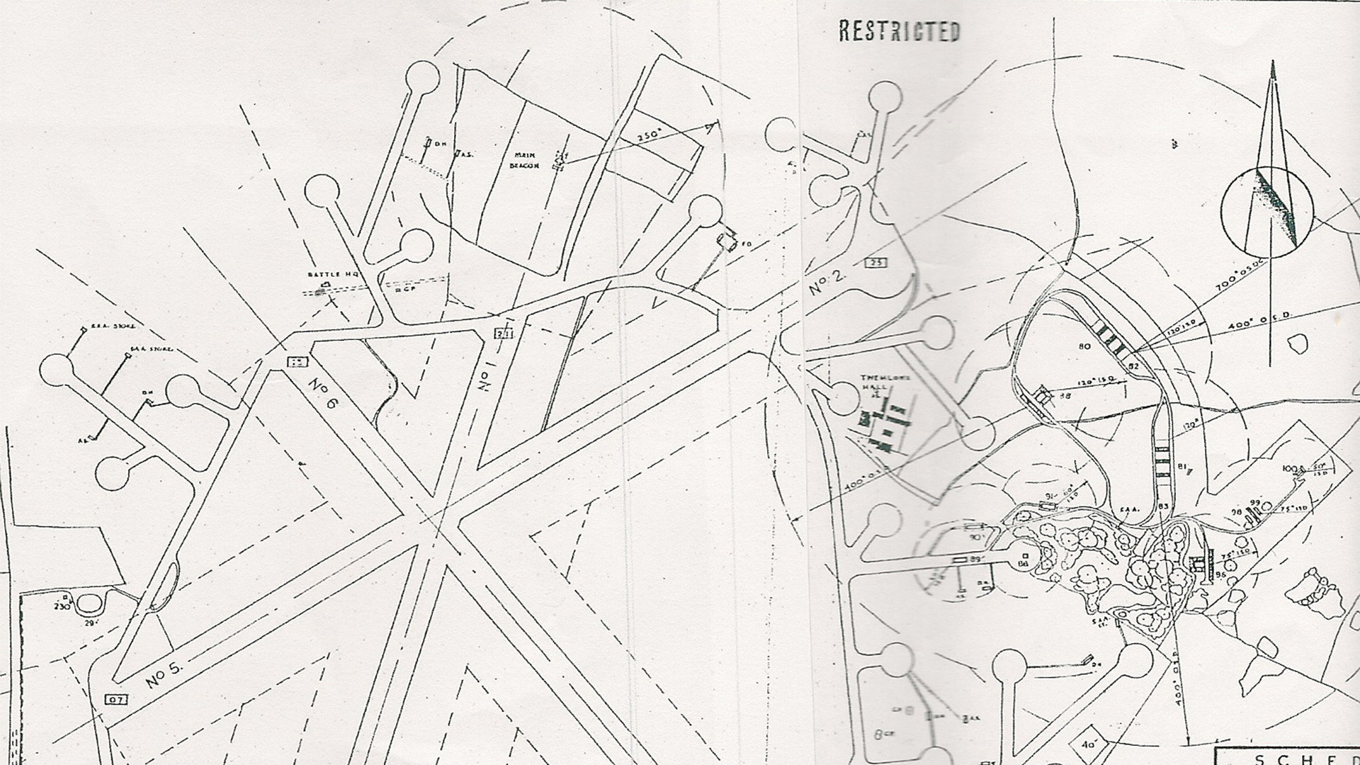
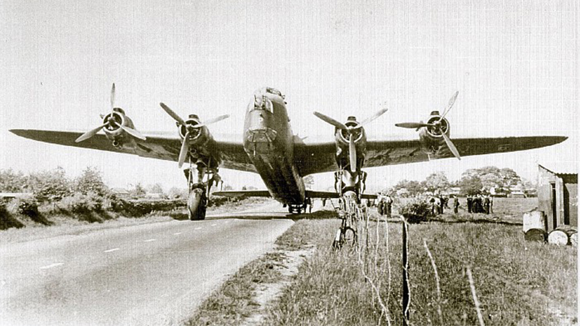
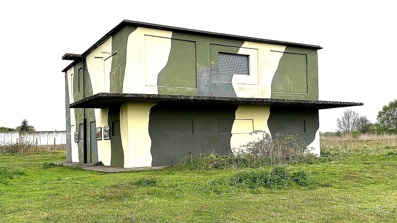
The Luftwaffe aerial vertical photo and the WW2 partial airfield map are both from the Whitchurch Museum and Archives. The picture of the Short Stirling on the A41 is from Sqdn Ldr Ray Glass. Am I correct in thinking this had landed on runway 07/25? Perhaps before it was extended across the A41? The picture of the control tower is by Kitty Logan.
David Torrens
This comment was written on: 2021-01-06 20:23:15Thanks for info on Tilstock. I am currently recreating the airfield as a free open source add in for Microsoft Flightsimulator. I live nearby in Whitchurch. I was surprised to find how much remains of taxiways and hangers etc. Would you like pictures when I progress further.
Dick Flute
This comment was written on: 2021-01-06 20:38:03Hi David, I would much welcome pictures. As jpegs please and a file size not exceeding 500KB. Best regards, Dick
We'd love to hear from you, so please scroll down to leave a comment!
Leave a comment ...
Copyright (c) UK Airfield Guide
