


Warrenpoint
WARRENPOINT: Joint aviation displays (Was once spelt as WARRENS POINT - see 1912 map)
Operated by: Henri Salmet and F P Raynham
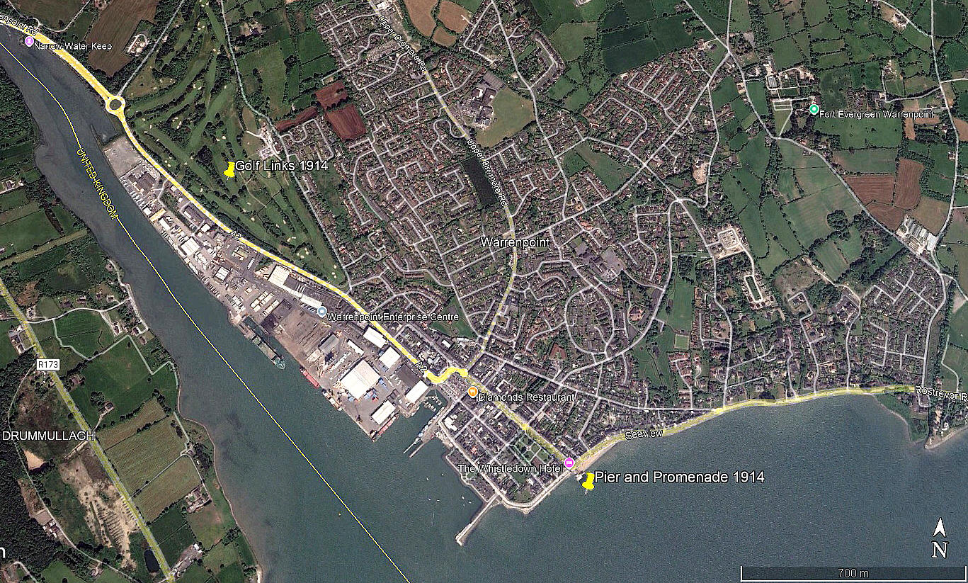
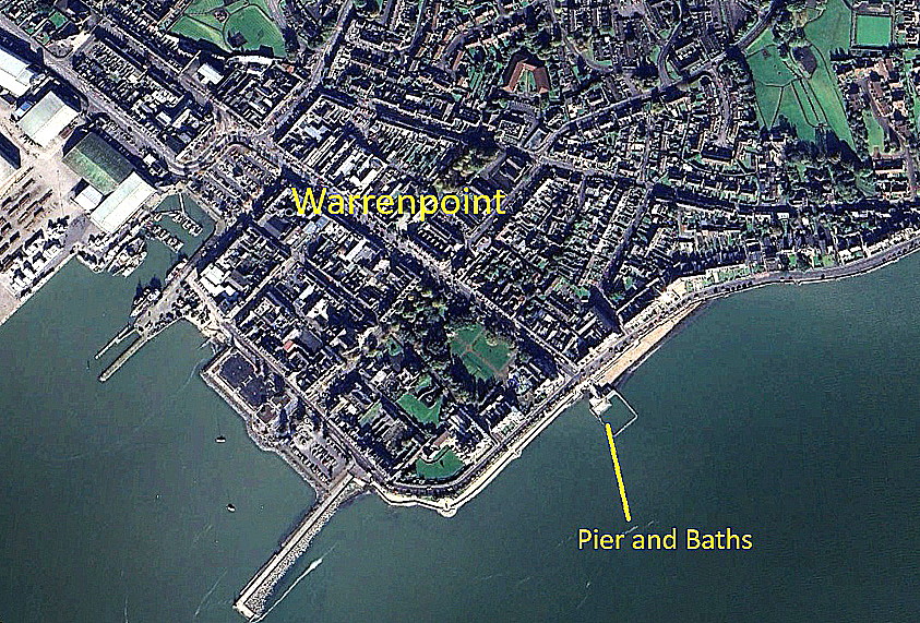
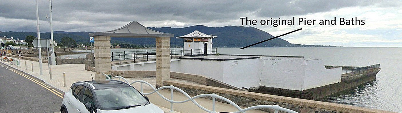
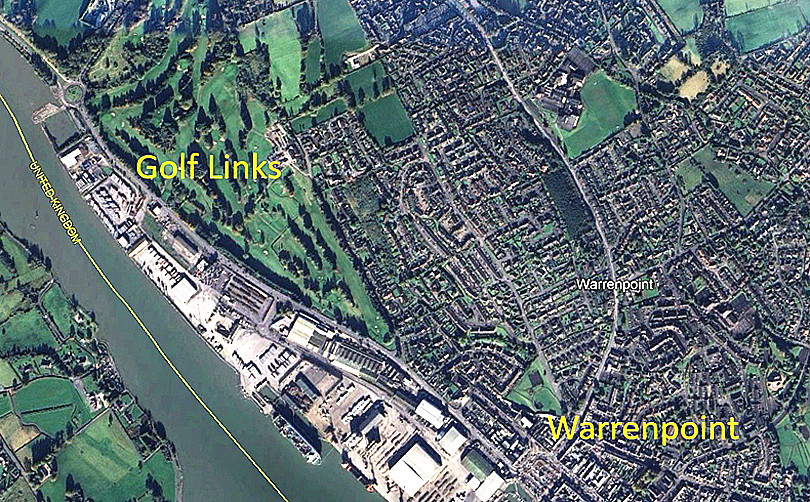
Locations: Salmet on the Golf Links, Raynham by the promenade/pier. WARRENPOINT is about 6.5nm SSE of Newry town centre
Period of operation: 20th and 22nd June 1914
NOTE: This region being strictly Catholic, and the 21st being a Sunday, absolutely no form of entertainment was allowed. Presumably because if it did occur the Dear Lord would rain down tempest and pestilence? No offence intended of course, but, in those days Catholic priests did have a certain reputation. Wasn't much, if any better, elsewhere in the UK.
A VERY BRIEF HISTORICAL OVERVIEW
For younger visitors to this 'Guide' it might be worth pointing out that, prior to 1919, when southern Ireland became the Irish Free State, (becoming the Rep[ublic of Ireland in 1949), the whole of Ireland, (or if you prefer Eire), was all part of the United Kingdom.
A MICHAEL T HOLDER GALLERY
We have Mike Holder, a great friend of this 'Guide', to thank for both discovering and researching what might be freely available to illustrate this listing, and providing the maps.
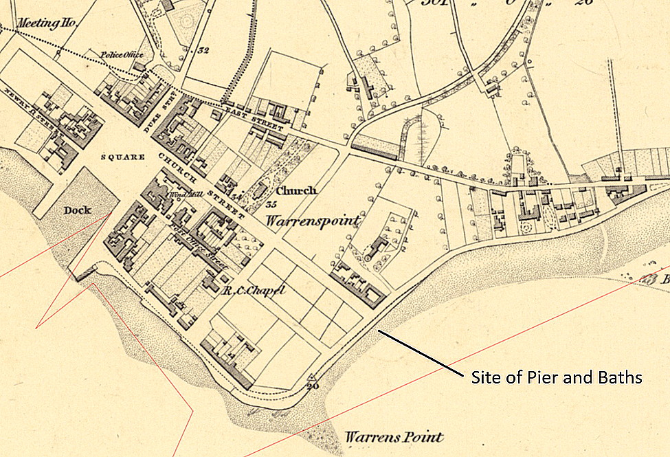
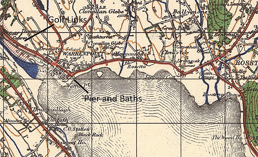
Note the spelling - WARRENS POINT - on the 1912 map.
A VERY SIGNIFICANT EVENT
At that point in time, in this region, it is very likely that few people in this region had ever seen aeroplanes at close quarters, or indeed perhaps, ever? The event was certainly well promoted.
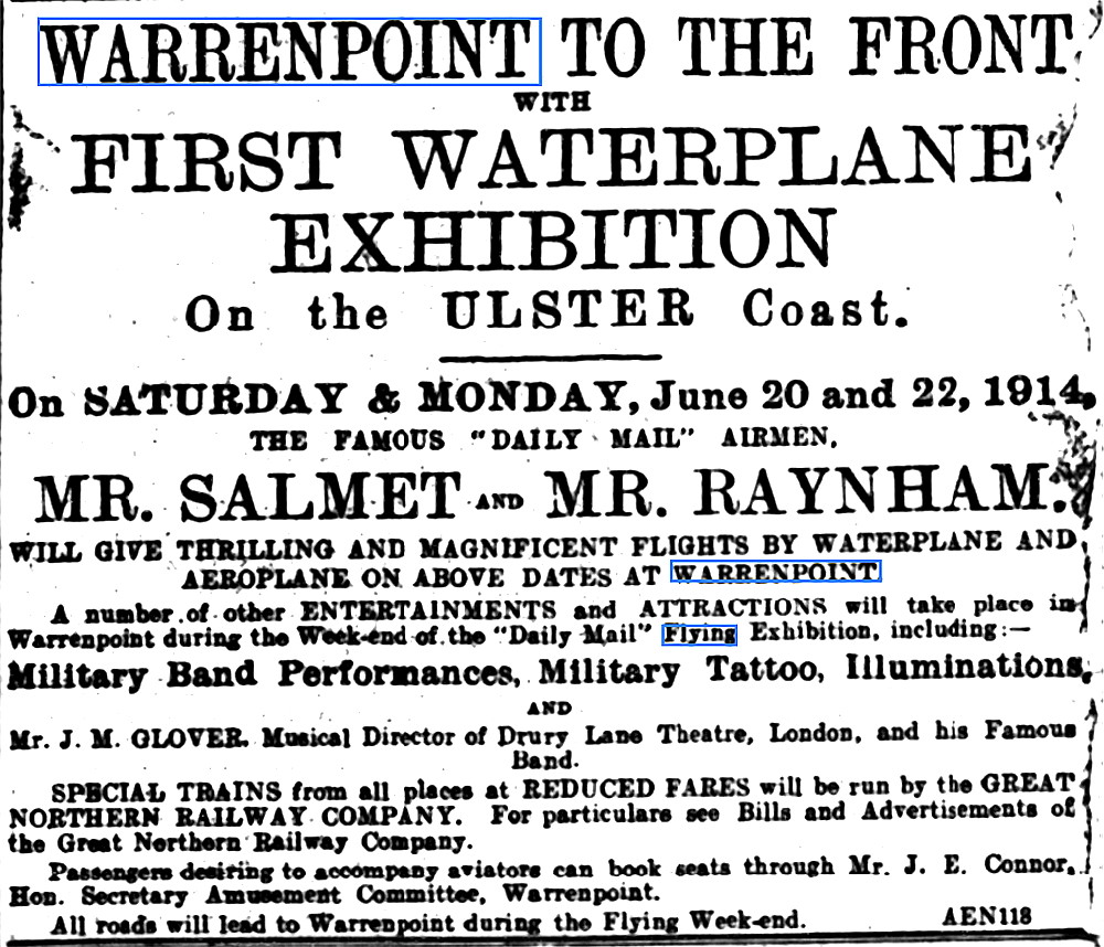
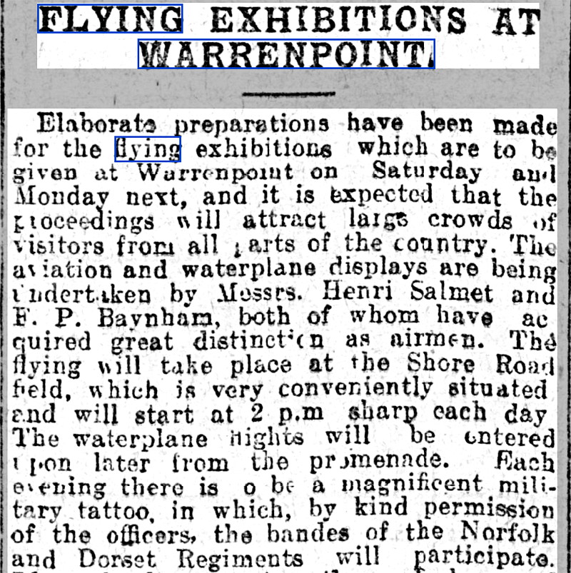
The advert appeared in Ireland's Saturday Night on the 13th June 1914. Article One, (in two parts), was published in the Evening Herald (Dublin) on the 19th June.
A FEW MORE ITEMS
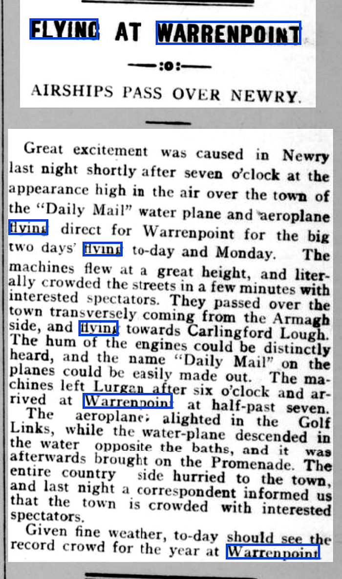
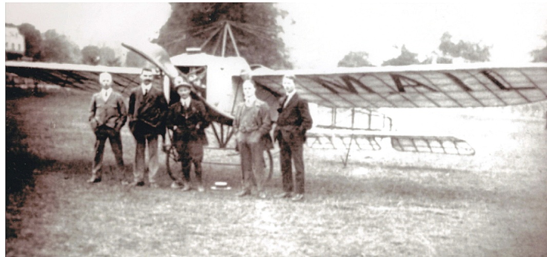
Article Two was published in the Newry Reporter on the 20th June. Photo One is of Henri Salmet, (centre) taken at the Lurgan Show on the 19th June. This was obtained from the Lurgan Show web-site.
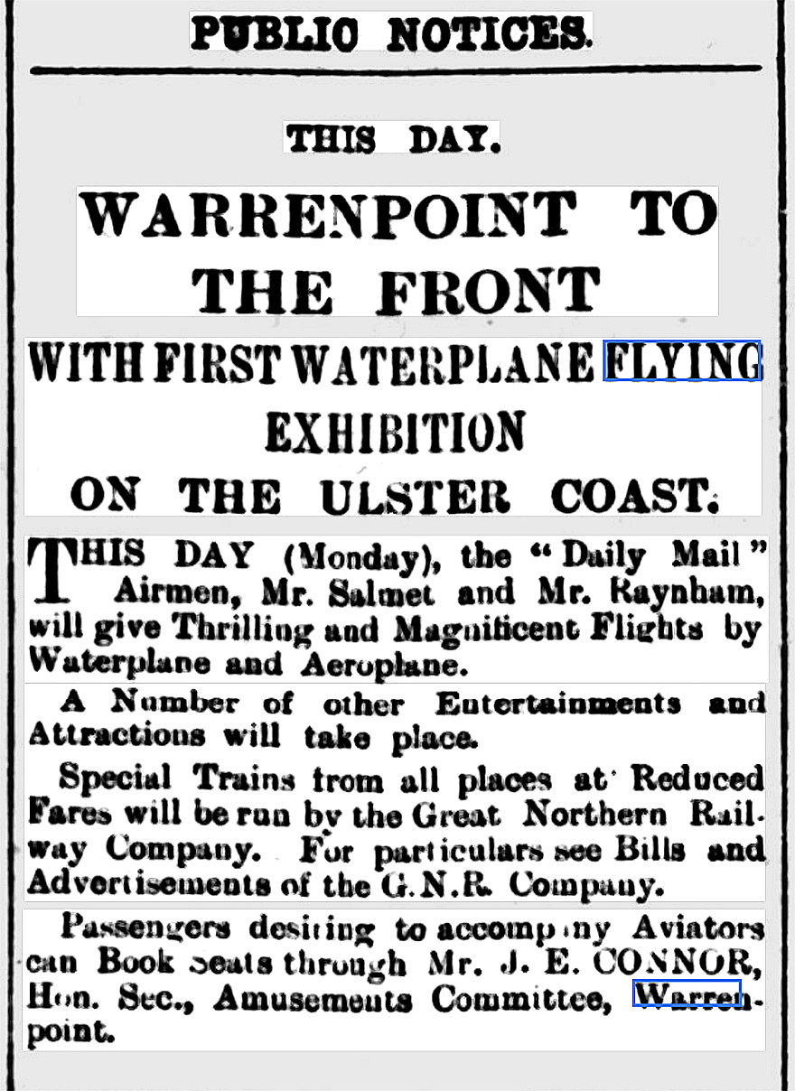
The Public Notice was published in the Northern Whig on the 22nd June.
THREE PICTURES OF THE EVENT
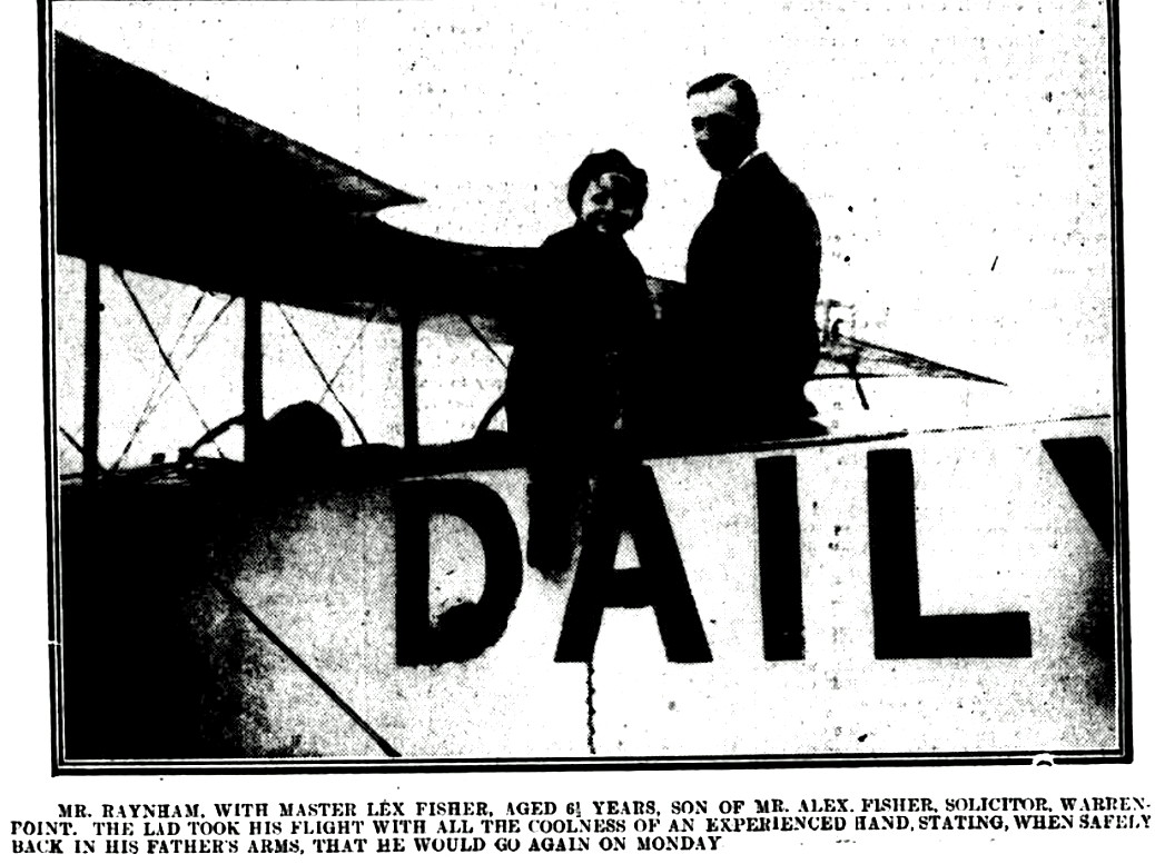
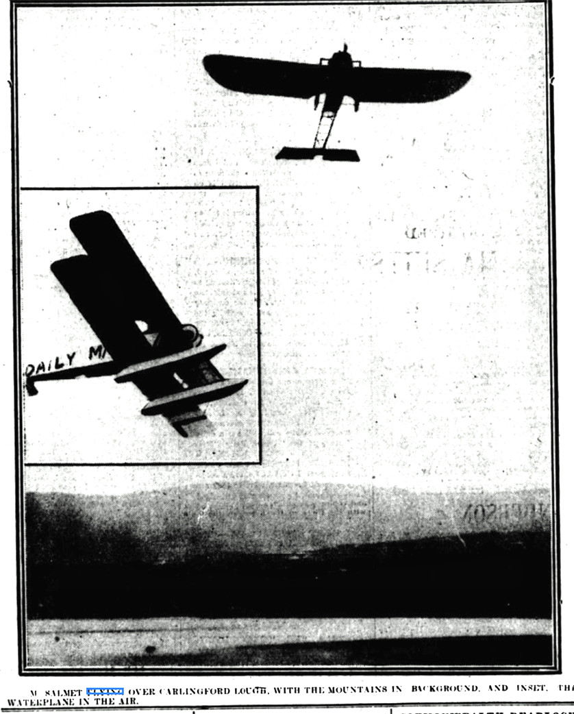
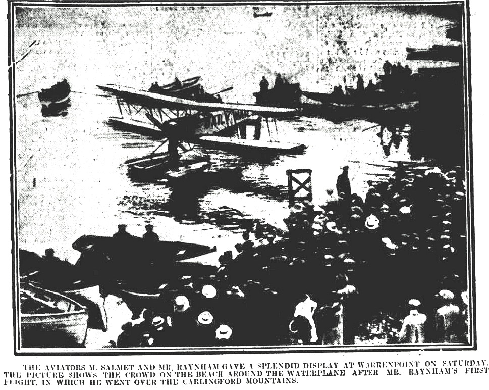
These were all published in the Belfast Telegraph on the 22nd June 1914.
DETAIL PICTURES OF THE LOCATIONS USED FROM GOOGLE
AND LASTLY
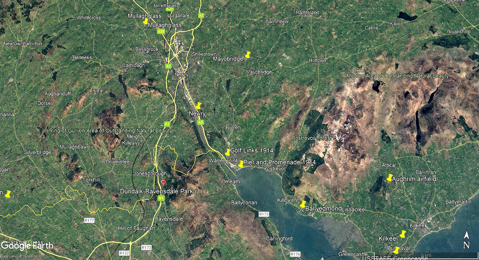
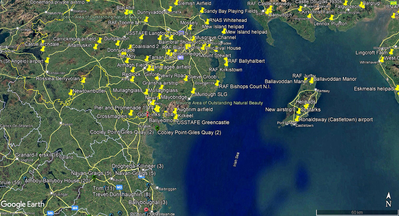
These two pictures are from my Google Earth © derived database. The area view especially has always surprised me, the northern end of Eire being so close to the mainland. The history of course, of Northern Ireland, makes me feel, as a Londoner, like it is a foreign country.
Bit like France geographically.Because, in both cases, have seen both countries from the top of a hill, on a clear day across the sea. Fortunately today, many old war wounds seem to have been healed. In Northern Ireland, and northern France, have found a most friendly welcome.
We'd love to hear from you, so please scroll down to leave a comment!
Leave a comment ...
Copyright (c) UK Airfield Guide
